Happy New Year readers! Let me know if the photo captions are working and if they are worthwhile?
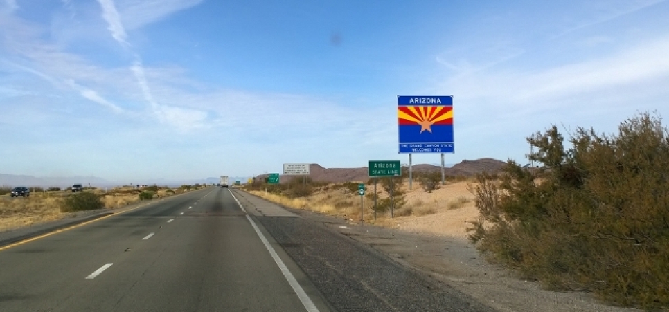
When we left Silver City we headed towards Arizona and just before crossing the state border we went through a valley that must get dust storms quite often. They had tons of signs saying if you encounter a dust storm you should; Pull over to the shoulder, turn your car off, take your foot off the brake pedal, and wait until visibility improves. Luckily we did not encounter a dust storm as we drove through that area. The first area we planned to visit in Arizona was the Old West Country. We stopped in at the Visitor Center in Willcox but it was closed because they were “In a Meeting” but we did see some old mining cars as this area has a lot of mining history.
We had reserved a primitive camping site (no hookups for water, electricity, or sewer) at Chiricahua National Monument for 4 nights so after filling up on diesel and groceries we headed in to the mountains. We stopped to check in at the visitor center but the ranger said there was no charge to go to the park and we could head to our site in the campground. Their rates had just gone up on January 1st so now it was $20 per night for primitive camping versus $10. Our site was listed at 26’ and our RV is 25’ (plus we have the bikes on the back) so it was quite tricky to get setup (forgot to take a picture). After we got setup we took the .5 km trail back to the visitor center to learn more about the area and to find out about the hiking trails.
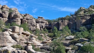
The National Monument area is actually just a very small subset of the Chiricahua National Wilderness and the Coronado National Forest. This area was formed very similarly to the City of Rocks in New Mexico (if you saw my last blog) where there was a massive volcanic eruption, except in this case the ash flow deposited 2,000’ of volcanic debris in this area (far more than City of Rocks). The heat and the pressure of the ash created layers that welded together to form the rocks. If one of the layers cooled faster than another it stayed more powdery and therefore was susceptible to erosion. Natural forces like heating and cooling, freezing and thawing have caused the erosion but they are also finding that air pollution is also having an impact on the rate of erosion. As you will see from the photos in this blog the formations that have been created are incredible!
On the first day of hiking we decided to walk from the campground up past the Organ Pipe formation and then do the Natural Bridge Walking trail. Our total for the day was about 11 KMS and the temperature swings were wild. The air temperature started off around 40 F and likely reached 68 F but there were dramatic differences in the sun versus the shade of the rock formations and depending on where the winds were blowing. It was great to see the Organ Pipe formation first thing in the morning as the light hit the pipes.
Further up the road we came to the entrance for the Natural Bridge Trail. This was listed as a moderate hike due to the time but after we compared it to the strenuous hikes we did the subsequent days we would actually say this one was more difficult with the number of ascend/descends. The trail climbs to a ridge and then descends to Picket Park where a lot of damage was done by the 2011 Horseshoe 2 Fire so there was less shade. Along the way you are constantly stopping and looking up at all the different rock formations and imagining what you see in them. At the end of the trail you reach a viewing area where you can see a small water-carved bridge across the canyon. We had our lunch at the view point so the sun could reach more of the bridge so we could see it better. We only saw 7 other people on this trail while we were hiking.
The next day we had booked the hiker shuttle at 9:05 from the campground (a great free service) to take us to the top of Massai Point and then we were going to do the Heart of Rocks trail. However it turned out that the weather had a 30% chance of rain and was overcast so we decided to change our plan and go through Echo Canyon. We felt the photos of the key rock formations in Heart of Rocks would be more spectacular on Friday when the sun was supposed to return (we were right). Since Echo Canyon was shorter we decided to start off with the Massai Nature Trail at the top (6870’ Elevation) and you saw some of those display boards in the earlier entry. Once we completed that we proceeded down the Ed Riggs Trail and back up to the start of the Echo Canyon trail. The main features of this trail are the Grottoes, an area called Wallstreet where you go through a walled corridor, and then down through the actual canyon. We finished off with the Upper and Lower Rhyolite Canyon trails through shaded oak woodlands (we saw 4 Mule Deer) returning to the Visitor Center. Everywhere in the park we had seen the Mexican Jays which are unique to this area. We were glad we had taken the shuttle because the trails were mainly in a downhill direction to drop the 1500’ of elevation. The total we did on this day was 9 KMS and you’ll see a large difference in the look of the formations when the sun wasn’t out.
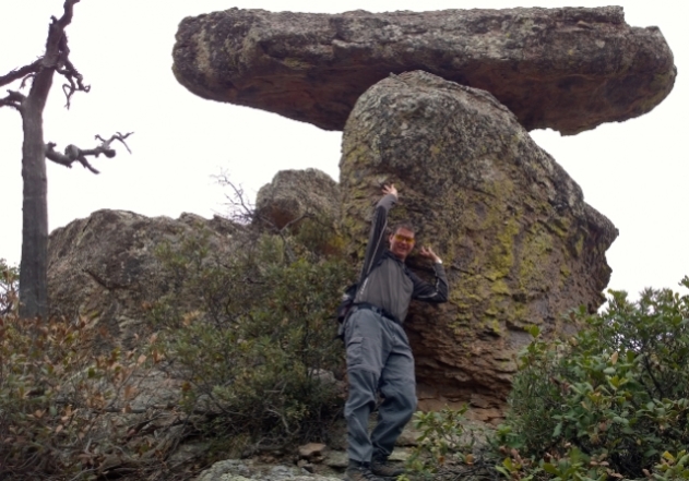
The following day the sun did come back out and we did the same routine with the shuttle to the top. On this day we did 15 KMS by doing the following trails; Massai (to retake some photos), Ed Riggs, half of the Hailstone, Mushroom Rock, Inspiration Point, Big Balanced Rock, Heart of Rocks loop, Sarah Deming, and Lower Rhyolite to get back to the Visitor Center. This day was definitely strenuous due to the length of the walk and due to some fairly significant ascents but it was also incredible! Our necks were getting stiff from continuously looking up at more rock formations. On this hike we saw Spherulites (misnamed hailstones), Mushroom Rock, the view from Inspiration Point including Chief Cochise Mountain, Big Balanced rock (diameter 22’, height 25’, weight 1000 tons), Pinnacle Balanced rock, Old Maid, Camel’s Head, Thor’s Hammer, Punch and Judy (for those old enough to remember who they are), Duck on a rock, Kissing rocks, and the spectacular views as we descended the steep Sarah Deming trail (880’ drop in elevation). We were certainly tired after completing 30 KMS of hiking in 3 days but we were also exhilarated to have seen such an amazing area. Naturally we celebrated with a nice bottle of New Mexico wine;-)
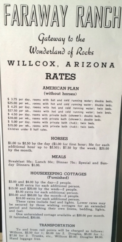
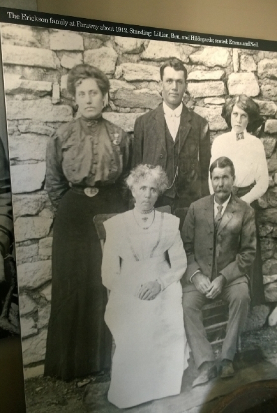
On the day we were leaving Chiricahua we lucked out because we stopped in the Faraway Ranch parking lot to clean off our windshield and then found out the ranger was about to do a guided tour of the ranch so we joined in with another couple for the tour. The history of the Swedish family that had owned the ranch was quite fascinating and was a real testament to the fortitude of Swedish women in that family. Neil and Emma Erickson settled at Faraway Ranch in 1888 but by the 1920’s their daughter Lillian and her husband Ed Riggs were running the homestead as a guest ranch. Both Neil and Ed were typically working away from the ranch so the reality is that Emma and then Lillian ran the household. On top of that Lillian gradually became deaf and blind but still ran the guest ranch! Ed helped to supervise the CCC when they were building the trails in the rock canyons. Lillian and Ed also lobbied for increased protection in the area. After the 3 Erickson children died the remaining family negotiated to have the national park service take over the ranch and all the furnishings inside. On the tour the ranger talked to us about all the history and walked us through the first floor of the ranch building itself. One of the coolest features was the fireplace in the dining room (sorry the photo is not good) that was built from stones that had been carved by the Buffalo Soldiers in the late 1800’s . Also the kitchen had been renovated and had the Swedish colours.
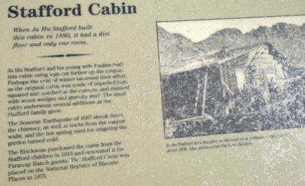
After the Faraway Ranch tour the ranger told us we could take the trail back towards the campground and see the Stafford Cabin which was the oldest log cabin in South Western Arizona. We saw the Stable barn first with the saddle holders and the horses named feed buckets. The Stafford Cabin was built in 1880 and it was interesting to see that they hadn’t peeled the bark off the logs before assembling the cabin because they were in a hurry to build the cabin before winter.
On our way to Willcox we tried to stop at some wineries that were south but the road was gravel and so wash boarded that our tooth fillings were falling out! Since the wineries were 3 miles down this road we decided to give up and go to two wine tasting houses in Willcox, Carlson Creek and Aridus. Both of them had very good dry red wines so we added more bottles to our collection. I’ve been thinking up areas in the RV where we could build some wine storage which we’re really going to need based on how many wineries are in this South Eastern corner of Arizona;-)











thanks for the journey. Love the rocks.
LikeLiked by 1 person
I like the captions. Cool. I did not know they were there. Alf had to tell me about them.
My vote is yes, please keep them.
Cheers,
The Peej
BSI – Black Sheep Inspirations
Inspiring YOU to stand out in the crowd
Cell 519 807 3337
Twitter @pjadischke
LikeLiked by 1 person
Thanks for the feedback Paula. I wonder if others didn’t know about the captions. I’ll keep doing them, with some humour😁
LikeLike
Hi Joel & Sharon, … Yes the pic’s are coming through and we enjoy looking at them, so keep them coming.☺
John & Esther Barker
Virus-free. http://www.avg.com
LikeLiked by 1 person
Your pic’s are very enjoyable. …. Do you guys plan to go to town of Tombstone, AZ ?…. Down hwy 80 south of Benson. … We were there about 5-years ago, and watched the replay of the shooting at the OK Corral. … They also have a great old cowboy type bar to have an afternoon glass of wine. … John Barker
LikeLiked by 1 person
Yes John we’re in Bisbee right now (did the mine tour today) and we’re heading to Tombstone tomorrow for 2 nights😉
LikeLike
The comments on the photos are working and are great as they give context .
LikeLiked by 1 person
I enjoy the comments for the (attempt at;) humour and for the context. Often helps in linking the words to the pics. You probably don’t need them on every pic, like on the things to read. I left a comment on the rock that you said to name, “Pregnant alien looking skyward “, let me know if you saw it. The commenting works strangely, at least on the iPad…
LikeLiked by 1 person
Thanks for the feedback Dwight. That’s what I thought about that rock as well😁
LikeLike