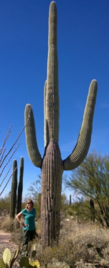
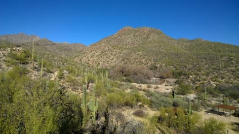
For our first couple of days in Tucson we stayed at the Rincon Country RV Resort. We were the little guy in the Mobile home park with lots of Class A’s and really large fifth wheels. We enjoyed the facilities, Internet access for the last blog, laundry, and of course the swimming pool and hot tub;-) The one day we drove to Saguaro National Park East (also called Rincon Mountain District) which was relatively close to the RV Resort. The park ranges in elevation from 2180’ in the low lying areas to 8666’ Mica Mountain. We went to the visitor centre to see the displays and watch a video on the park. Naturally one of the prime things to see in this park is Saguaro (pronounced sah-WAH-row) Cacti so we decided to Mountain Bike on the Cactus Forest Trail (11 KMS) to see them. This was one of our favourite MTB rides so far on this trip! The views of the Rincon Mountains and the Saguaro’s along the rolling hills of the trail made the ride really enjoyable. Here are a few fun facts about Saguaro’s:
- A 25 year old Saguaro is about 3’ tall and they can get 40’ tall after 150 years
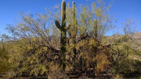
- Young Saguaro’s will start growing under Mesquite and Ironwood trees and many years later will outlive their nurse trees
- It takes 60 to 75 years before the first arm will come out of the Saguaro
- The internal part of a Saguaro has really solid wooden ribs with a waxy external coating
- Woodpeckers will make holes in the Saguaro’s and once they leave owls or purple martins will make nests
- The Saguaro forest was in jeopardy due to Tucson expansion and cattle trampling seedlings until 1933 until this East area was made a National Monument
- A large Saguaro can extend its roots up to 100’ from the base but only a few inches below the surface to capture any water possible
- Saguaro’s can survive with 60% water loss
- There is a rare type of Saguaro called Crested or Cristate and they develop unique and grotesque growth patterns and they really don’t know why (photo later)
We parked our bikes at one point along the trail in order to go and see the Lime Kilns and the Lime Falls (2 KM Hike). In the 1880’s as Tucson was being built they needed quicklime to build the Adobe houses so they gathered the fine limestone and used the kiln to make the quicklime to be used in the mortar. Lime Falls would normally have had some water flowing in January but this year has been abnormally dry. We did see a couple of packrats scurrying around the rocks though. Here are the photos from the visitor centre, the MTB trail and the hike.
Once we finished the bike/hike we returned to the RV and then decided to do the 13 KM Cactus Forest Loop Drive. We stopped at various look out points, did the short Desert Ecology Trail, and visited Javelina Rocks. We were glad we had driven this loop instead of riding our bikes as some of the hills were quite steep (we saw one couple struggling)!
When we left the Tucson RV Resort we were heading to Catalina SP but we stopped for a hike in the Sabino Canyon Recreation Area as some other hikers had told us about this park. Our National Park pass got us into this area and we opted to hike directly from the visitor centre instead of taking one of the trams up the canyons. The Santa Catalina Mountains were formed 12 million years ago and are primarily granite and a banded gray and white rock called Catalina Gneiss. The creek leading to the small Sabino Dam has riparian and desert flora due to the water flow. However this January has been extremely dry and therefore we did not see much water flow. Many years ago there was a plan to build a massive dam in the canyon to create a lake but luckily the residents protested to stop it from being built. The loop we chose included the Sabino Walkway, Esperero Trail, Rattlesnake Trail, Creek Trail, Sabino Dam Trail, Sabino Lake Trail, and back on the Bear Canyon Trail (total 6 KMS). At the end we also did the short Bajada Nature Loop. Unfortunately this recreation area does not have camping as we would have liked to do some longer hikes in this park.
Catalina SP is extremely popular for camping as it is close to Tucson and the campsites are large and not close to your neighbours. However the popularity means that it is booked up to a year in advance so all we could get was an boondock site in the Ringtail loop for 3 nights. Due to the popularity they were allowing people to overflow in to the Group Areas so we ended up adding on an extra 2 nights in the Gila Monster Overflow and that was actually nicer than the spot in Ringtail.
On our first day in the park we walked over to the Trailhead visitor centre to get the hiking map and decided to do the Romero Canyon Trail to see Montrose and Romero Pools, total of 13 KMS with an elevation gain of over 900’. The pools are shallow catchments on the canyon streams that flow seasonally. We didn’t see any water in the Montrose Pools but we did see some beautiful areas around Romero Pools. The first section was relatively flat but then the next 3 KMS was extremely steep and very rocky so we took it slow and stopped for lots of views and drinks of water, as it was hot climbing up. We were again very happy to have our hiking poles with us for balance. We met our neighbour campers on the trail and they told us to go past Romero Pools for an even prettier location so we went up the wash and found a spectacular location to have our lunch. Later we realized that we had found something they hadn’t seen as we did find the location they mentioned. The way back down was far simpler although we did have to contend with the 80 F temperatures. By the time we reached the trailhead we had finished our water so we splurged and bought a large cold lemonade in the gift shop (of course followed by a beer when we reached the RV);-)
The following morning we set our alarm so we could get up really early and the see the Super Blue Blood Moon. It was Super because of Perigee where it was only 357,000 KMS from earth which is almost as close as it gets. It was called a Blue moon because it was the second full moon in January (full moon is every 27.3 days). It was a Blood moon because it turns a red/orange colour as the earth blocks the sun’s path to the lunar surface. I tried various settings on my Smartphone and did get a few shots of note but they aren’t that clear as the zoom capability is not strong enough. I’ve included a photo series I downloaded taken in the Tucson area so you can see what we actually saw. The next occurrence will be January 31st 2037, who knows where we’ll be then;-)
Later that evening we also went to a ranger led talk on the moon and one of the cool facts he included was that there is actually a man on the moon. There was an astronaut who didn’t make the cut to make it to space so when he died in the 90’s they actually took his ashes up and spread them on the moon’s surface!
During the day we decided to drive north to see Oracle SP and also visit Biosphere 2. Oracle SP is a 4,000 acre wildlife refuge in the foothills of the Catalina Mountains (no camping yet) and it contains the Kannally Ranch House (Mediterranean and Moorish style) which is on the National Register of Historic Places. We were extremely lucky on our timing because when we arrived at the ranch house one of the volunteers was conducting a tour of the property for friends of another volunteer and they let us join their tour!
In 1902 Neil Kannally arrived in Oracle from Illinois and homesteaded the land and later other members of the family joined him. Part of the reason they came to this area was because some of them had Tuberculosis and the dry climate was supposed to help (several died from the disease anyway). The family was quite wealthy and eventually had over 1.100 head of cattle grazing. The layout was quite odd as there were Adobe buildings lower down the hillside where the family members would sleep and then they would climb up the hill to the main building where the kitchen, dining room, and living room were located (built 1929-1933). The 5 siblings would entertain people from Oracle in the evenings. Several of the siblings never married and the final surviving member Lucile passed away in 1976 and donated the land to the Defenders of Wildlife. She requested that all the paperwork be burned as she thought it wasn’t important, therefore much of the family history was lost. One exception was a set of cowboy paintings that one of the brothers did because they had been stored in a closed up storage area. The Defenders of Wildlife really couldn’t afford to maintain the ranch house buildings so they later transferred the property to the State Park Board. A significant chunk of money has been set aside for this park so they hope to have a campground in the next 2 years which would be great as they have the ranch house history and also quite a few hiking trails. We were sitting in the patio area after the tour and a large Harris’s Hawk landed in a dead tree right by us.
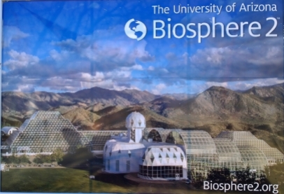
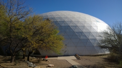
For our next stop we headed south to Biosphere 2 (Biosphere 1 is the Earth) and again got lucky that a tour was just about to begin. This facility is currently operated by the University of Arizona but was originally built as a closed biosphere environment to see if humans could build a space colony that could be self-sufficient. It originally cost $150 M to build and was funded by a Texas oil tycoon. They used the closed system for two experiments, once from 1991-1993, and a second time from March to September 1994. After those experiments Colombia University took over the facility but they let it decline and in 2007 the University of Arizona took it over. Here are a couple of links if you would like to learn more about Biosphere 2:
Wiki link for Biosphere 2 info
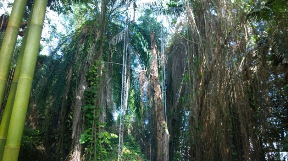
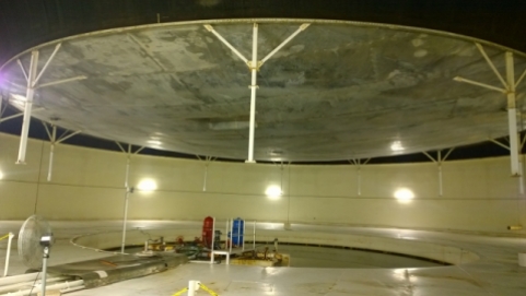
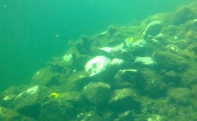
Our tour guide reminded both of us of a friend (Mr Smooth) based on his looks his mannerisms (although he was bald). The tour was about 1.5 hours and the guide used a broadcasting microphone so we could hear with headsets as some areas had a lot of noise and the group was quite large. We started off with a short video and then proceeded to the main complex which contained the Rainforest, the Ocean (in bad shape), the Aquaponics display, the Mangrove Marsh, the Desert, and finished off with the Infrastructure (3 acres of Biosphere needs 2 acres of infrastructure underneath) and then some of the current experiments being done. One of the coolest things we saw was the moving lung mechanism they used to equalize the air pressure difference in the Biosphere as the air heated up during the day and then cooled down at night. They had the South lung which was the one we saw and then a backup lung on the other side of the campus. This prevented all the glass windows from exploding with pressure changes. It was actually hard to get out of the “lung building” due to the air trying to rush in as you went out the door.
After the tour you were free to walk around a few other areas of the campus. We went first to the Ocean Gallery and read about how they have plans to transform the ocean area into a mini version of the Sea of Cortez so they can study climatic changes on the habitat. Then we went into the area where the people were living when they did the closed loop experiments from 91-94. We saw the LEO (Landscape Evolution Observatory) experiment where they are studying how water, energy, and carbon move through landscapes. Lastly we saw how they are testing growing food in inflatable pods without soil so they could use this on manned trips to Mars. Biosphere 2 is listed as one of the “50 Must See Wonders of the World” and we can understand why after our tour. In the parking lot we got a good shot of a Roadrunner.
We returned to Catalina SP and the next morning moved in to the overflow area and the first shot shows the view from our campsite. That day we had decided to do a MTB ride on the Bridle Trail connecting to the 50 Year Trail. The ranger said the trail was moderate to difficult and we definitely found the difficult aspects on some sections of the 50 Year Trail. I found that my legs were getting oxygen burn on the uphill rocky sections and Sharon coined the term B-Hiking (meaning walking your Mountain Bike on the Trail so you don’t fall off into cacti!!! That would be a prickly situation.). Our friend Dennis would have absolutely loved this trail and I would have loved to have his bike on this trail;-) We climbed the first section until we reached the top of the ridge and then it had up and down sections in the foothills with beautiful views of the Catalina Mountains including up to Mt. Lemon. We saw more MTB’ers on this trail than any other ride we’ve done this trip but Sharon was the only women! We did a total of about 15 KMS riding that day with about 8 being in the difficult category. The most fun part for me was the ride back down the rocky ridge at the end, going down is so much easier than going up! That evening we climbed up the hill by our campsite and had a nice sunset.
For our last day at Catalina we decided to hike the various shorter trails, Romero Ruins Interpretative Trail, Birding Trail, and the Nature Trail for a total of 7.5 KMS. Romero Ruins was an archeological site with surface features from a Hohokam (native) village from 500 AD as well as the ruins of the Romero homestead. On the Birding Trail we saw Cardinals, Pyrrhuloxia and sparrows. The nature trail had signs about the wildlife of the area with lots of cool facts and many different types of cacti so Sharon made up a collage of the prickly parts of the cacti. That evening we had an even better sunset than the night before so what a fitting way to end the amazing stay we had at Catalina SP. Definitely a place we would come back to but we’d have to book a long time in advance!



















Hi you guys, …. This was definitely one of the more interesting blog. … I enjoyed it immensely. … Thanks for sending it….. John
LikeLiked by 1 person
Thanks for your comments John, we really have enjoyed this area so far. We’ve spent a month already just in South Eastern Arizona! It’s going to take a lot of years to see all the states at our pace😁
LikeLike
Great blog again, all the photo’s looks like you are on your own. There are other people in USA arn’t there?
LikeLiked by 1 person
I’ll see if I can find some people for the next blog😉 Definitely in this area all the trails have had people on them, not so much in the other areas we’ve been.
LikeLike
Meep meep!! I loved the roadrunner! The landscape is beautiful and I think that the saguaro cacti look so happy. All their arms up waving “hello!”
Hello Joel and Sharon!
LikeLiked by 1 person
You’re right Ella, the Saguaros seem like a bunch of happy giants hanging around in the desert😁
LikeLike