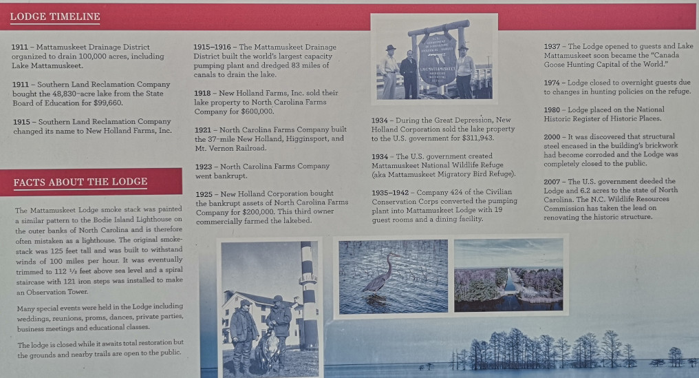
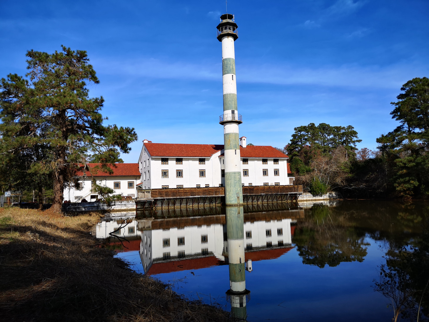
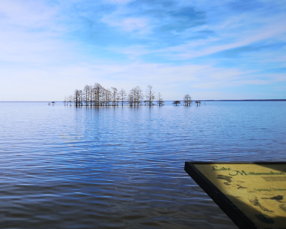
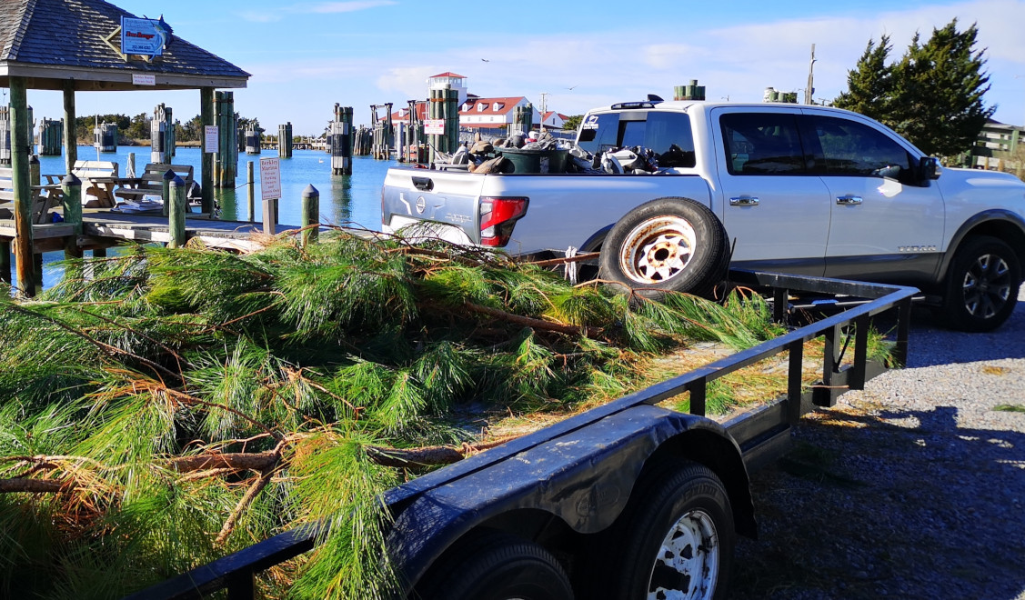
As we headed inland to Goose Creek SP to partially avoid the storm, we decided to take the longer more scenic route. This took us south through Alligator River National Wildlife Refuge and then west along Pamlico Sound and through several small fishing villages. As we reached New Holland we turned in to see Mattamuskeet National Wildlife Refuge. However, the first thing we saw looked like a tall lighthouse and it was painted like the Bodie Island Lighthouse. The display board explained that it started as a pumping station for Lake Mattamuskeet in 1915-16. Lake Mattamuskeet was the largest natural lake in North Carolina (14 miles long and 5 miles wide) and the goal was to drain it to use the rich soil in the lakebed for farming. The station could pump up to 1.2 million gallons/minute, but it was expensive to operate using coal as it’s fuel source. Three different owners tried to make a go of it but it was shut down in 1932. The US government bought Lake Mattamuskeet in 1934 to make it into a Wildlife Refuge and then they had the CCC convert the pumping station into a lodge with 19 guest rooms and a dining room. The lodge opened for guests in 1937 and was called the “Canada Goose Hunting Capital of the World” 😉 Refuge hunting policy changes in 1974 caused the lodge to close to overnight guests, and in 2000 it was closed to the public due to structural issues.
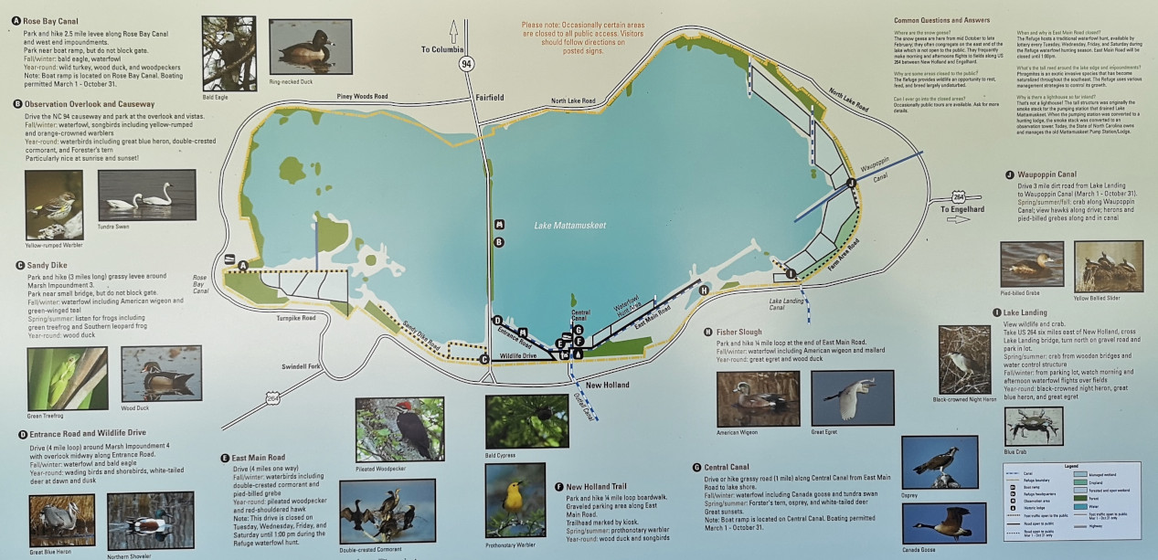
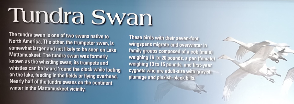
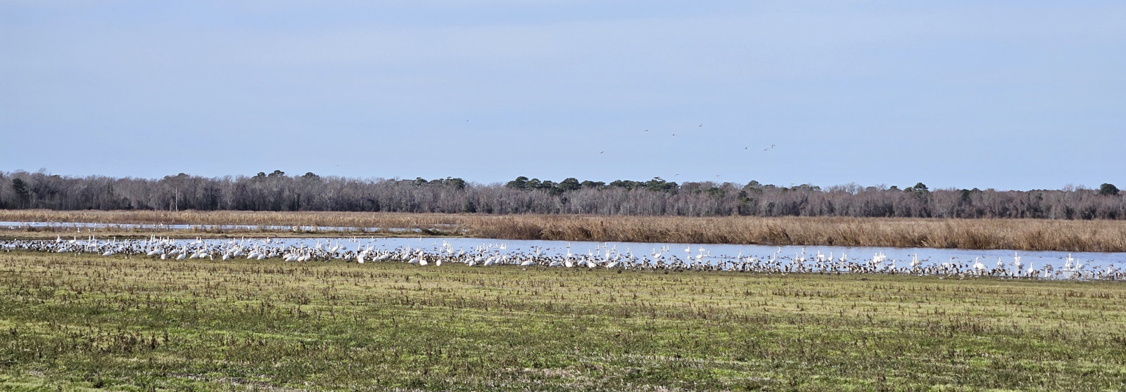
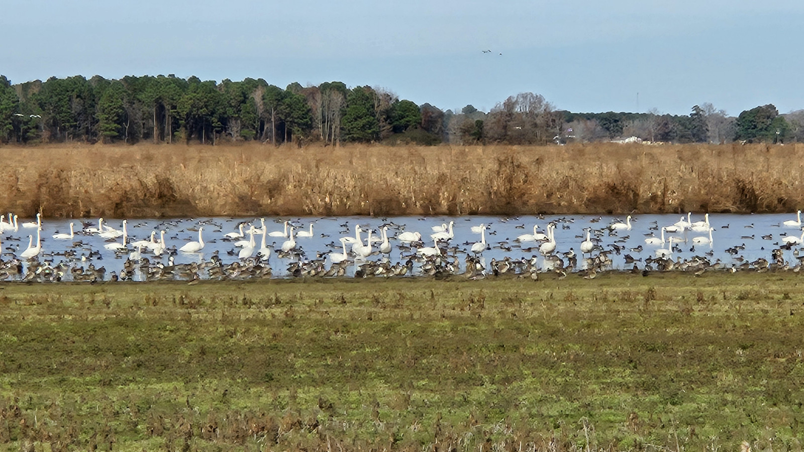
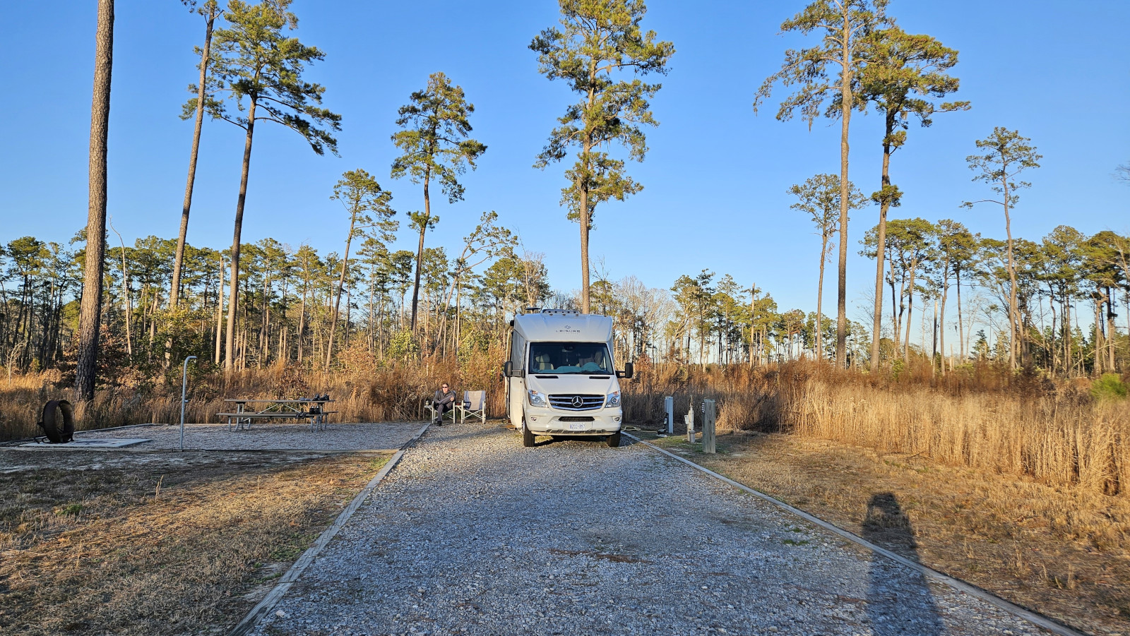
Next, we looked at the displays inside the refuge headquarters. The volunteer had only been working there for 1 week and I guess they didn’t train her because she had no idea what we could do or see in the refuge. We drove on the dirt roads through the refuge looking for any Tundra Swans or Canada Geese but saw absolutely nothing. Then when we left the refuge area, we saw all the swans in a farmer’s field that had been flooded. Once we reached Goose Creek SP we went to our site (which was huge, must be a brand-new campground in the park) and had time to watch the sunset enjoying a cold beer. From this latest selection the only Dogfish Head beer that was any good was the 60-minute IPA and then the Lost Colony Charon Stout was much better.


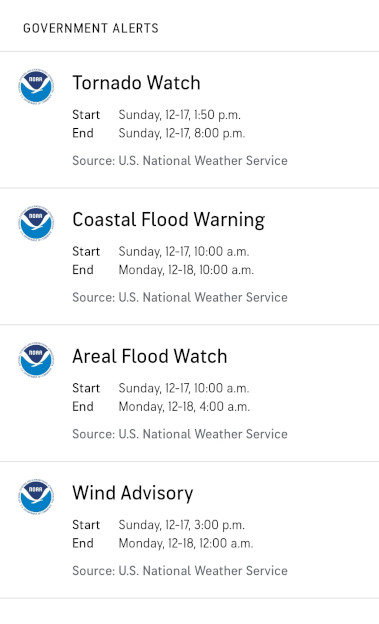
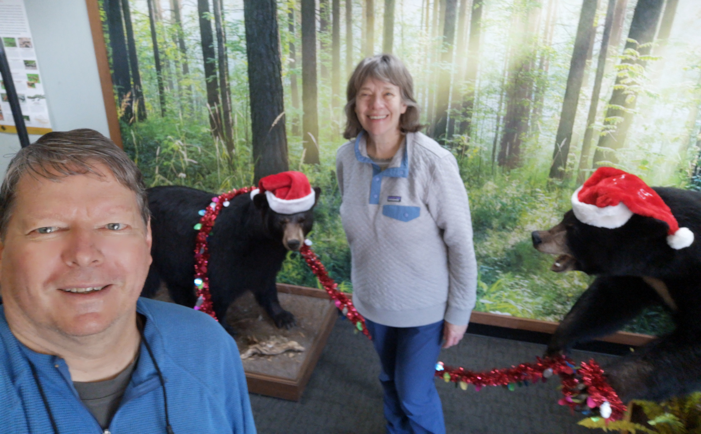
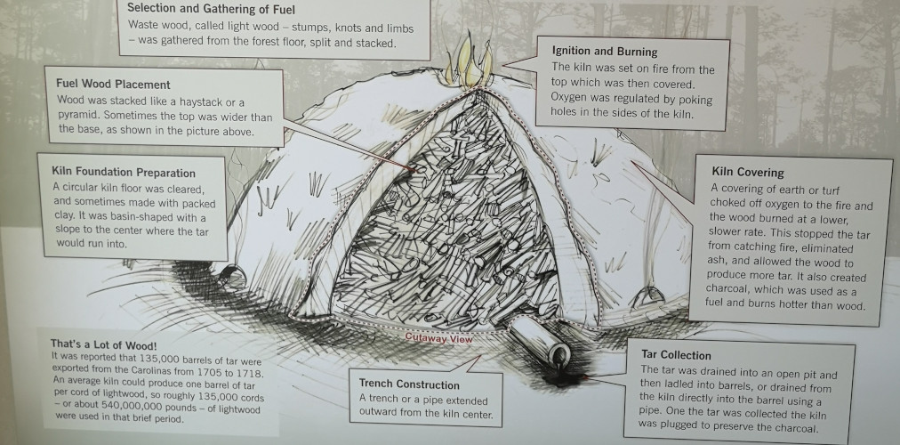
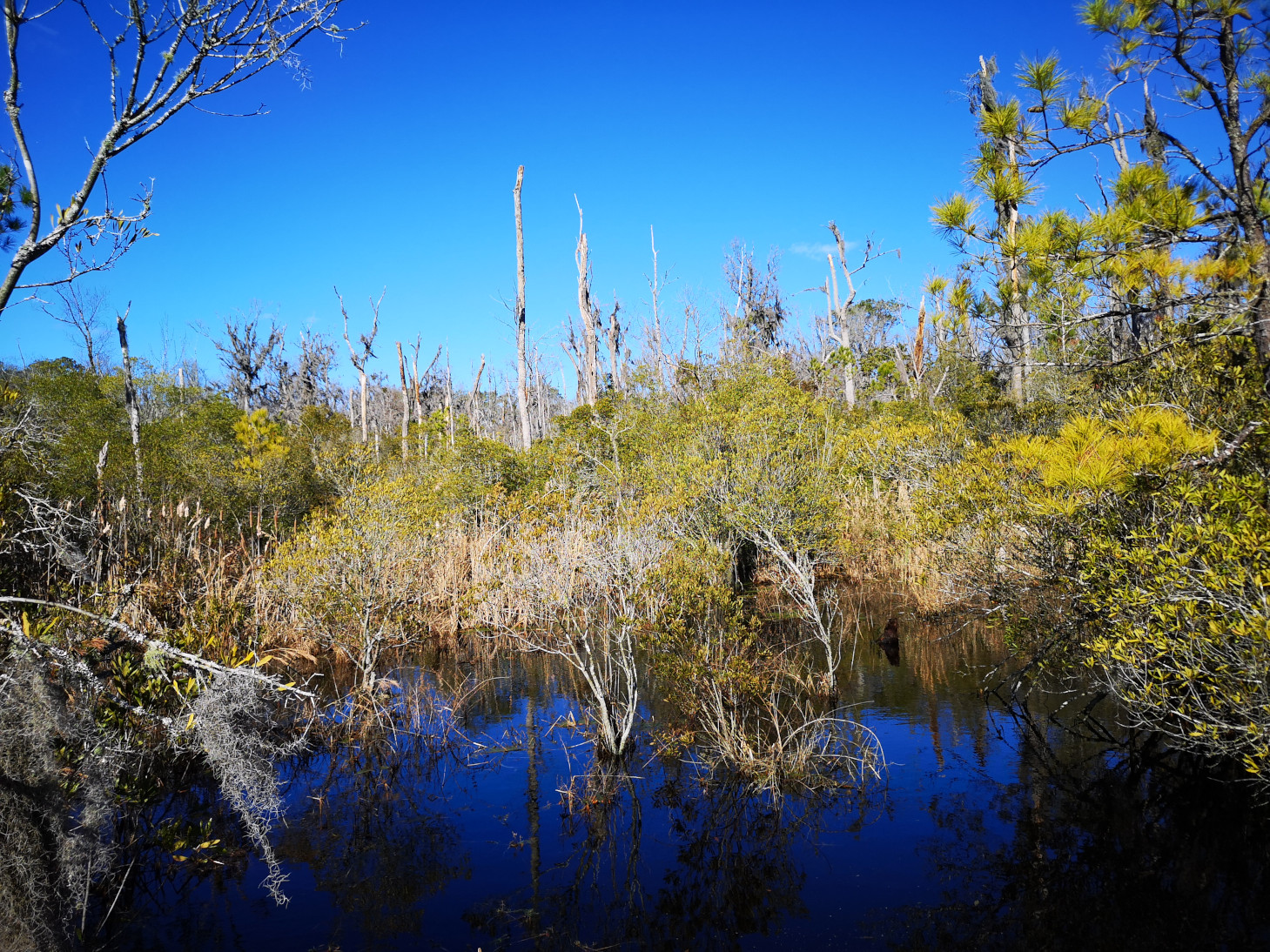
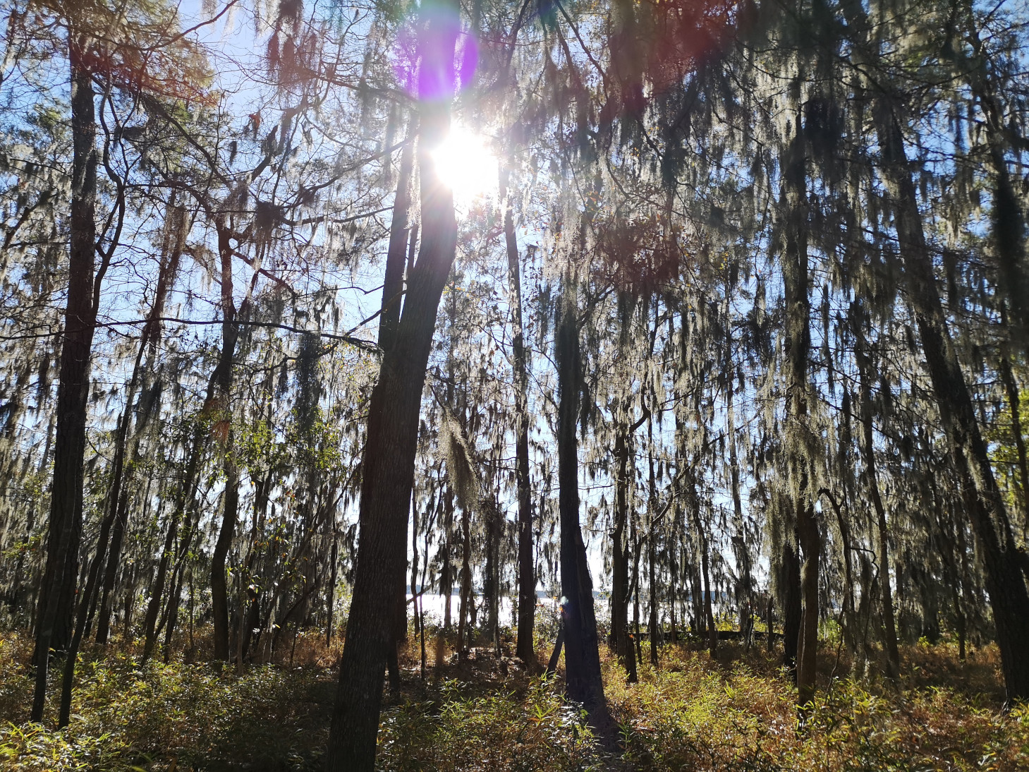
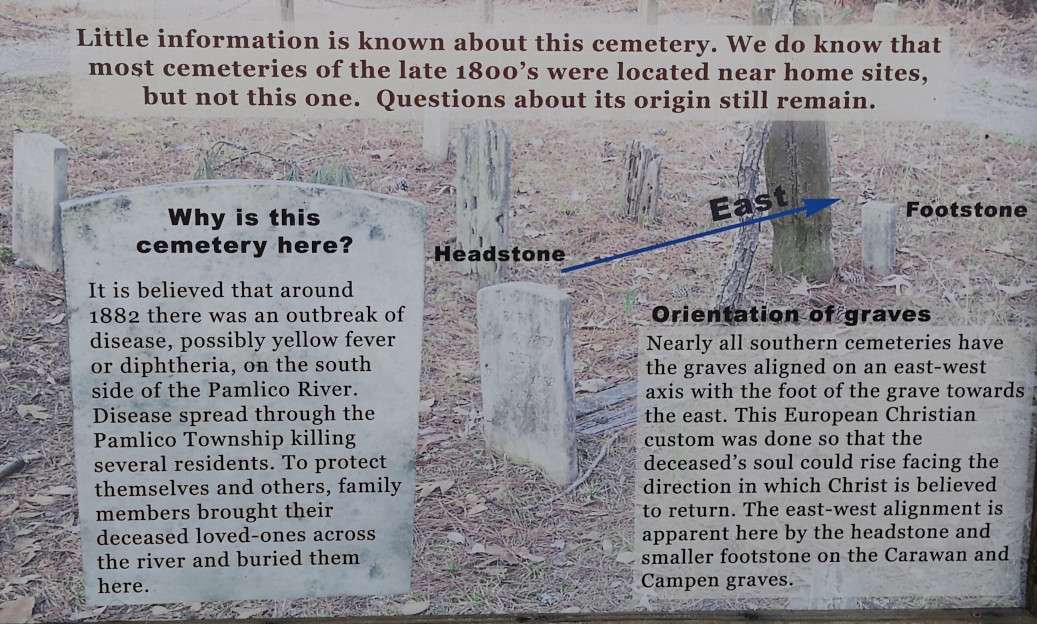
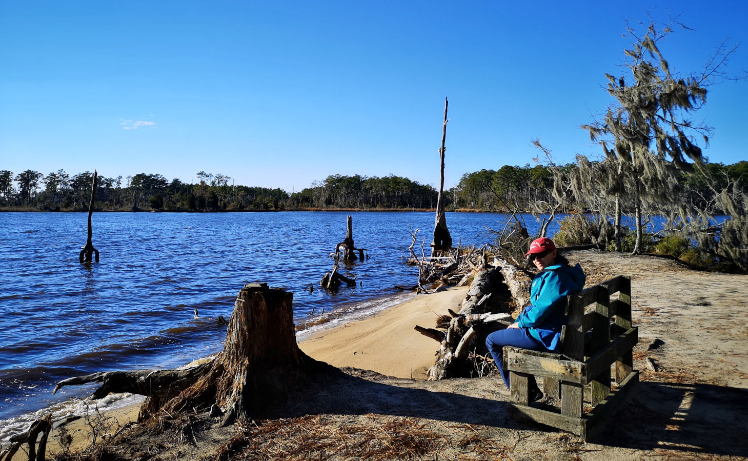
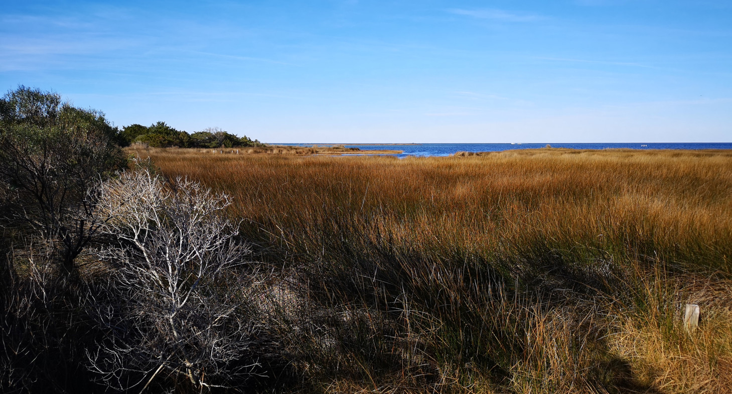
As you’ll see in the slides we had lots of watches, warnings, and advisories the next day but for us it was an all-day rain event, so we stayed in and worked on editing photos and the blog. Our winds were about half of what they were getting along the coast. Since Monday was our only useable day in the park, we decided to do all the hiking trails (almost 18 kms), made up for getting no exercise the day before (you don’t get many steps in when you stay in the RV all day). We were very glad we both had new waterproof Gortex hiking boots as we headed out to explore the park and the newly created ponds along the hiking trails. First, we checked out the Visitors’ Centre where we saw the Christmas Bears and learned about the park history in lumber production and tar kilns. To produce tar for ship building they would gather waste wood from the swamp and maritime forest and pile it up with a drainage ditch below and then cover it with earth. The fire would burn very slowly, and the tar would drip out into the drainage ditch to in turn be collected. The nearby town of Bath was very important to the naval stores industry because it was the first port of entry to North Carolina starting in 1716 due to its proximity to Ocracoke Inlet. The first trail we took was along a boardwalk where we learned about Ghost Forests. As climate change brings sea level rise and the salinity gets too strong in the marsh some of the bald cypress trees die off leaving large dead trees in the marsh. After the boardwalk the hiking became more challenging due to standing water from the rain along the trails. We had to do some bush whacking beside the trails to get around all the ponds. Near the beach they had an old cemetery, and this was the first time we had ever seen where they had a head stone but also had a foot stone. Later we had to walk the main road as there was no way we could continue along the trail since it was more than a foot underwater! We were both pretty exhausted after this long day of hiking, so we sat out in our massive campsite and enjoyed happy hour as the sun set.


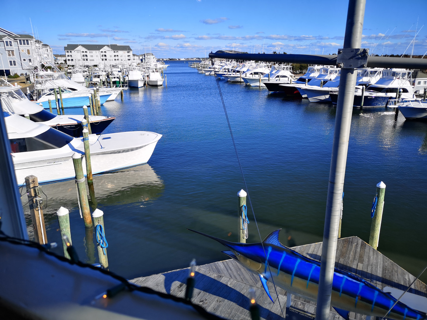
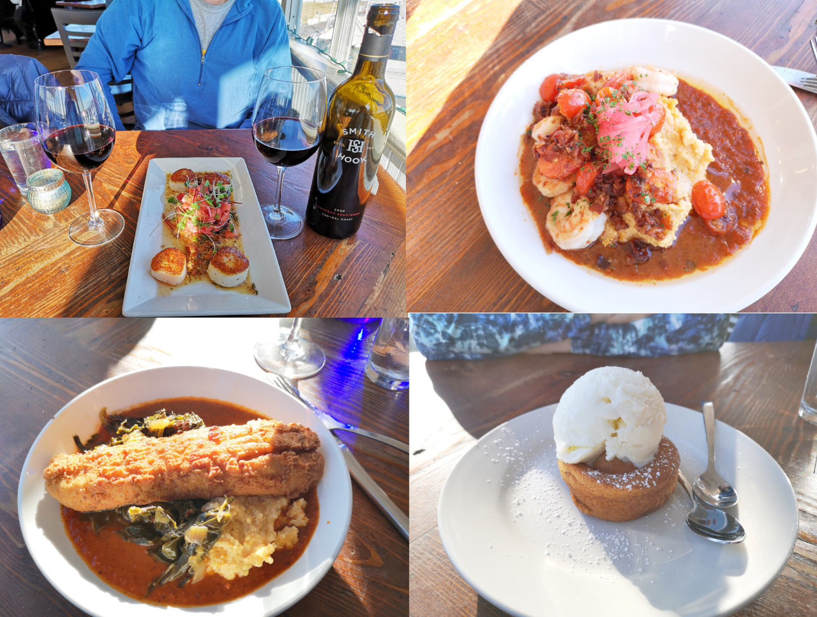
Back to our “regularly scheduled program”, we headed back to Oregon Inlet Campground. We took the highway route, stopping in Manteo for some groceries and then out for an excellent seafood lunch at Bluewater Grill and Raw Bar. It just happened to be ½ price wine Tuesday, so we got a bottle of Smith & Hook Cabernet Sauvignon! For appetizer we had the Seared North Atlantic Sea Scallops which were perfect, Sharon had the Shrimp and Grits, and I had the Fried NC Speckled Trout, and for dessert we had Warm Bourbon Spiced cake with Ginger Ice cream, everything was phenomenal!
When we got settled in at the campground Joel blogged and Sharon went to the beach to watch the sunset.
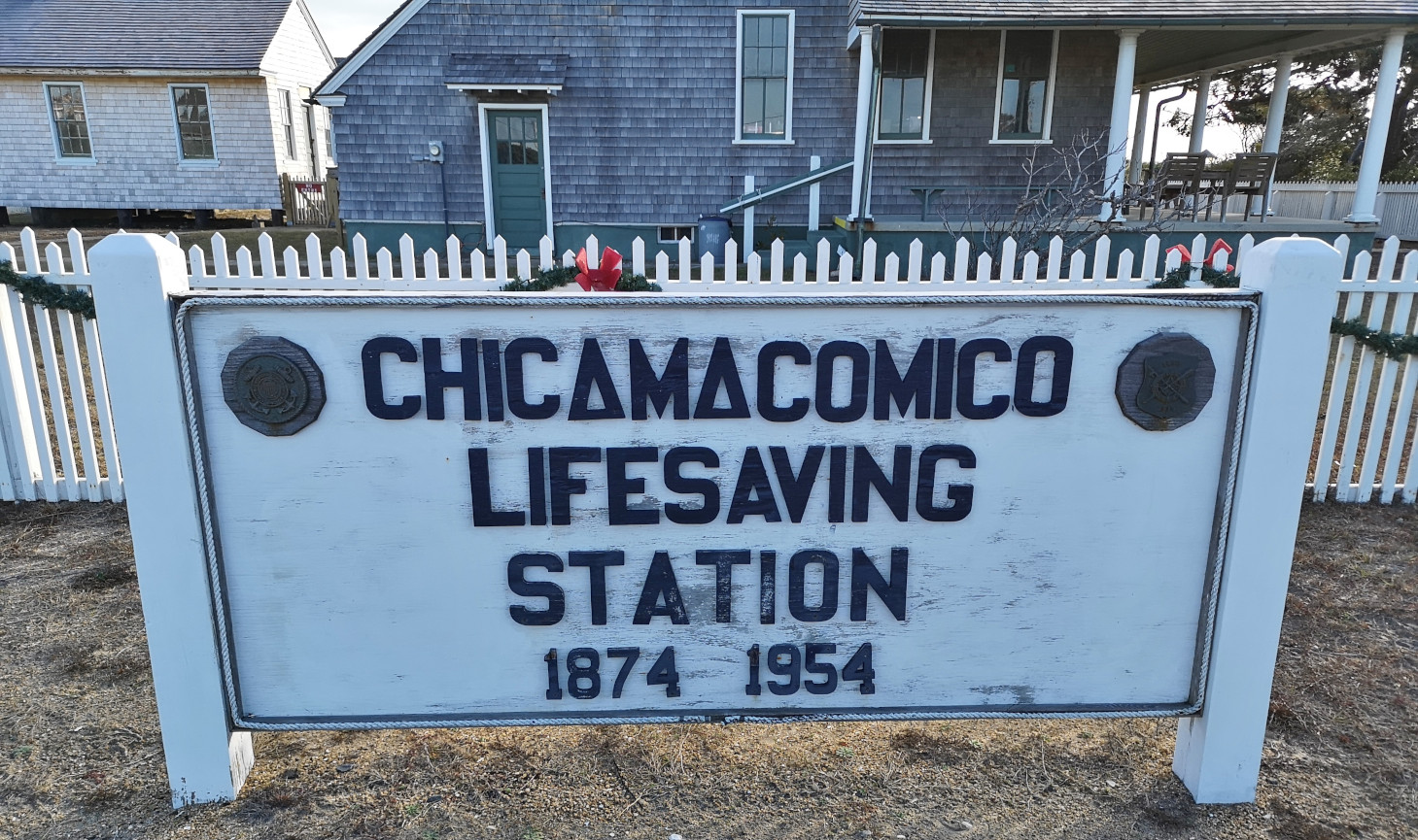
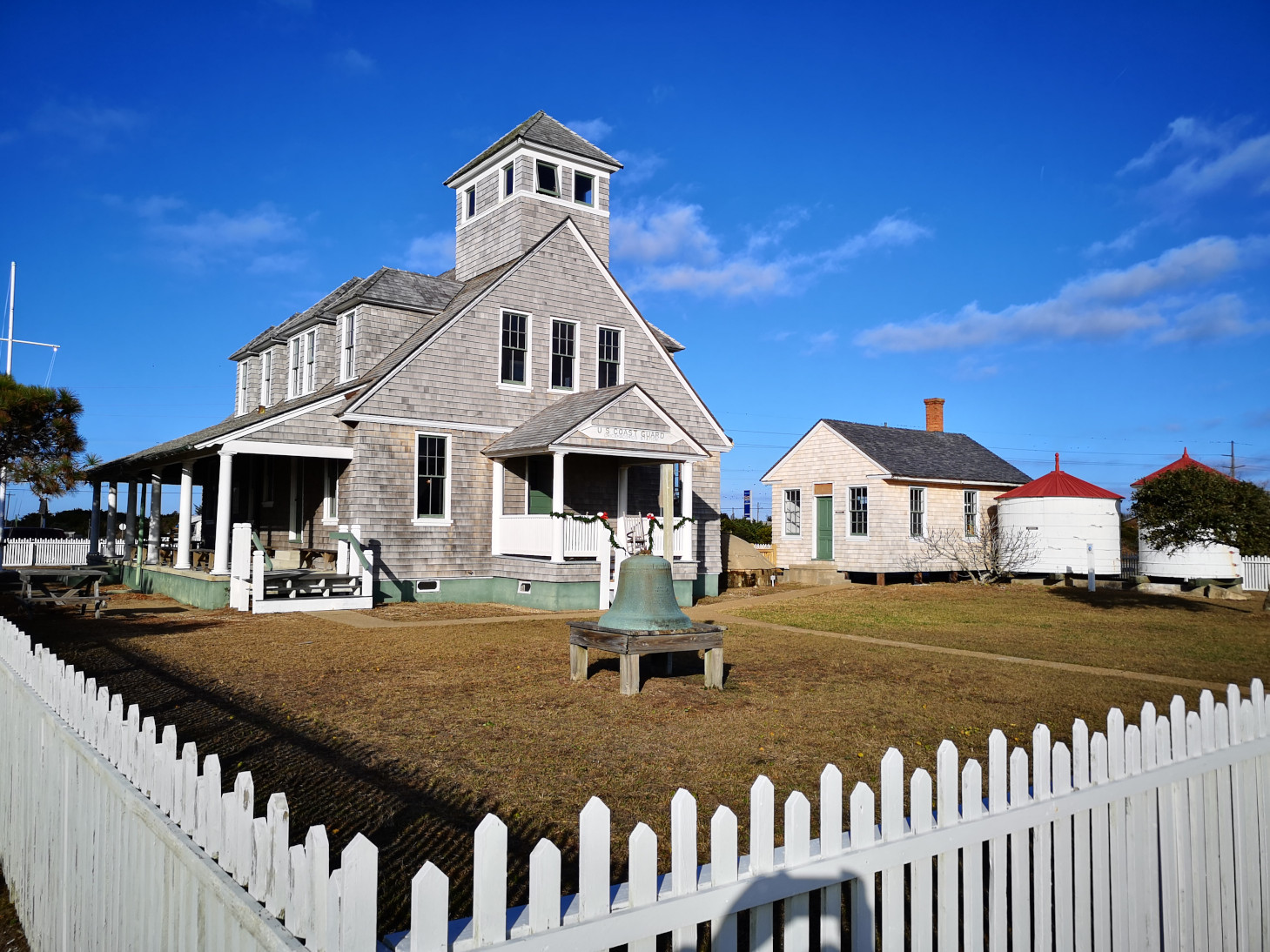
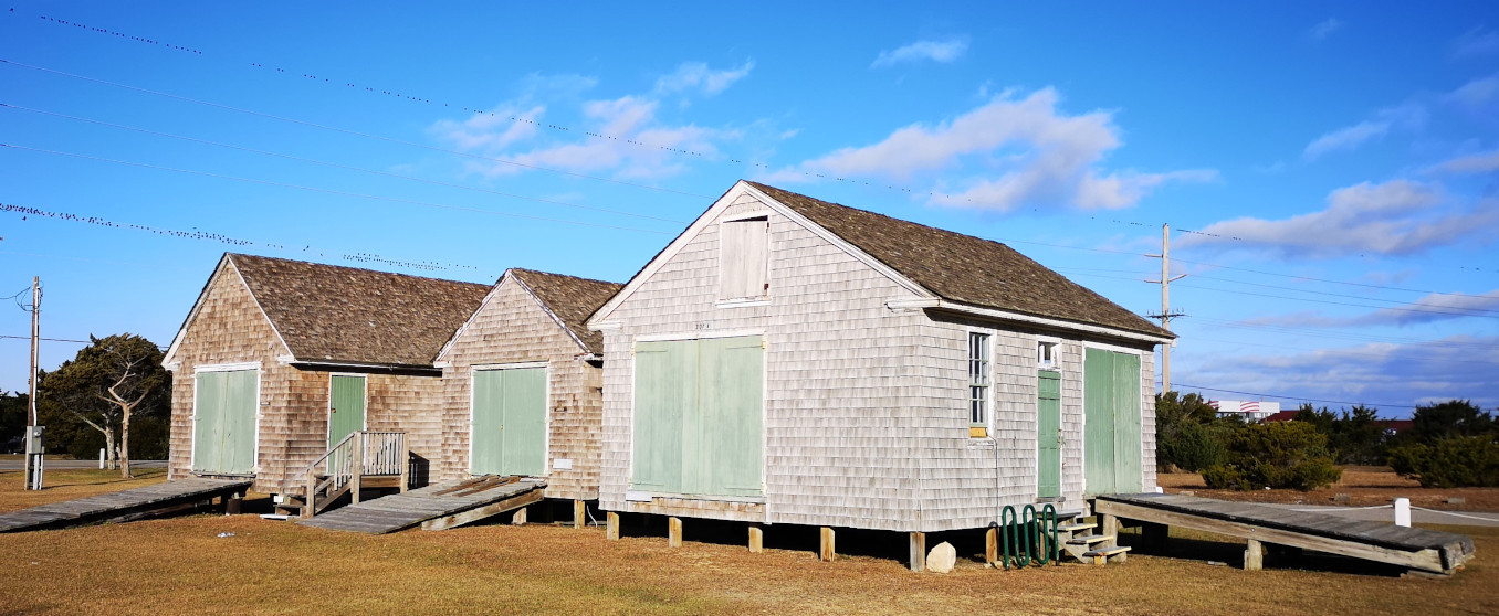
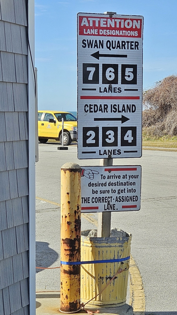
The next day we had to drive south on Highway 12 to Cape Hatteras so we could catch the ferry to go to Ocracoke Island. We had been monitoring the reports on the storm damage and Highway 12 was closed for one day as they cleared the sand and water from the 14’ storm surge that had breached the dunes. However, the road on Ocracoke Island had been closed for 3 days so the ferry had not been operating. Luckily, they opened late Tuesday, and we were planning to take it on Wednesday. We really got lucky with rebooked timings. We had seen Pea Island already so first stop south was in Rodanthe to see the Chicamacomico Life Saving Station. Unfortunately, the museum was closed for renovations but at least we could look around the outside of the buildings. We saw the 1874 station that was the first in operation in NC, in total there were 29 life saving stations built 6-7 miles apart. The 1911 station was much larger with a cookhouse, a boathouse, a tractor shed, and a 2 horse stable. It also had 2 water tanks and a water cistern. The site was converted to the US Coast Guard in 1915 and saw action in both WWI and WWII before being decommissioned in 1954.

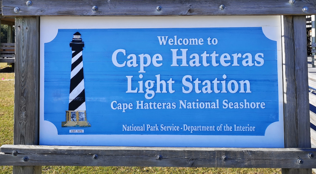
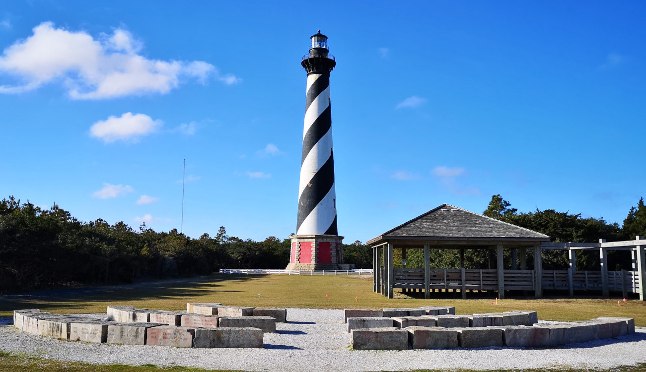
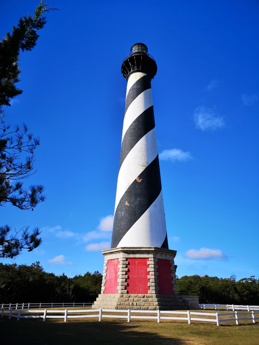
As we continued south on the Outer Banks we went through small towns like Waves, Salvo, Avon, and Buxton. They were all touristy but not as populated as Nags Head. In Buxton we turned off to visit Cape Hatteras Lighthouse. Here are some fun facts about it:
- The first lighthouse was a 90’ sandstone structure built in 1803 but the light didn’t carry far enough so they extended it to 150’ with a first order Fresnel lens in 1854.
- In 1861 retreating Confederate soldiers took the Fresnel lens so the Union soldiers wouldn’t be able to use it.
- Shell damage during the war prompted a new lighthouse to be built in 1870 and that is the one still standing today.
- Cape Hatteras Lighthouse is known as America’s Lighthouse as it is the tallest brick beacon in the country at 198’.
- Beach erosion started to threaten the lighthouse in 1935 so they setup a temporary tower. The Fresnel lens was damaged in the 1940’s and the lighthouse was electrified with 2 active 1000-watt lamps that can be seen for more than 20 miles.
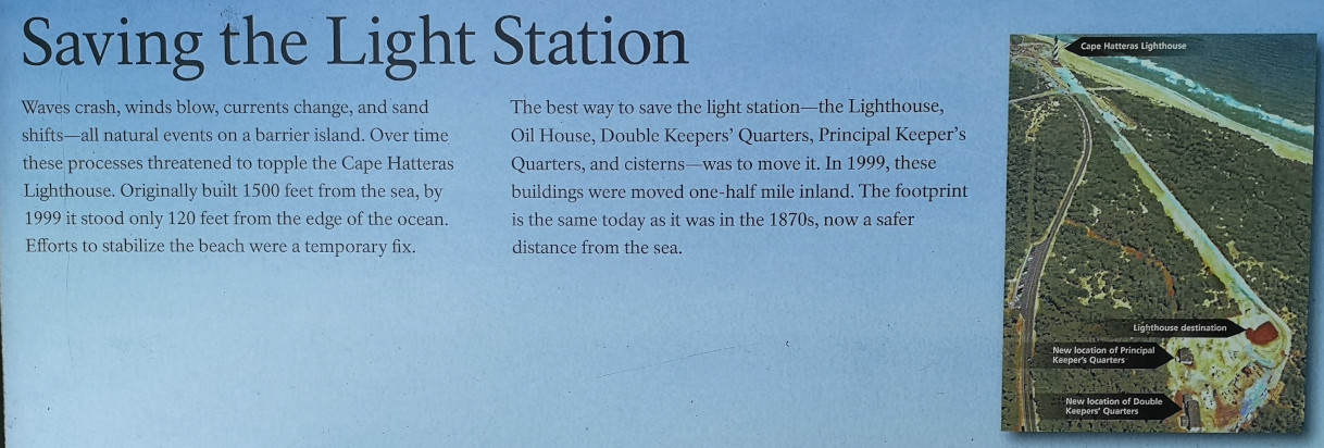
- In 1999 the lighthouse was moved a ½ mile inland over the course of 23 days on railroad tracks in order to save it from any further erosion.
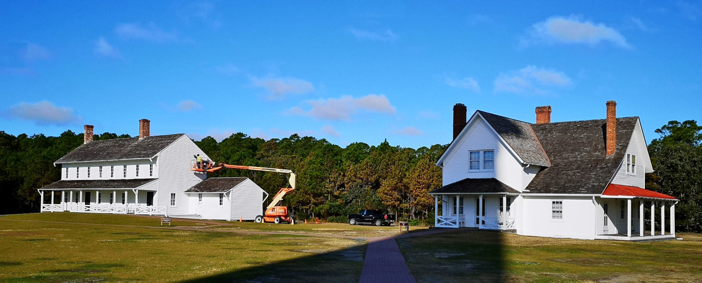
- The original base stones were saved and can be seen by the visitors’ centre. Currently work is underway to restore the Double Keeper’s quarters and the Principal Keepers quarters.
They didn’t have the lighthouse open for climbing when we were there, so we enjoyed it from ground level.


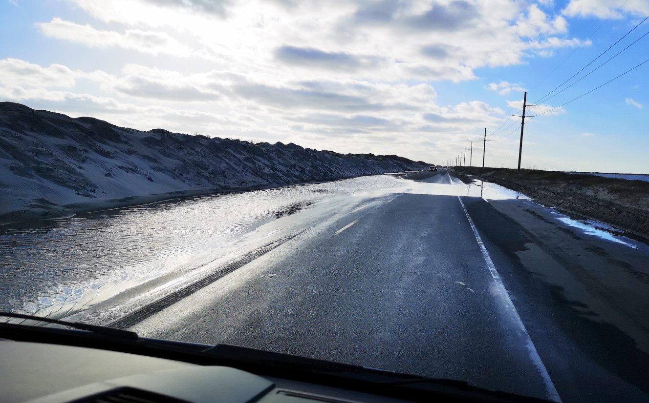
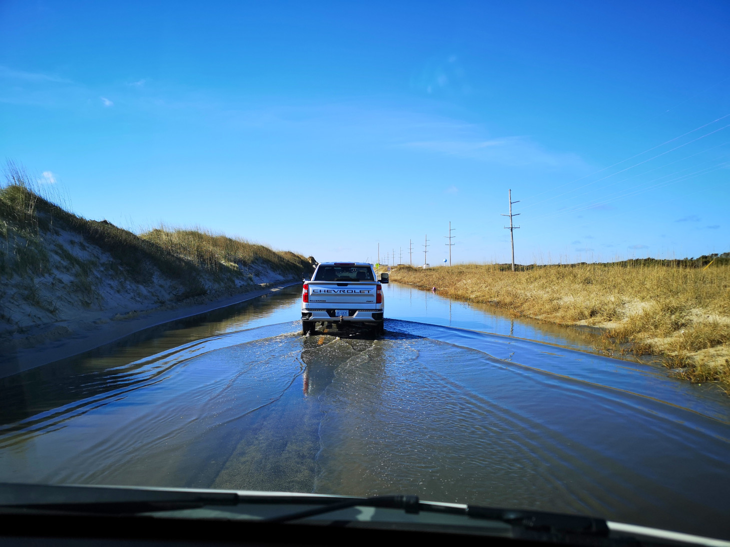
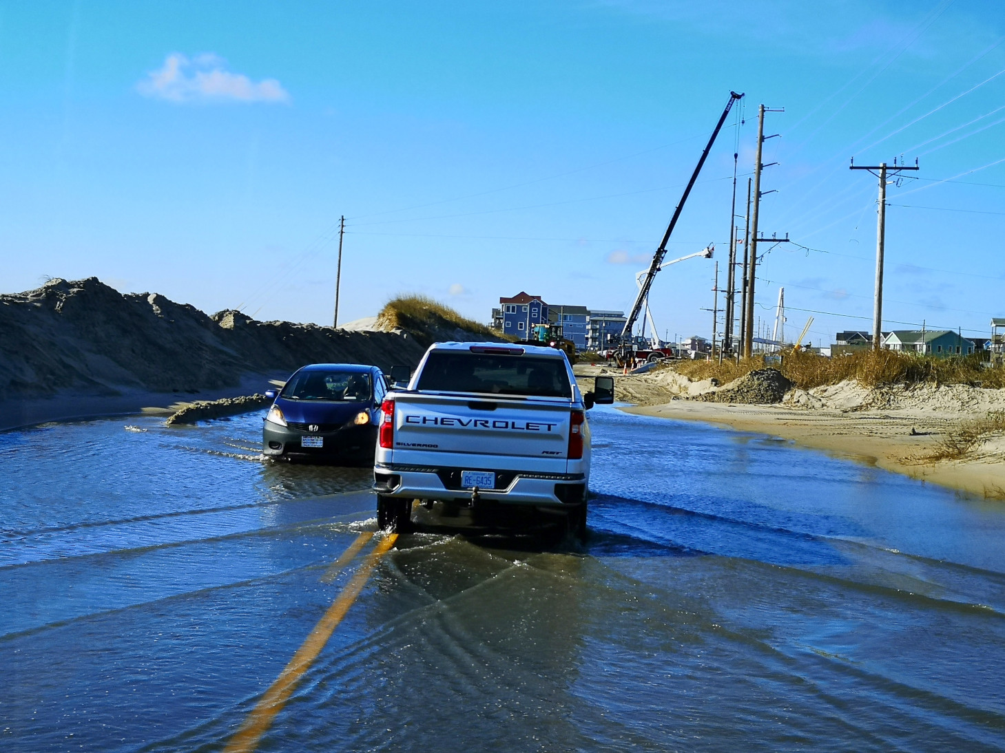
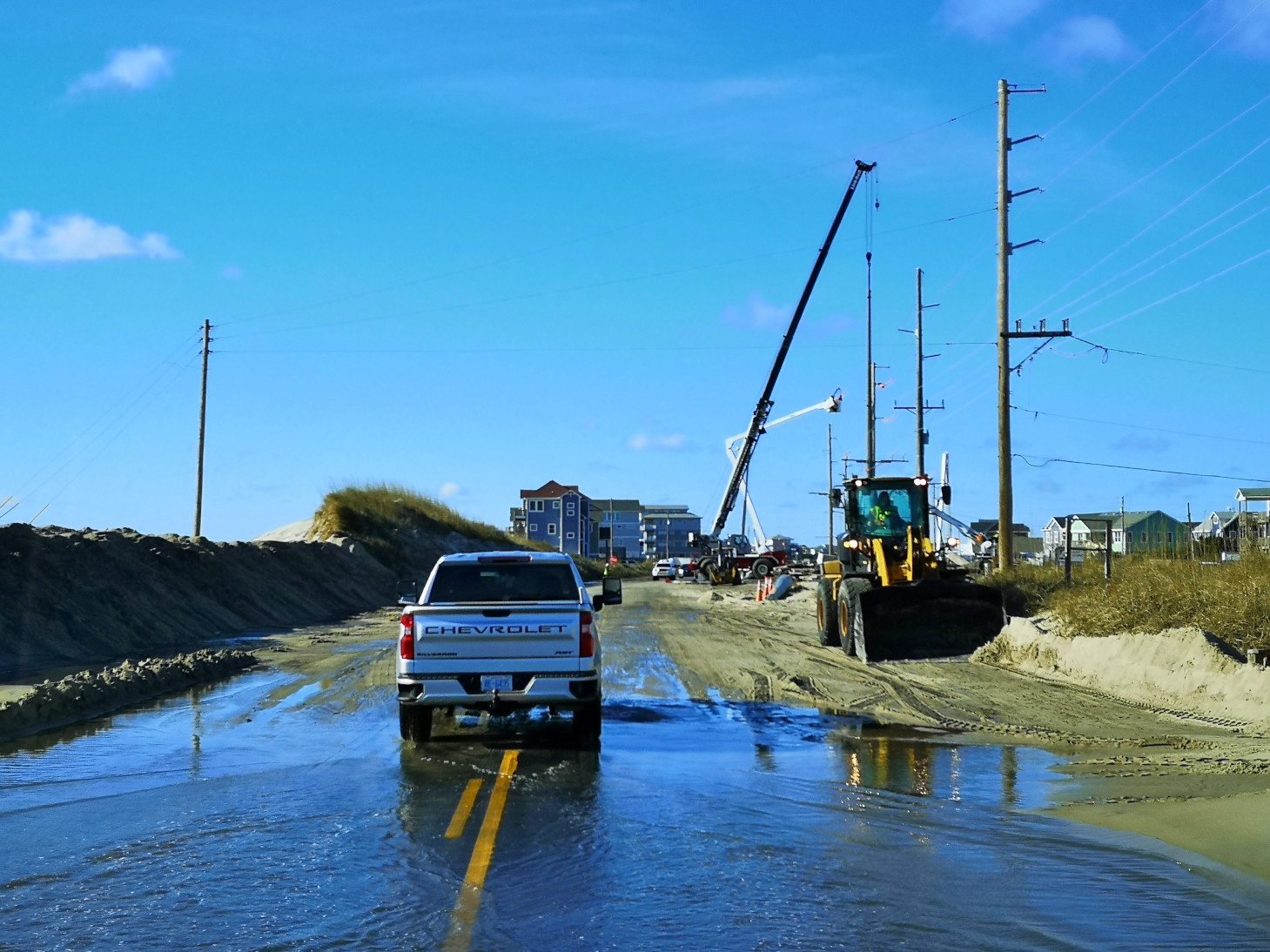
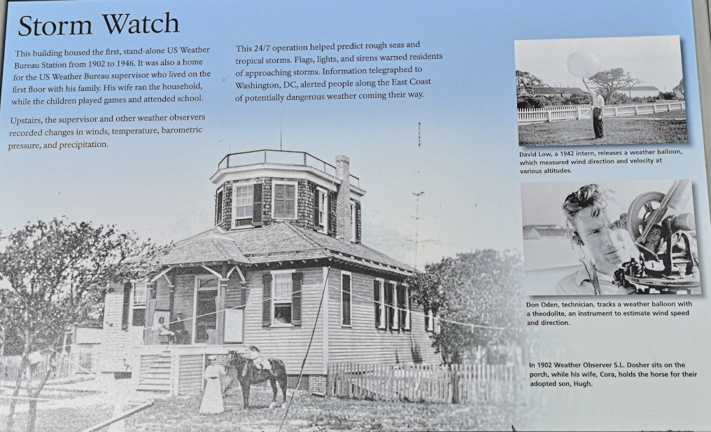
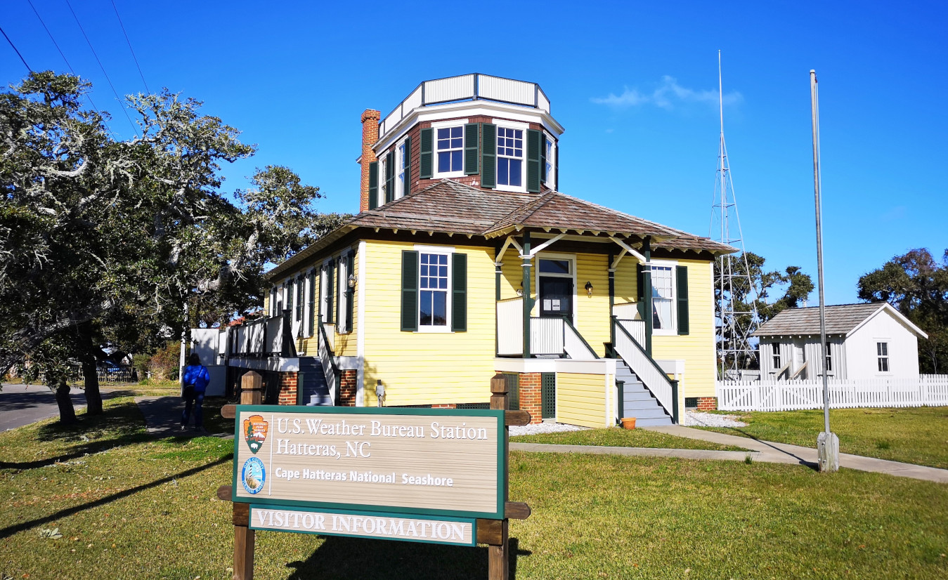
After the lighthouse and Buxton, the Outer Banks starts to turn SW and you go through Frisco and Sandy Bay and that’s where we saw the worst of the road conditions where we actually had to drive through salt water on the road (not the best thing for the vehicle) and through sand areas that they were still clearing and they were also working on power lines as well. Once in the town of Hatteras we stopped to see the first stand-alone US Weather Bureau Station that was operational from 1902 to 1946. Again, because this is more off season it wasn’t open to visitors.
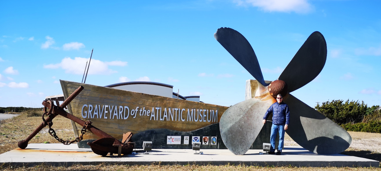
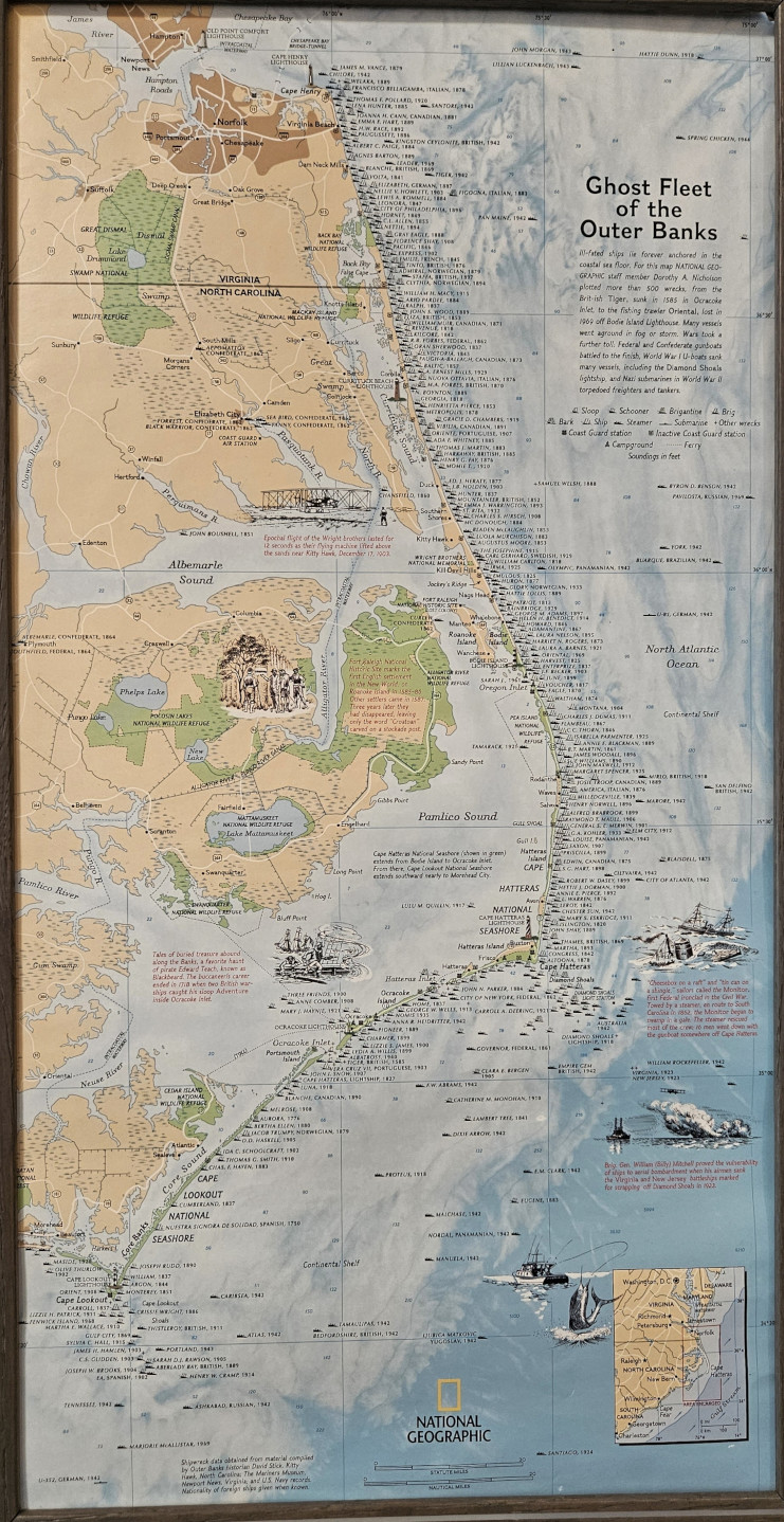
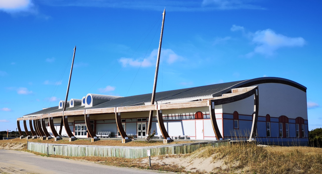
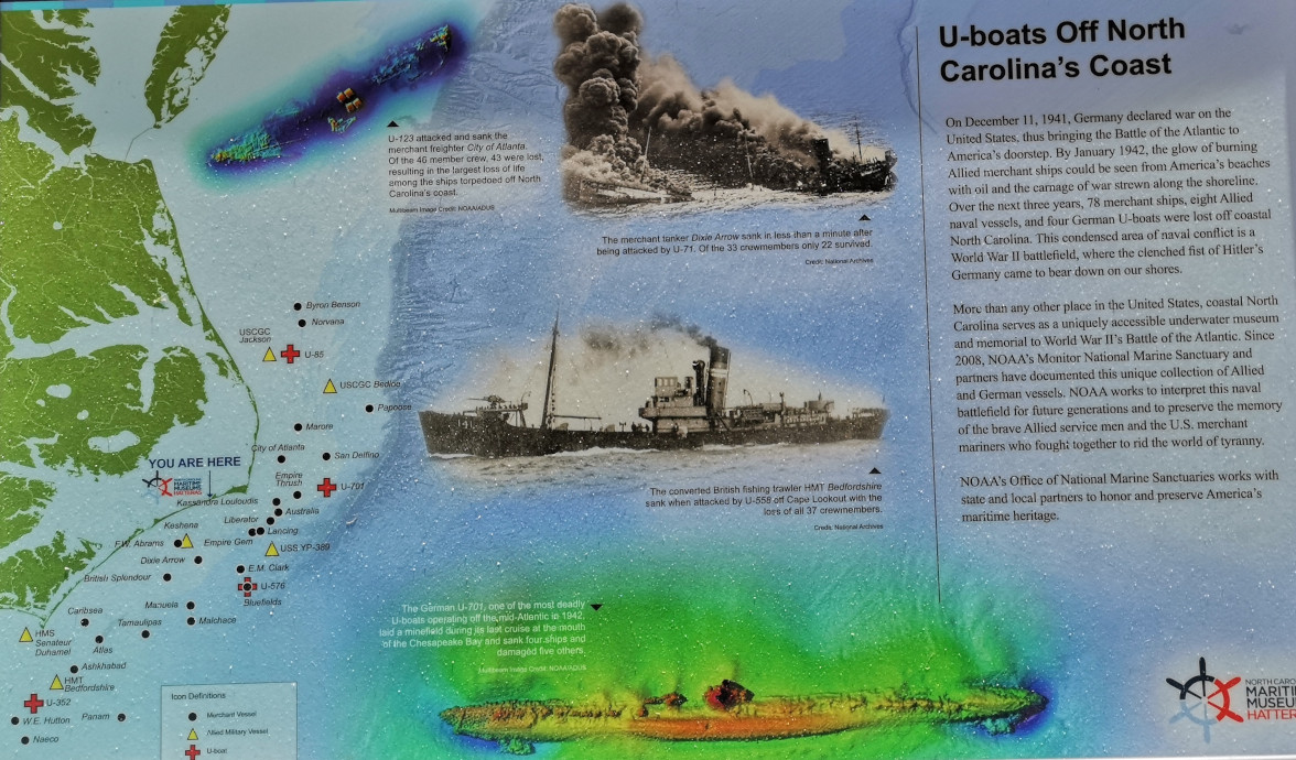
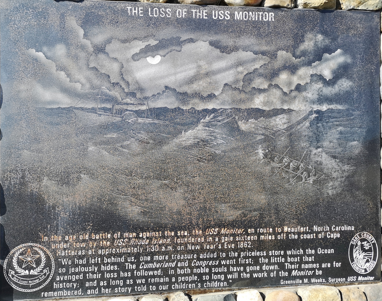
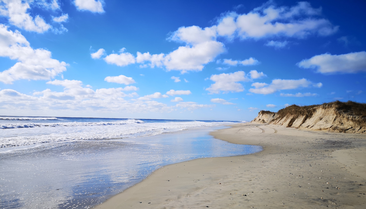
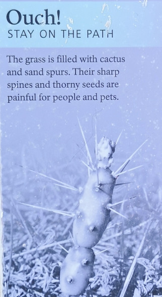
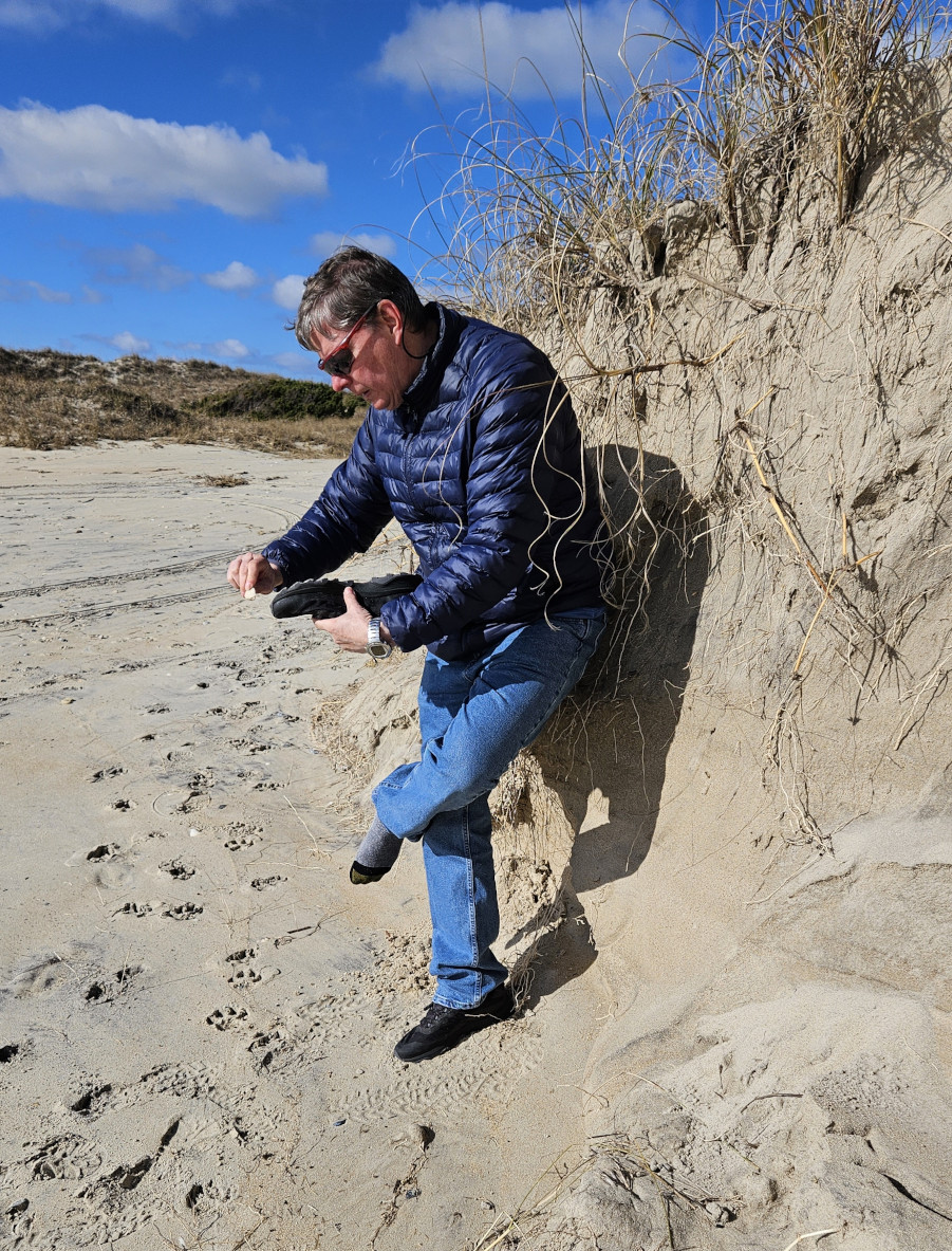
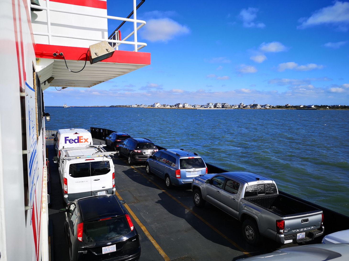
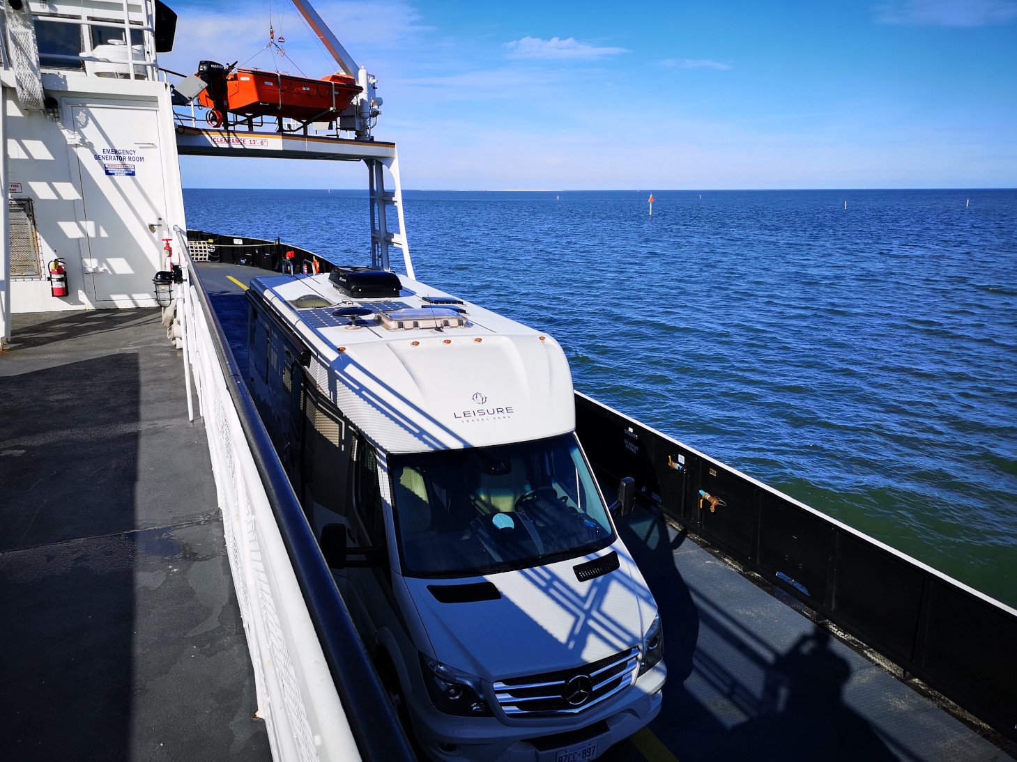
We were taking the free ferry from Hatteras to Ocracoke Island, we arrived early so we were second in line to get on the ferry. In the terminal we chatted for a long time with the ferry attendant, and he told us several things to see as we continued our journey south. Since we had time, we decided to walk over to the Graveyard of the Atlantic Museum which was just across the parking lot. Unfortunately, it was closed for renovations so we could only look at the outside exhibits. The area of the Outer Banks Coast has more than 500 shipwrecks from all different time periods so that’s why they call it the Graveyard of the Atlantic. One of the most famous wrecks was the USS Monitor which was an ironclad ship used during the Civil War, it sank on New Years Eve of 1862. After looking at the outside exhibits we took a stroll on the beach but had to clean the bottoms of our shoes as they were full of sandspurs from the grass around the museum. The sand spurs are incredibly sharp, so you don’t want to bring them back into the RV!

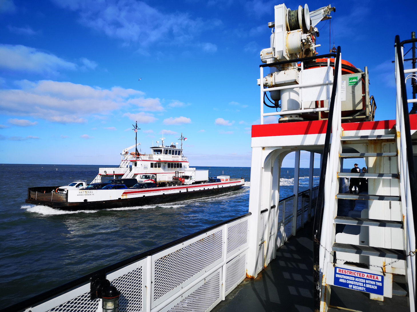
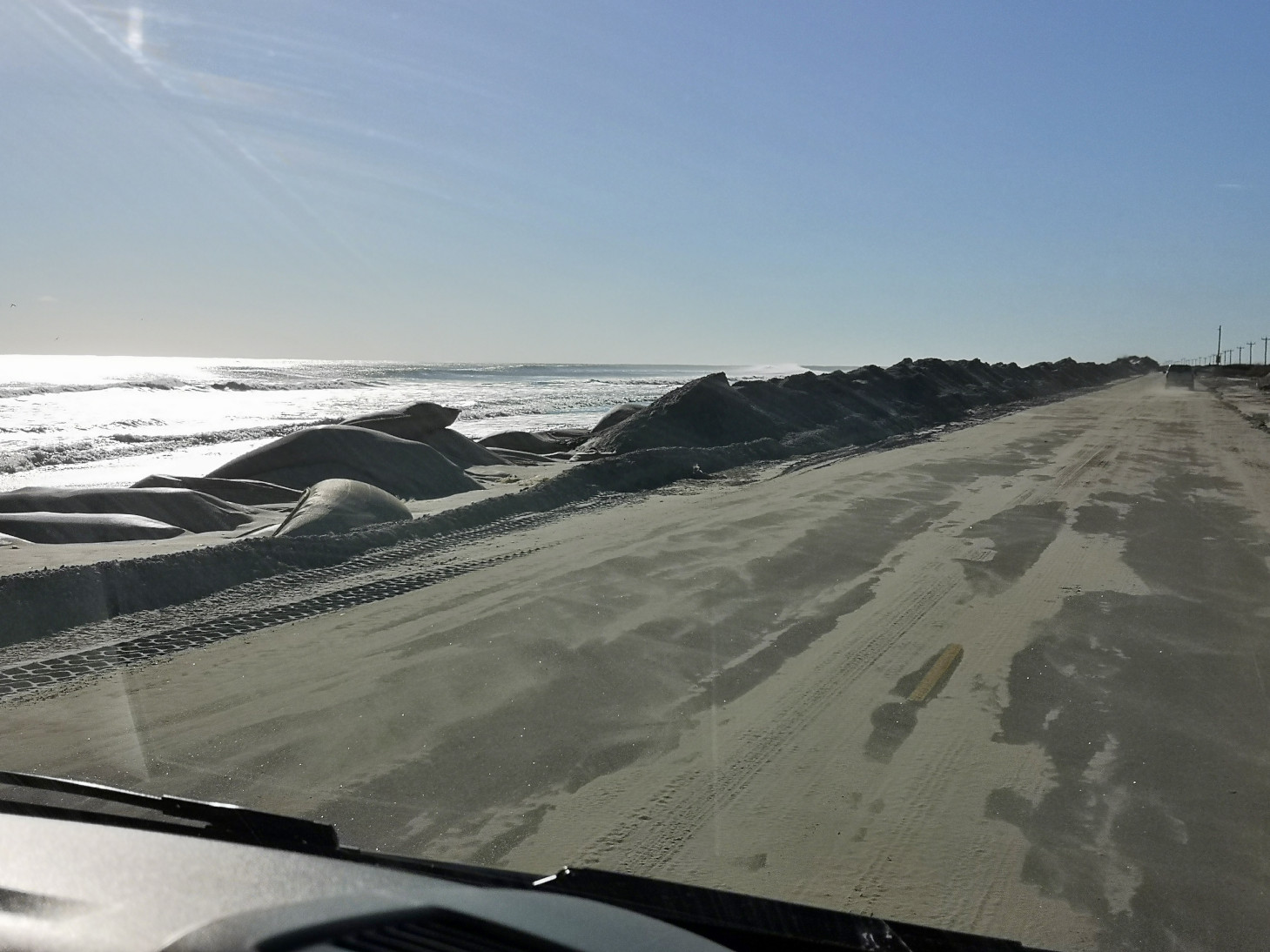
The crossing to Ocracoke Island is not that far in actual distance but the ferry has to follow the dredged channel so it takes about an hour. Once on Ocracoke Island we could see why the road and ferry had been closed for 3 days as they were still clearing sand off the road! The distance from the Atlantic Ocean to the bay side was incredibly small so it would be so easy for the storm surge to wash over the dunes. They even had sand filled sacks that were at the base of the dunes to try to protect them, but the front-end loaders were active trying to pile the sand back up onto the dunes.


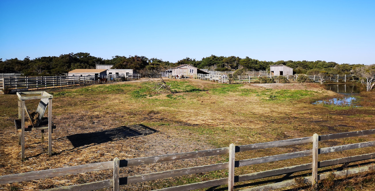
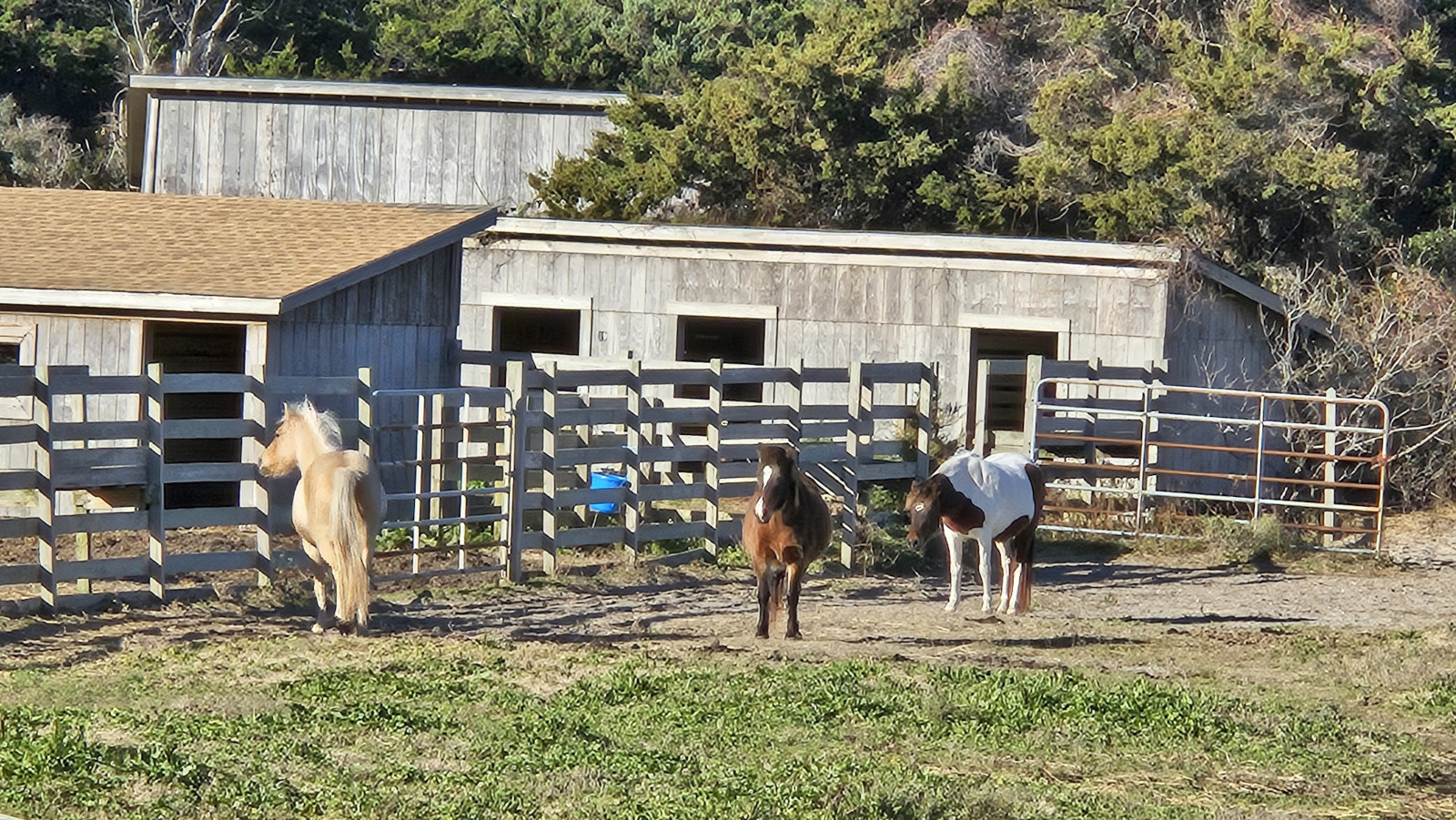
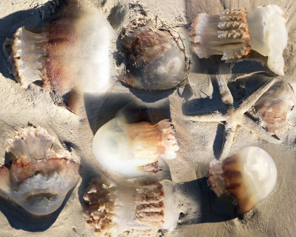
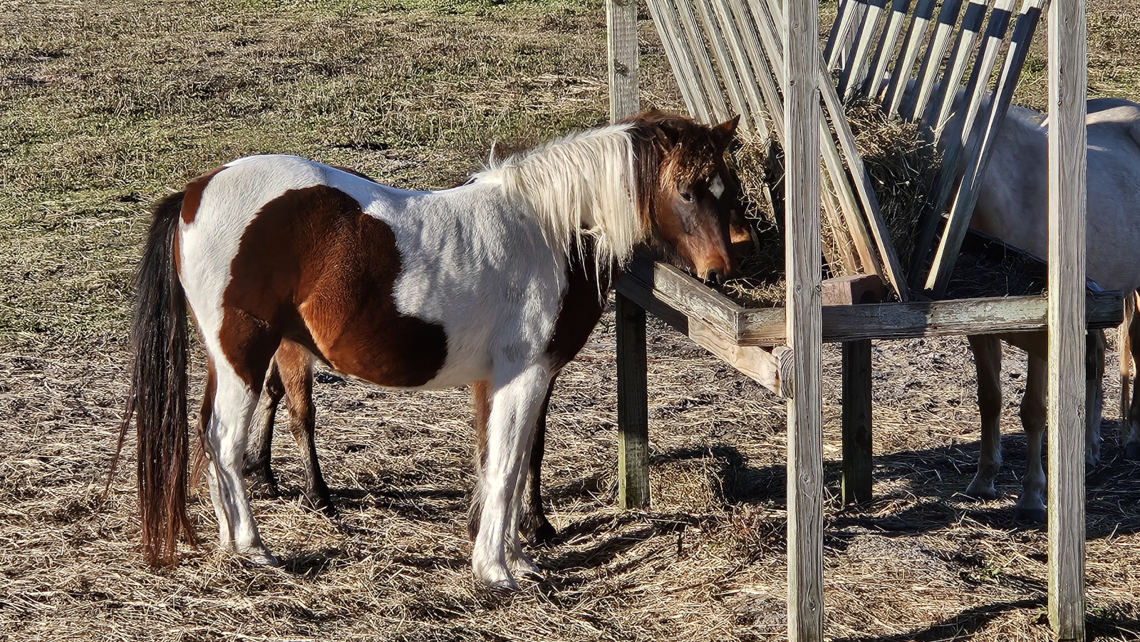
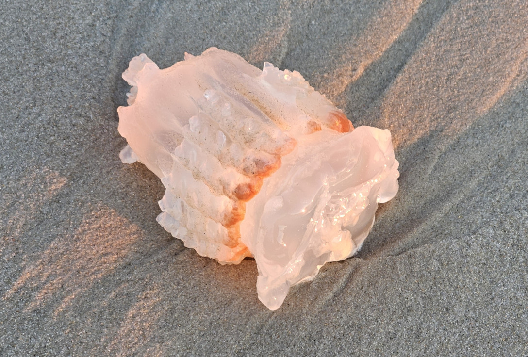
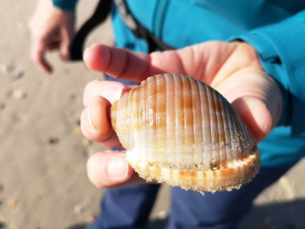
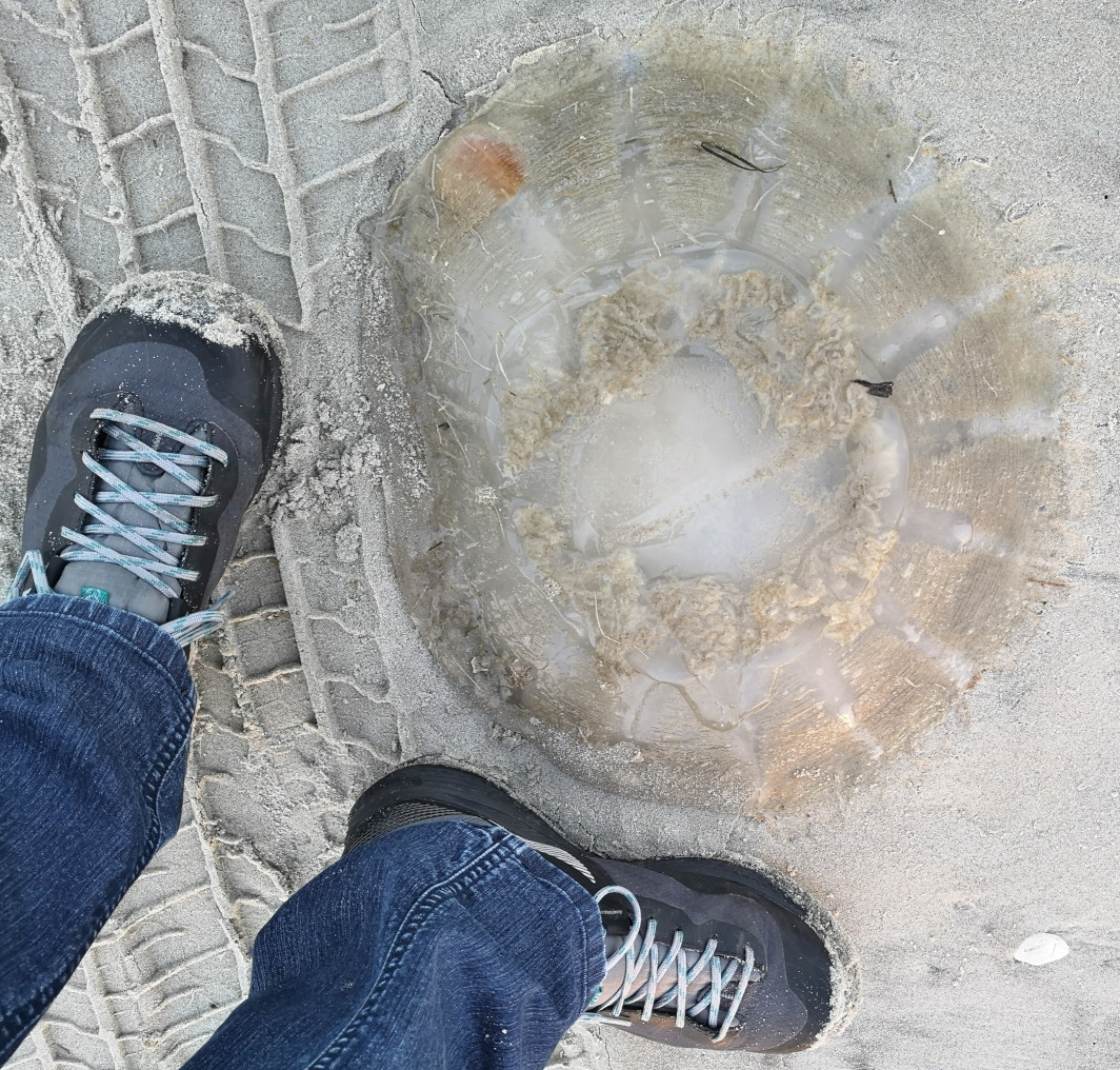
Before reaching the Ocracoke Campground we stopped to see the Ocracoke Pony Pasture. Ocracoke has had wild horses since the 1730’s. Once the highway was put on the island in 1959 the National Park service corralled the ponies to protect them from cars on the road. Due to sea level rise, the park has lost many acres of the corral area so they are studying what they should do next with the horses. When we first watched the ponies from the viewing platform they were in the distance. However, we walked across to the beach on the other side of the road and looked for some seashells (mainly saw dead jellyfish) and then when we returned to the corral the horses were feeding right by the platform. We continued to the campground where we had a nice site but no services.


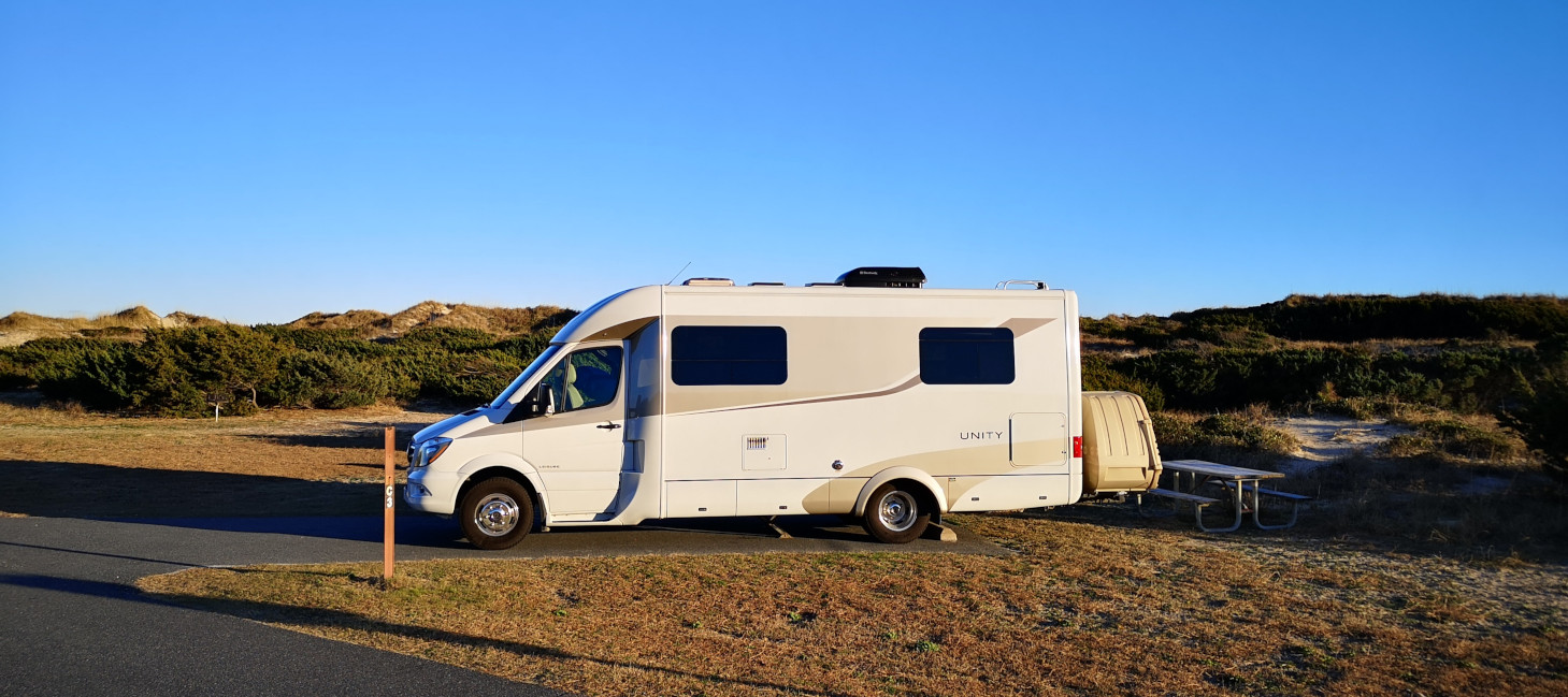
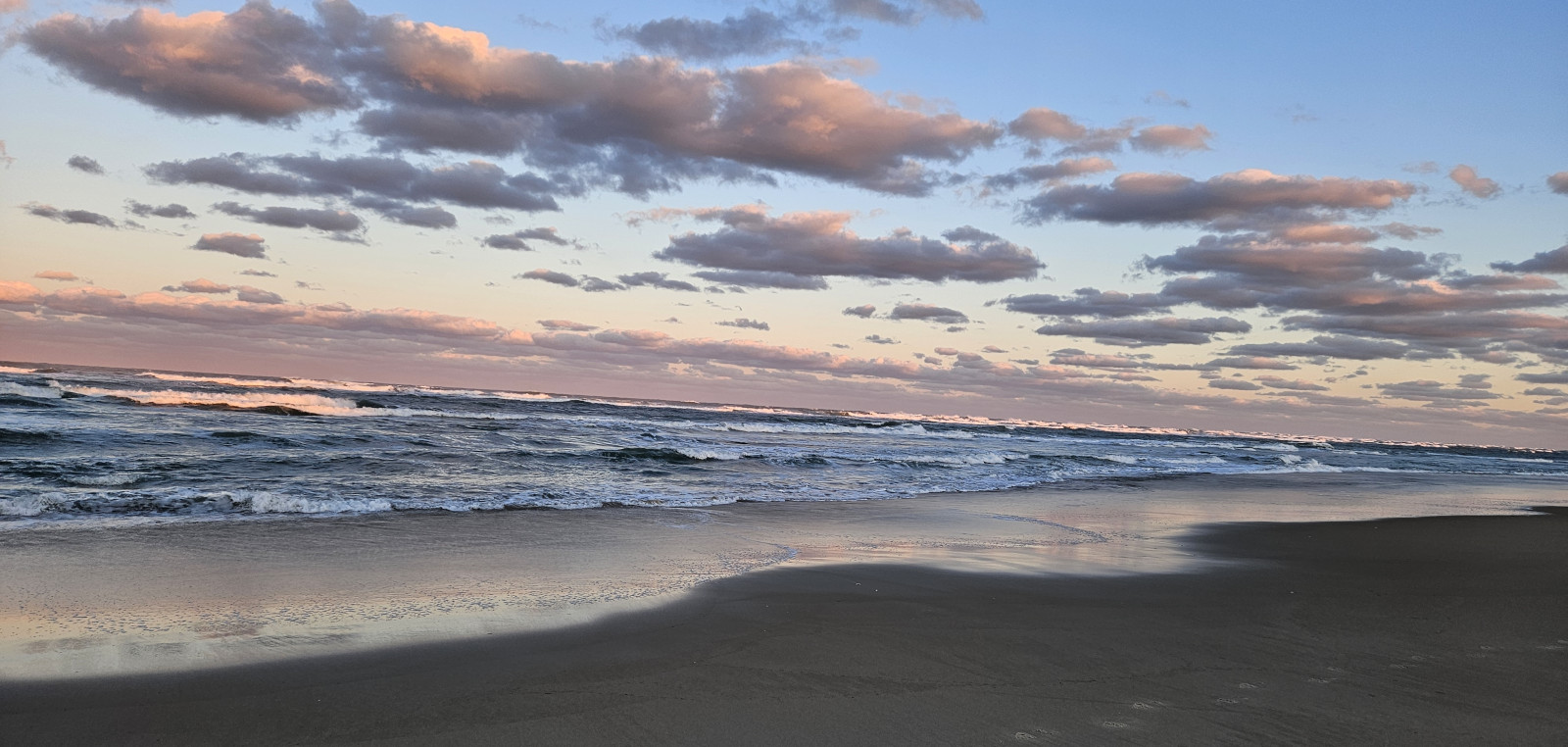
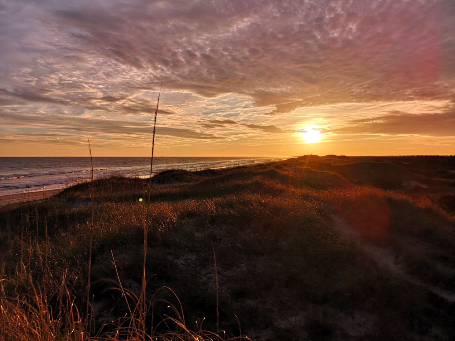
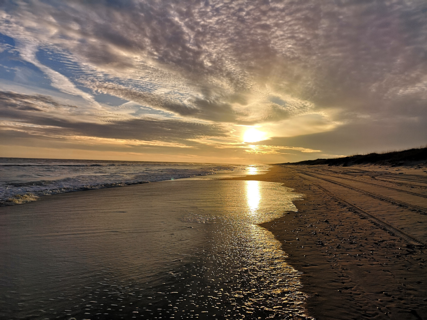
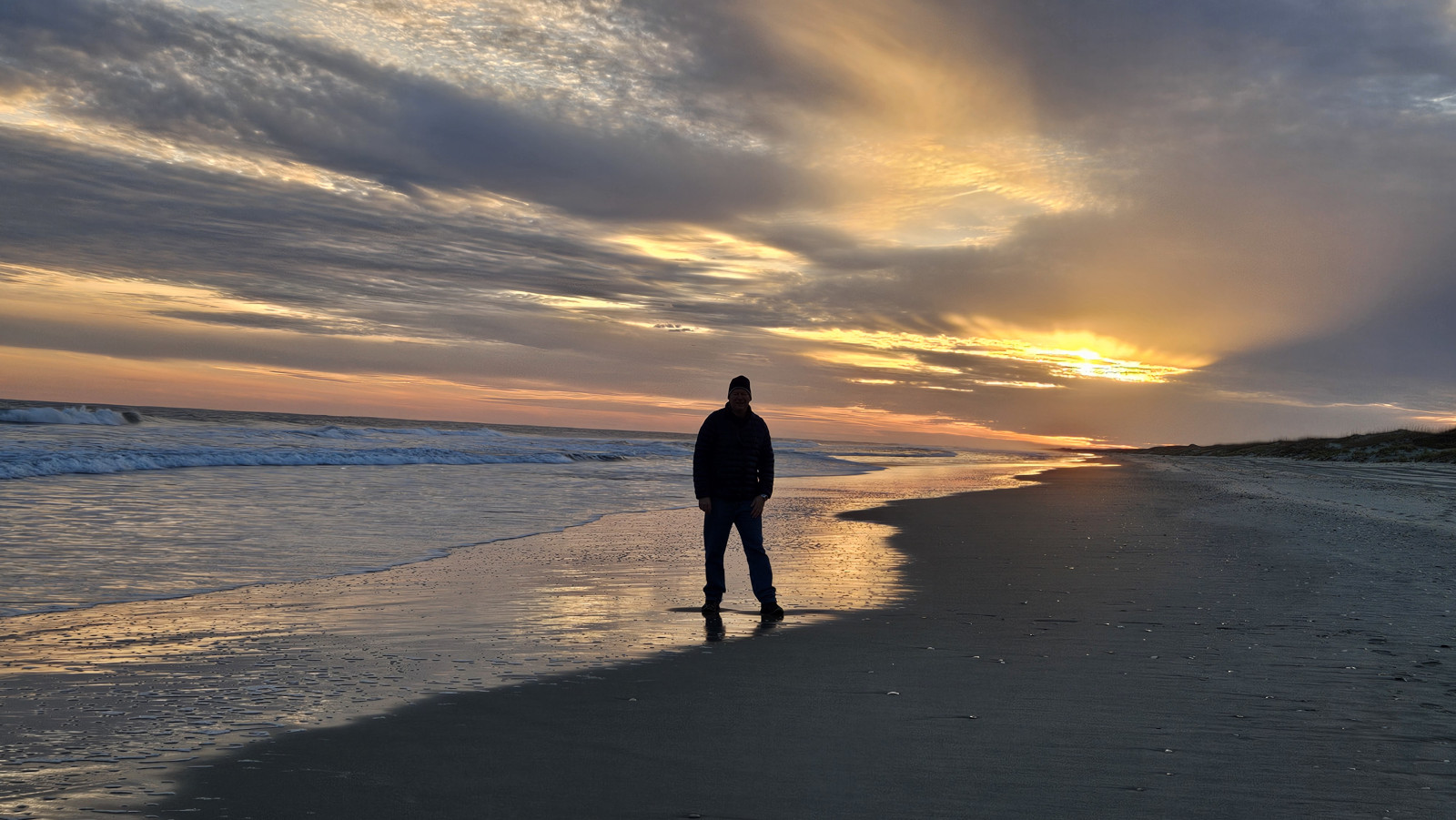
Ocracoke Campground is right on the beach, so you just have to climb up over the dune and you are there. The beach faces almost directly west so you get fantastic sunsets over the tip of the island. We stayed on Ocracoke for 3 nights and all 3 had great sunsets. Here was our first night.
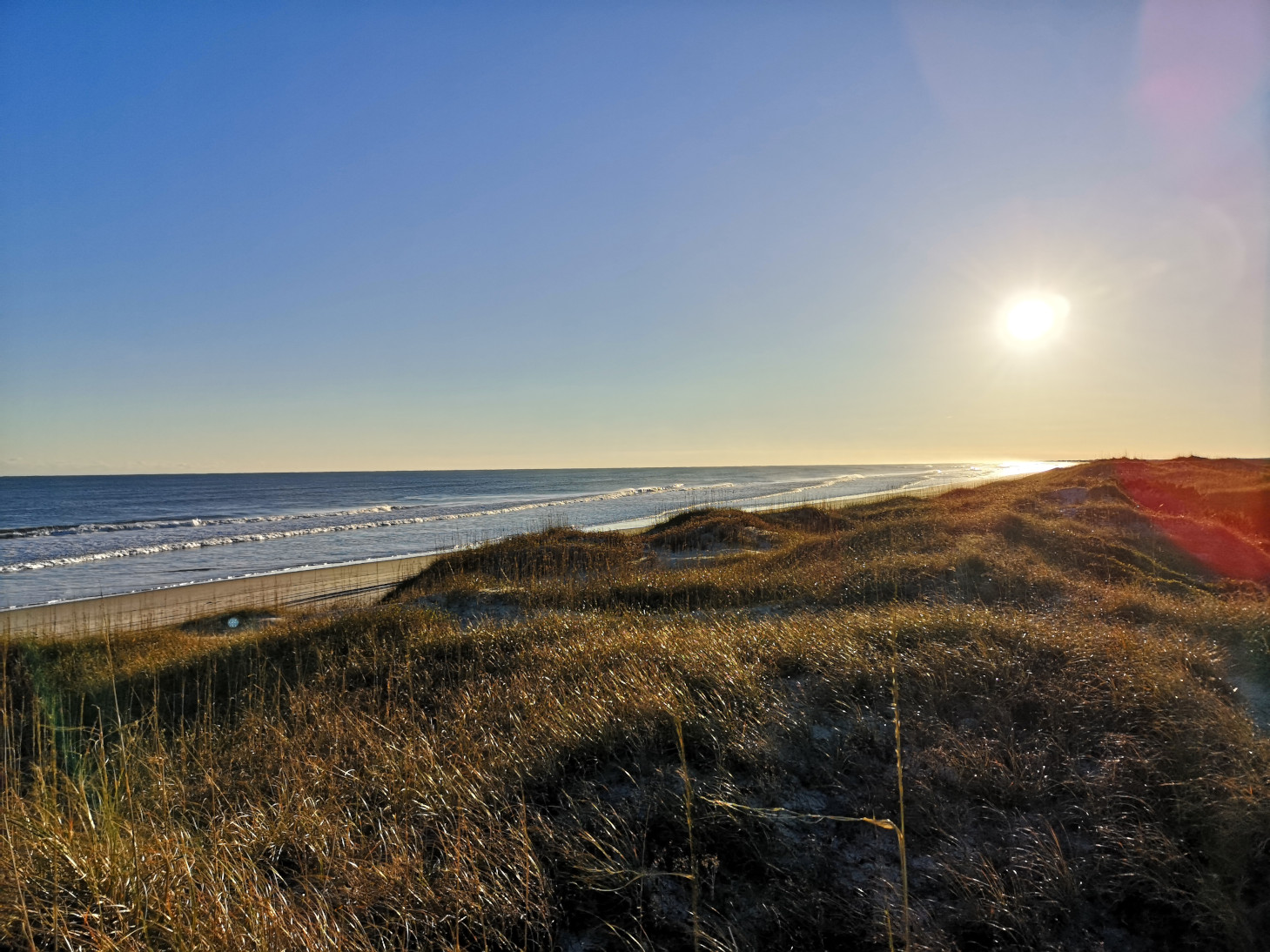
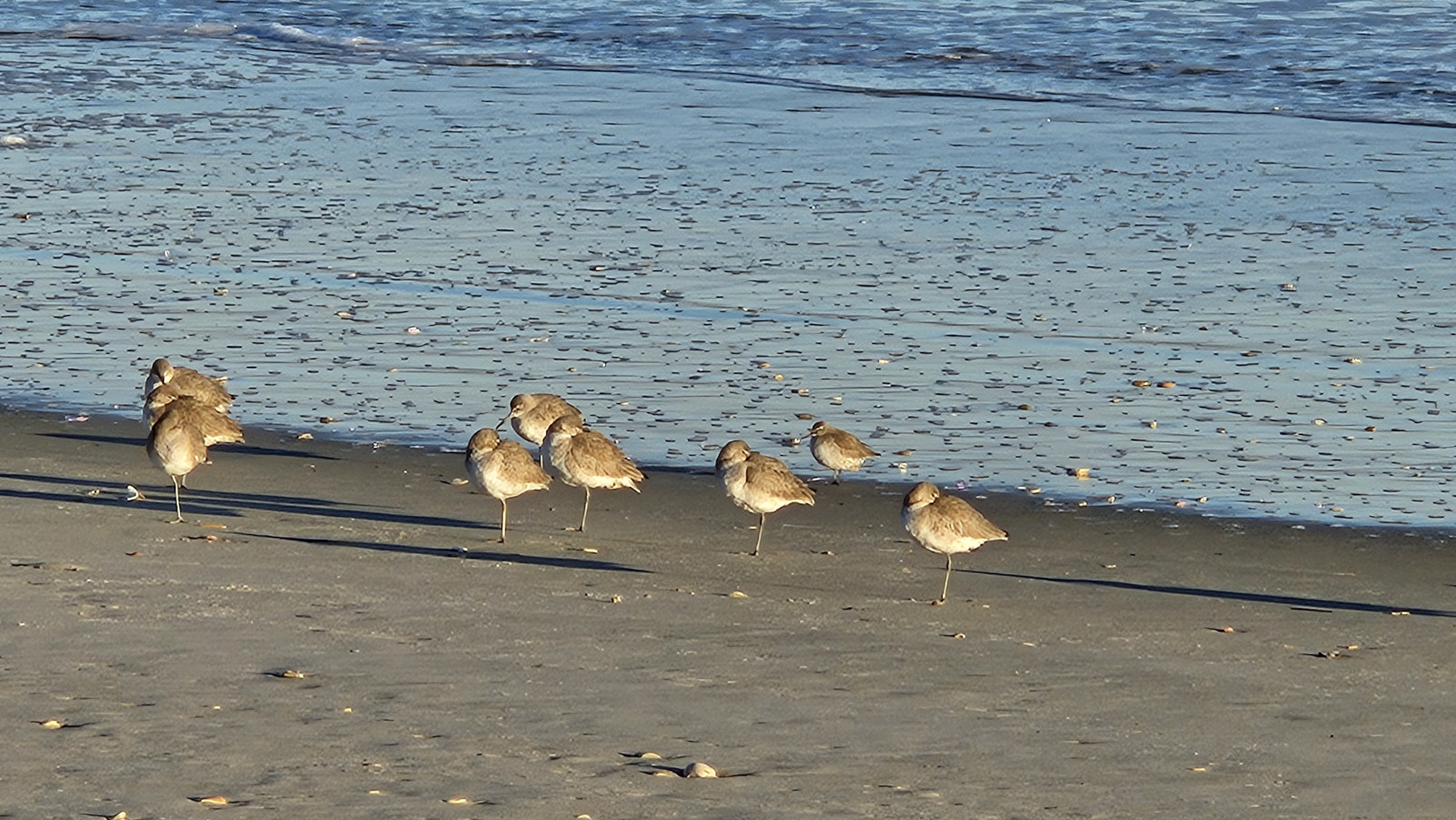


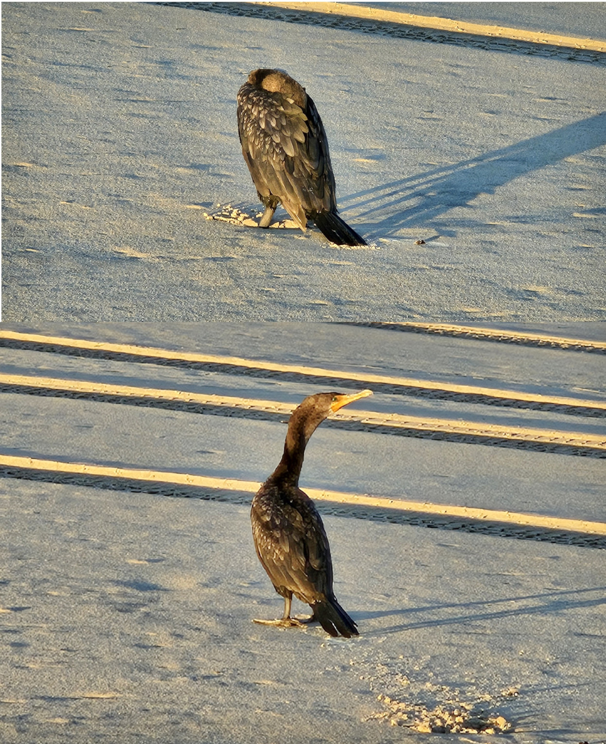
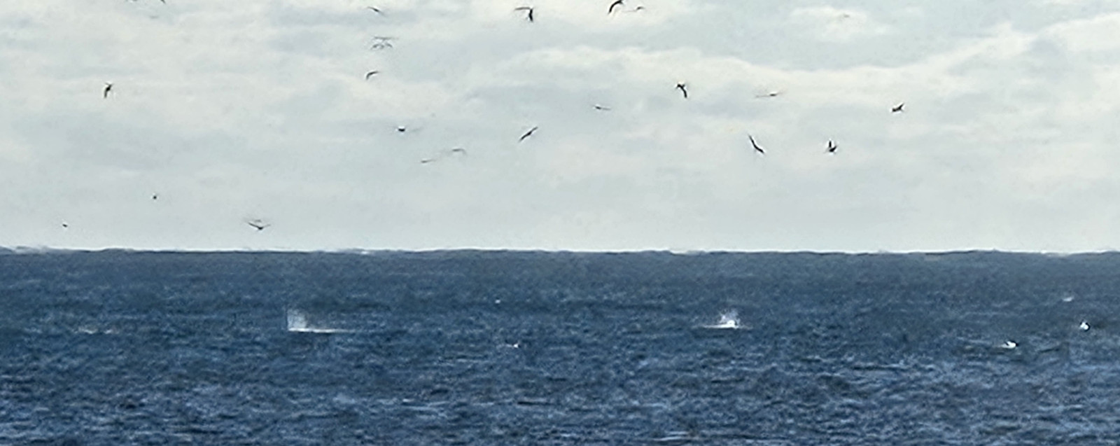
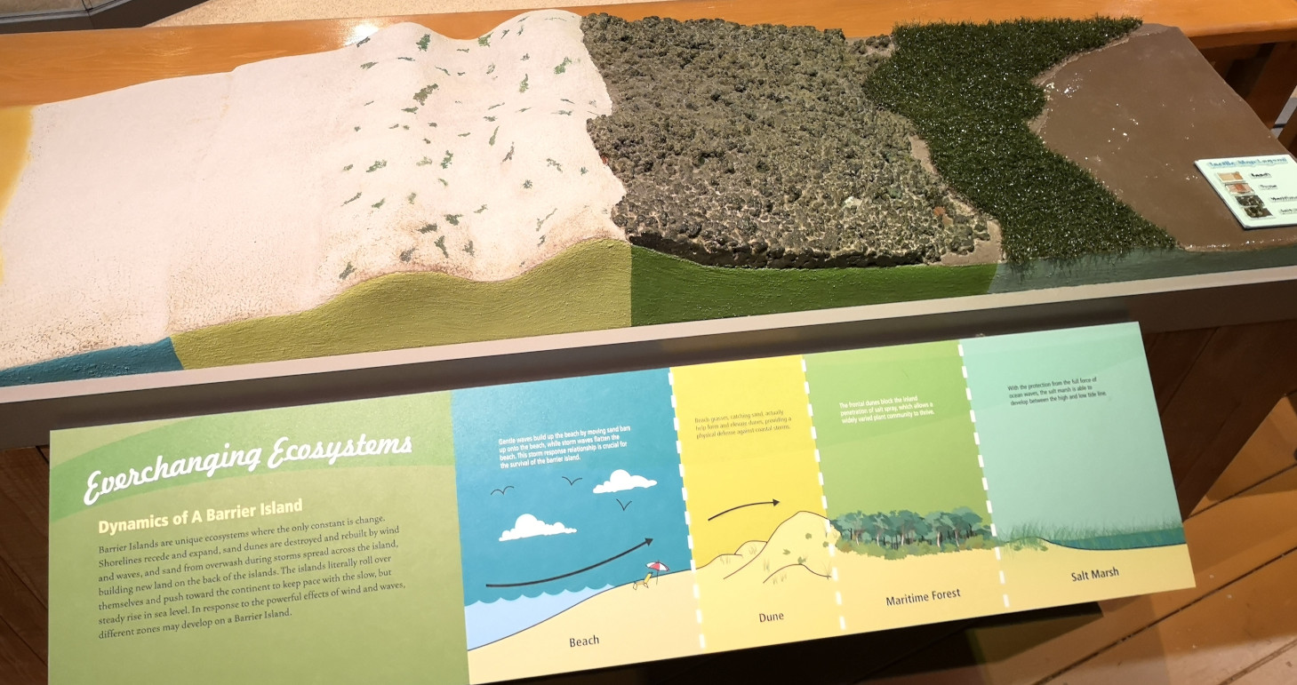
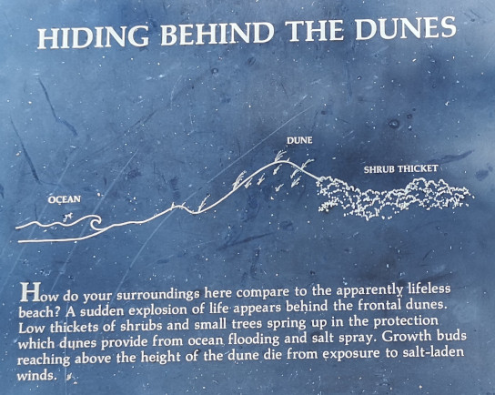
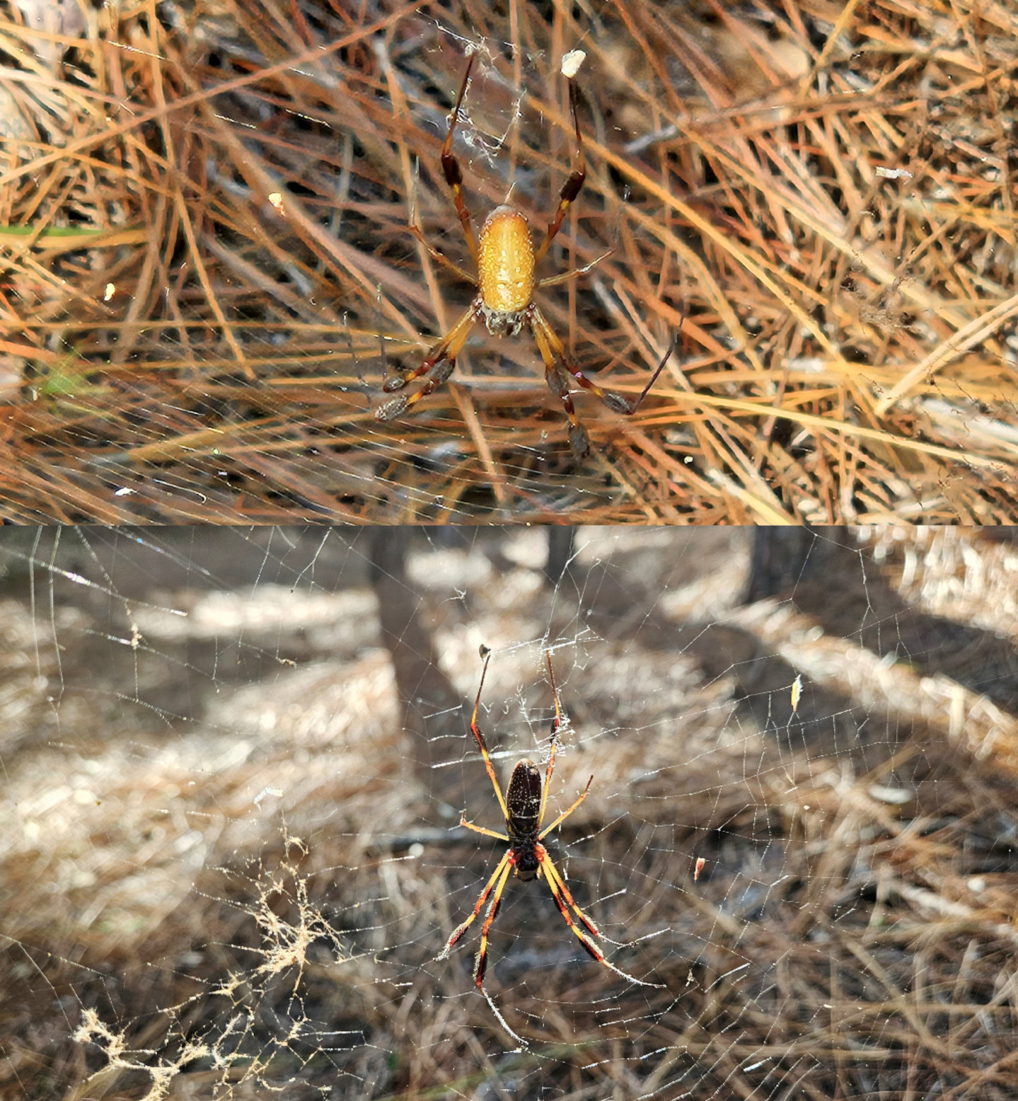
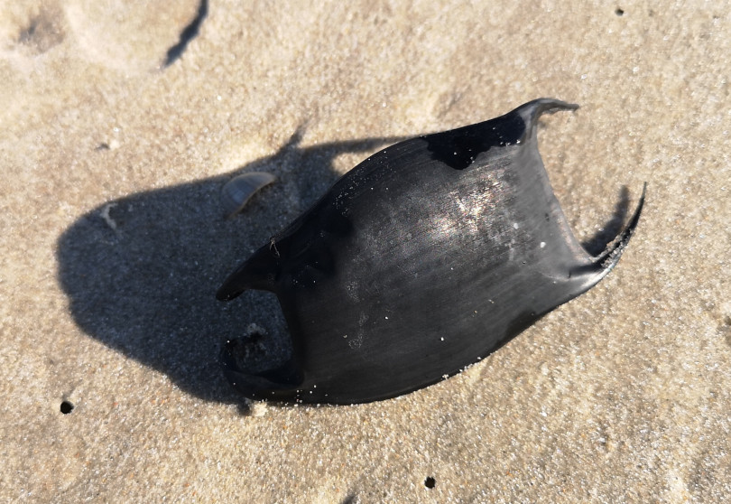
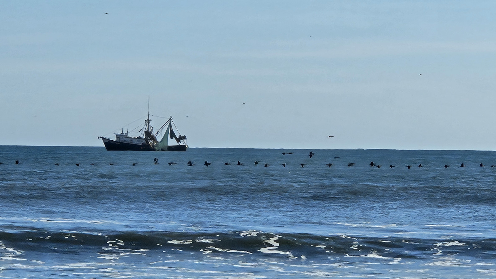
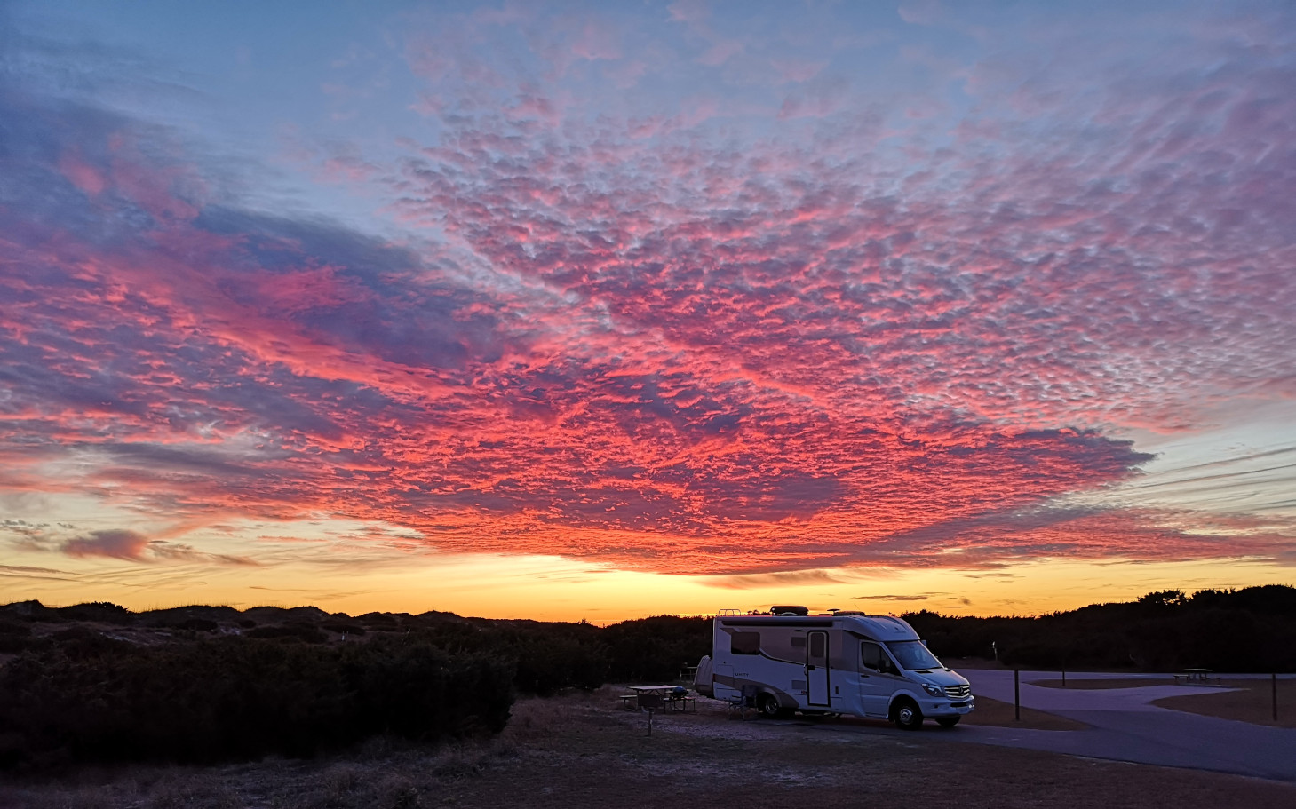
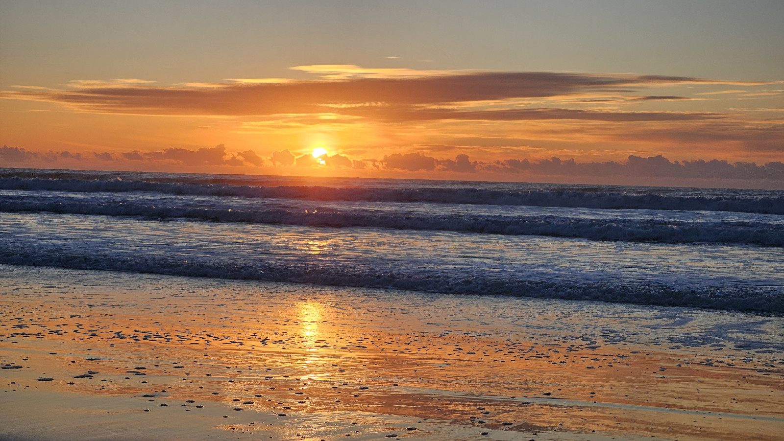
The next day we did the short Hammock Hills Nature trail (across the road from campground) and we were surprised how large the dune hill was climbing up into the pine forest. This barrier island is like the others where you go from beach to dune, then maritime forest and lastly to salt marsh. The nature trail had display boards explaining the vegetation in each of the zones. The coolest thing we saw was a large Golden Silk Orb Weaver spider. After the nature trail, we walked along the beach where we saw a Mermaid Purse, a Reticulated Cowrie Helmet shell and offshore we saw a large flock of Cormorants flying in a line and a fishing boat. That evening we had an even more spectacular sunset.


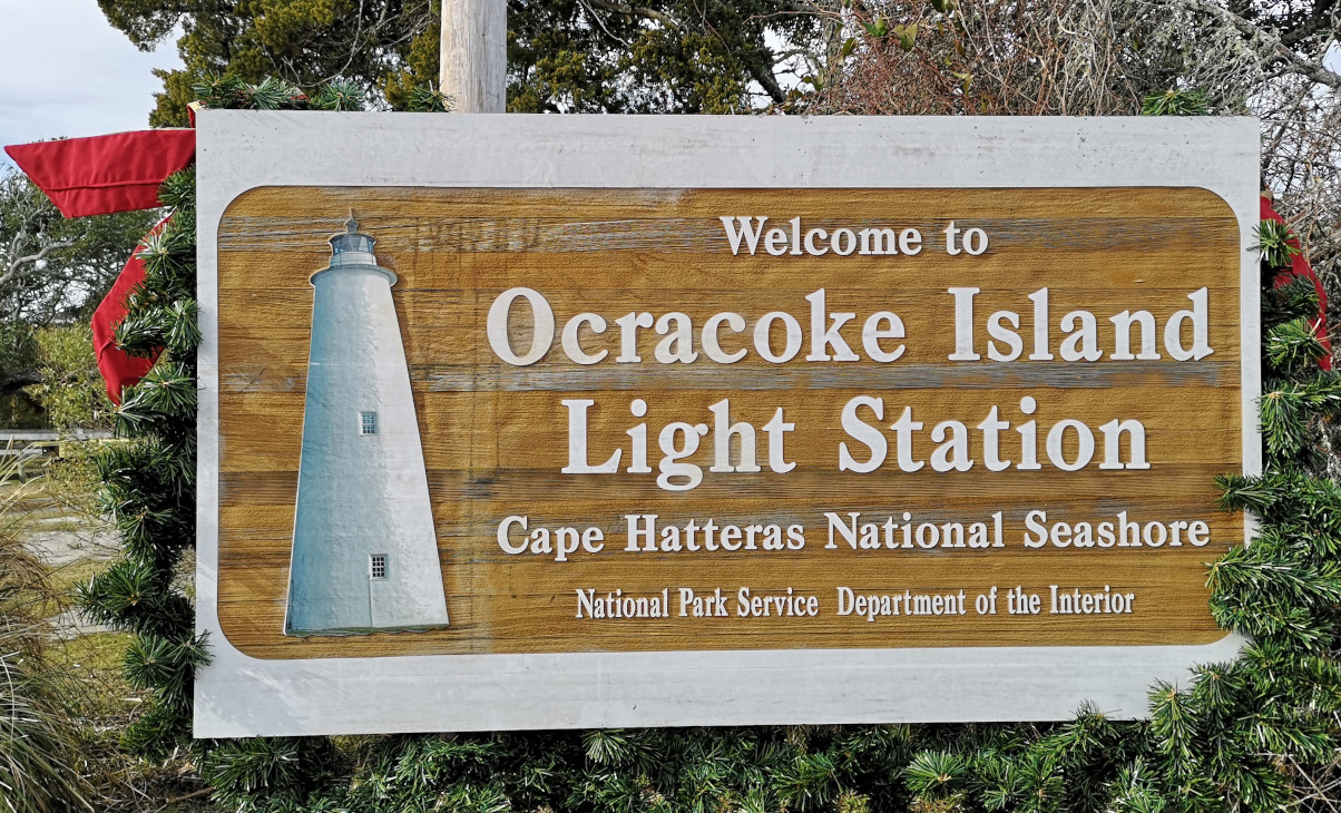
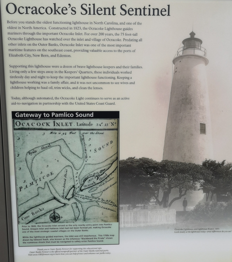
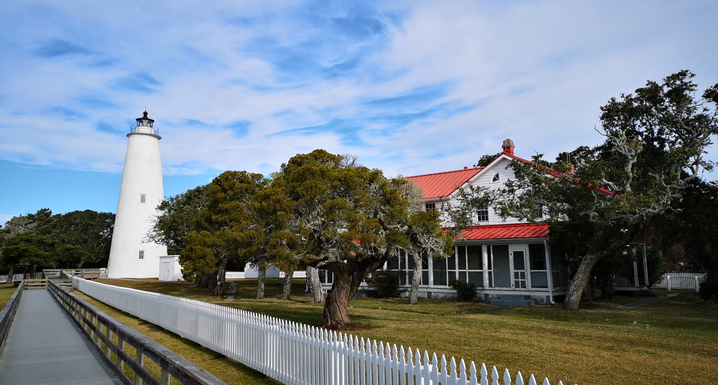
The next day we drove into Ocracoke village to look around. Our first stop was the Ocracoke Island Light Station which is the oldest functioning lighthouse in North Carolina. It was constructed in 1823 and stands 75’ tall and guides ships through Ocracoke Inlet. In 2019 Hurricane Dorian flooded the Light Keeper’s house so it wasn’t open to the public. A restoration project is underway to raise the station 4’ and that is supposed to be completed by 2025.
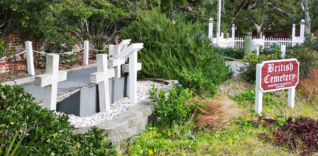
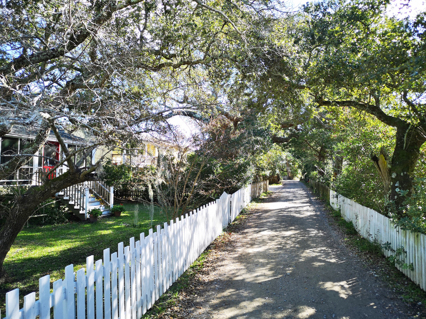
After the lighthouse we parked by the ferry terminal and walked around town to see the historic sites as well as do some shopping at the kite shop and also the local thrift store (a seahorse candle holder). One of the historic sites was the British cemetery where 4 British sailors from the HMT Bedforeshire were buried after dying in WWII anti submarine patrols. Their ship was torpedoed and sunk by a German sub, and all were lost, only these four bodies were recovered.
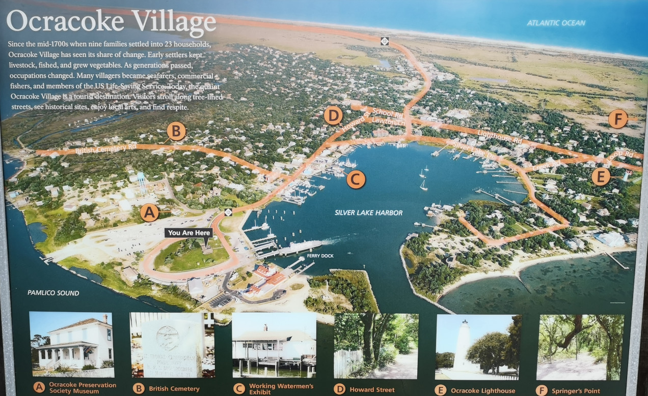


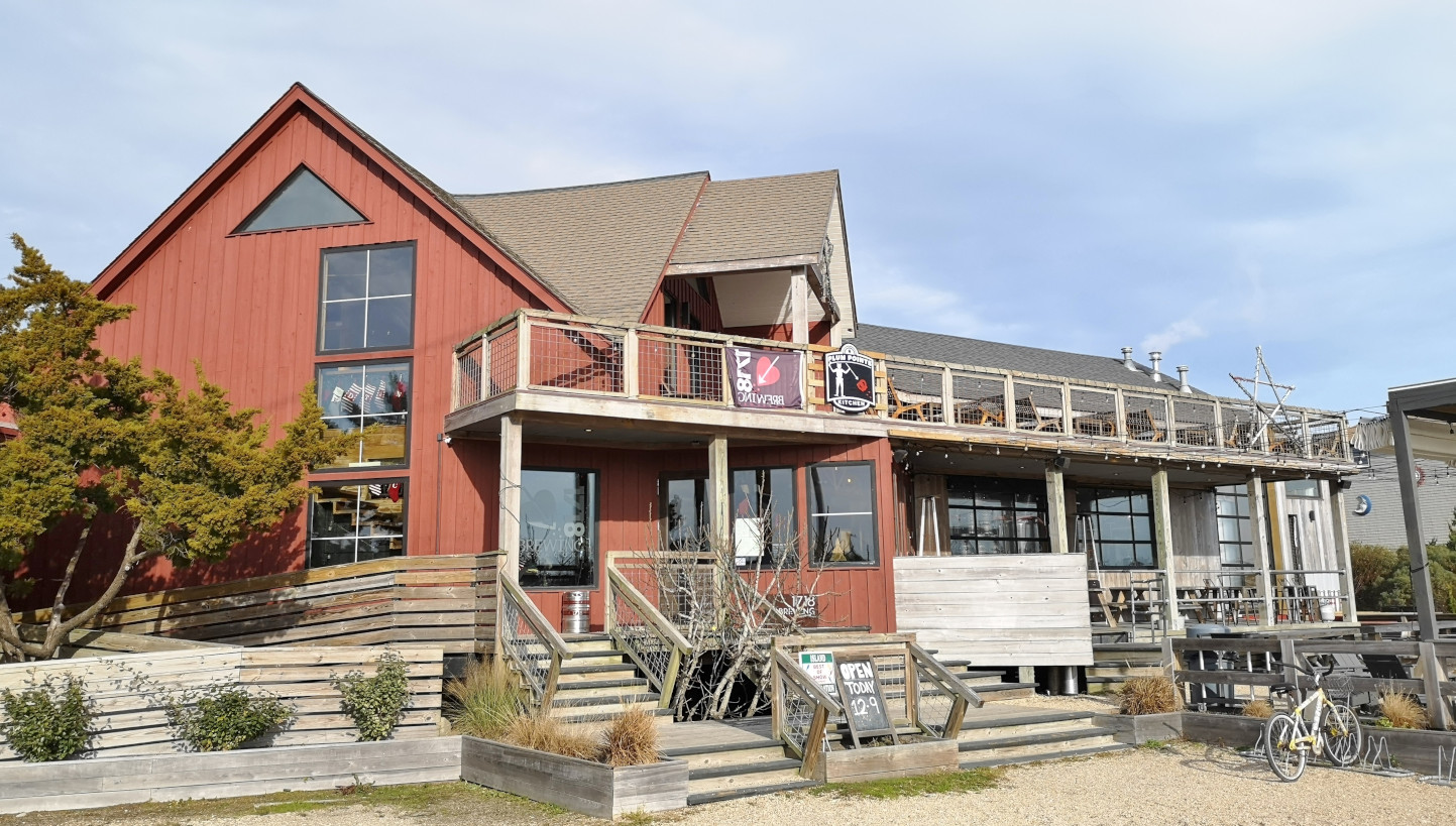
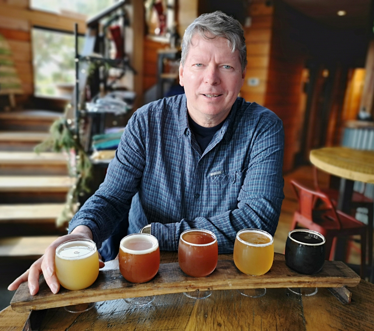
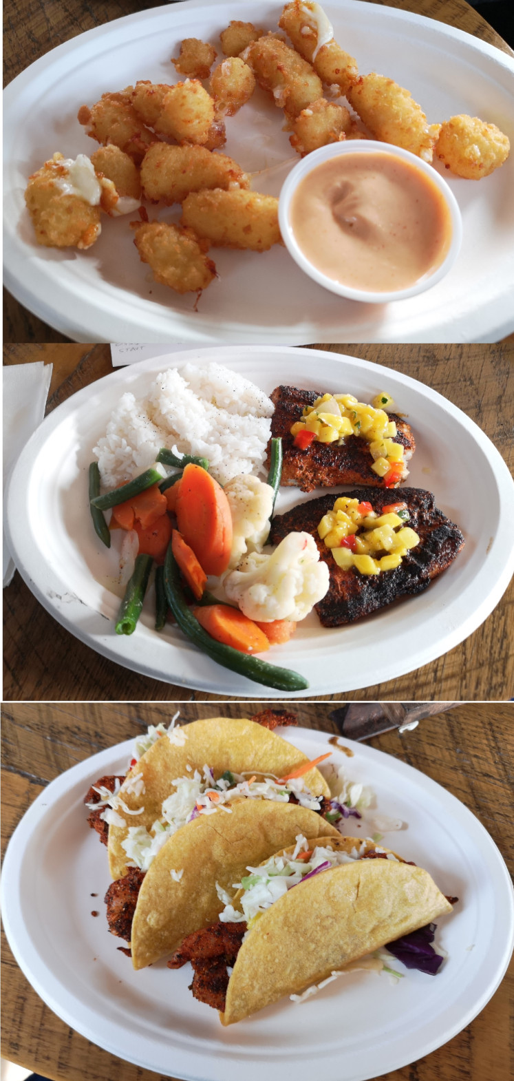
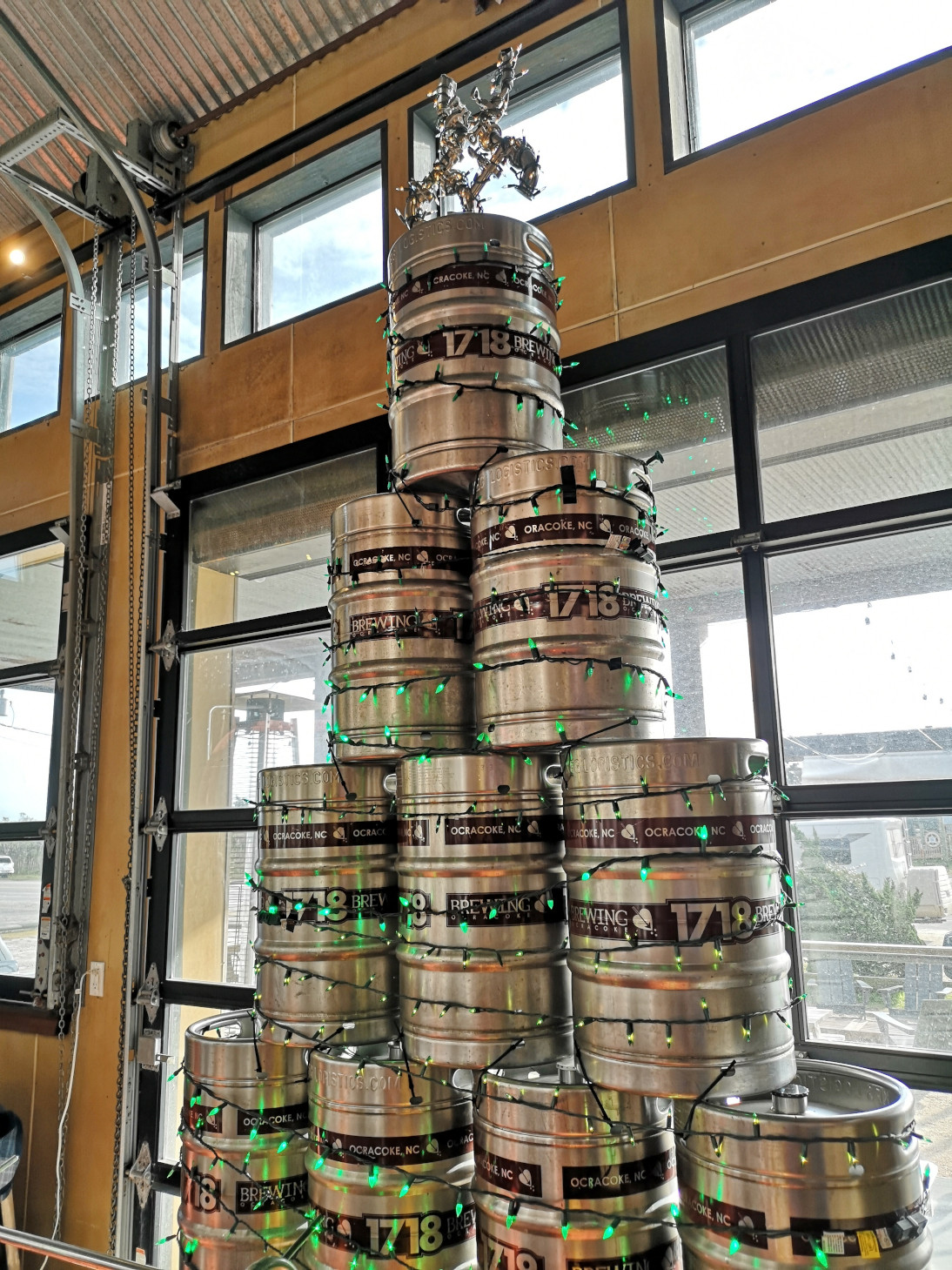
Our last stop in town was 1718 Brewing, connected with Plum Pointe Kitchen for some beers and lunch. I decided to have a flight which included, Frontside Grind West Coast IPA, Rye-Toid Red Ale, Badda-Boom Bourbon Barrel Aged Strong Ale, You Better Watch Out Belgian Tripel, and lastly Oyster Stout which was filtered through oyster shells so you couldn’t have a shellfish allergy to have this beer. The beers ranged from 6.1 to 10.5% so we opted for Sharon driving back to the campground😉 For lunch we had spicy cheese curds as an appetizer and then I had the Blackened Flounder (spices were so good we bought a bottle of them), and Sharon had the shrimp tacos. Great beers and a great meal!

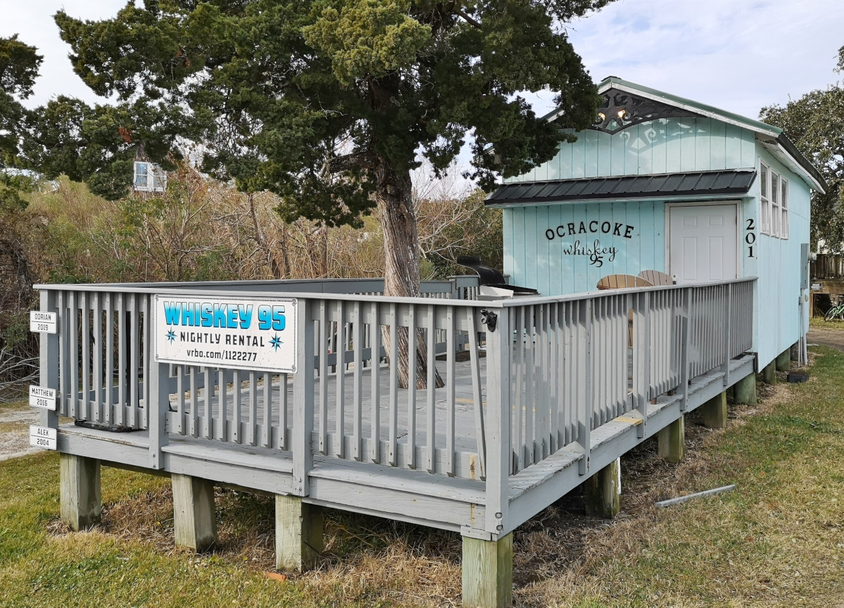
That evening we had another nice sunset, each night very different from the others. Sharon woke up early the following morning and got a photo of the sunrise as well. Then we drove into Ocracoke village again for a walk around before we boarded the ferry to head to Cedar Island for Christmas. That section of the Outer Banks they call “Down East” so we’ll talk about that in the next blog.


It’s ironic that you can’t find any birds in the national refuge but find lots of them in farmer’s field. LOL.
LikeLiked by 1 person
The RV happy hour needs more advertising. There is just one lonely guy in the whole site. hahaha.
LikeLiked by 1 person
😉🤣
LikeLike
I put some nice comments on some pictures. Maybe you don’t get notified. I forget how this works (or not).
LikeLiked by 1 person
I’m seeing them all Danny👍
LikeLike
Beautiful sunset/sunrise photos!!!! I’ve decided that all graveyards should make sure the graves have feet on them. And someone try saying Chicamacomico really fast three times!!! Your lunch photos at 1718 Brewing made me really hungry….and thirsty!!! Looking forward to getting hungry at the next blog!!
LikeLiked by 1 person
This is fun Ella as I’m getting to recall all we’ve done as you add your comments 👍👍😎
LikeLike