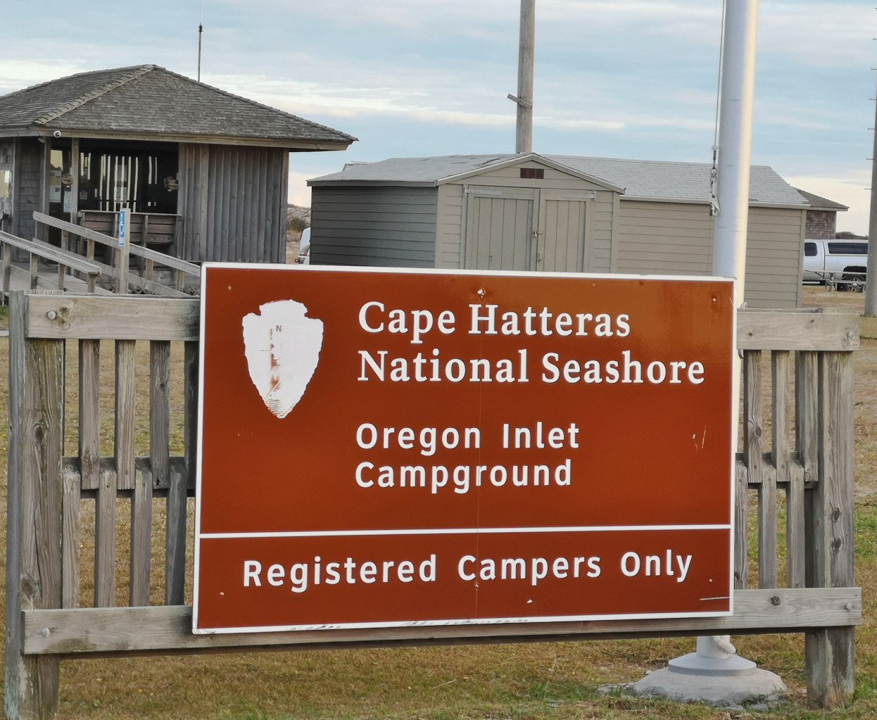
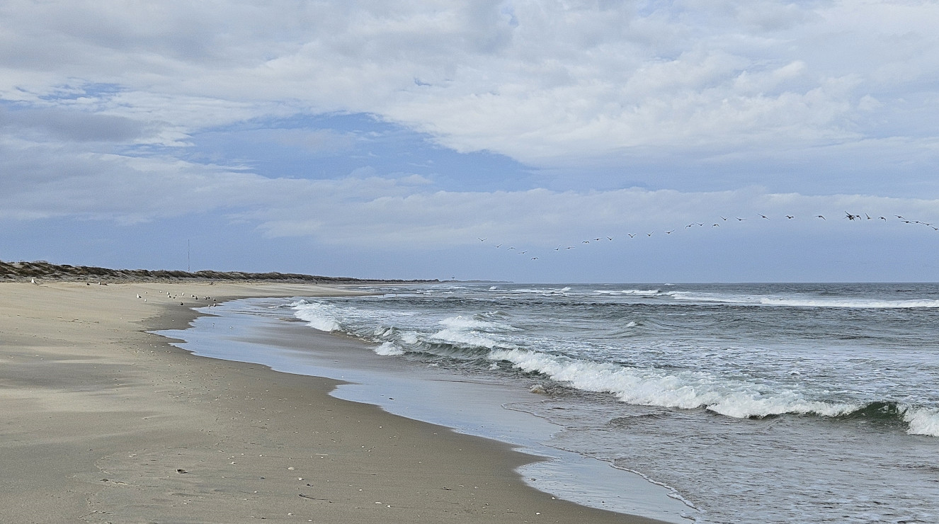
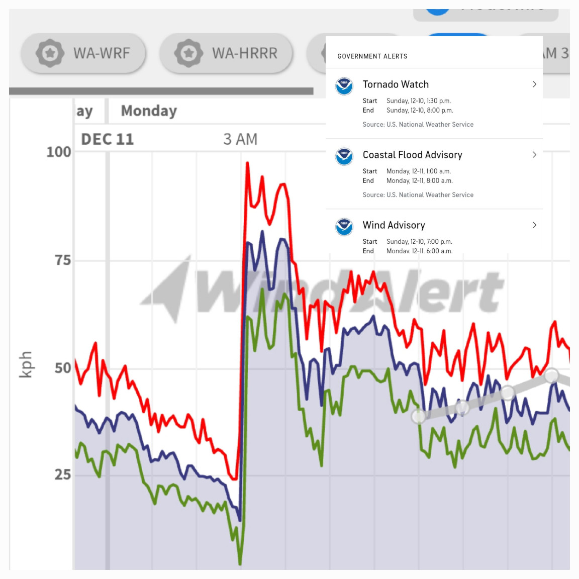
As we headed south into North Carolina and onto Nags Head and south to Oregon Inlet campground (part of Cape Hatteras National Seashore) we were short on time for any stops to arrive in the daylight. Consequently, we had to bypass a winery and we also had to bypass the Grave Digger shop. If you are a monster truck fan you’ve likely heard of the Grave Digger truck, and we went past the shop where they build those trucks. Later, on a PBS NC station, we saw a tour of the shop and how they build the trucks, maybe a stop for another trip😉 We had booked into Oregon Inlet for 6 nights (we ended up staying 7) so we could see a variety of things in this upper area of the Outer Banks. Our first day was rainy so I was working on the prior blog and Sharon took a short walk on the beach when there was a break in the rain. The beach by the Atlantic Ocean was very close to campground. That evening we had incredibly scary winds at 3 am. We both woke up as the RV was shaking back and forth. I said to Sharon we better put everything loose away and close all the cupboards in case we get toppled over on our side. You’ll see from the weather chart we hit peak gusts of 98 KPH winds and we were in a Tornado watch, a Coastal flood advisory, and a Wind advisory! Needless to say, we didn’t sleep much for the next 3 hours.
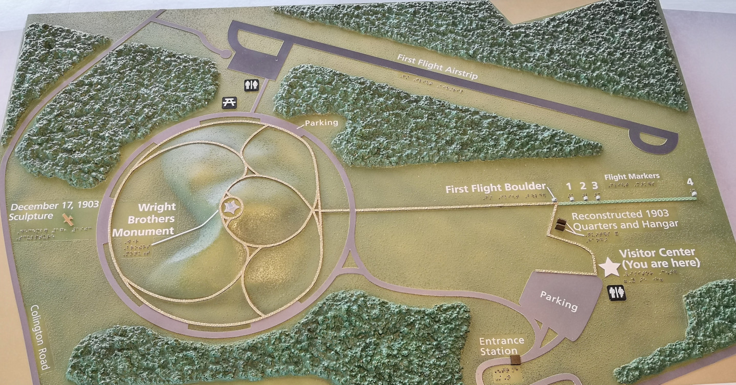
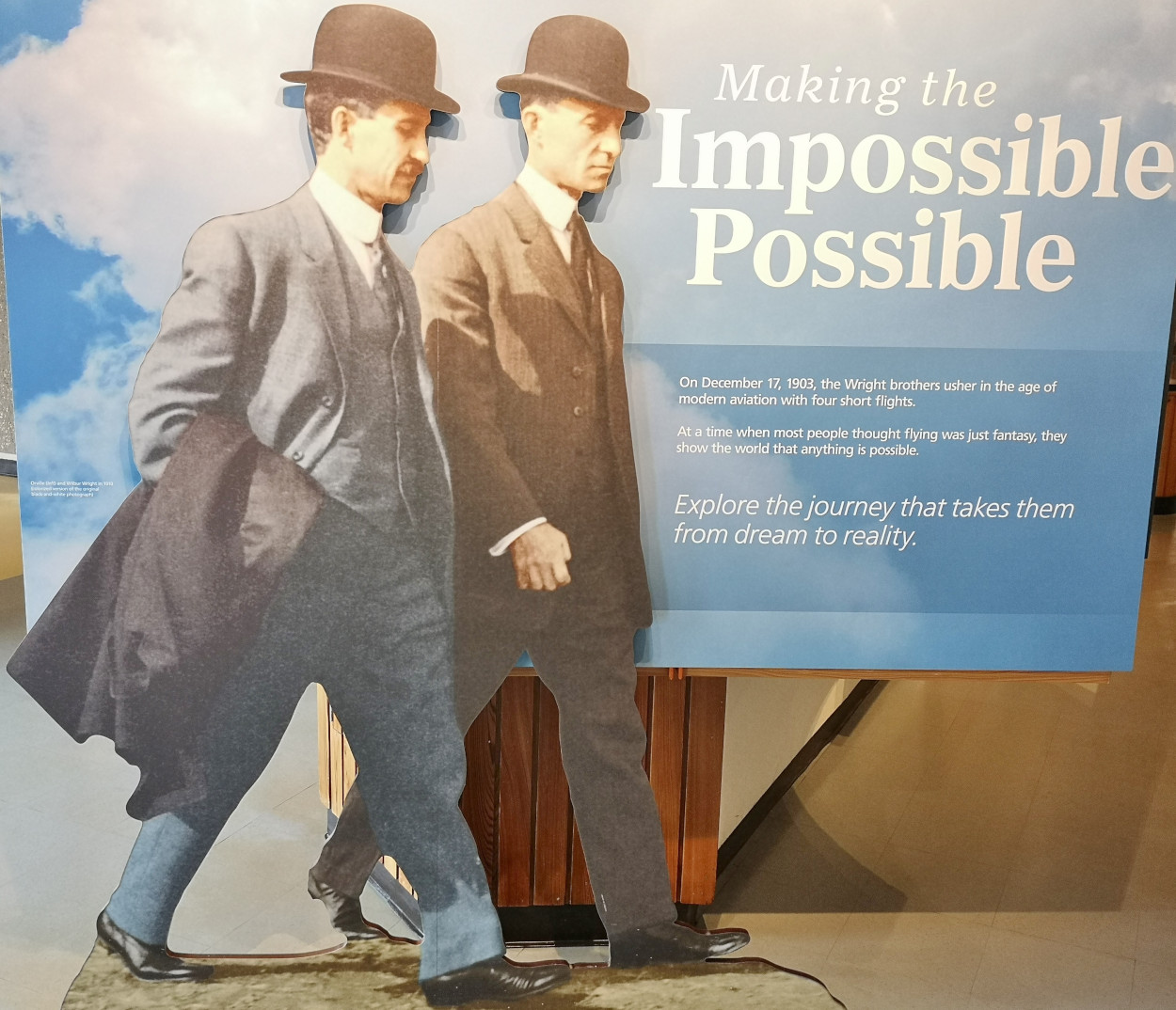
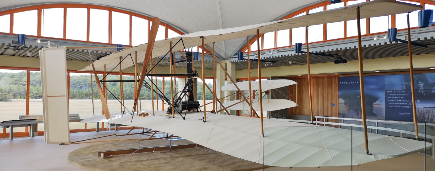
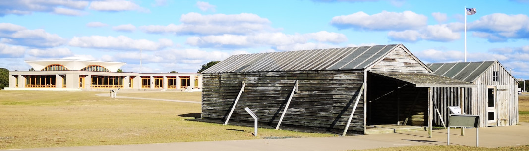
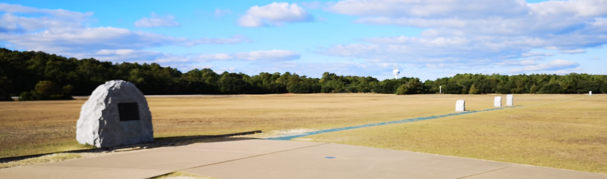
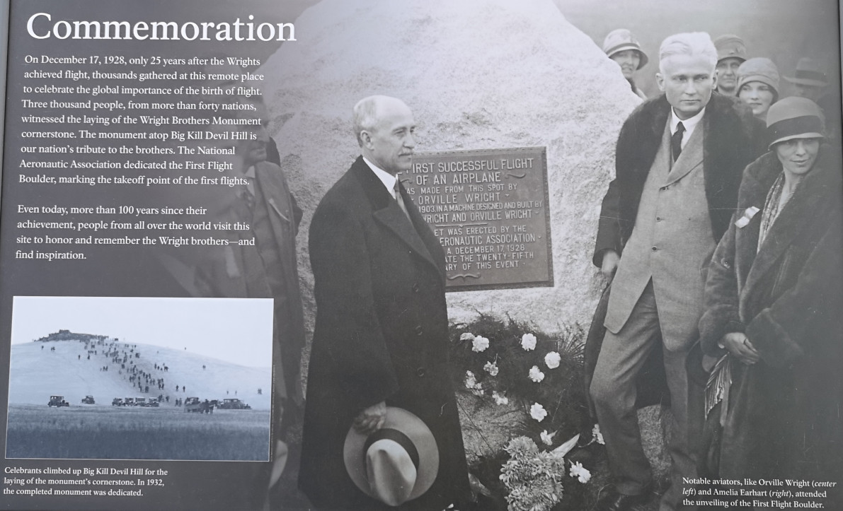
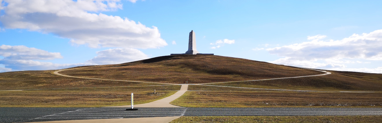
The next day we drove north to see the Wright Brothers National Memorial. We started off with the museum and then attended the ranger talk on the brothers. After we walked out to see the reconstructed quarters and hangar buildings and the location where they took off and the 4 points of landing on the 4 flights in 1903. Then we walked up to the top of Big Kill Devil Hill where they tested gliders in 1901 and 1902 and where the monument is located and lastly to the brass sculpture of the 1903 event. Here are some fun facts about the Wright Brothers:
- Wilbur and Orville grew up in Dayton Ohio. Their mother Susan was a college graduate and mechanically minded. Their father Milton was an ordained minister. Their parents encouraged them to test their wings and pursue their dreams. There were 7 children in the family.
- Wilbur was the older than Orville and was smart, quick-witted, could retain facts, and put things in a logical order. Orville was the dreamer, idealist, restless thinker, and sharp dresser. He was also mechanically minded, like his mother, and could see why something wasn’t working and how to fix it to make it better.
- One day Milton brought a Helicopter toy home that Wilbur and Orville called the Bat and this started their obsession with how things could fly.
- The boys first business was publishing an African American newspaper called the Dayton Tatler in 1890. They also saw how popular bicycles were becoming so they started a bicycle repair business, which helped for some of the supplies they needed for their gliders and flyer.
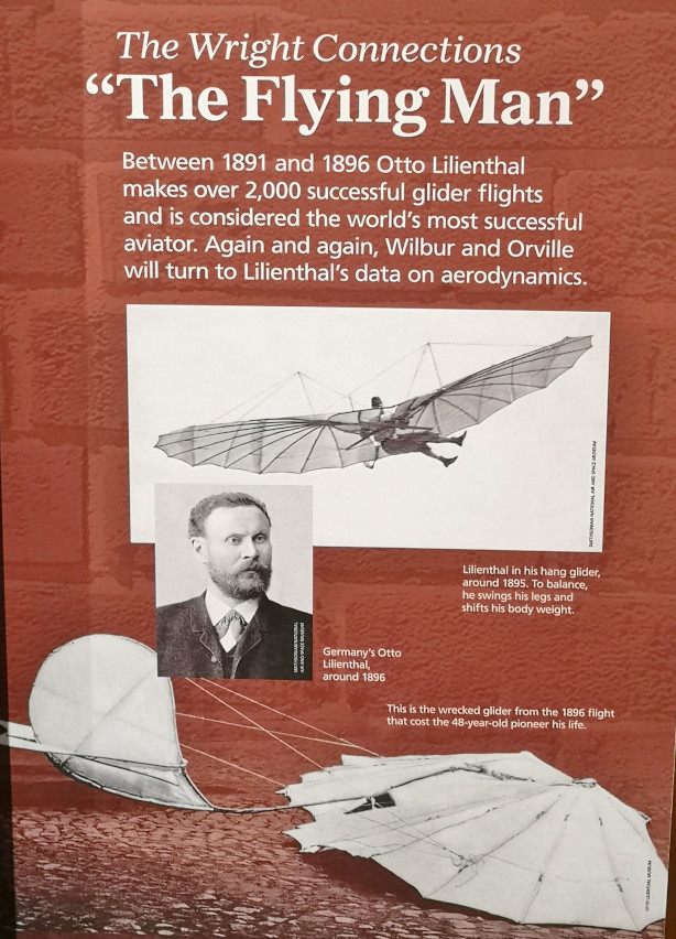
- Between 1891 to 1896 Otto Lilienthal (world famous “Flying-Man”) made 2,000 glider attempts but unfortunately dies in an accident in 1896. His death restarted Wilbur and Orville’s interest in flight so they started to study how they could fix the issues that caused Otto’s death.
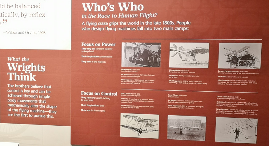
- Many people were attempting flight in this time period but the Wright brothers were the first to pursue how to design control into their flyer instead of concentrating only on power.
- In order to choose a destination to test their flying machines they contacted the national weather service to find out the windiest places in the country and Chicago was #1 but they wanted a small place and Kitty Hawk was #6 on the list and only 60 people lived there so they choose that location. From Dayton they had to take a train, then boat, then train, and again boat with all their plane parts each time they went.
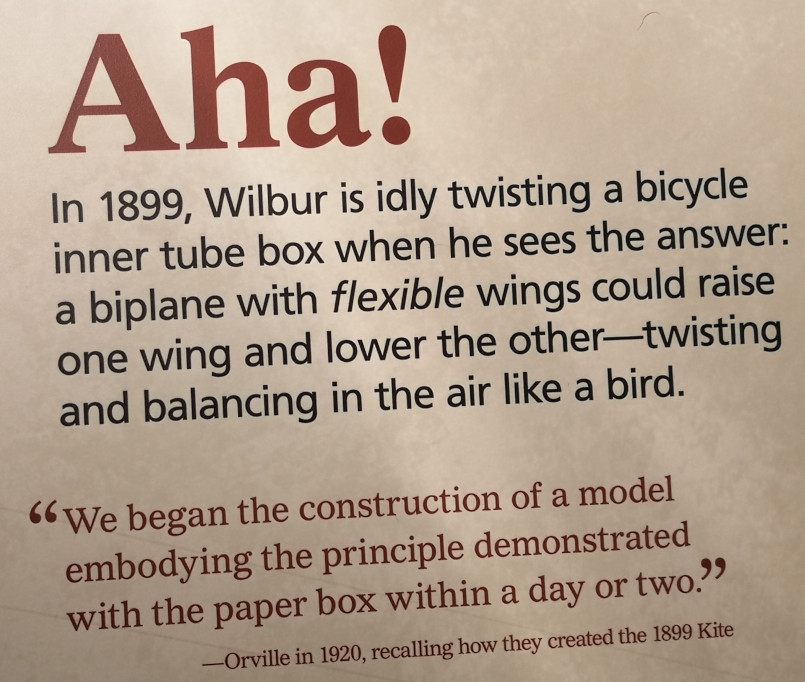
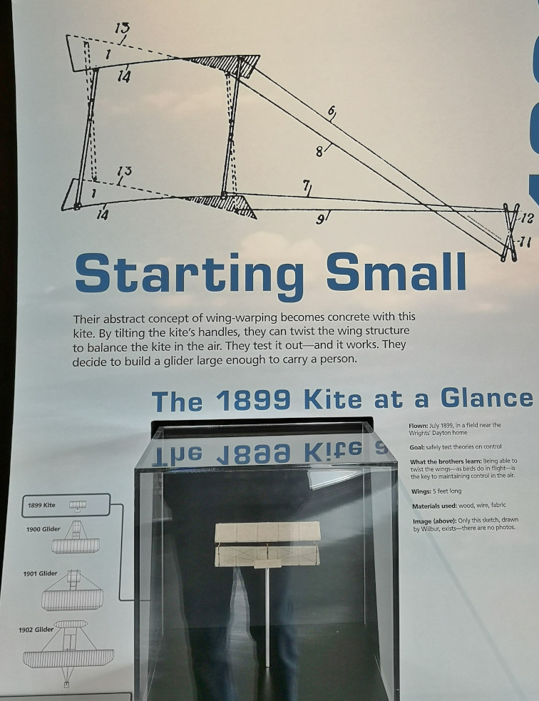
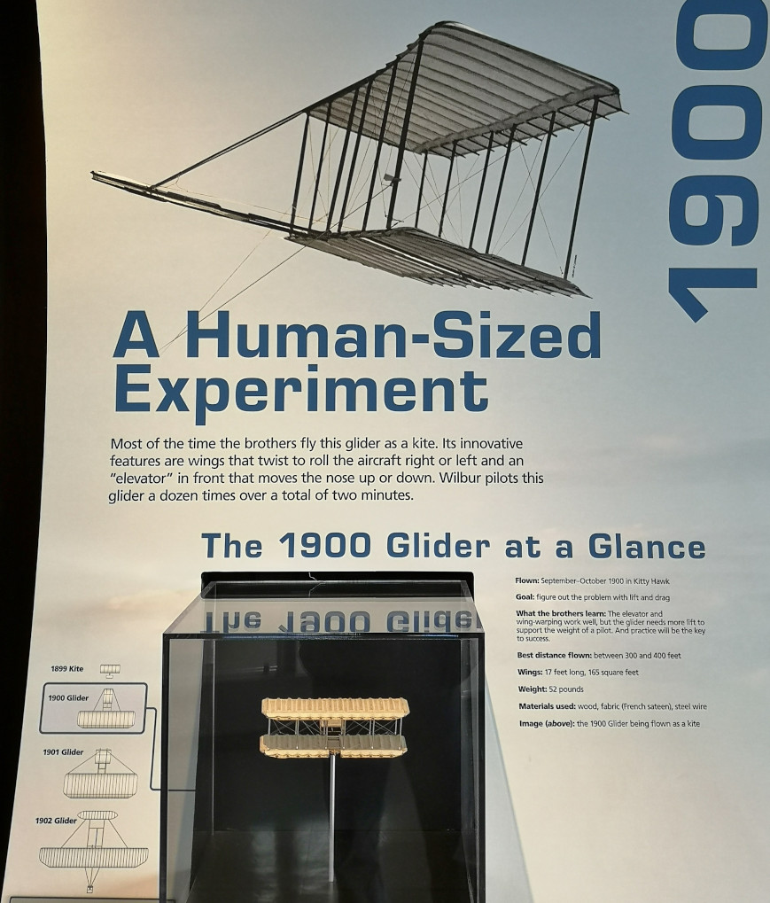
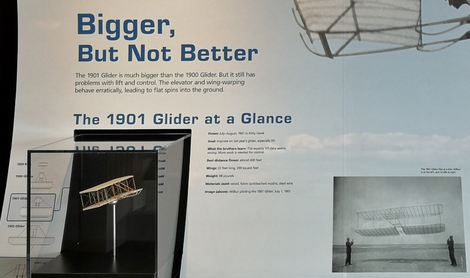
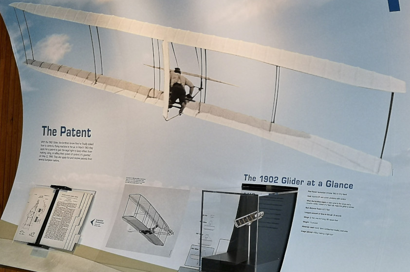
- The sequence was a kite in 1899, a glider in 1900, a bigger but not better glider in 1901, a record setting glider in 1902 and finally the flyer in 1903.
- There were 4 problems to solve to reach the final goal of powered flight. Problem #1 Lift – they used a wind tunnel to design the right curved wing shape that generated the most amount of lift and least amount of drag.
- Problem #2 Control – They developed their-axis control (roll, pitch, and yaw). The wings and hip cradle control roll, the elevator in the front of the flyer controls pitch, and the rudder at the back controls yaw.
- Problem #3 Thrust – the propellers generate horizontal lift which acts as thrust. The breakthrough was their propeller design which were basically wings spinning in a circle. The flyer had 2 propellers spinning in opposite directions to counteract torque.
- Problem #4 Power – The engine provides the power but it was unlike any other engine ever built as it was lightweight made of aluminum and had 4 cylinders producing 12 horsepower.
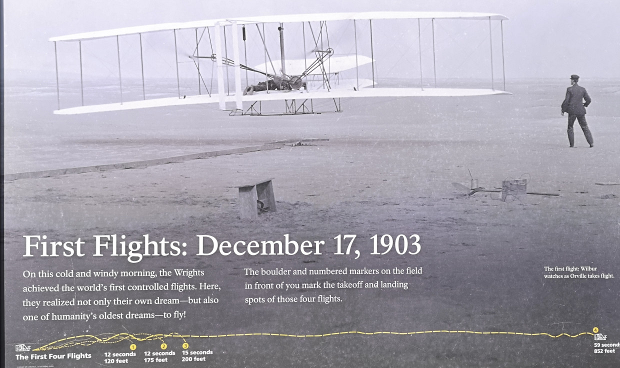
- On December 17th, 1903, they completed 4 powered flights. Flight 1 Orville travels 120’ in 12 seconds, Flight 2 Wilbur goes 175’ in 12 seconds, Flight 3 Orville travels 200’ in 15 seconds, and lastly Wilbur flies 852’ in 59 seconds. They went in the hangar to celebrate and were going to try other flights but when they came back out major winds had come through and damaged their plane beyond repair.
- In 1969 when mission commander Neil Armstrong stepped onto the moon’s surface, he carried with him fragments of the 1903 flyer in tribute to the Wright brothers.
One thing that was baffling me about this whole sequence of events is how the Wright brothers could afford to do all this trial and error to reach their goal. I asked the park ranger who had originally done the presentation and she said the brothers were extremely frugal and had very little outside activities that they spent their money on. This combined with the money they made with their bicycle repair shop business and the fact that they had access to lots of the parts they needed from the shop helped them to pursue their dream. You can make the impossible possible by following your passion and pursuing your dreams.


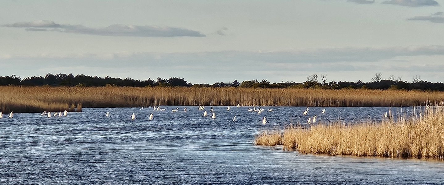
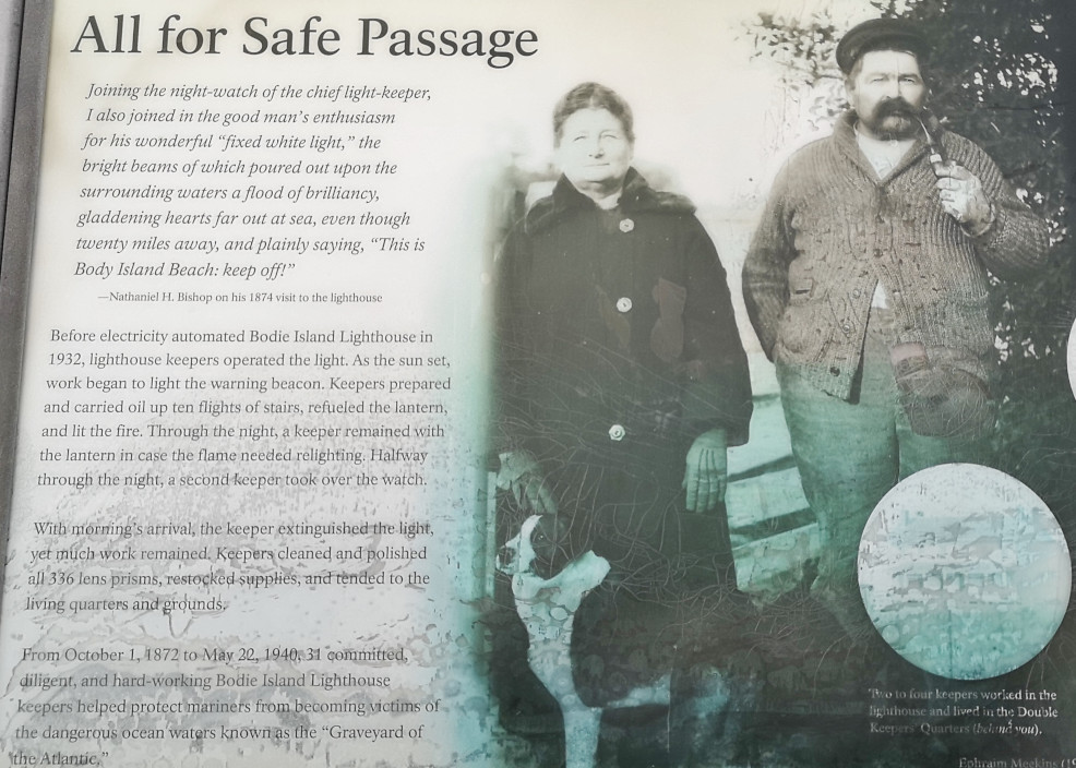
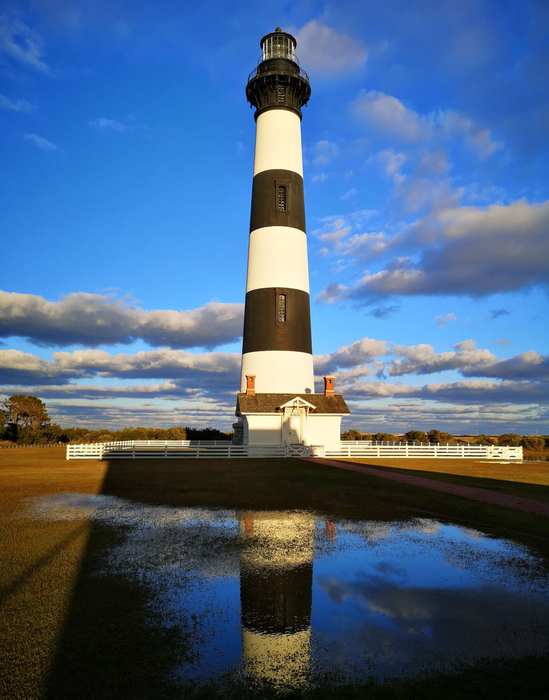
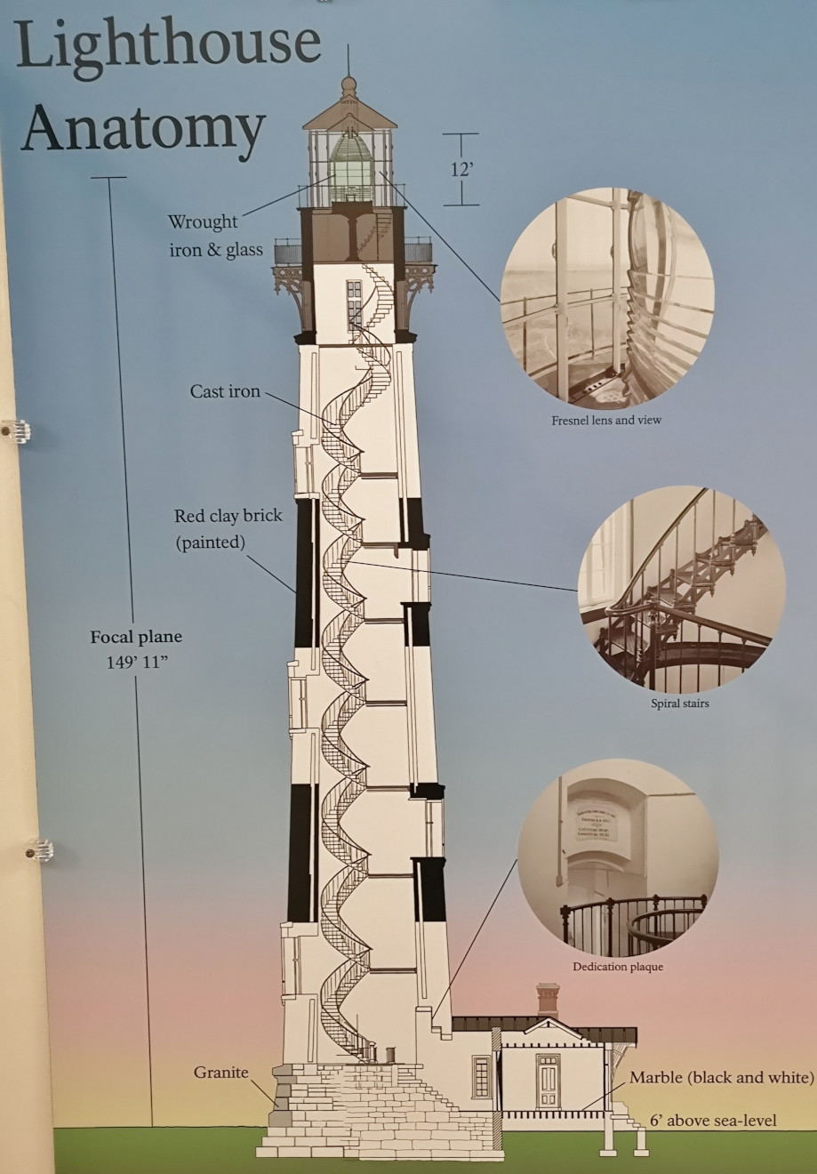
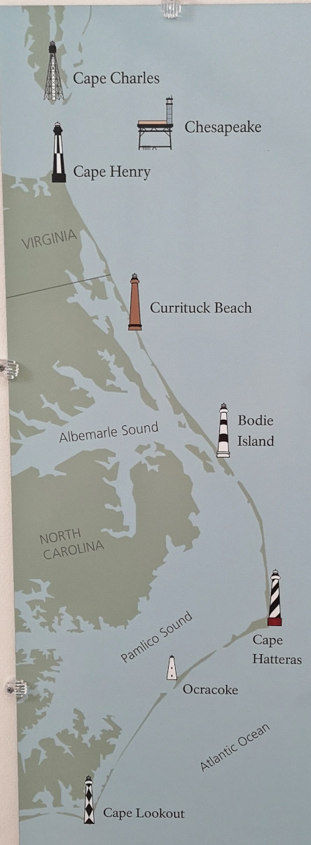
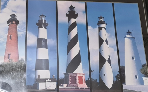
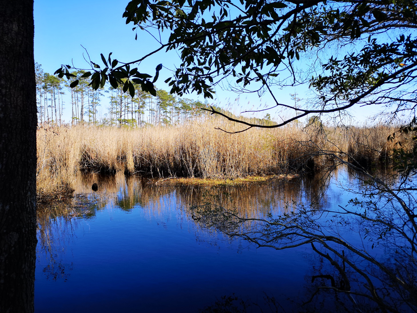
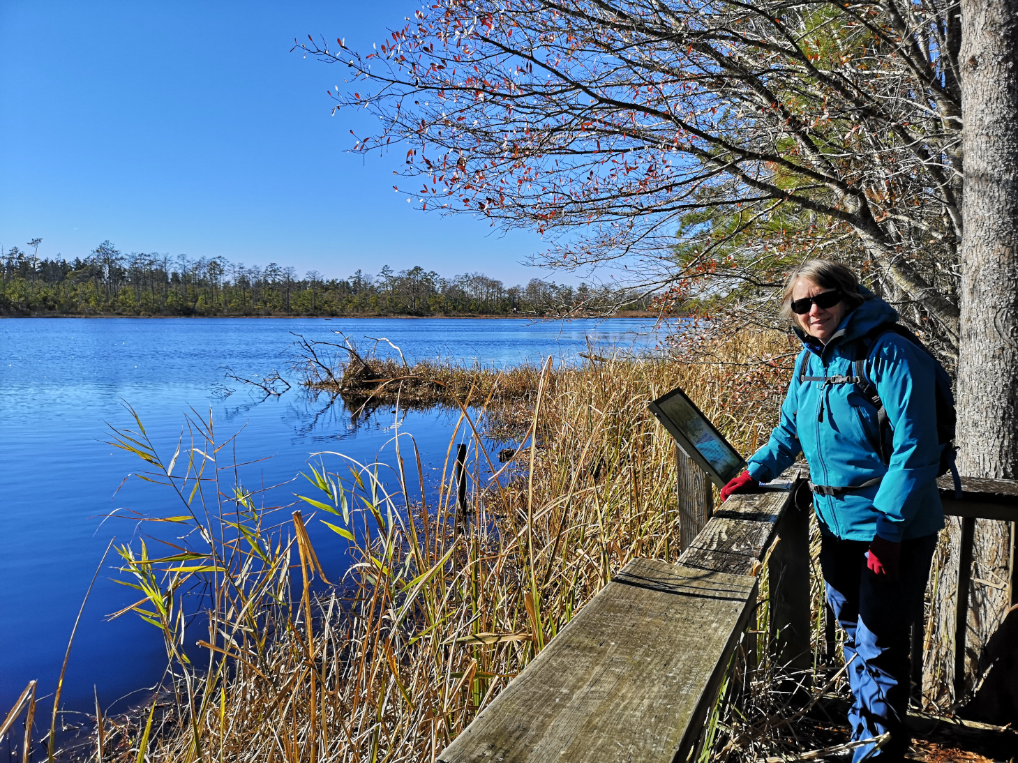
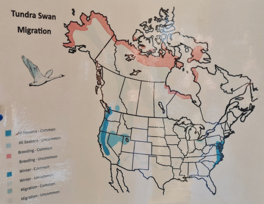
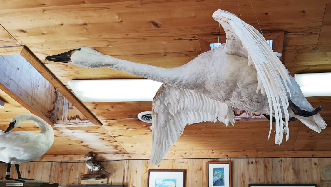
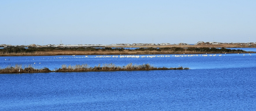
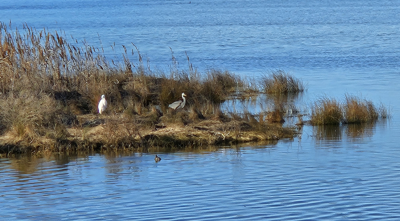
Heading back to the campground we decided to stop at the Bodie Island Marsh Blind, and we got to see a flock of Tundra Swans feeding. Then we stopped to see the Bodie Island Lighthouse and our timing was perfect for getting some beautiful pictures of this lighthouse in the golden hour. The current lighthouse was the third one built. The 1847 lighthouse was abandoned because it had a poor foundation. The 1859 one was blown-up in 1861 by the confederate troops because they were worried the union troops would take advantage of the lighthouse for navigation. The current lighthouse was completed in 1872 on the north side of Oregon Inlet and stands 150 feet high. You can see the beam of light 19 miles into the ocean. The lighthouse wasn’t open to climb but we did a short hike to a lookout and enjoyed the setting sun.


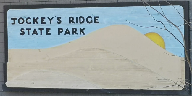
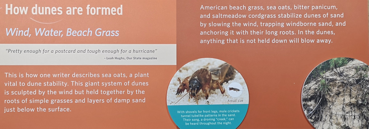
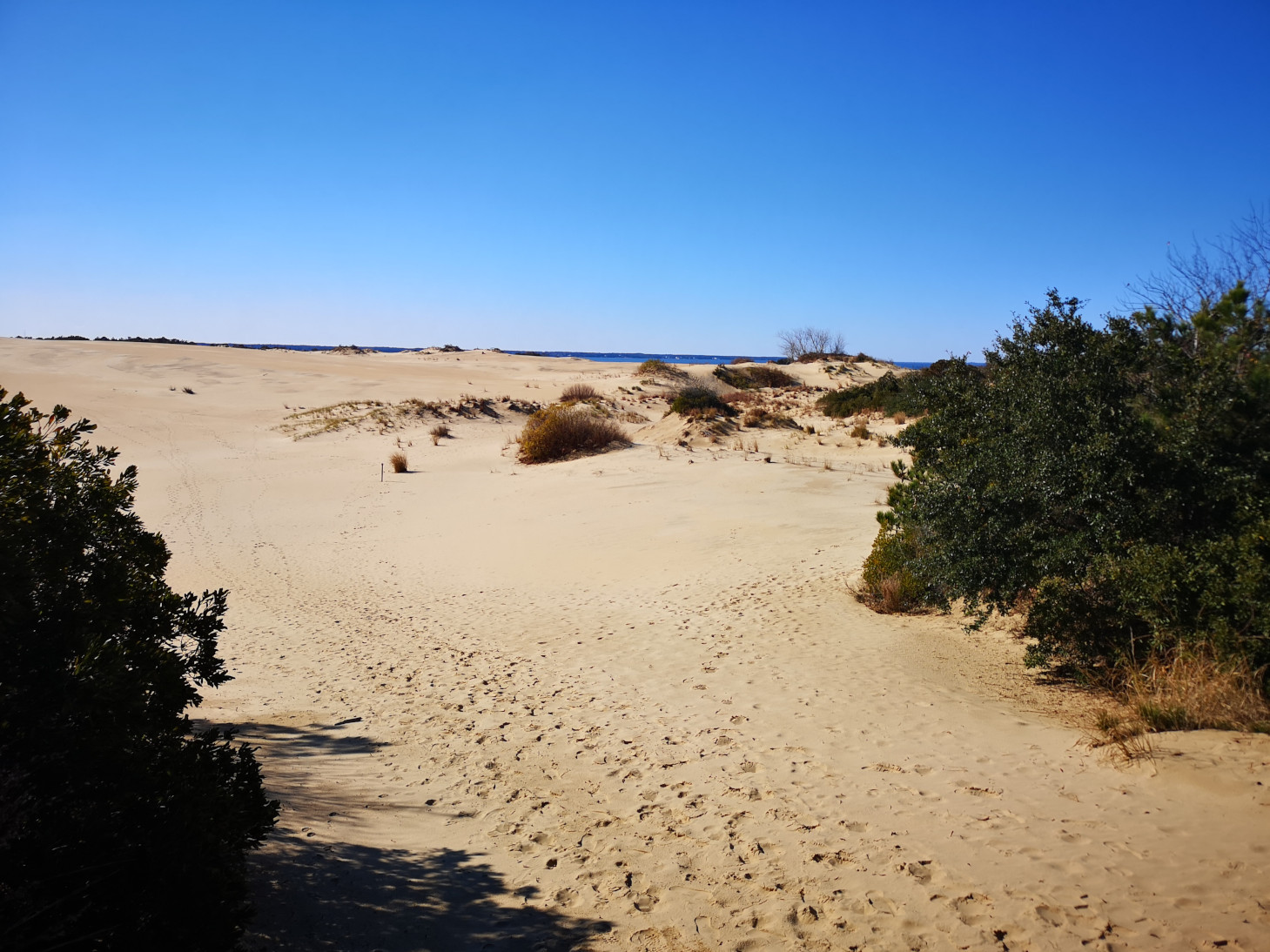
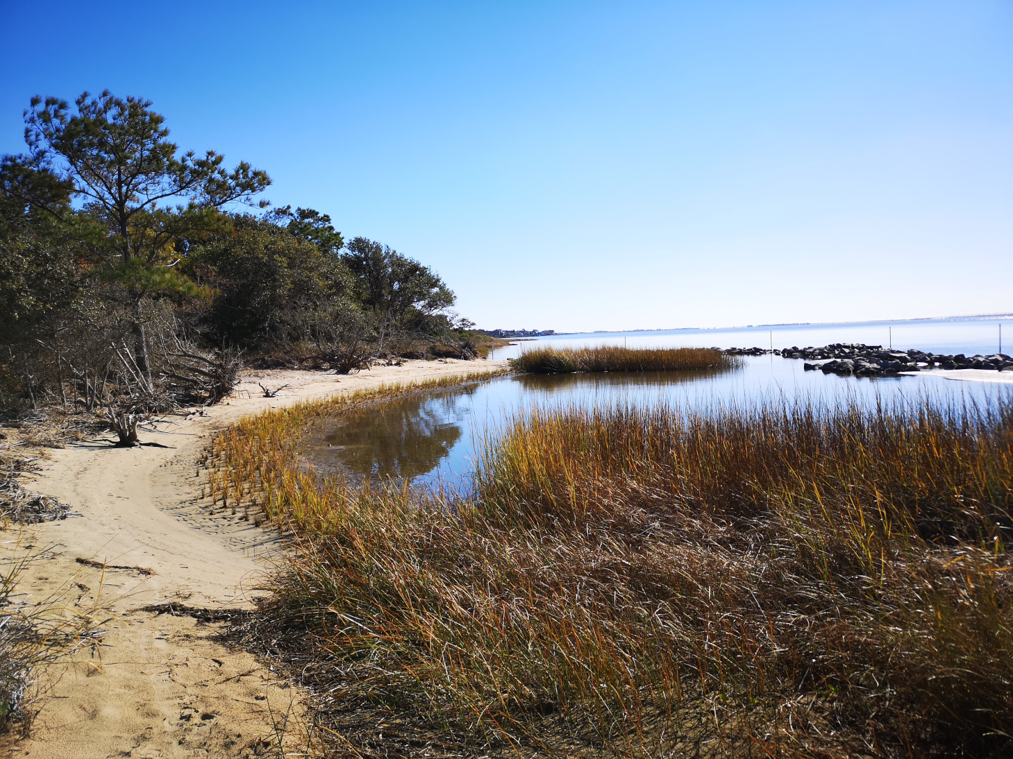
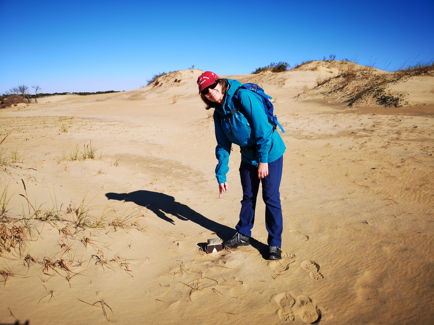
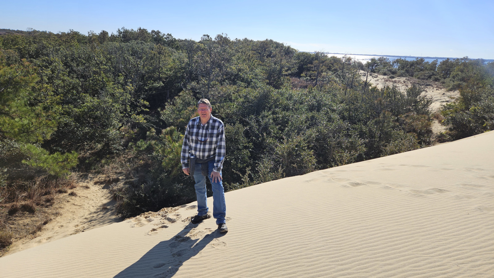
The next day we headed out to Jockey’s Ridge State Park. This park has the tallest natural sand dune in the eastern US with heights from 60 to 80 feet, it’s constantly on the move. In the winter it moves NE and in the summer SW, so it just blows back and forth. At one point a development was going in this area but a woman blocked the developer and then eventually the state bought the land and created Jockey’s Ridge State Park. It’s a fun place to walk the dunes and explore. We did the Tracks in the Sand trail to Roanoke Sound then we went up to the top of the ridge and the Park Ranger had told us we could just walk over the dune to get to the Soundside Nature Trail. Some fun facts from the visitors’ centre:
- The dune sand is mostly quartz and is beach sand washed up from the ocean and blown across the land. Obviously both the Wright brothers and we have seen how strong the winds can be in the Outer Banks!
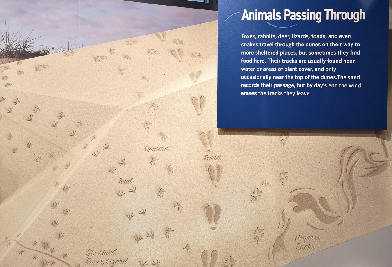
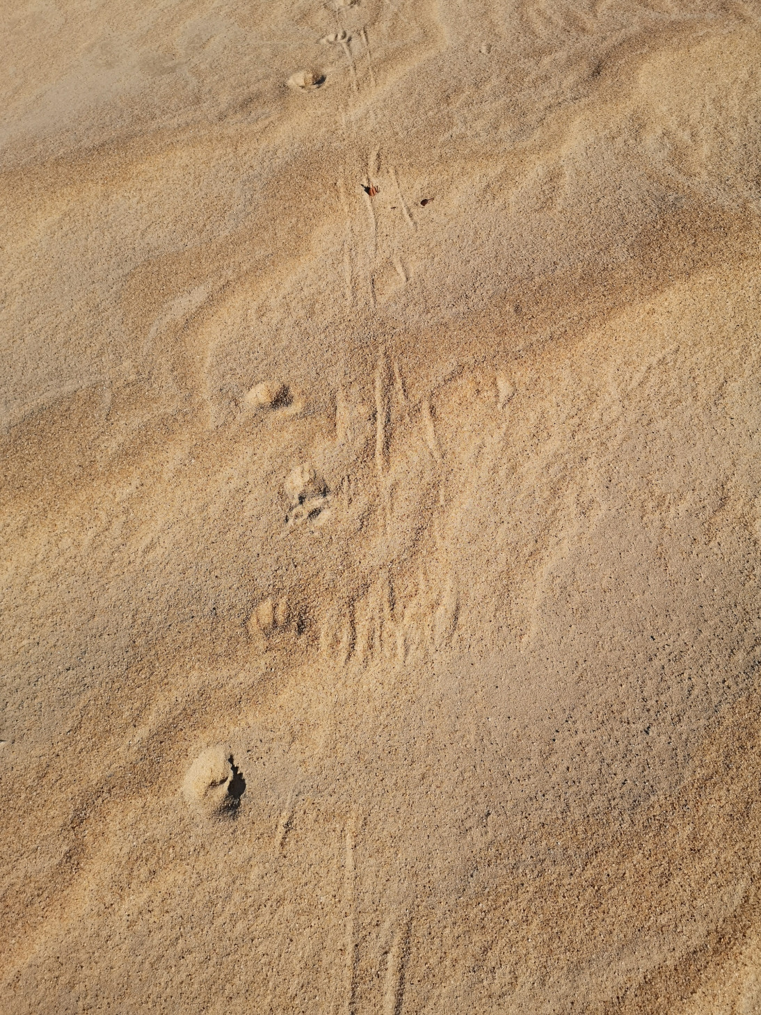
- We found lots of tracks in the sand dunes and were trying to identify which animal had left them.
- This park’s main feature is the sand dunes but there was also mature Maritime Forest areas with live oaks and pines.
- The beach is a buffet of marine worms, mollusks, and crabs for shore birds.
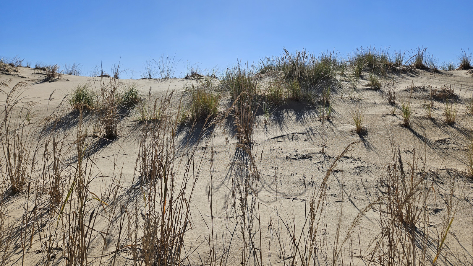
- Growing on the front side of the dune are grasses whose roots stabilize the dune then give way to shrub thickets.
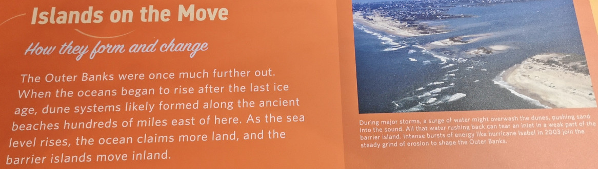
- The Outer Banks can be as narrow as 150’ or as wide as 5 miles.
- In between the shrub thickets and maritime forests fresh water can collect in pockets which is a refuge for animals.
- On the back side of the barrier islands, the sound shore and grasses provide a healthy habitat for juvenile fish, crustaceans, and mollusks.
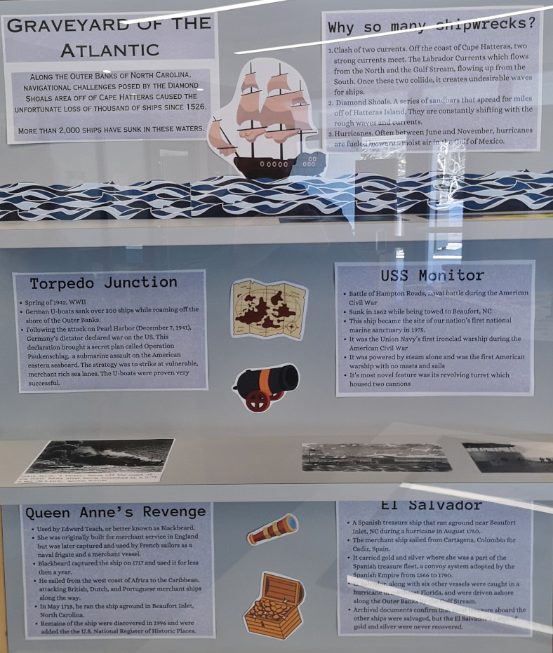
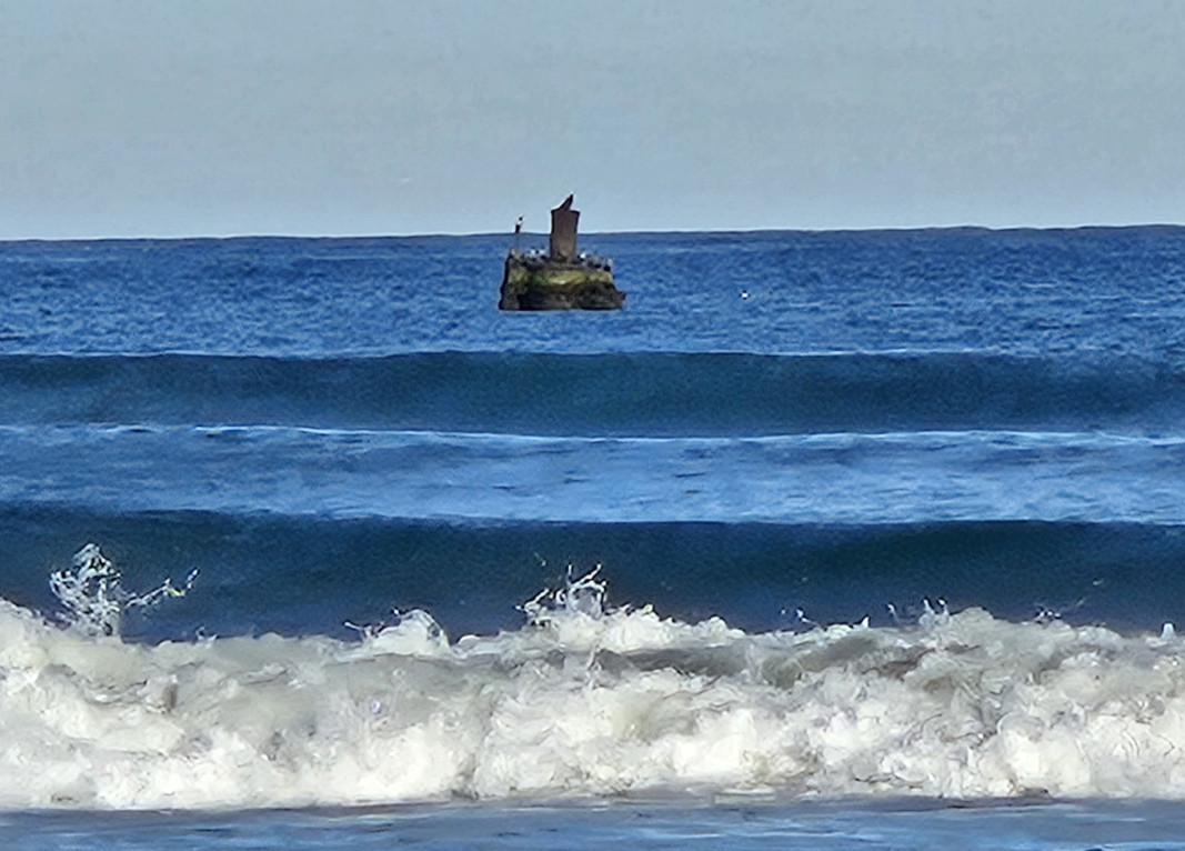
- The shore is called the Graveyard of the Atlantic as more than 2,000 ships have sunk due to strong currents, diamond shoals, hurricanes, and war activity.
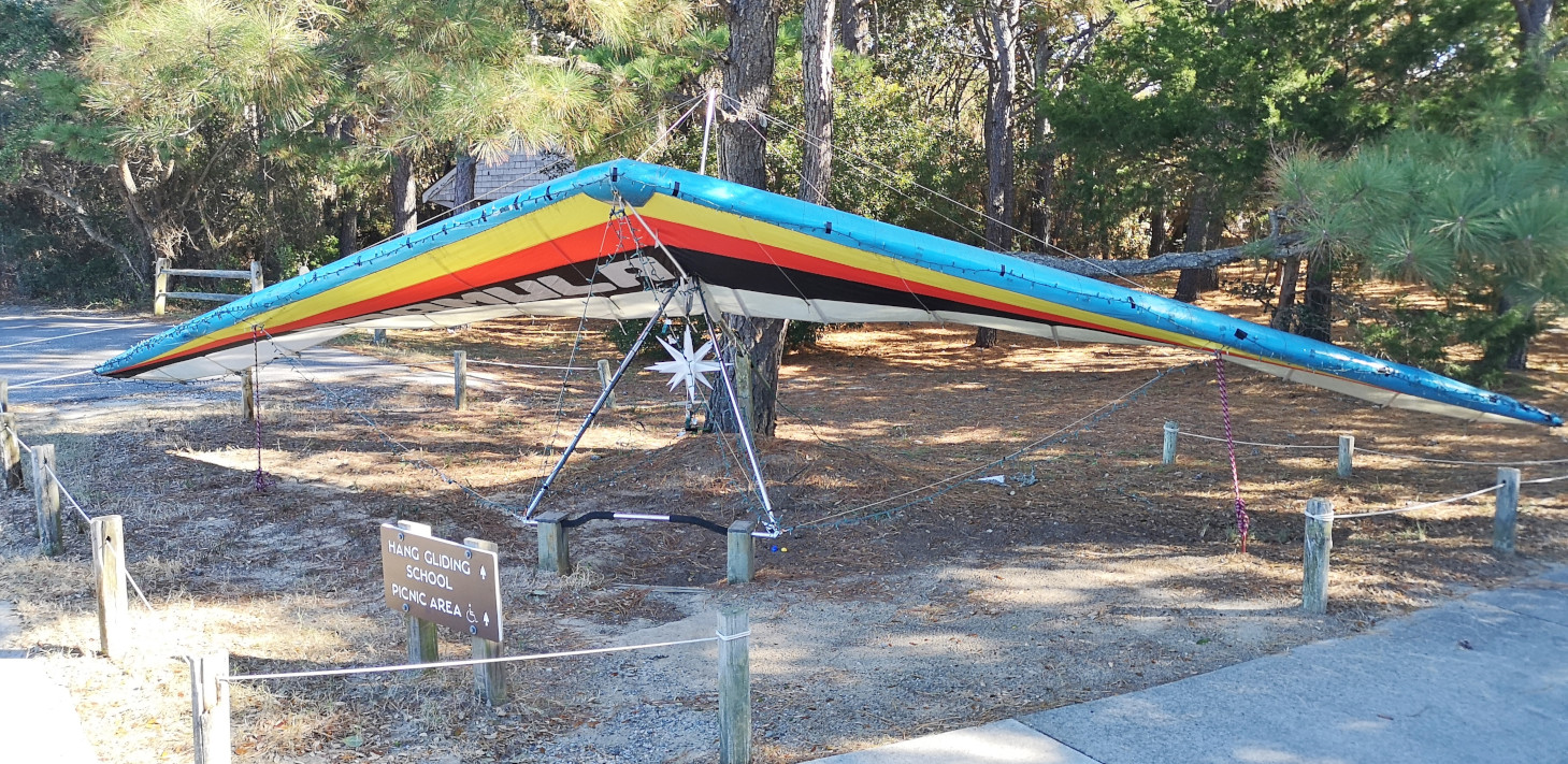
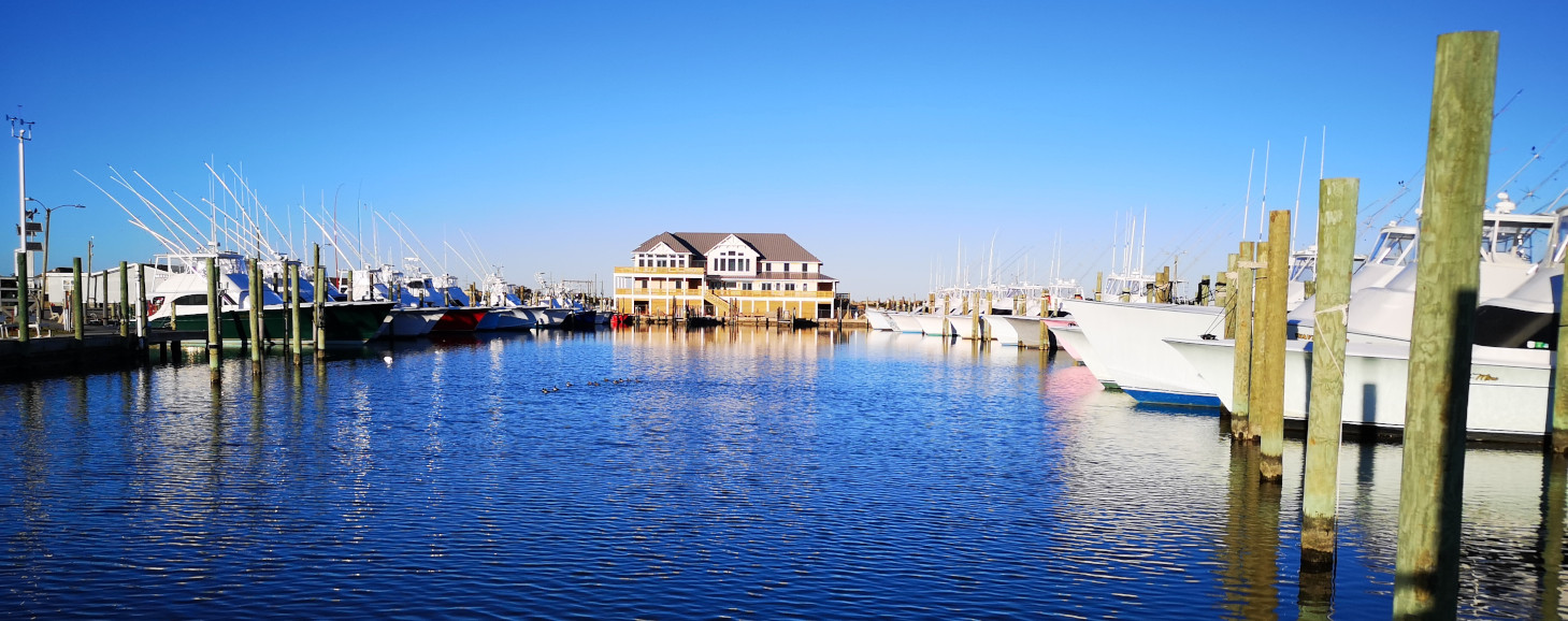
There was a hang-gliding school at the park, but it was a 3 hour course so we opted not to take it. If they had an option where people would take you for a ride, I might have tried it. Also, on the ocean side of the dune there were remnants of a mini golf course that was abandoned and now buried in the sand. Instead of taking the highway back, we took the beach road to check out all the houses. Nags Head is definitely a tourist destination. We also stopped in to see the fishing charter area that was across the road from our campground.


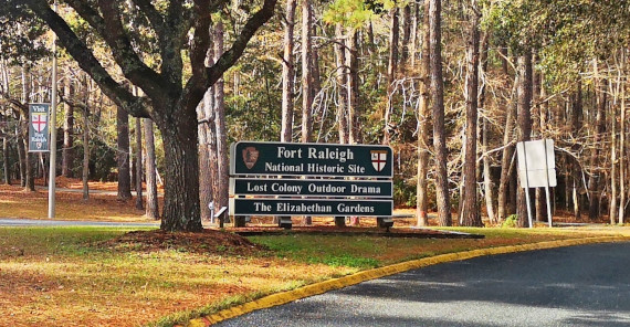
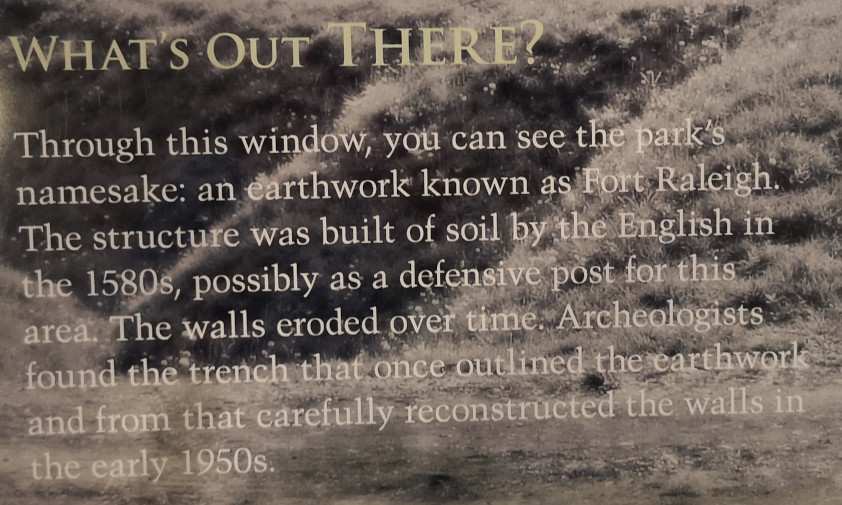
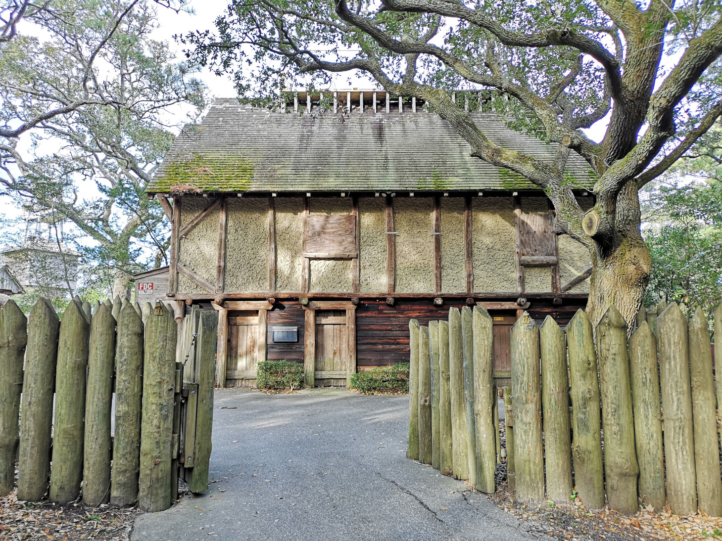
Today we headed to Roanoke Island by taking a bridge from Bodie Island, our destination was Fort Raleigh National Historic Site. We arrived just as an interpretive tour was starting, here are some fun facts:
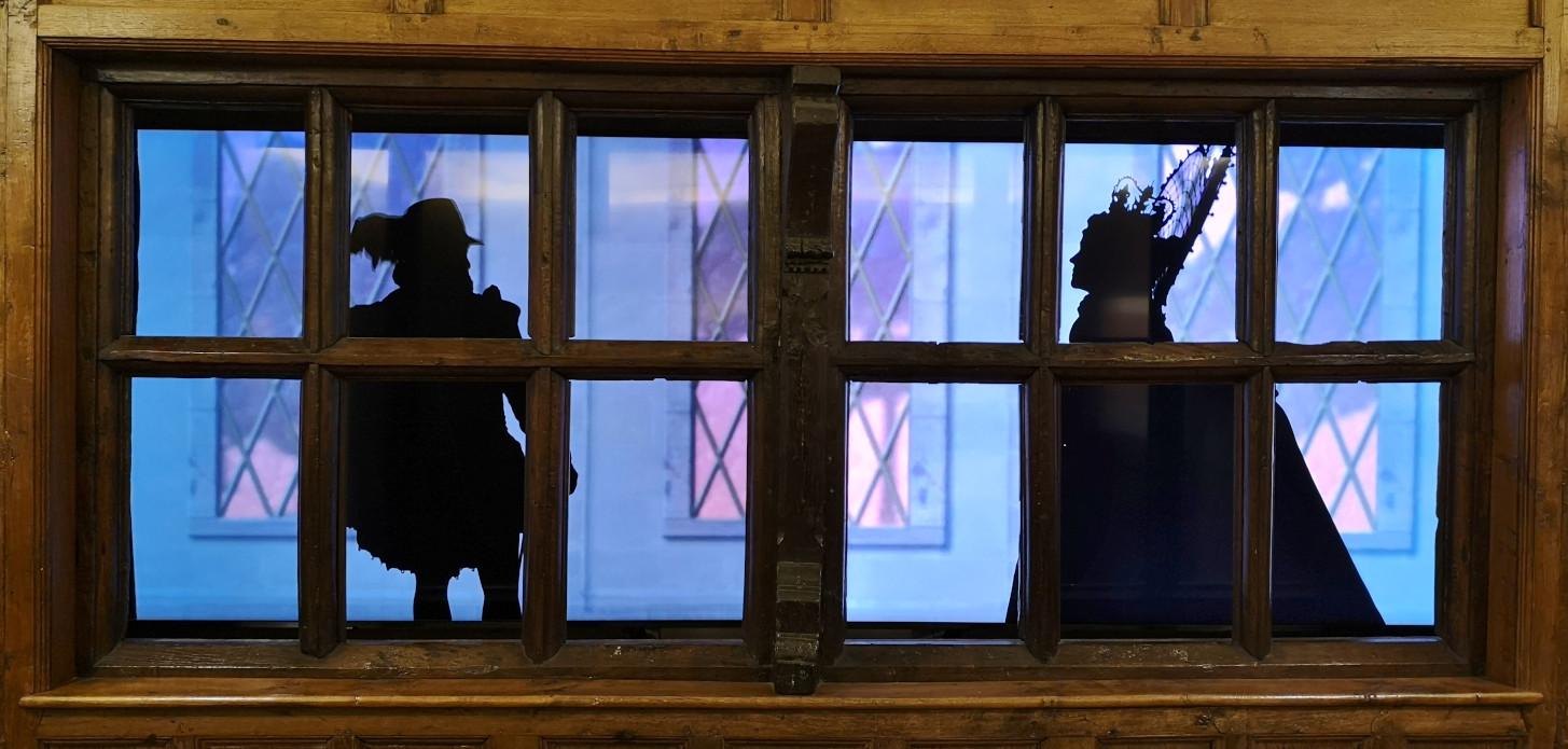
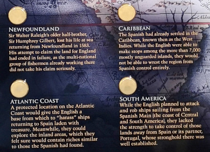
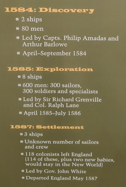
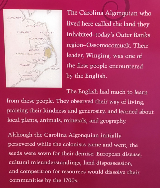
- 1584 – Sir Walter Raleigh sponsored the first exploration and settlement of the North American coast with a charter from Queen Elizabeth. The English were welcomed by the Algonquians on Roanoke and when they departed two Algonquians came with them to England (Manteo and Wanchese). The report back to Raleigh was a positive one.
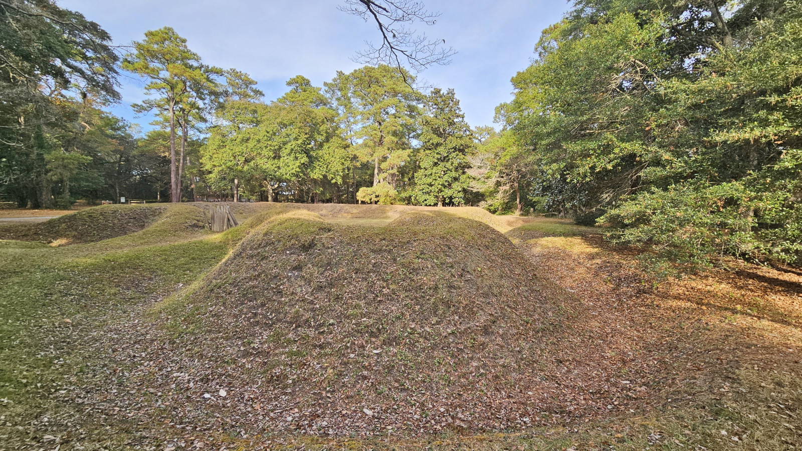
- 1585 – Raleigh sent seven ships with over 600 military people in hopes of occupying the land for England. Artist John White came along to record pictures of the expedition. With limited supplies, the military depended on the Algonquians, however several were dying due to the European diseases brought on the ships. Trouble was brewing and when replacement supplies didn’t arrive on time, the men went back to England with Sir Frances Drake (who was also in the region), only 15 stayed to maintain England’s foothold in America. The earthen fort structure was built during this time.
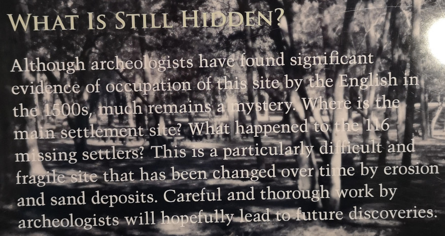
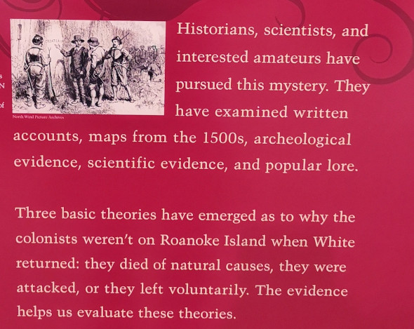
- 1587 – Trying to create a true colony, 117 men, women and children were on the next voyage. They hadn’t planned to colonize Roanoke but further north near Chesapeake Bay. However, when they stopped to look for the 15 men left behind in 1585, the ship’s captain refused to take the colonists any further. The Algonquians remembered the bad treatment they received, and things were deteriorating so the Captain returned to England for supplies, leaving the colonists. However, White and his ship weren’t allowed to return as all ships were needed to fight Spain. When he did return in 1590, no colonist could be found. They became known as The Lost Colony of Roanoke.
- On August 18th 1587 the first child of English parents was born in America and her name was Virginia Dare. The county is named Dare after her and there are many businesses that also use the Dare name.
- 1862 – Civil war Union forces take over Roanoke with 13,000 troops on the island. Word spread that on Roanoke enslaved workers found a safe haven. Hundreds arrived and the army established a Freemen’s Colony. By 1865 3,500 people were in the colony but that dropped to 950 in 1867, when landowners reclaimed their land, the Freemen had less area to farm and faced starvation so left the area.
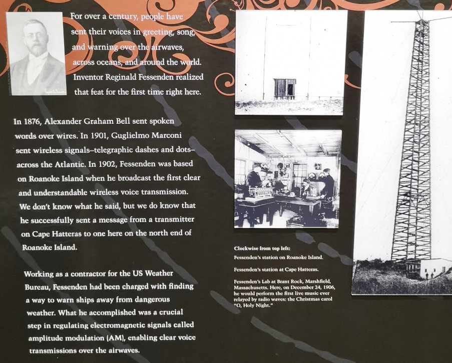
- 1902 – The first human voice using wireless technology was transmitted by Reginald Fessenden, wouldn’t he be surprised at wireless technology today!
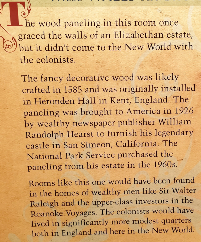
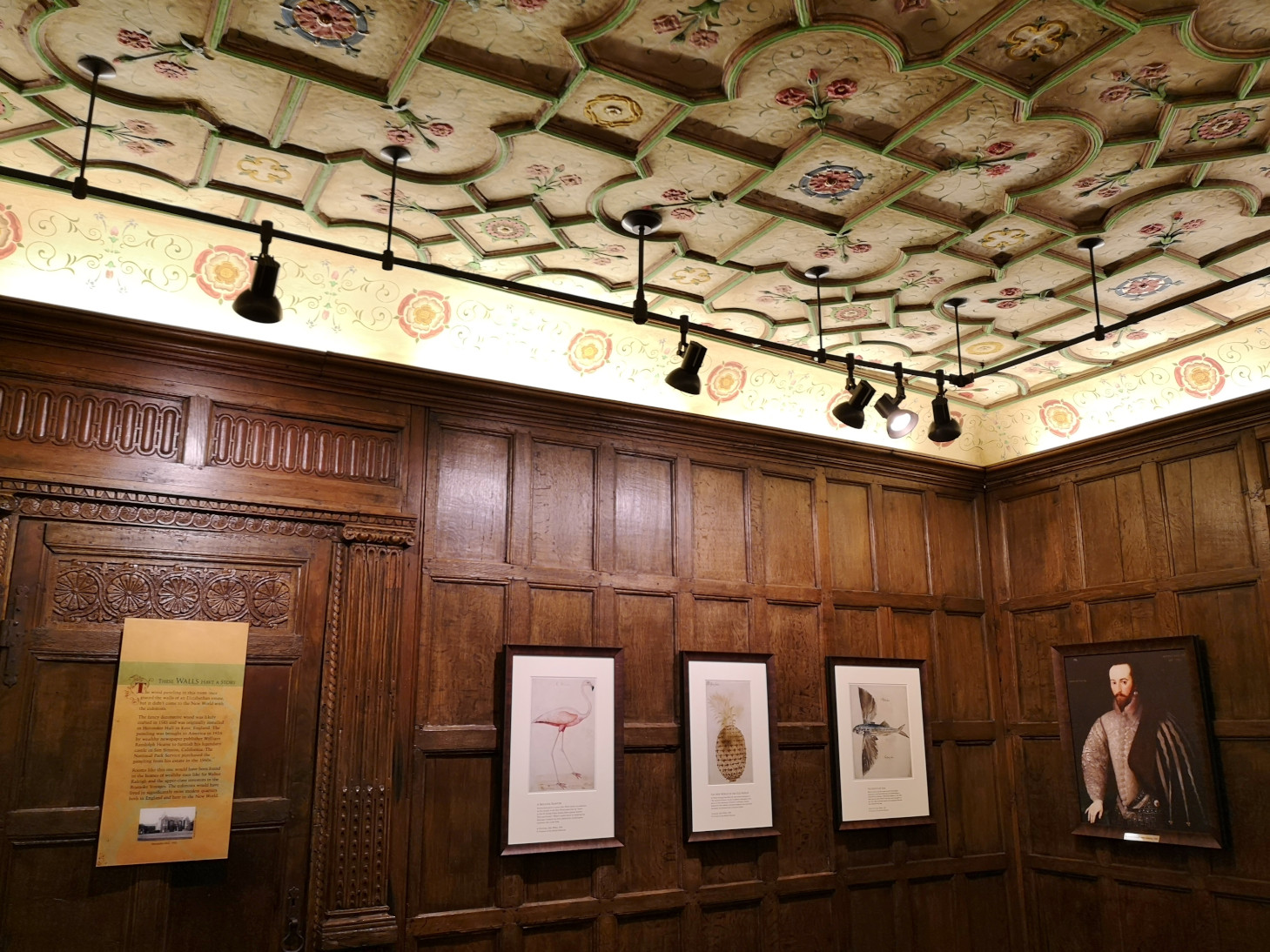
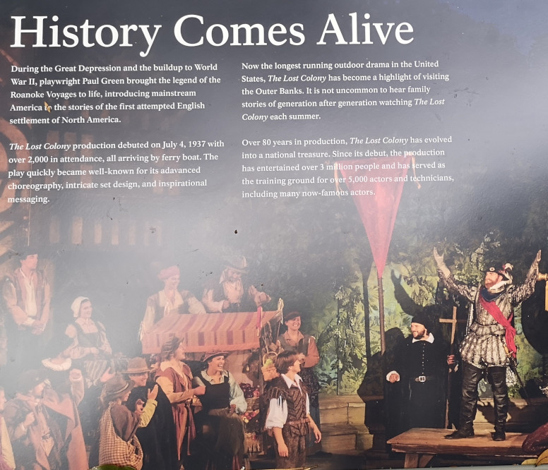
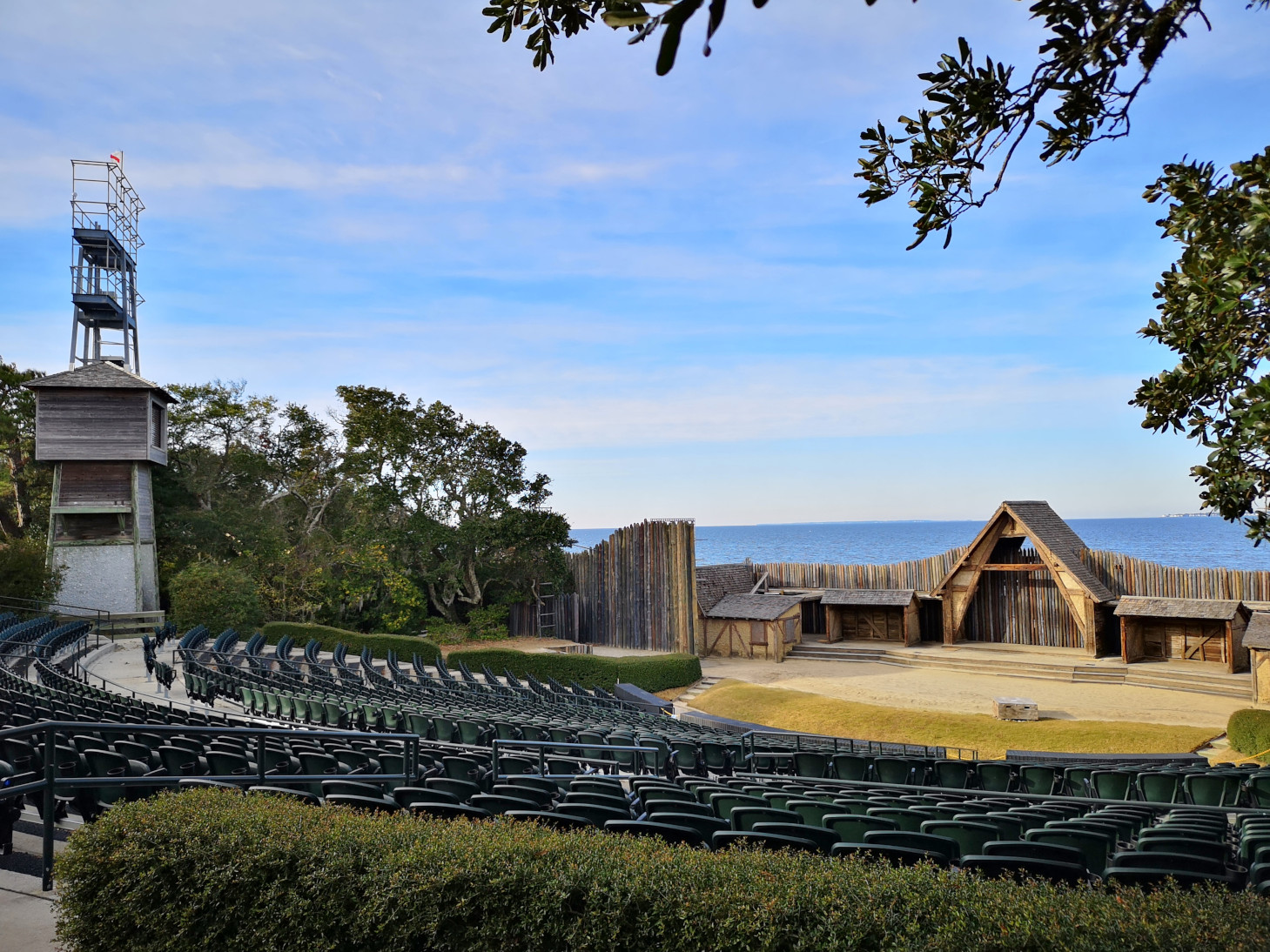
After the guided tour we spent time in the museum which had lots of displays. Then we walked around the grounds and the nature trail and saw the open-air theatre. This theatre puts on a show called The Lost Colony which they have been doing since July 4th, 1937. It is now the longest running outdoor drama in the United States. A few days later the waiter we had at a restaurant had been one of the cast members.


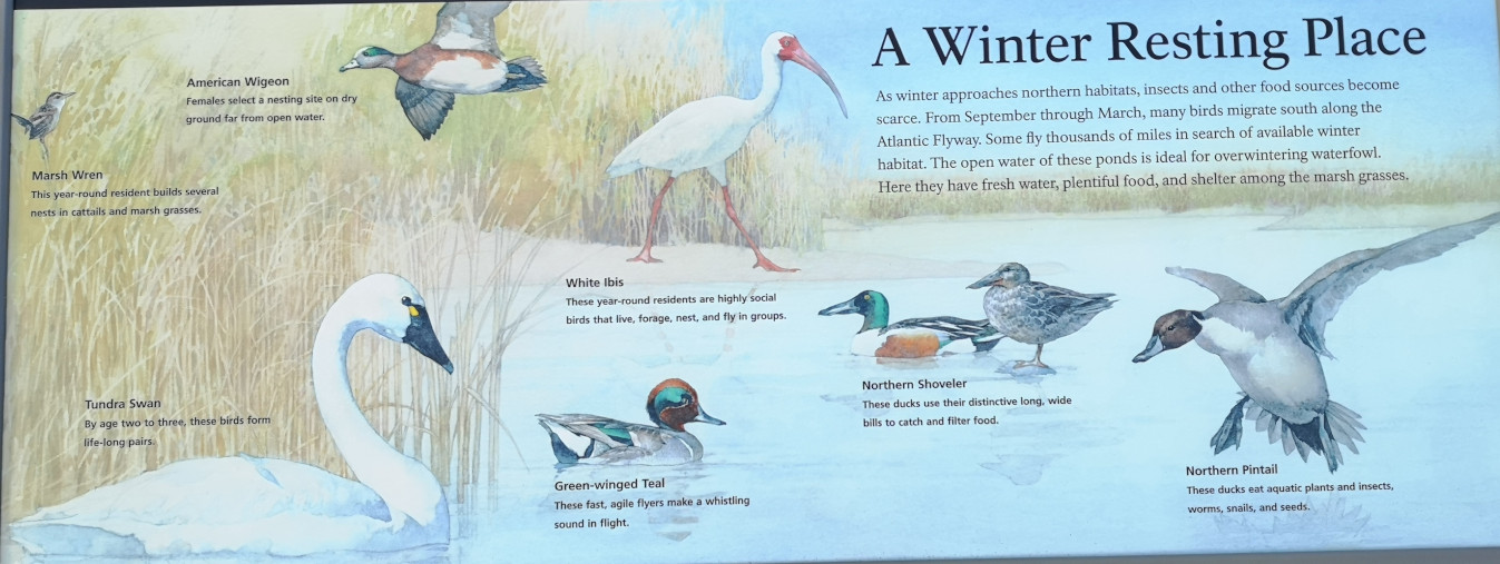
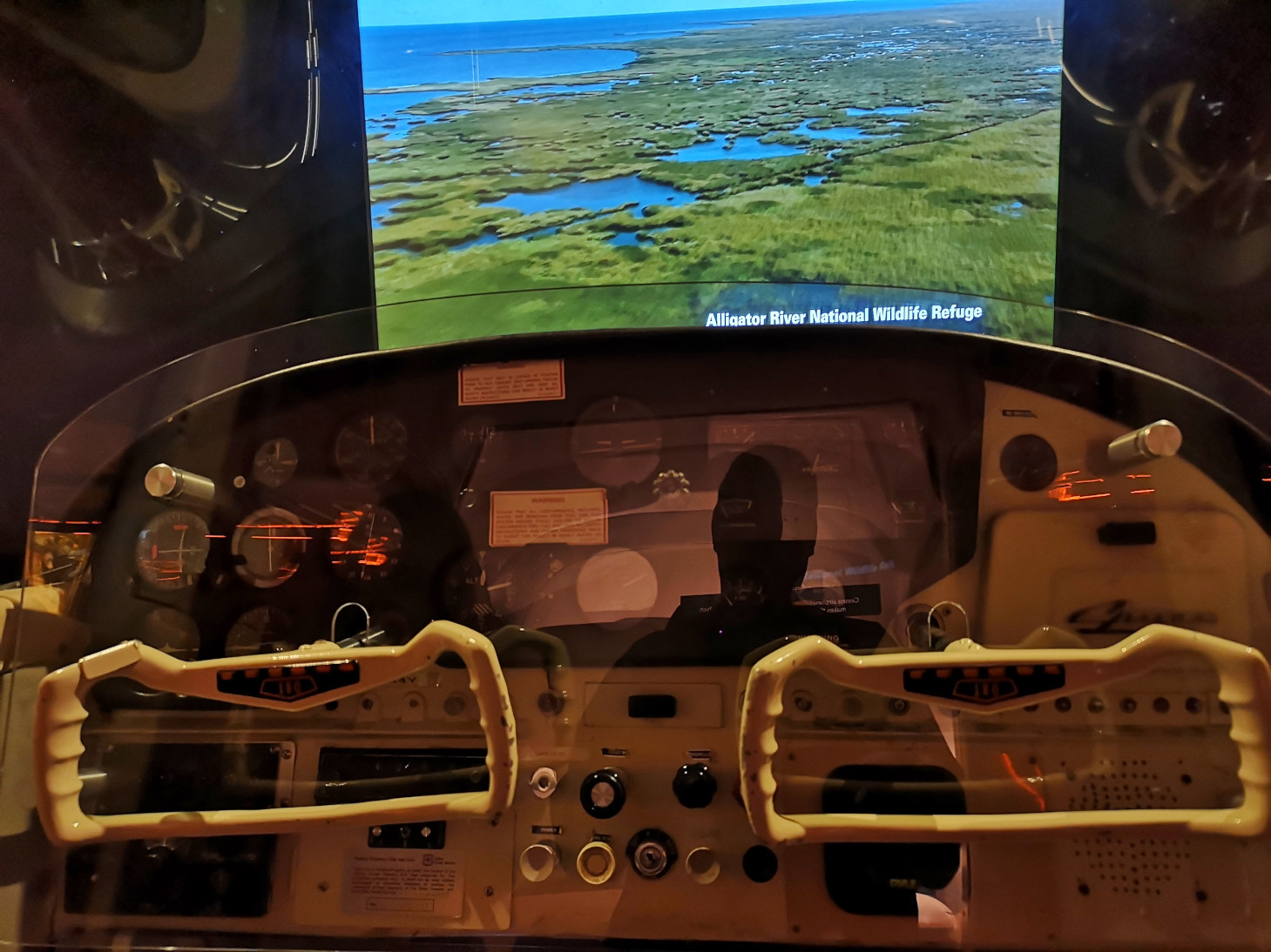
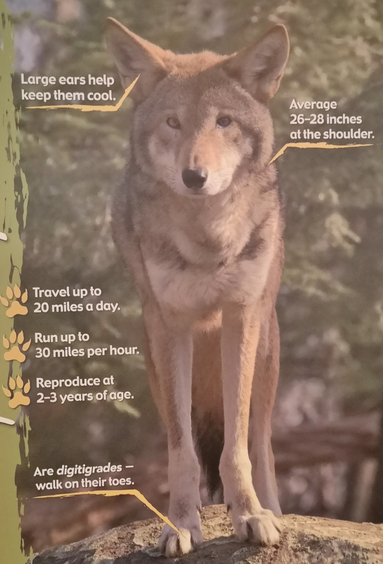
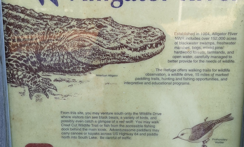
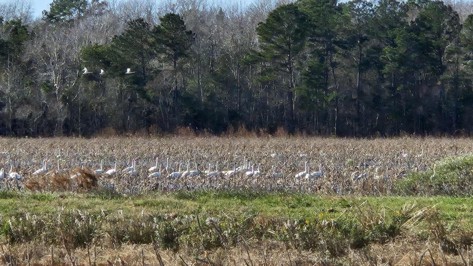
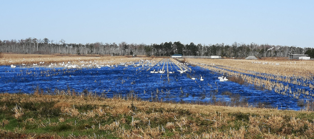
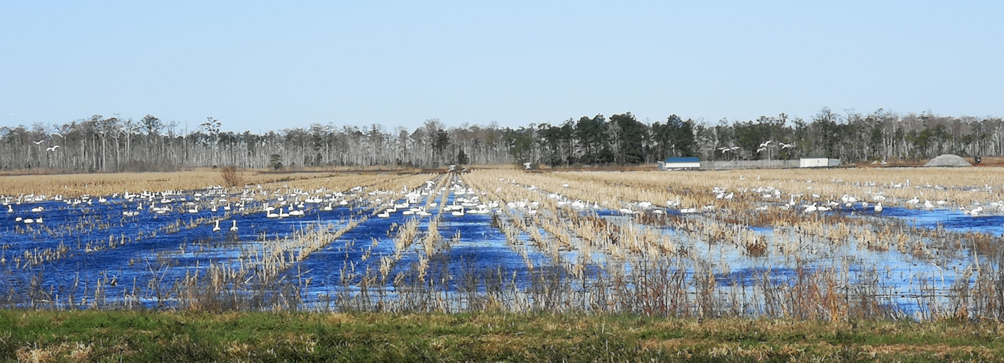
As we left Fort Raleigh, we stopped at the Coastal North Carolina Wildlife Refuges Gateway Visitor Centre. It was very good with a small theatre area where you could feel rough roads from your seat (sub-woofer action)! You could fly in a simulator helicopter over the area. The closest refuge was Alligator River and the ranger said we could see lots of Tundra Swans as they flood the fields so they can stay at this time of year. We decided we would check it out the day after as the sun would soon be setting, part of the challenge at this time of year. The refuge is also home to alligators, black bears, and red wolves.
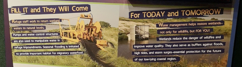
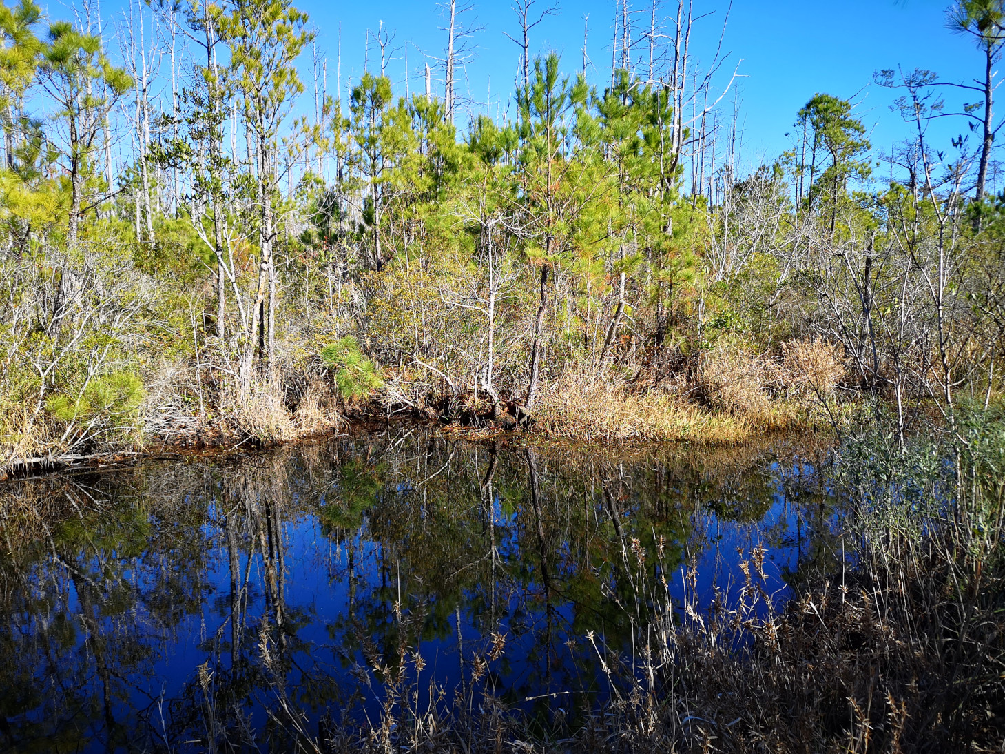
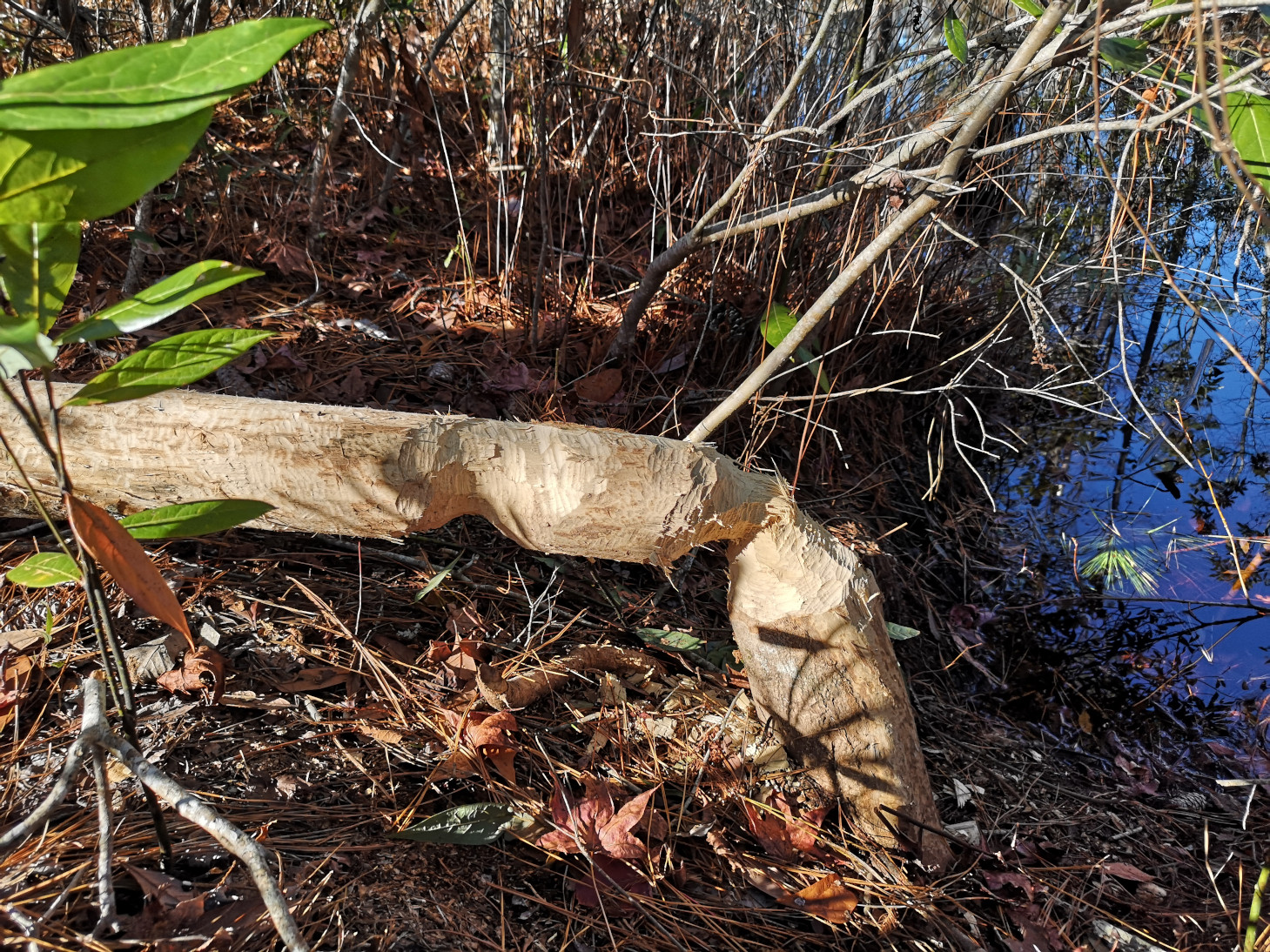
The next day we drove over the bridges to get to Alligator River National Wildlife Refuge. We started off with a short trail along the canal system and then we drove on the Wildlife Drive loop dirt road. We saw lots of Tundra Swans in the first field but then we drove west and in another field the Tundra Swans were even closer. Next, we did the Sandy Ridge trail where we saw signs of the beaver but not the actual beaver. We also got a view of Sawyer Lake.
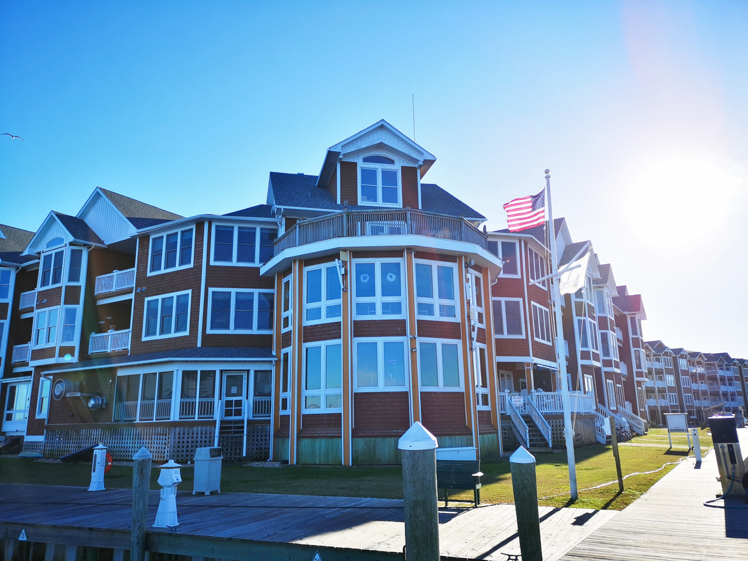
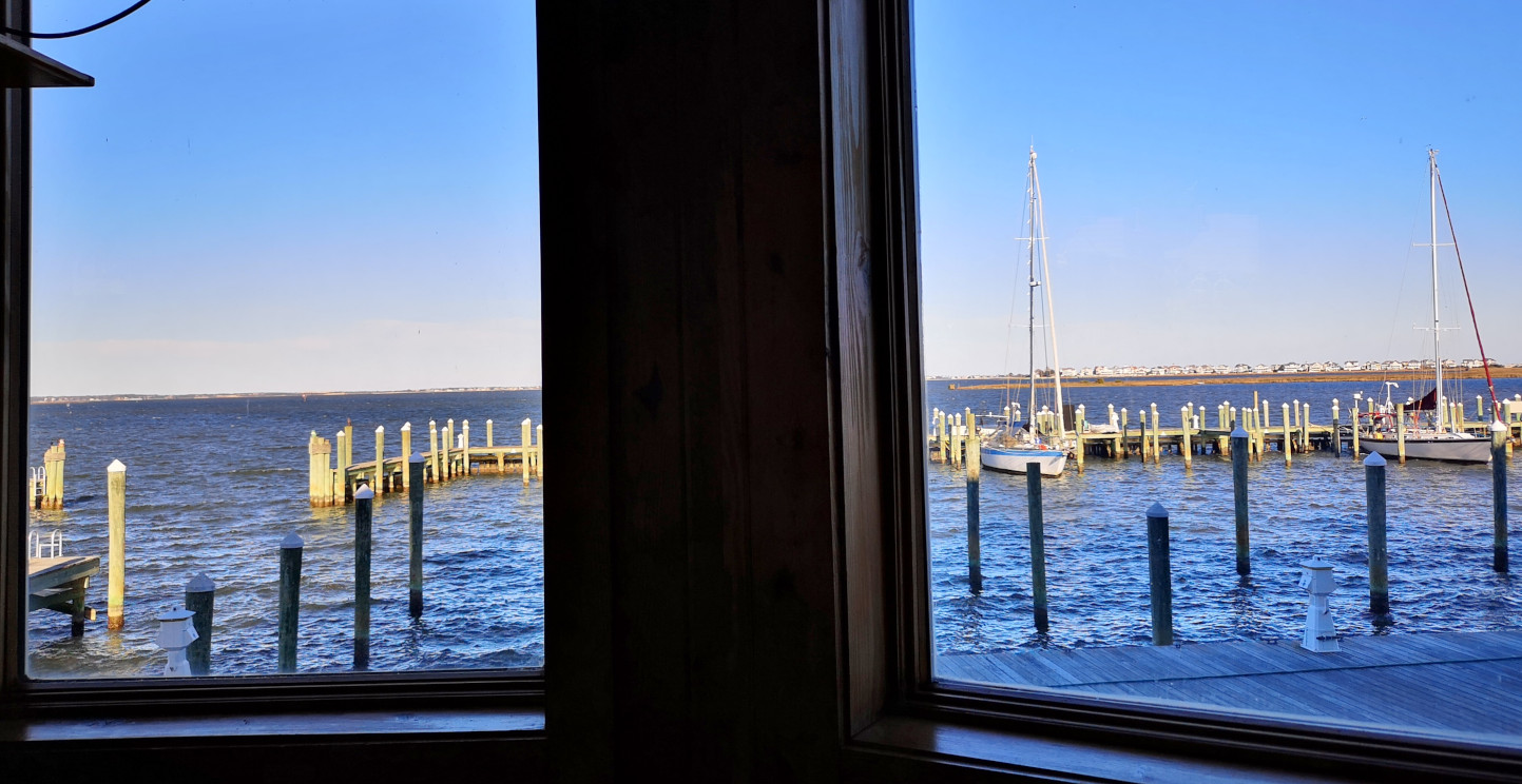
After exploring for the morning, we decided to go out for lunch to Stripers Bar and Grille for another seafood lunch. I tried a Michigan Kalamazoo Stout and a local Highland Brewing Oatmeal Porter, we had a Crab Rangoon appetizer, and I had the Lemon Pepper Flounder topped with crab meat and Sharon had Grilled Scallops😉 Excellent lunch in a local type of place with a great view.

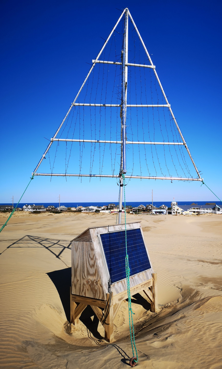
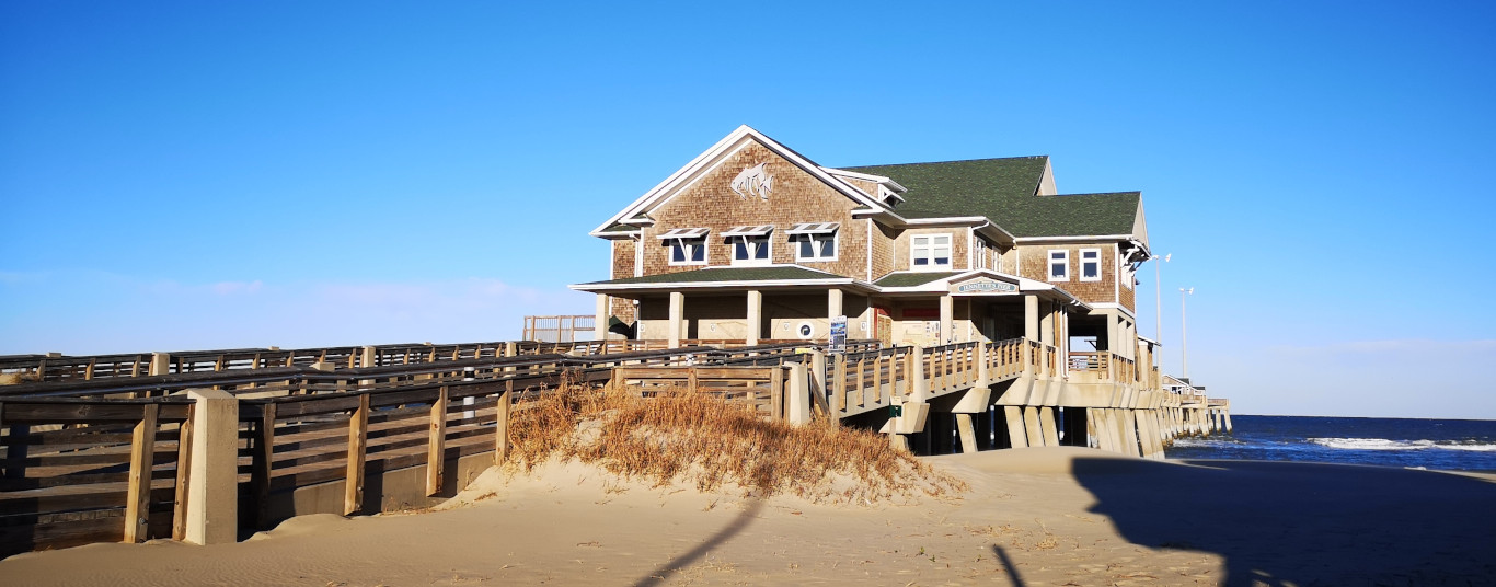
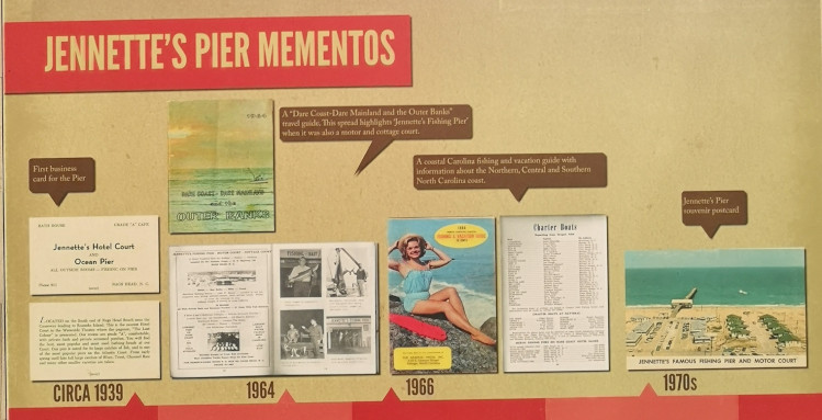
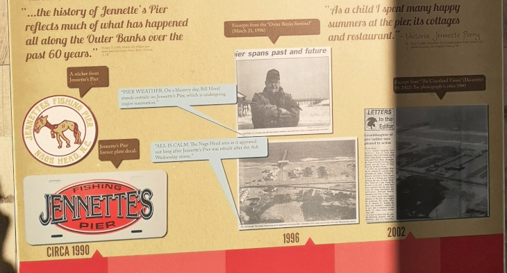
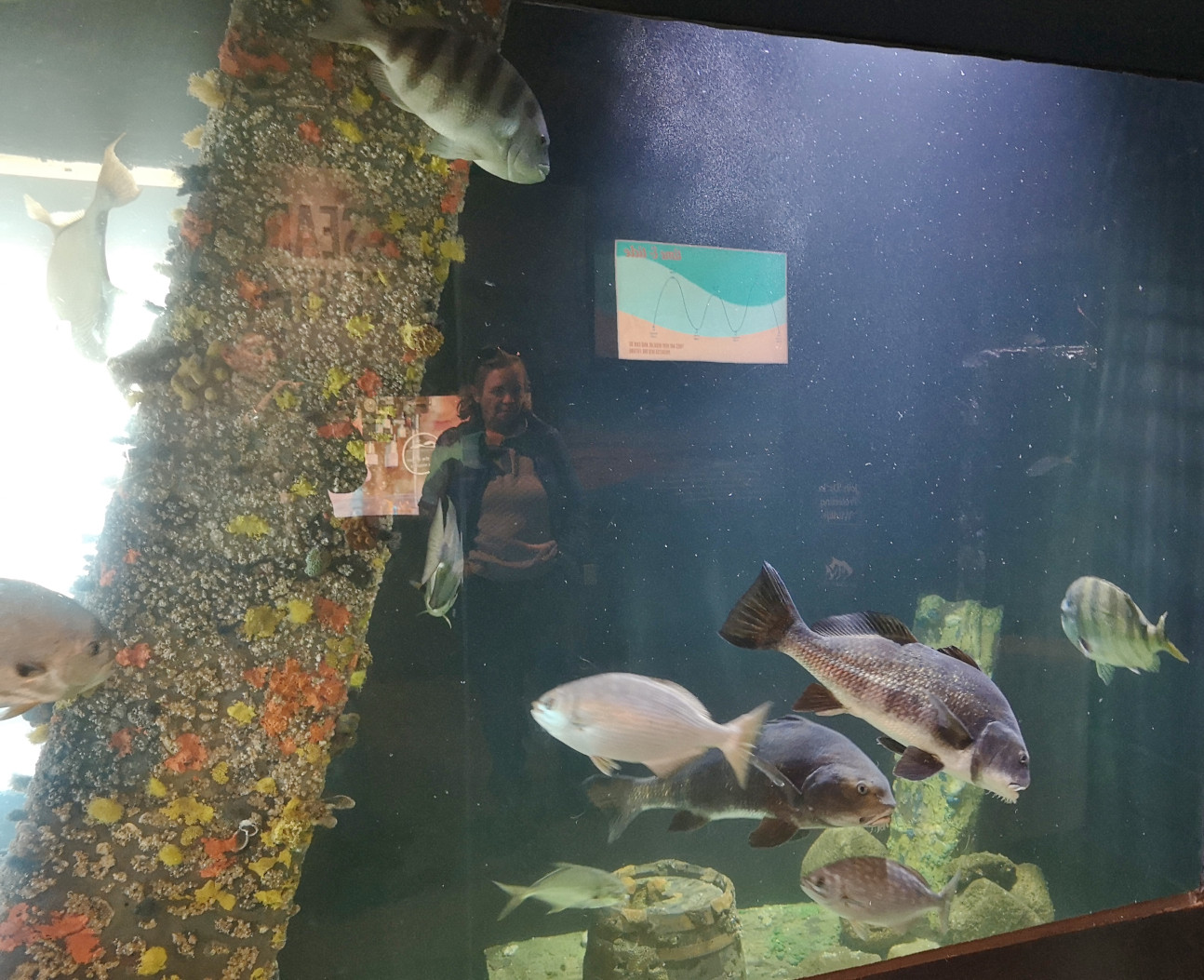
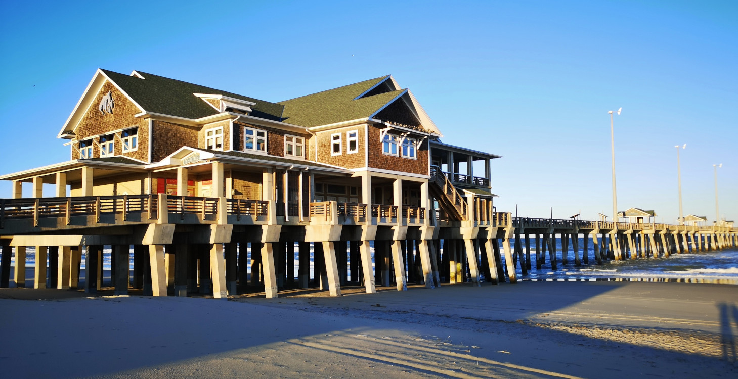
Our last stop before returning to the campground was Jennette’s Pier. This location is famous for being a place for people to pay to fish off the pier but we were there just to see the aquarium displays they had inside. The pier had originally been built in 1939 but then it was destroyed by hurricanes in 1960 and 1962, and then purchased by the NC Aquarium Society in 2002, only to be destroyed again in 2003. In 2008 rebuilding began and was completed in 2011 to hopefully survive any future storms. The aquariums explained about the Sealife that lived around the pier with sample tanks and even live underwater cameras. They also do a lot of Plankton research here which was interesting to us since we had named our RV Plankton – drifter at sea. The pier is also the home of a full weather station which is where we had been getting our local weather data.


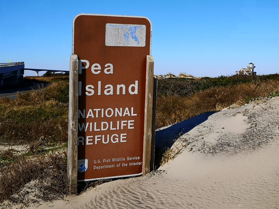
We had been closely watching the weather forecast and a serious storm was moving its way up the coast and the prediction for Sunday was for wind gusts topping 124 kph. Since we had seen the prior Sunday how bad 98 kph was we didn’t want to experience this storm anywhere on the Outer Banks. That evening we modified our plans to go south and decided instead to go inland to Goose Creek SP since the winds would at least be more manageable there. This meant on the Friday we would tour Pea Island and then move to Goose Creek SP on Saturday where we would stay for 3 nights to let the storm and the aftermath get dealt with. As we found out later this was definitely the correct decision.
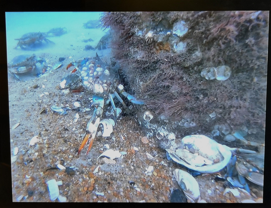
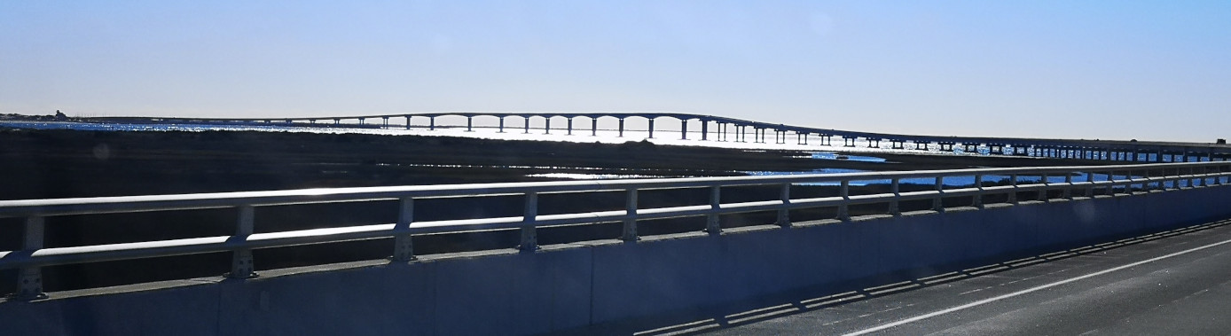
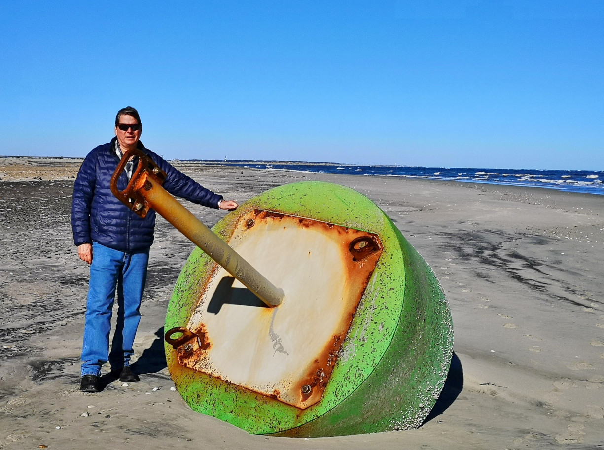
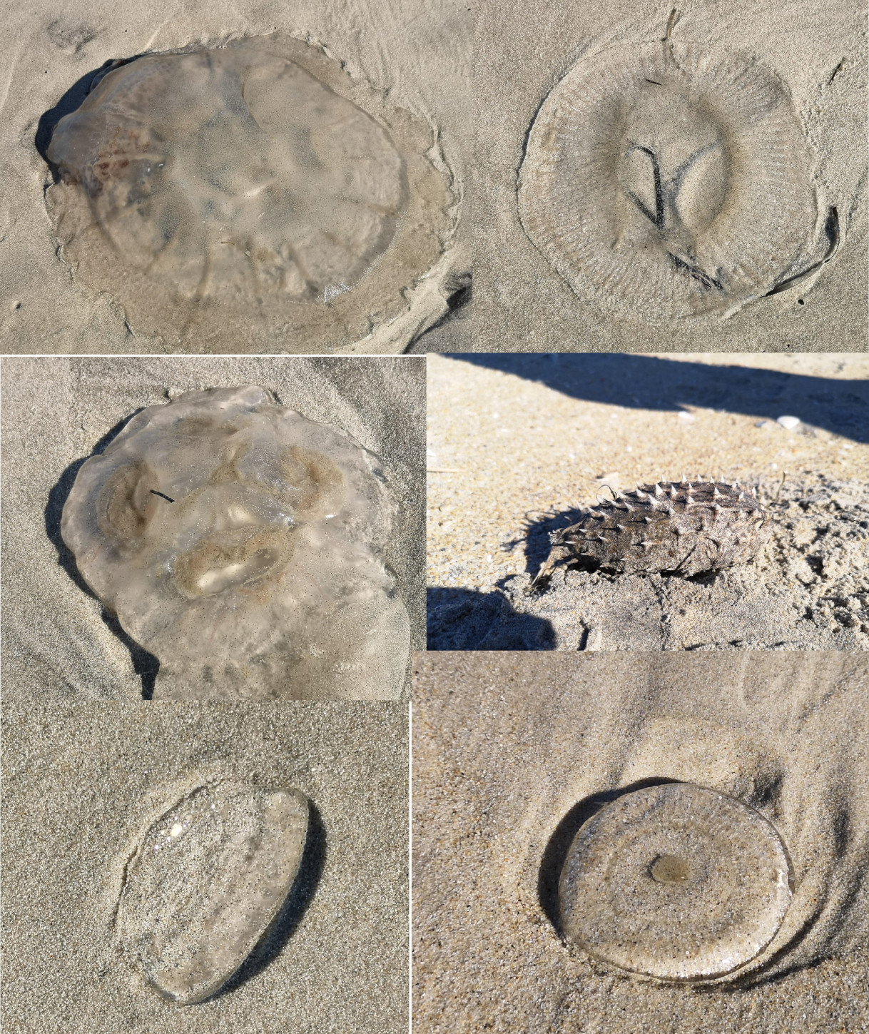
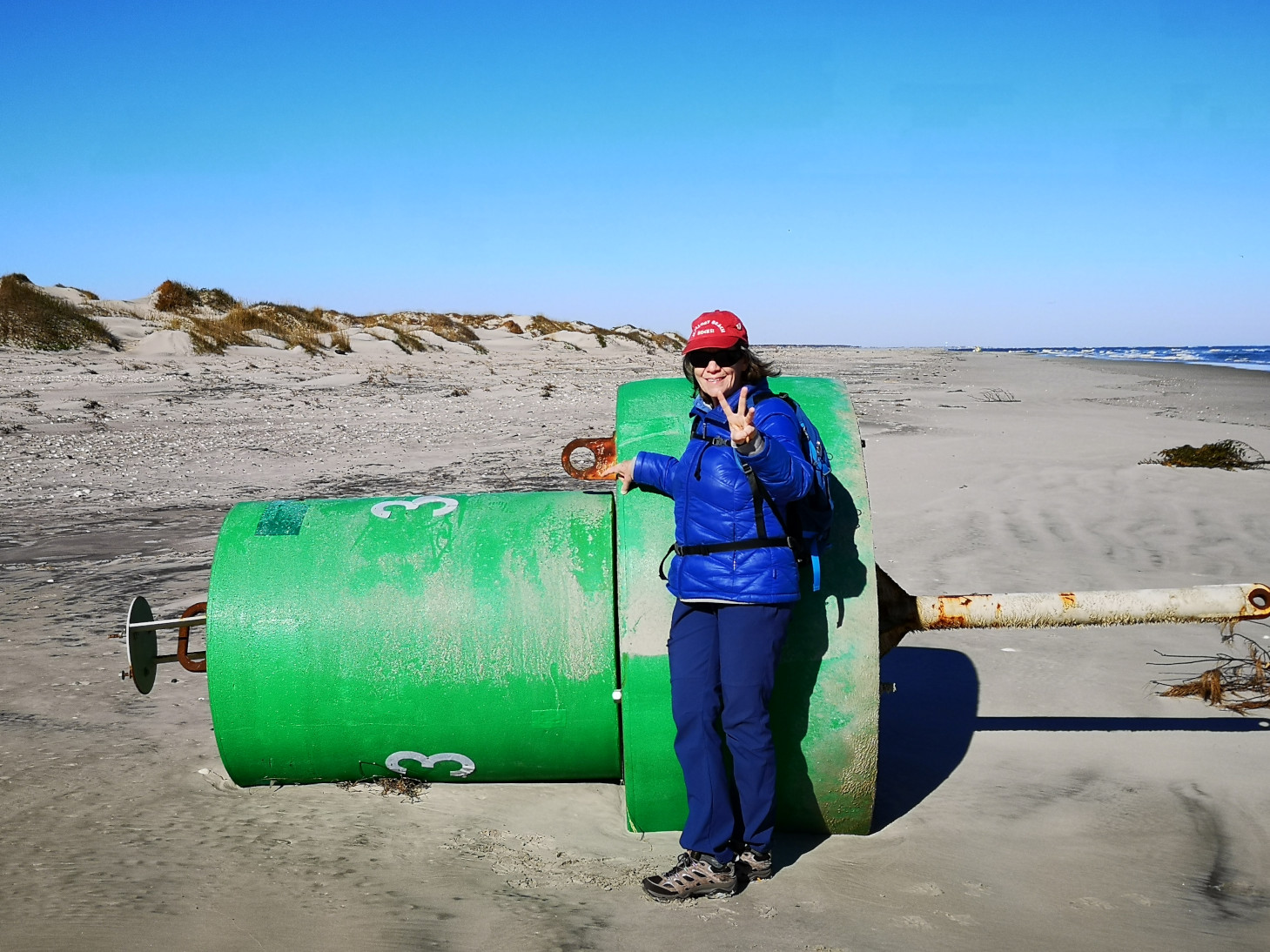
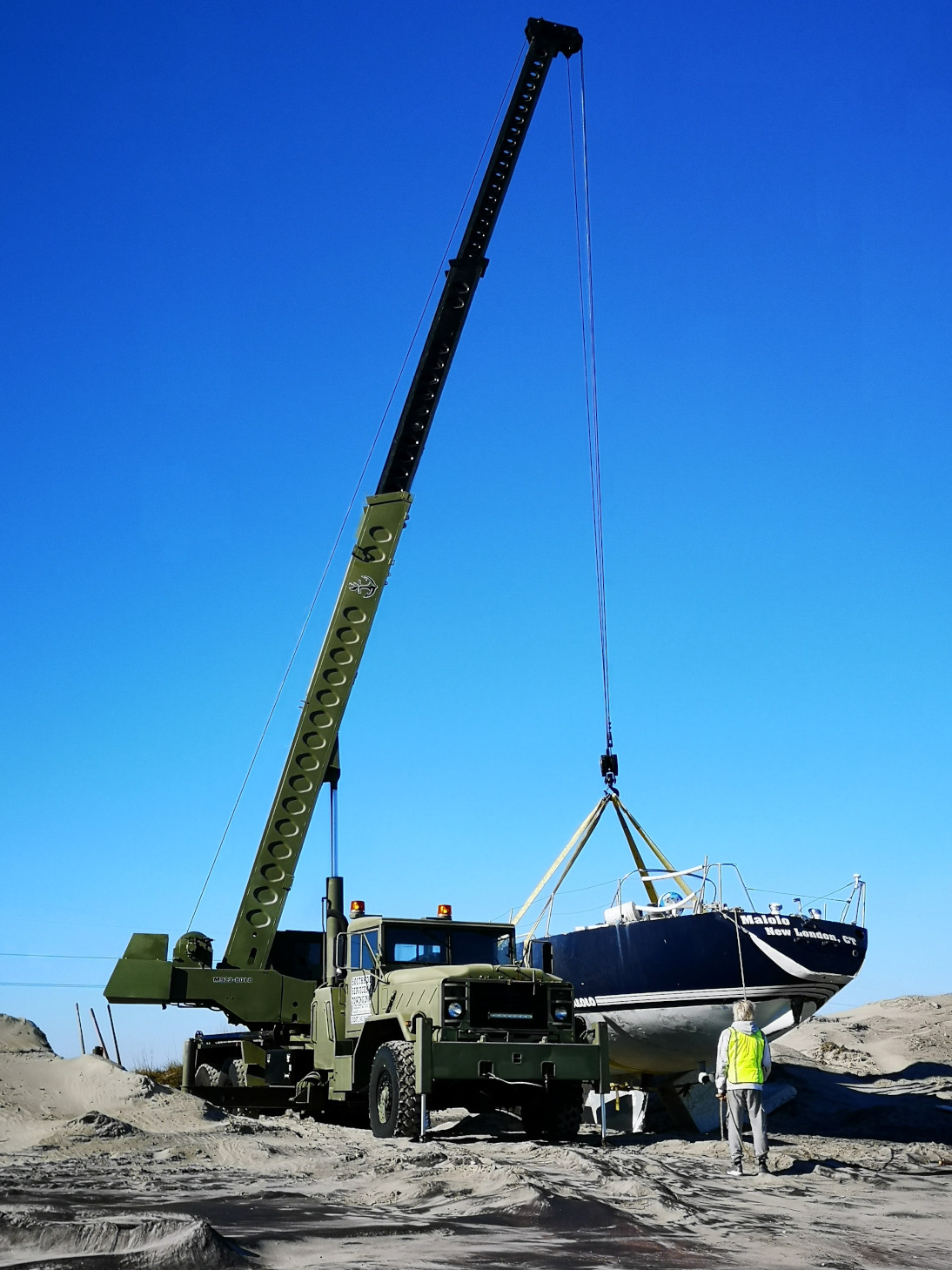
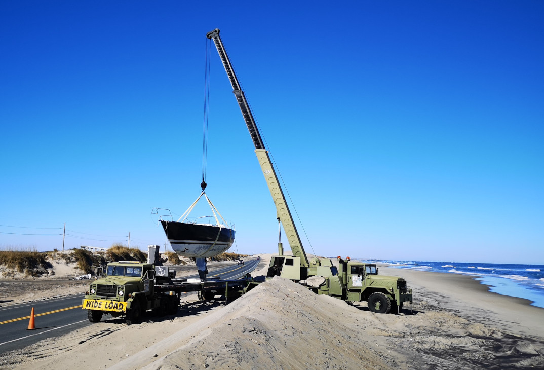
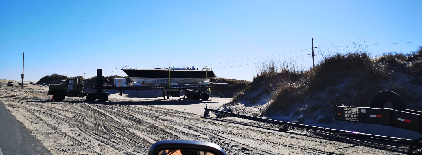
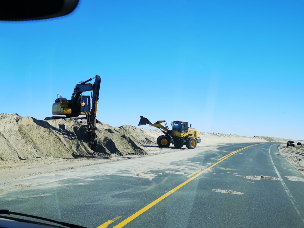
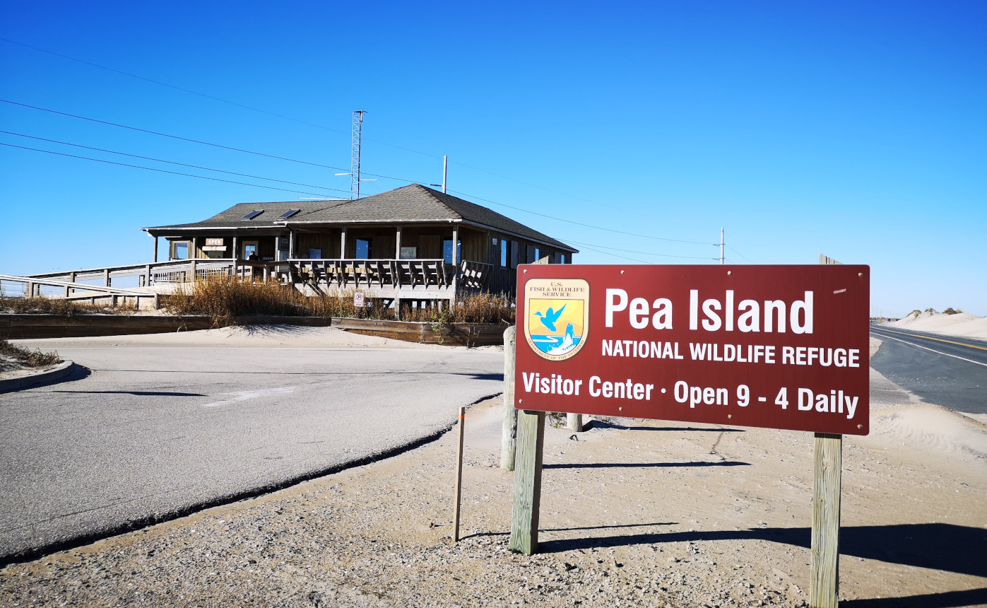
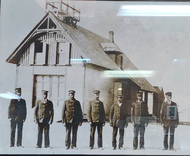
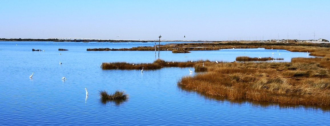
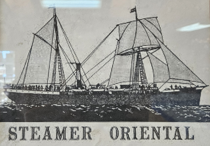
We crossed over a long high bridge to reach Pea Island National Wildlife Refuge, midway point on the Atlantic Flyway for numerous waterfowl. The island got its name from the small flower that grows and creates a bean which they called dune peas. These provided the birds with lots of nourishment. The name Pea Island stuck. Our first stop was the Oregon Inlet Life Saving Station (operational from 1874-1954) which the historical groups are trying to raise money to restore. We decided to take a walk along the beach to look for shells and as we progressed, we saw a dead Burr fish, lots of jellyfish, and a couple of marker buoys. Further down the beach it looked to me like a sailboat had run aground in the sand and a digger was trying to remove it. As we got closer, we realized that a crane was there, and they were trying to hoist the sailboat onto a huge flatbed truck. We read later that the sailor was from Connecticut and had just purchased the boat. He was heading south and ran out of fuel, lost power, couldn’t make it into Oregon Inlet and then ran aground. To recover the boat they winched it ashore into the sand dune and then dug out the dune to hoist it onto the truck. It turns out this happens all the time along the Outer Banks. We watched with fascination as the whole process unfolded and we realized later that the actual owner was there helping the recovery crew. Here is a link to the article: Grounded Sailboat Recovered

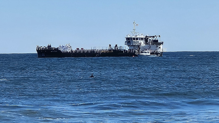
Pea Island is a birders paradise with over 365 different species passing through or staying for the winter. We got a good look at some tundra swans through the scope in the visitor’s center and chatted with the 30-year volunteer. Then we did a walk around the pond, but a lot of the birds were in the distance, so we had better views of the Tundra Swans at Alligator River. Across the highway you could climb over the dune and see a shipwrecks boiler out in the water. We also saw a few dolphins cruising along the coast.

That will close off this blog and next stop will be Goose Creek SP.

I’m just catching up on blog reading. Interesting thing about walking on dunes. Some TV show we saw says to stay off dunes to preserve them. Maybe these ones move seasonally so no big deal to walk on them.
LikeLiked by 1 person
The dunes by the road are man made and continually re-piled up to protect the road. In the oarks they have set paths over the dunes so you can get to the beach. They do ask you to stay off the dunes otherwise.
LikeLike
Poor sailboat owner! He may have been OK if he had just few more gallons of fuel on board.
LikeLiked by 1 person
Finally catching up!! I love the photos of all the tundra swans. Incredible to see so many in one place. I don’t know why you didn’t keep one of the buoys to bring home. They would fit quite nicely on top of the RV. (-:
I’m hoping that the move inland helped with the winds. I’ll find out in the next blog – onward ho!
Ella
LikeLiked by 1 person
Thanks for your comments Ella and yes the move inland definitely helped 👍
LikeLike