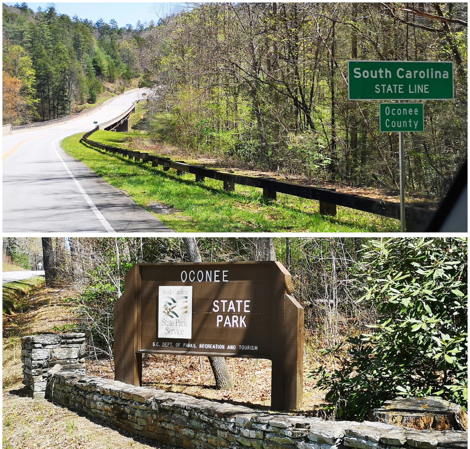
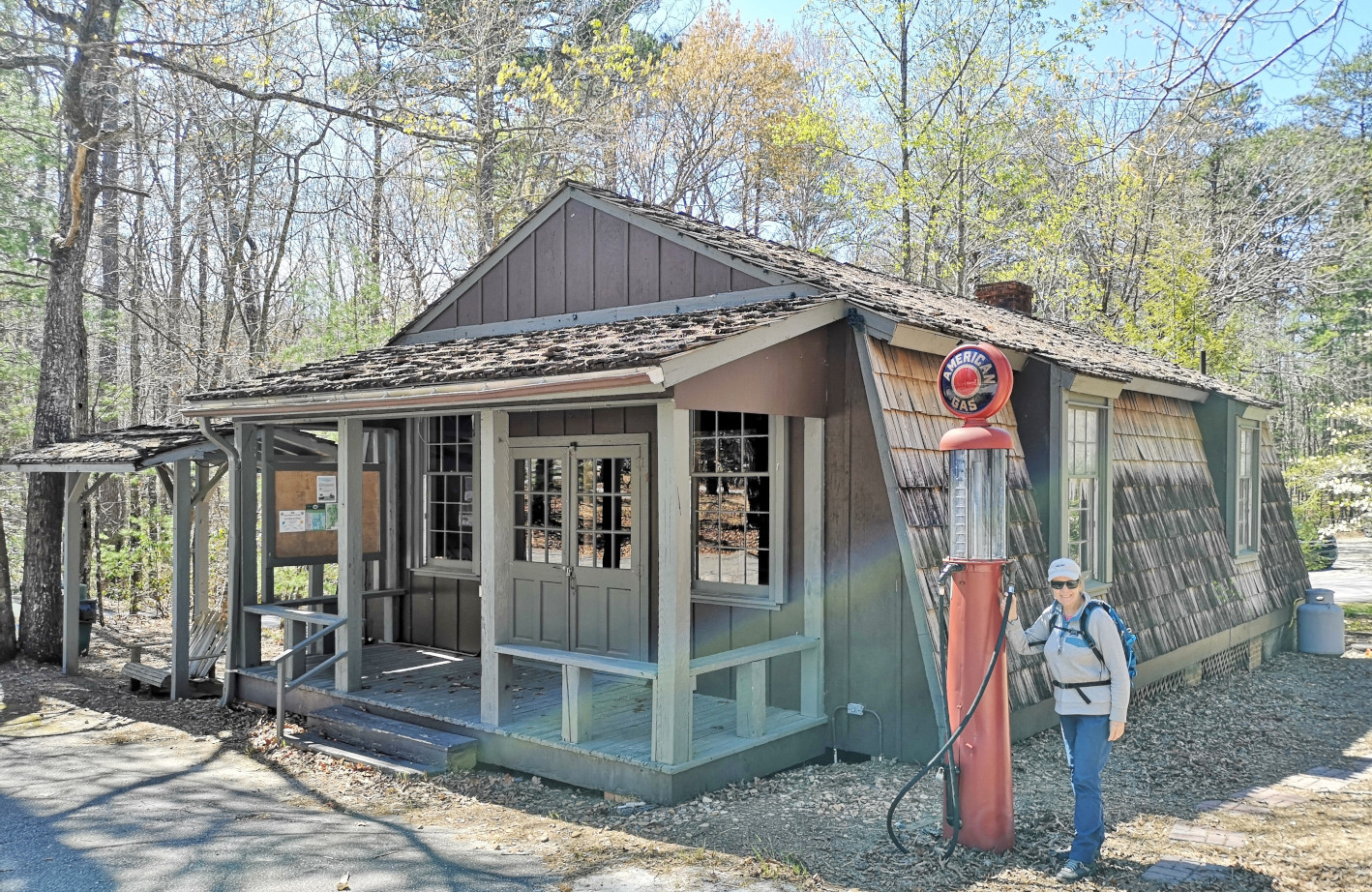
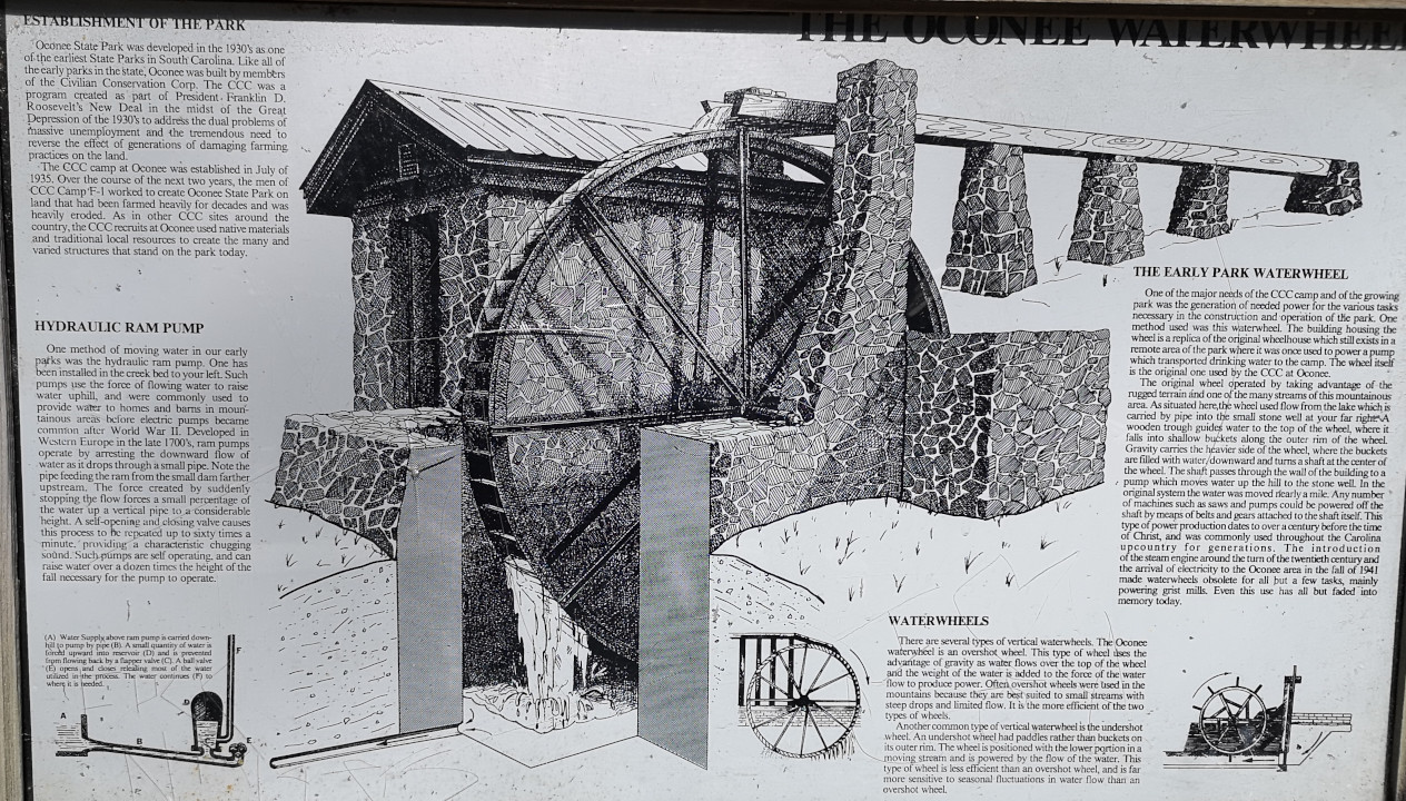
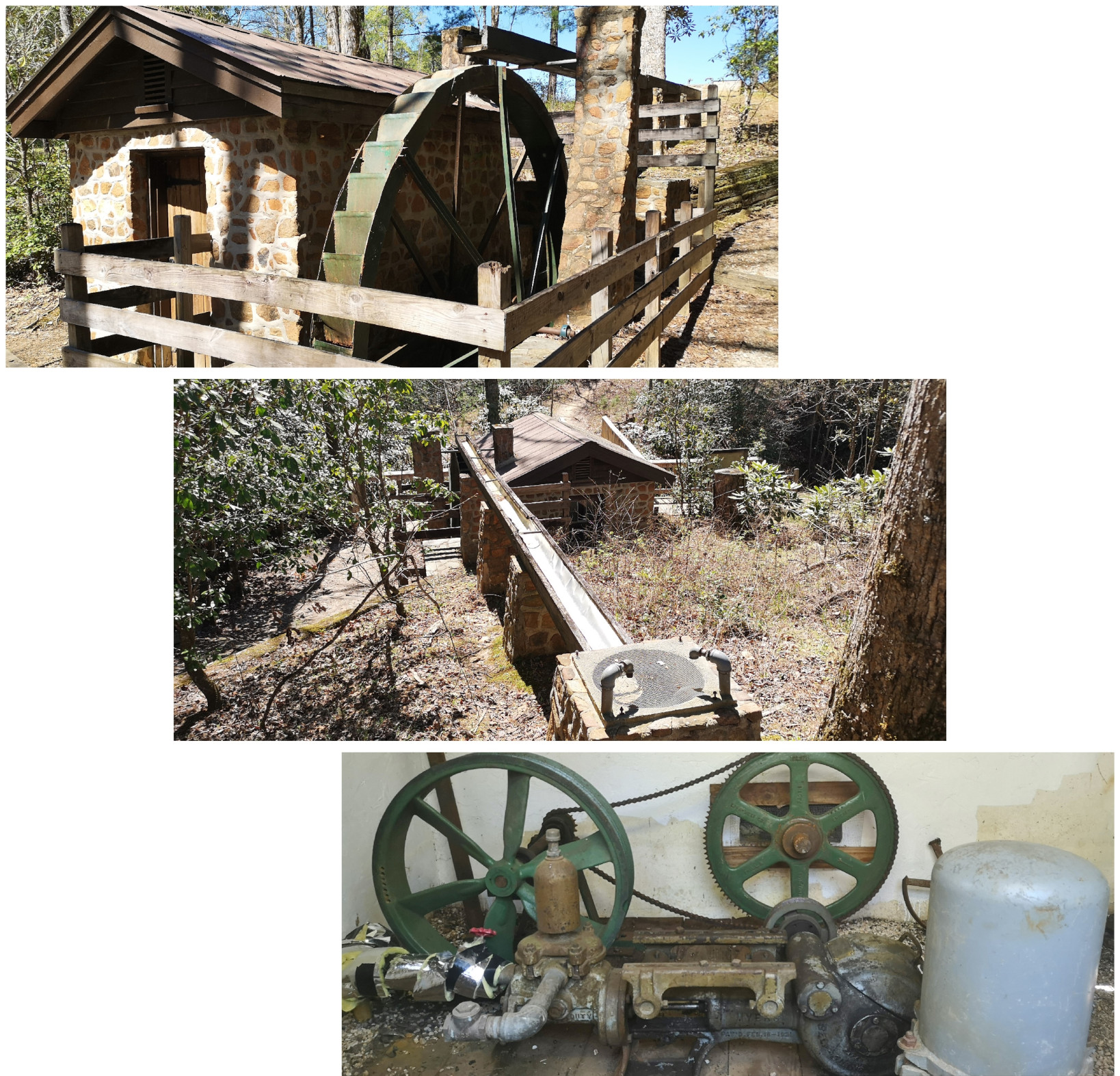
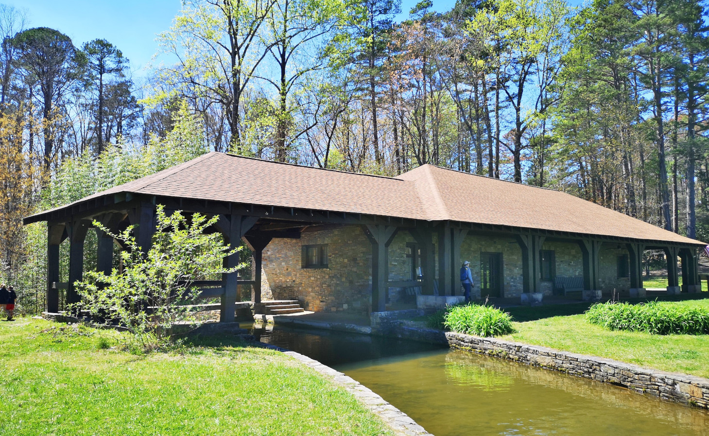
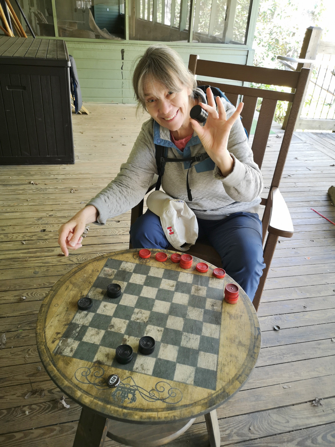
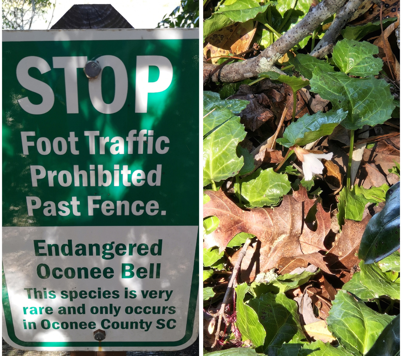
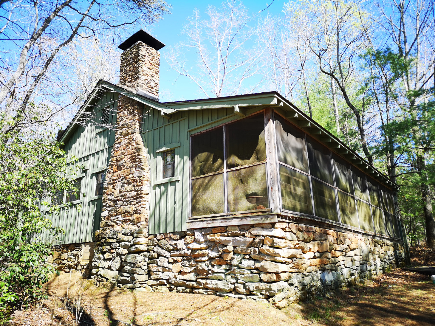
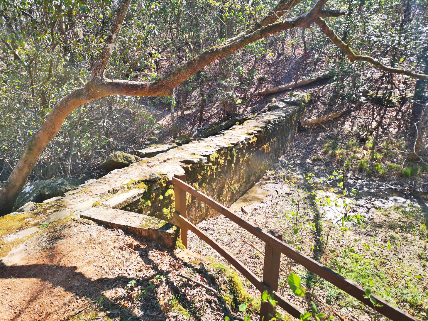
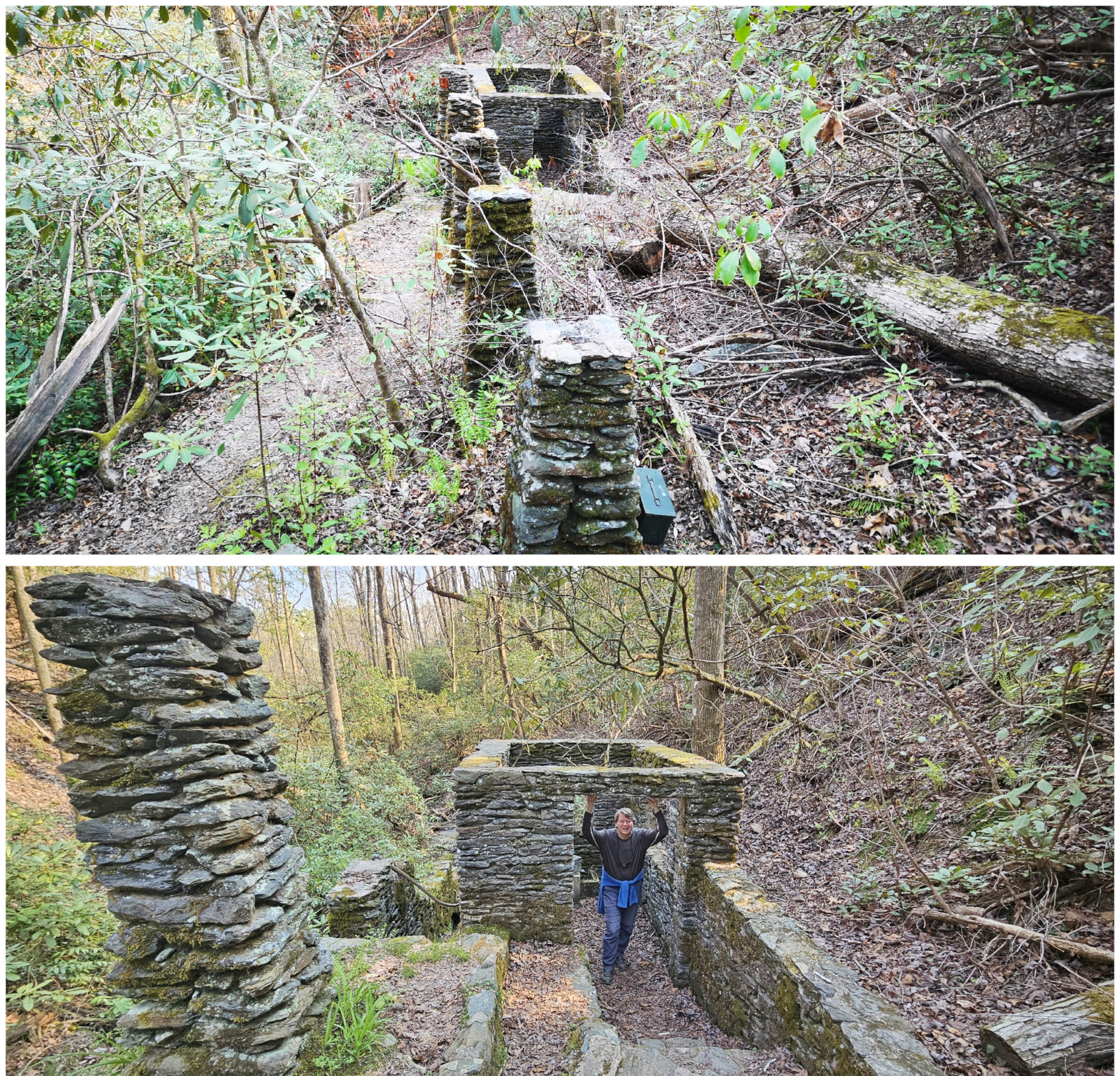
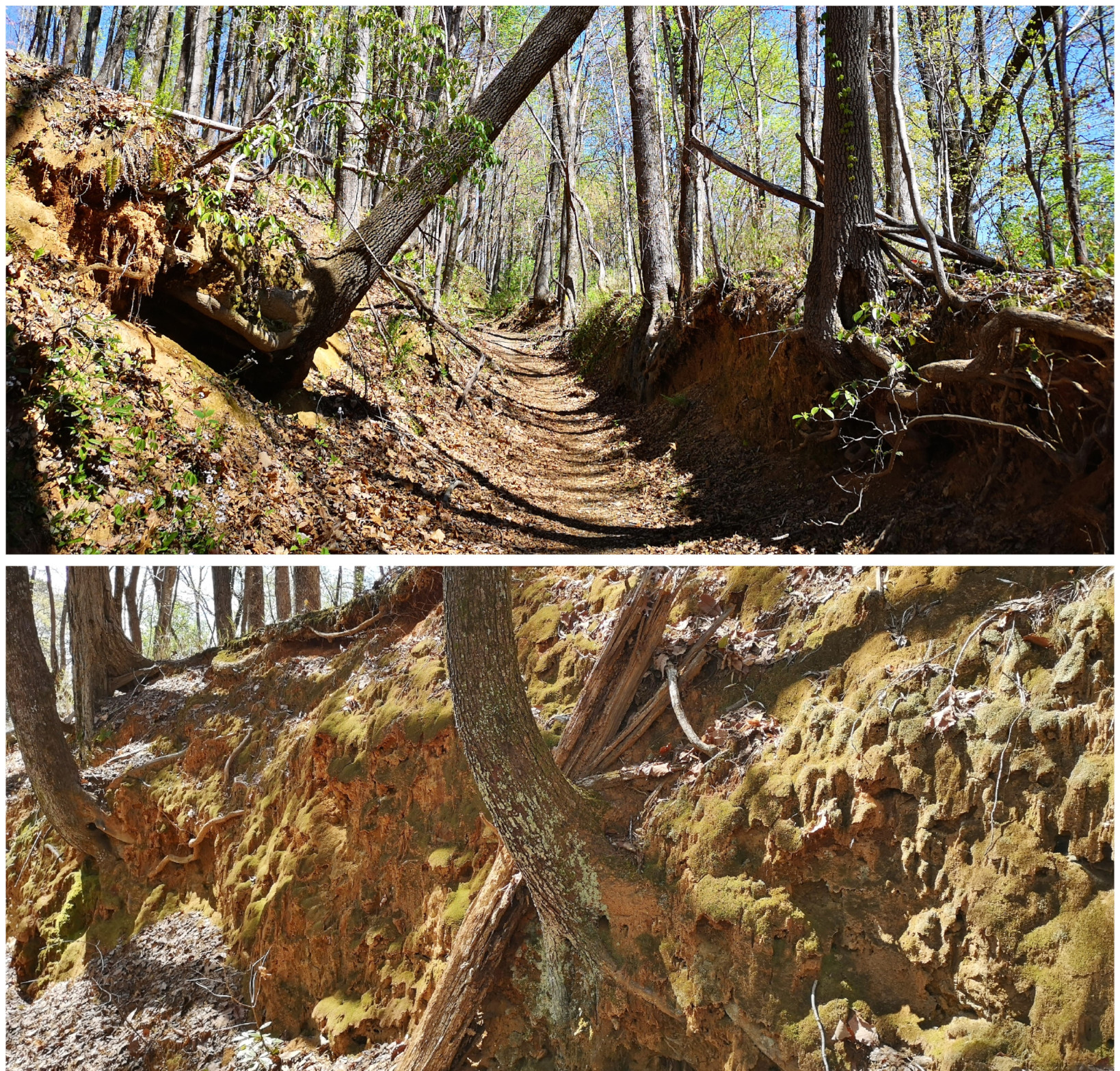
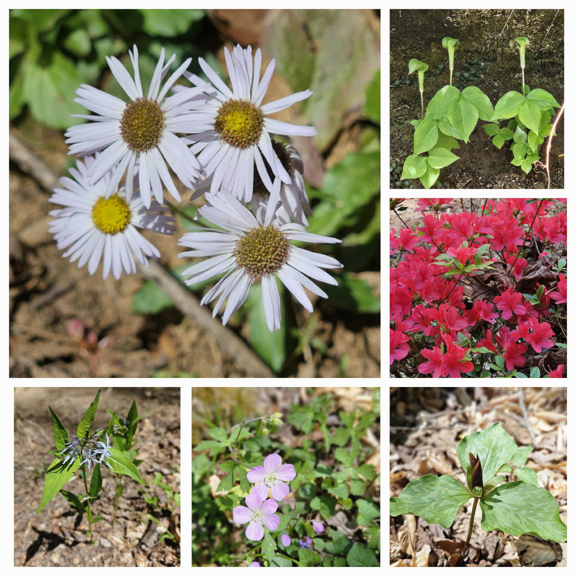
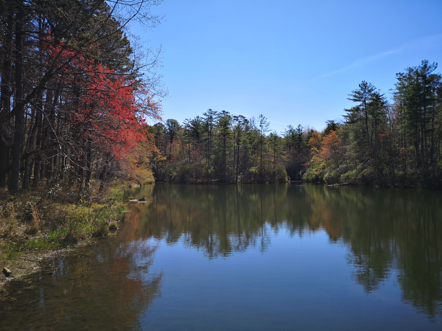
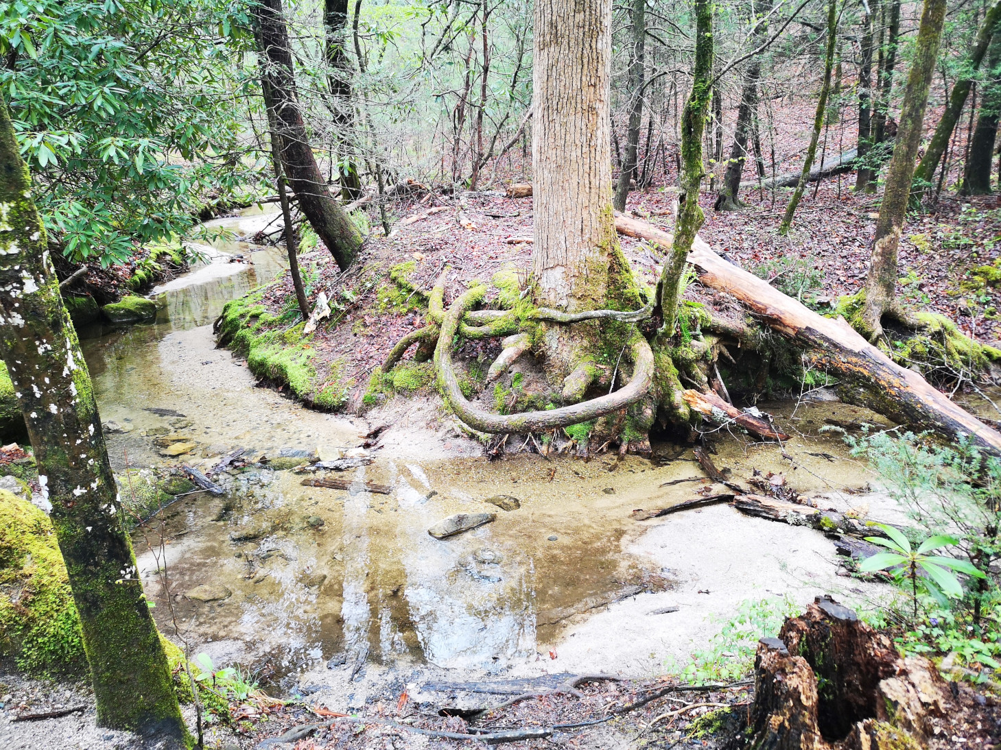
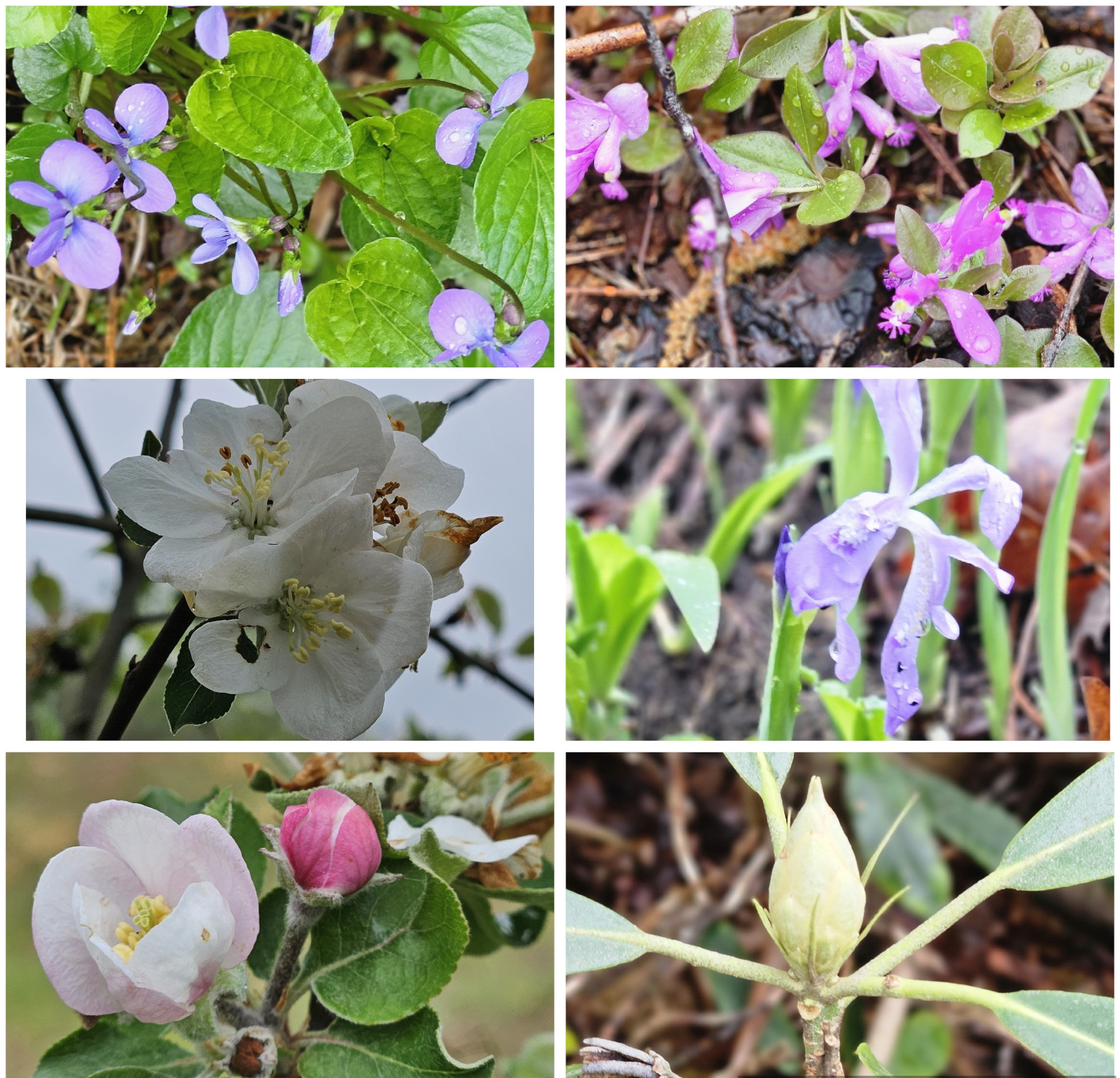
From Tallulah Gorge Georgia we went north and crossed into South Carolina to go to Oconee SP. This park was built by the CCC in the 1930’s and covers 1165 acres. We had booked in for 2 nights although if we had more time we likely would have stayed longer as it was adjacent to Stumphouse MTB park and there was a connector trail we could have taken to get there. The park was extremely busy when we checked in on Friday night April 5th but by Saturday many sites had emptied out and by Sunday there were only a handful of sites occupied. It appeared that spring breaks were now over. After we checked in, we went for an 8 km hike to see the CCC built waterwheel and buildings and around the lake to see the rare Oconee Bell Flowers and the CCC built cabins. At the visitor centre we played a game of checkers, and this time Sharon was the winner😉 Then we took the Oconee Passage trail and connected with the Old Waterwheel trail to see the original water supply the CCC used when building the park.
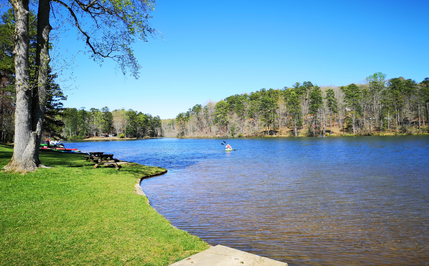
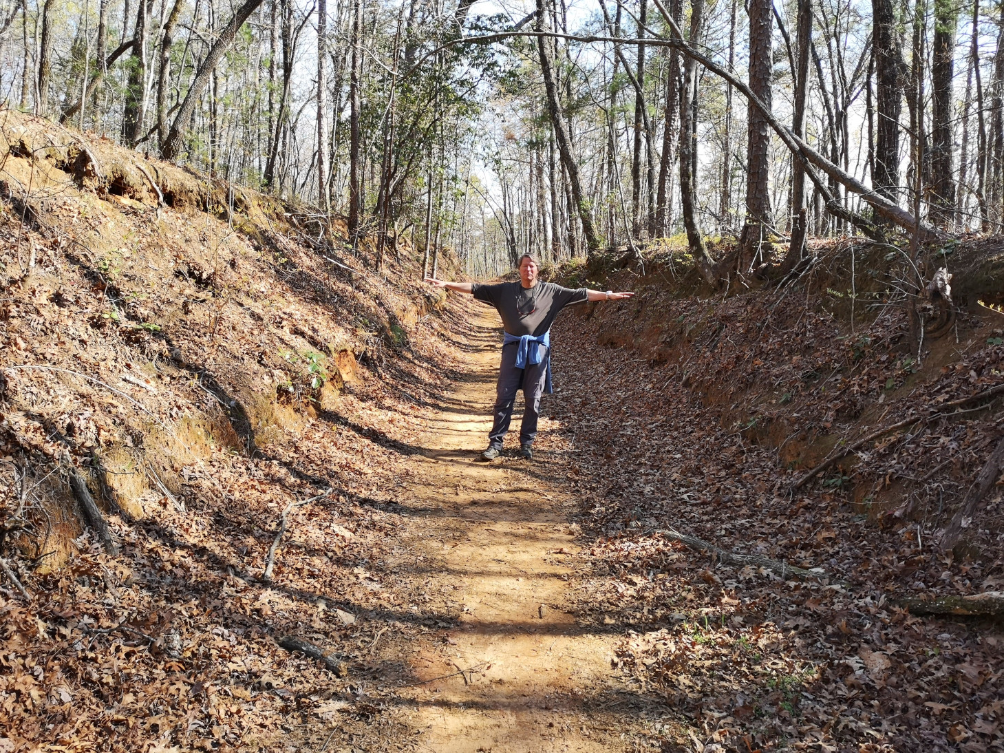
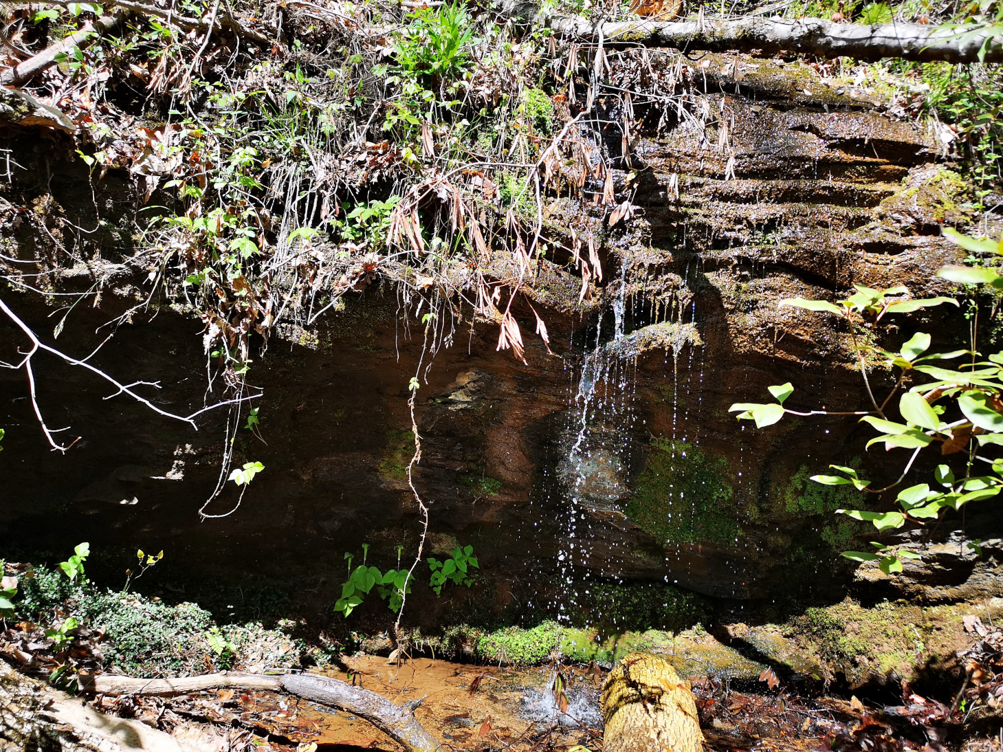
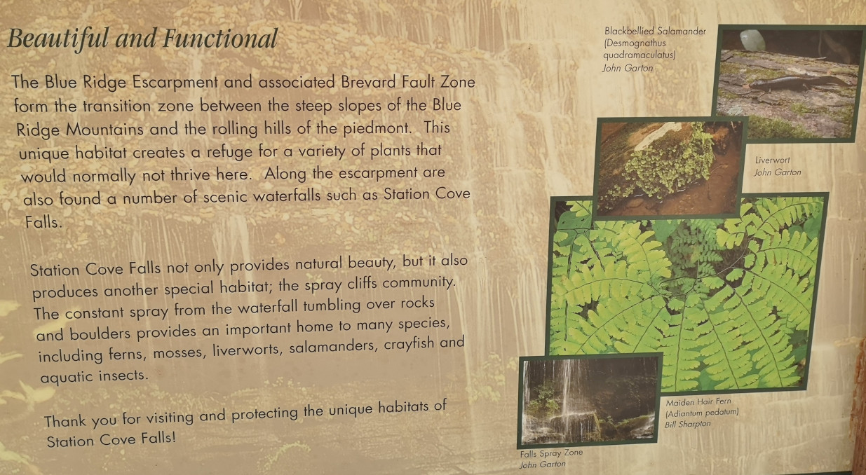
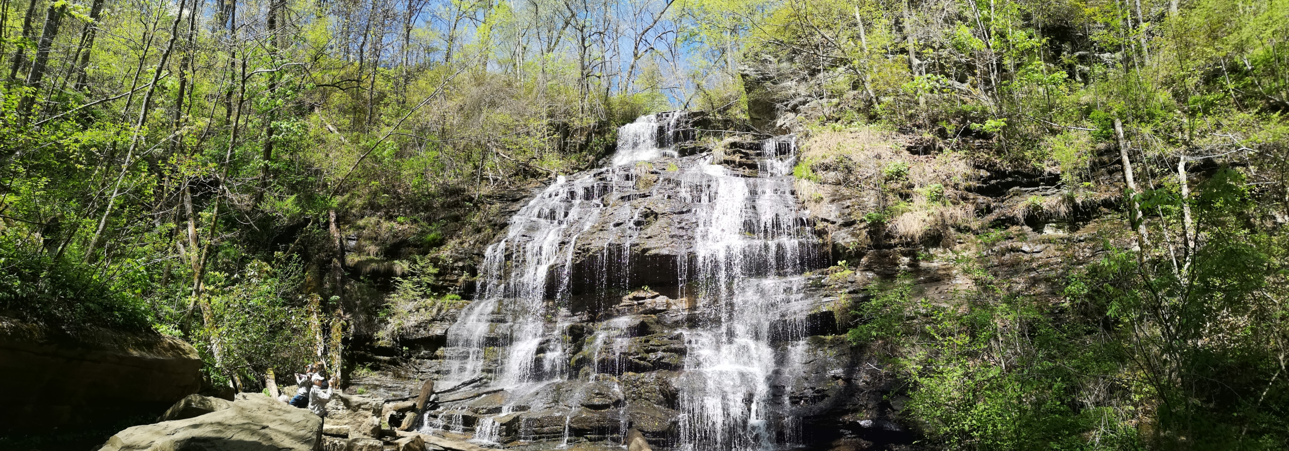
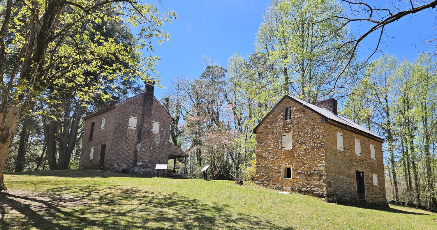
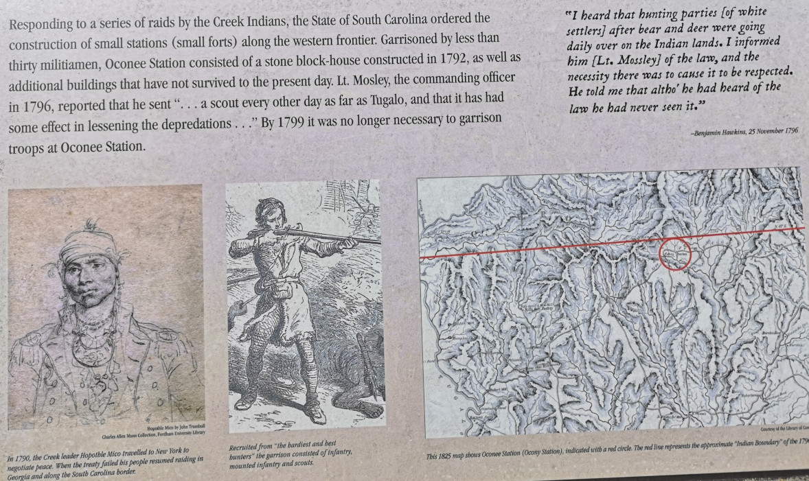
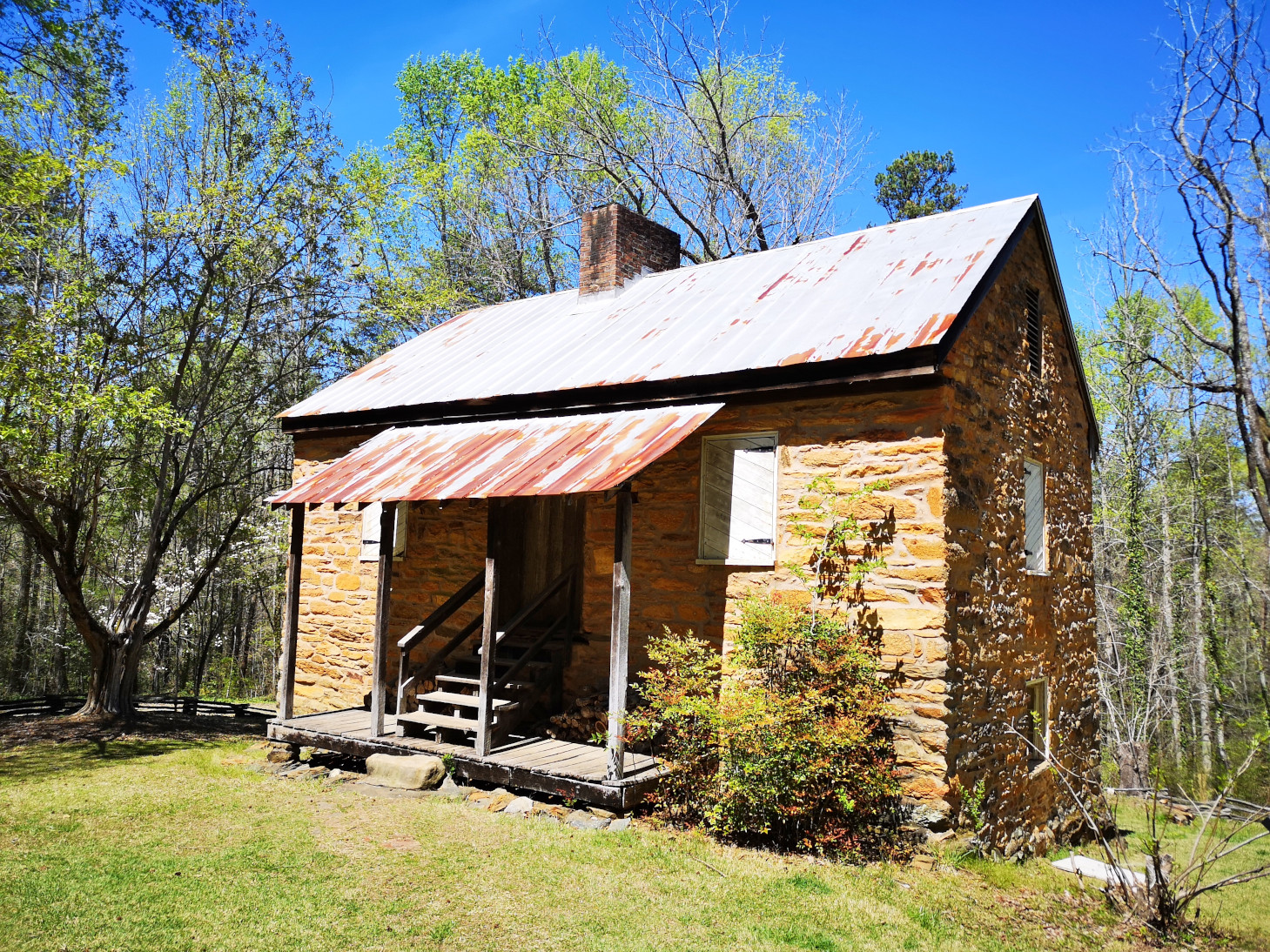
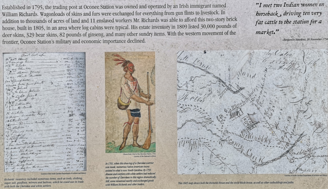
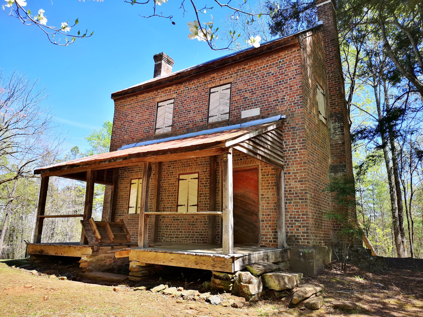
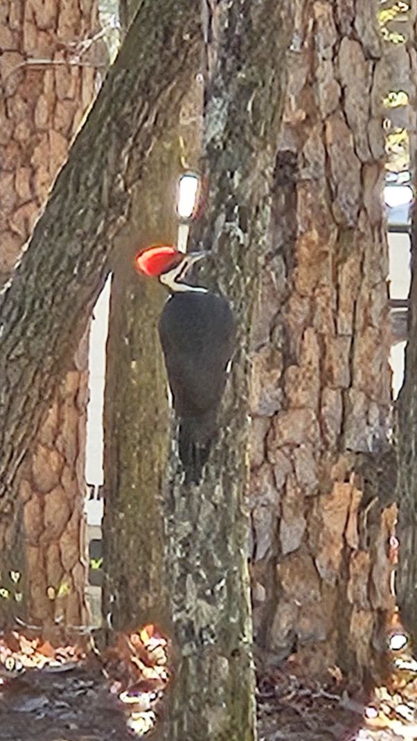
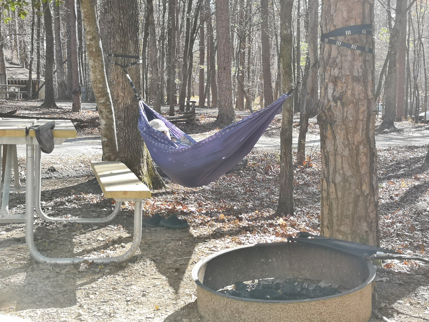
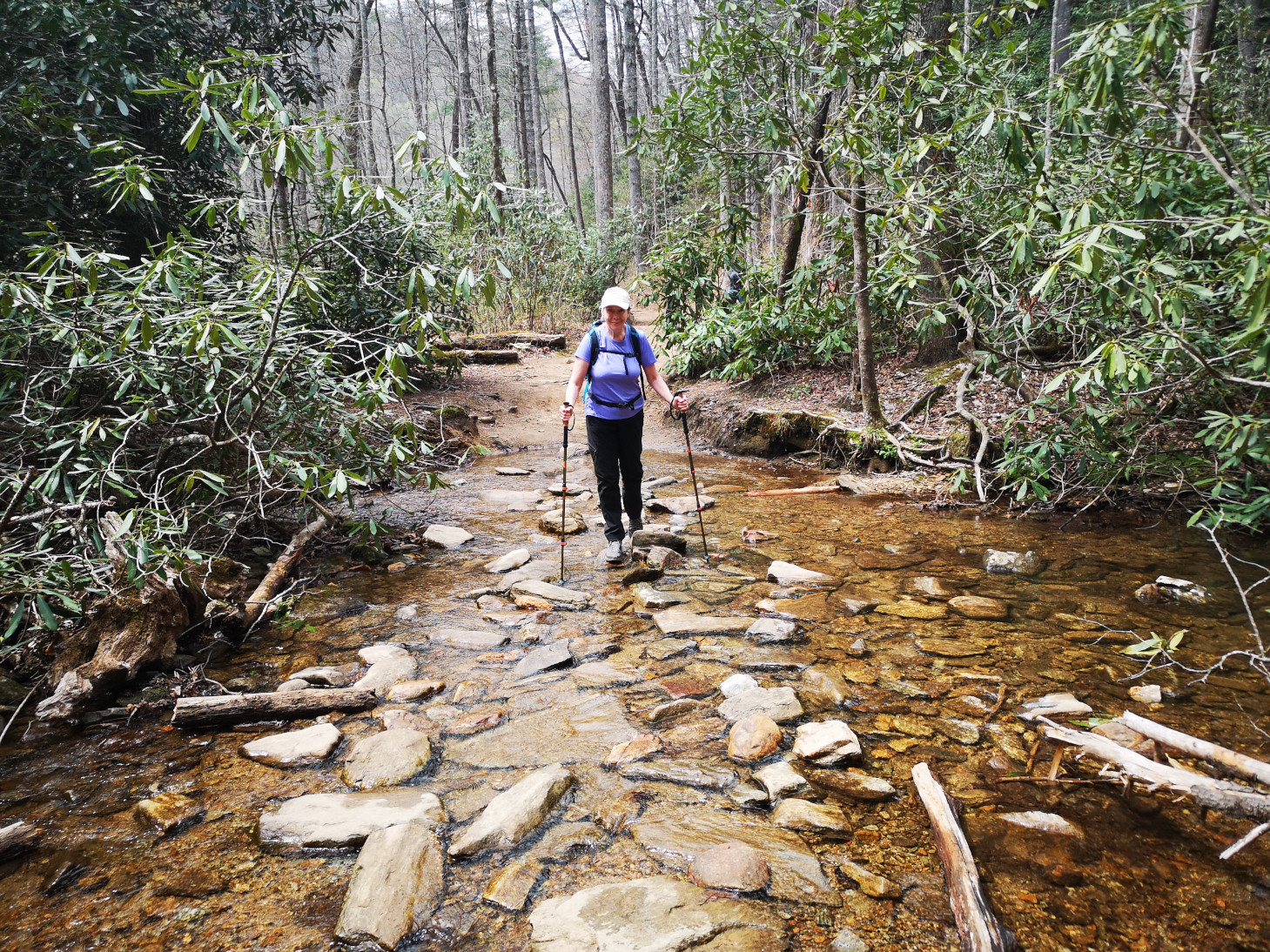
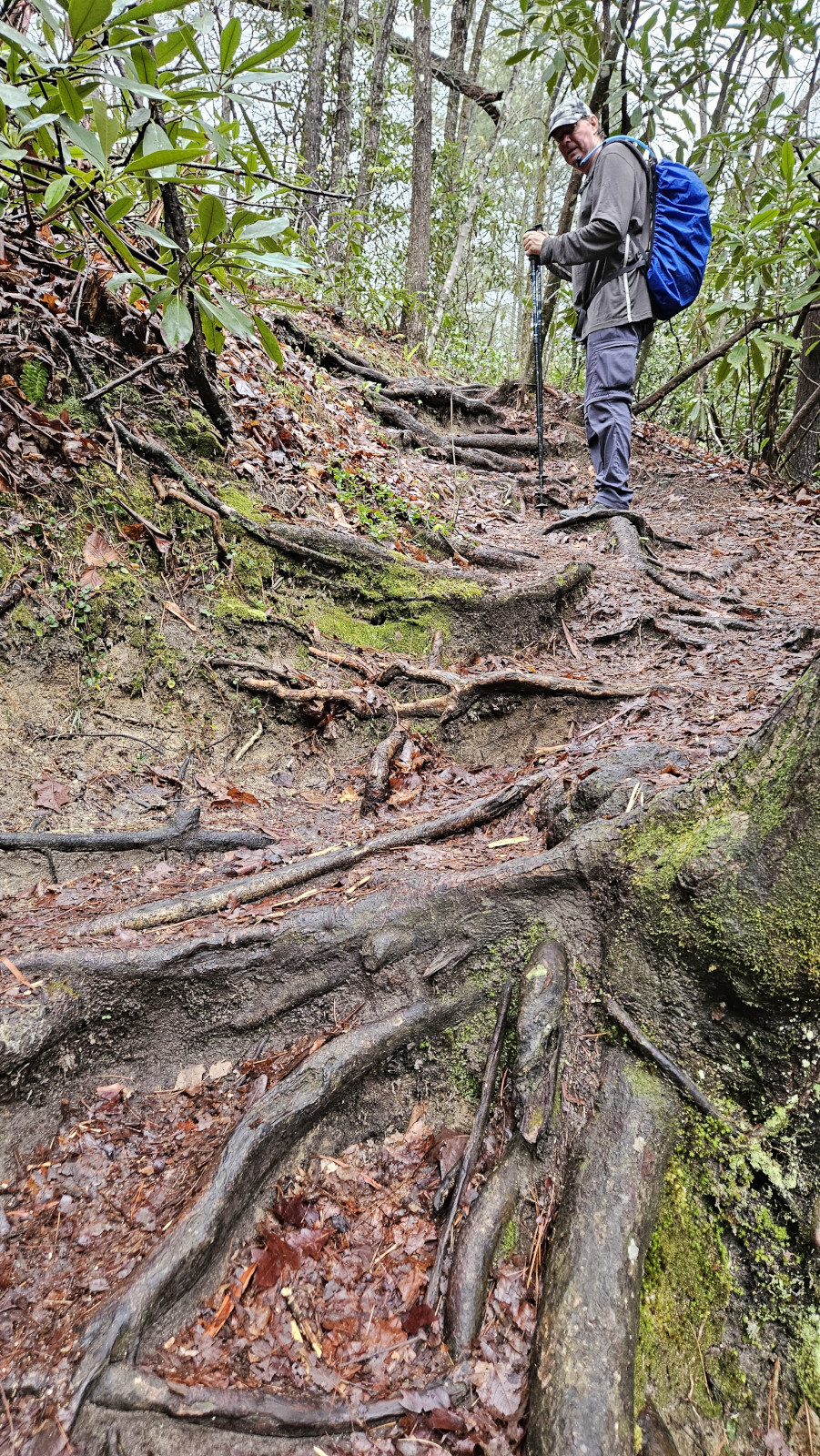
The following day we decided to tackle a 17 km hike to Station Cove Falls and on to Oconee Station Historic Site. The distance really wasn’t an issue but the fact that the trail went straight downhill for 3 kms and you knew you had to come back up that same section to get back, in the heat, meant that it was mentally and physically challenging. However, as you will see from the photos it was worth the big effort. Most people drive to the parking area for Station Cove Falls and walk the short distance in from there, so we saw very few hikers doing the long hike from Oconee SP and back. Once we got to the falls there were lots of people making it a bit challenging to get photos of the falls without other people in the photo. We had lunch at the falls since it was such a beautiful location and eventually, we got a gap in the crowds to get some great photos. After the falls we hiked over to the Oconee Station Historic Site. There was a stone block house from 1792 used as a base for state militiamen to patrol the area and a 2-storey brick trading house built in 1795 by an Irish immigrant to exchange skins and furs for other products. In the peak season they have interpretative programs at this site. Our hike back was the long steady switch back climb until we returned to our campsite in Oconee SP. We were treated there with a pileated woodpecker exploring the trees across from our campsite. Sharon set up her hammock so she could relax after the long hike. The next morning before leaving we took a walk along the lakeshore so we could take note of some nicer campsites right at the water’s edge.


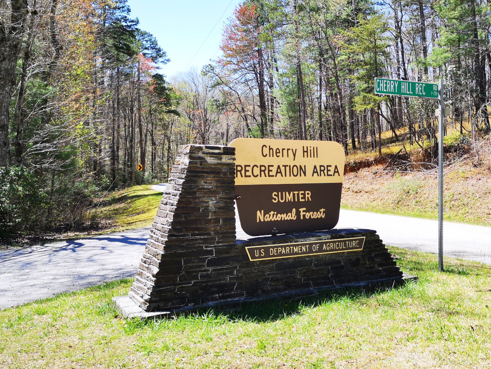
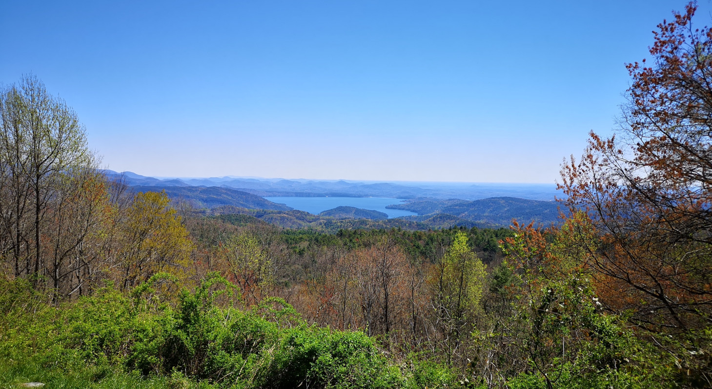
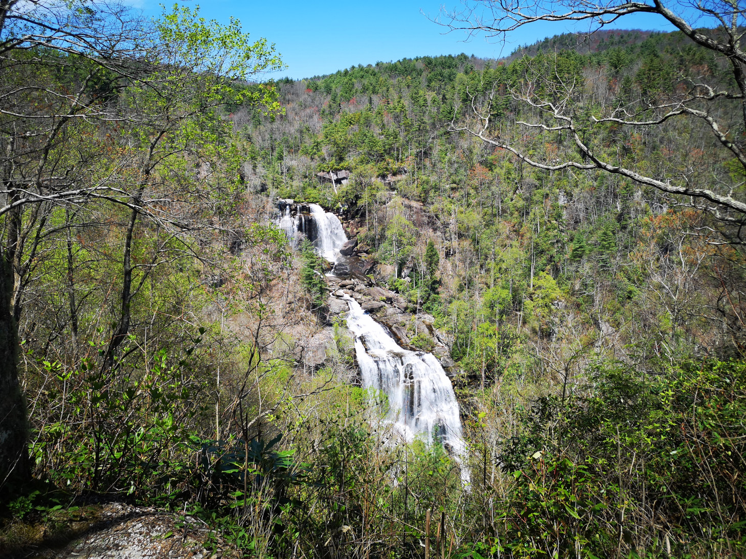
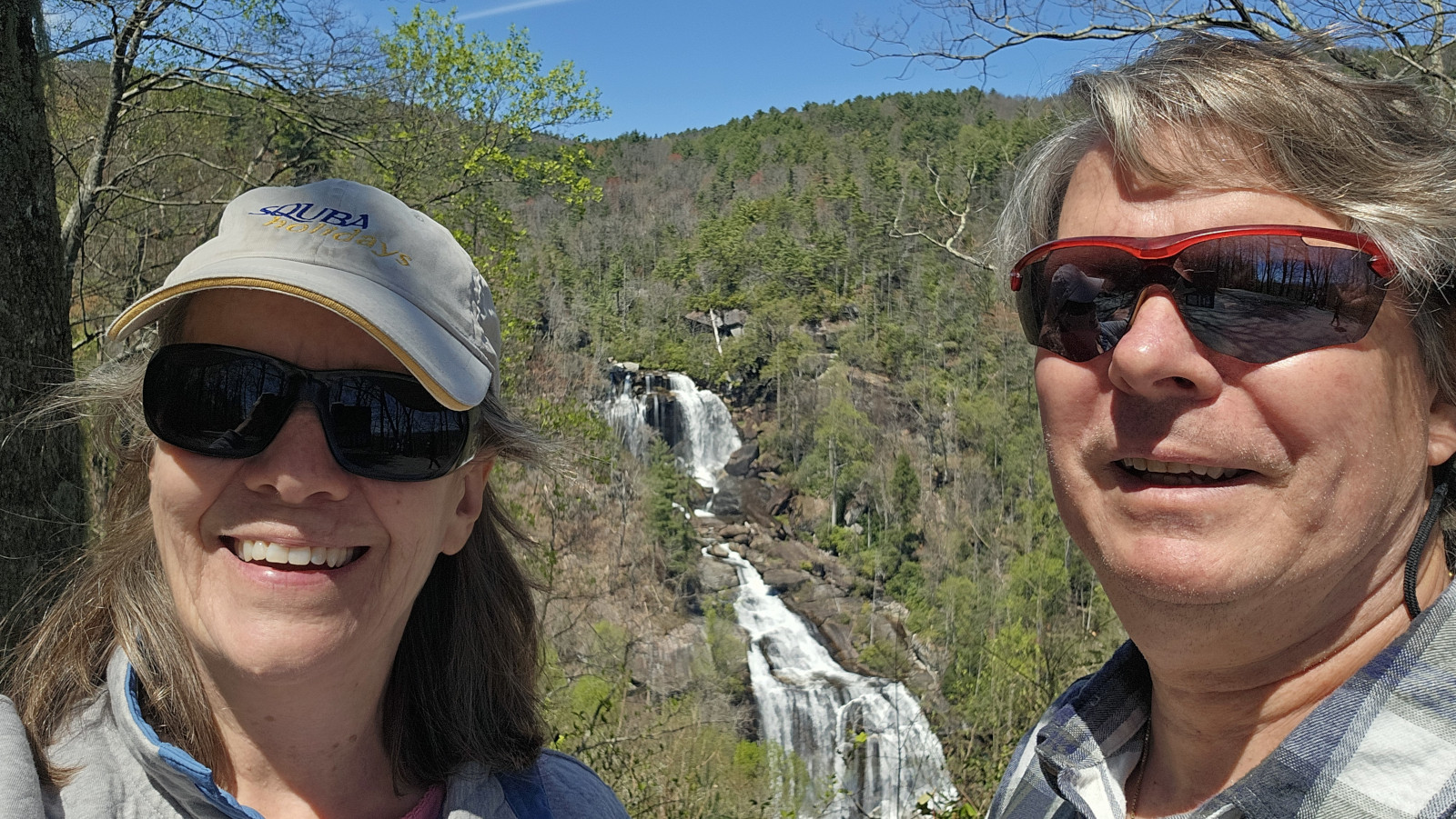
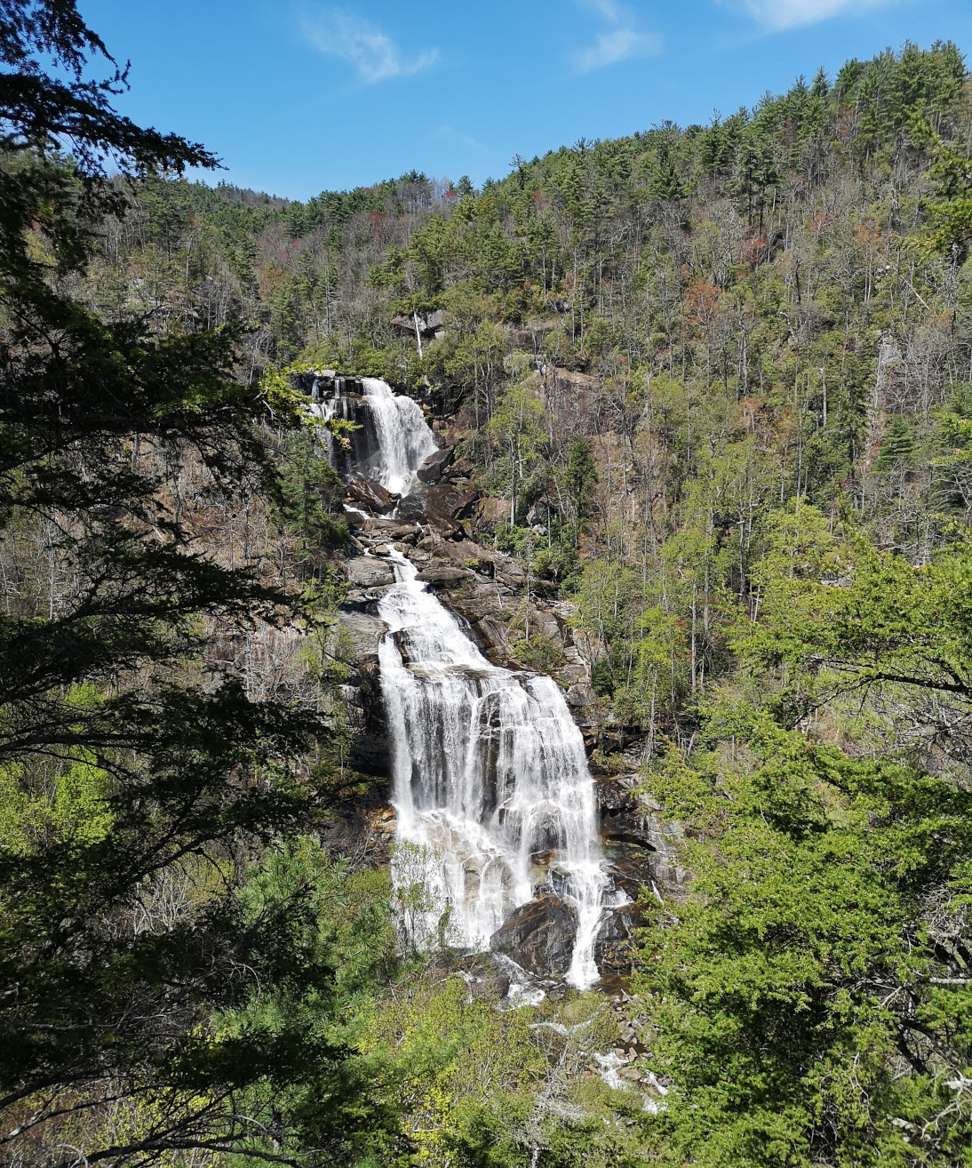
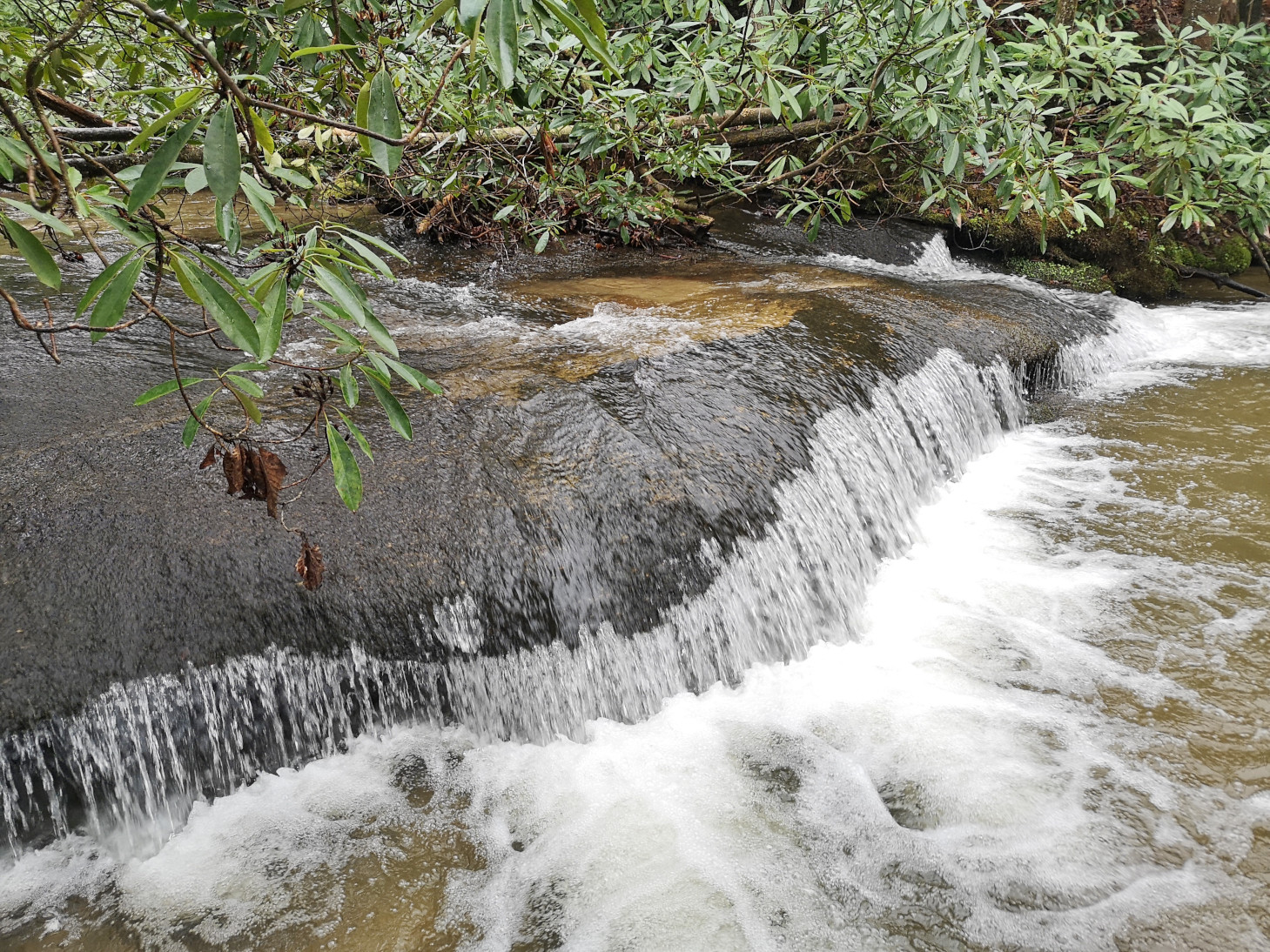
Our next destination was Gorges SP in North Carolina which wasn’t very far away but we made a few stops enroute. First was Cherry Hill recreation area where we stopped for lunch. Next was a scenic overlook to see Lake Jocassee and then once in North Carolina we stopped at Whitewater Falls and did a short hike. It was funny because there was a set of stairs you could go down to get a better view of the falls and a lady was just coming back up and she said she would not do it again even if you paid her $100,000. Since we had done 1100 steps a few days before we thought we would go ahead anyway, and we were glad we did. It was no big deal at all, and we needed no money to do it😉 Sometimes you have to ignore other’s comments.
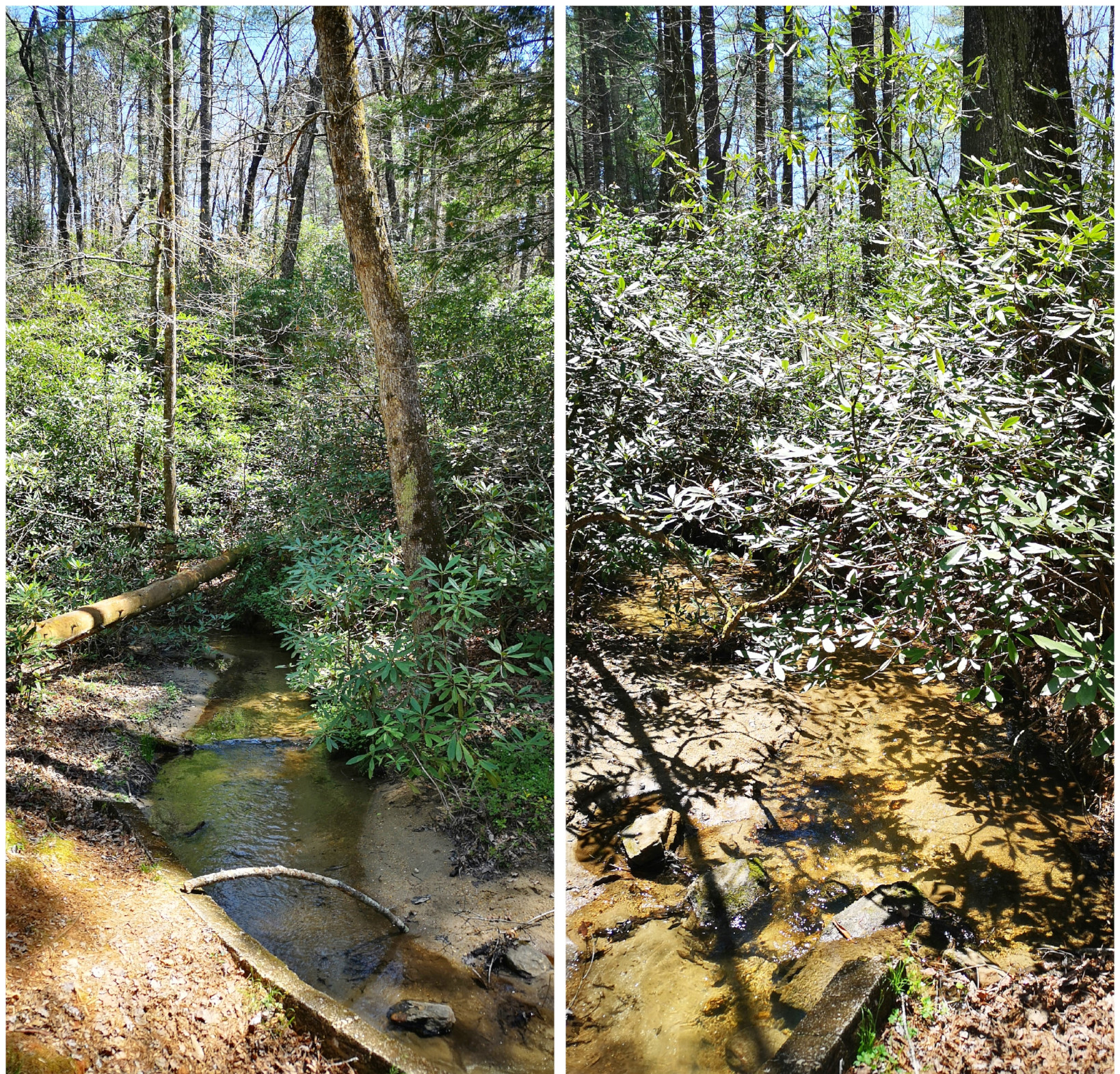
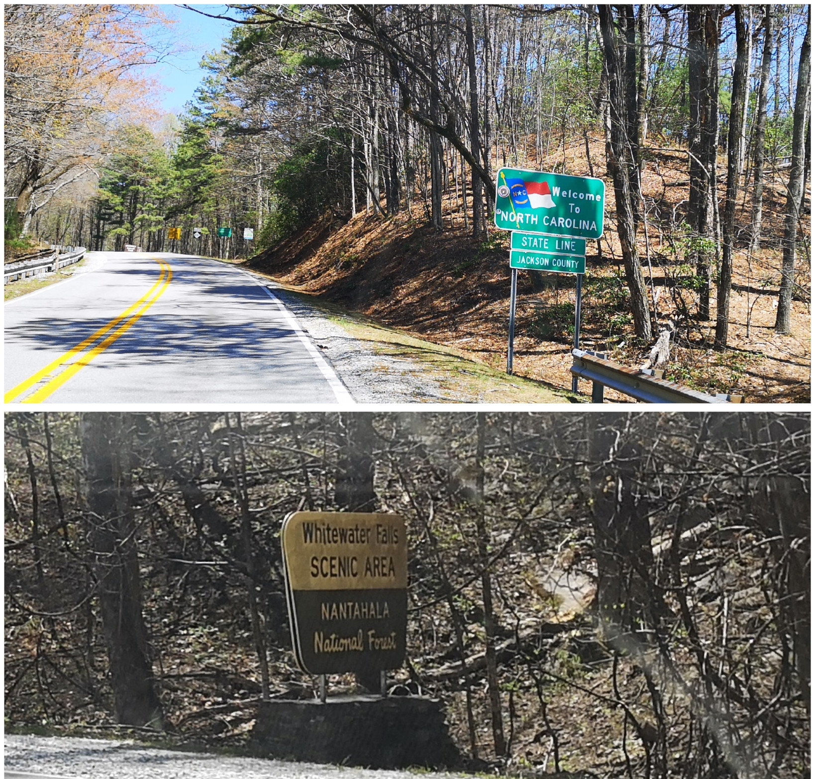
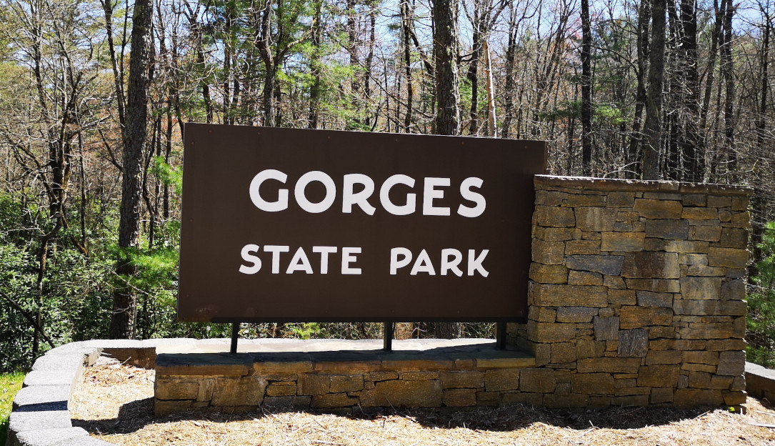
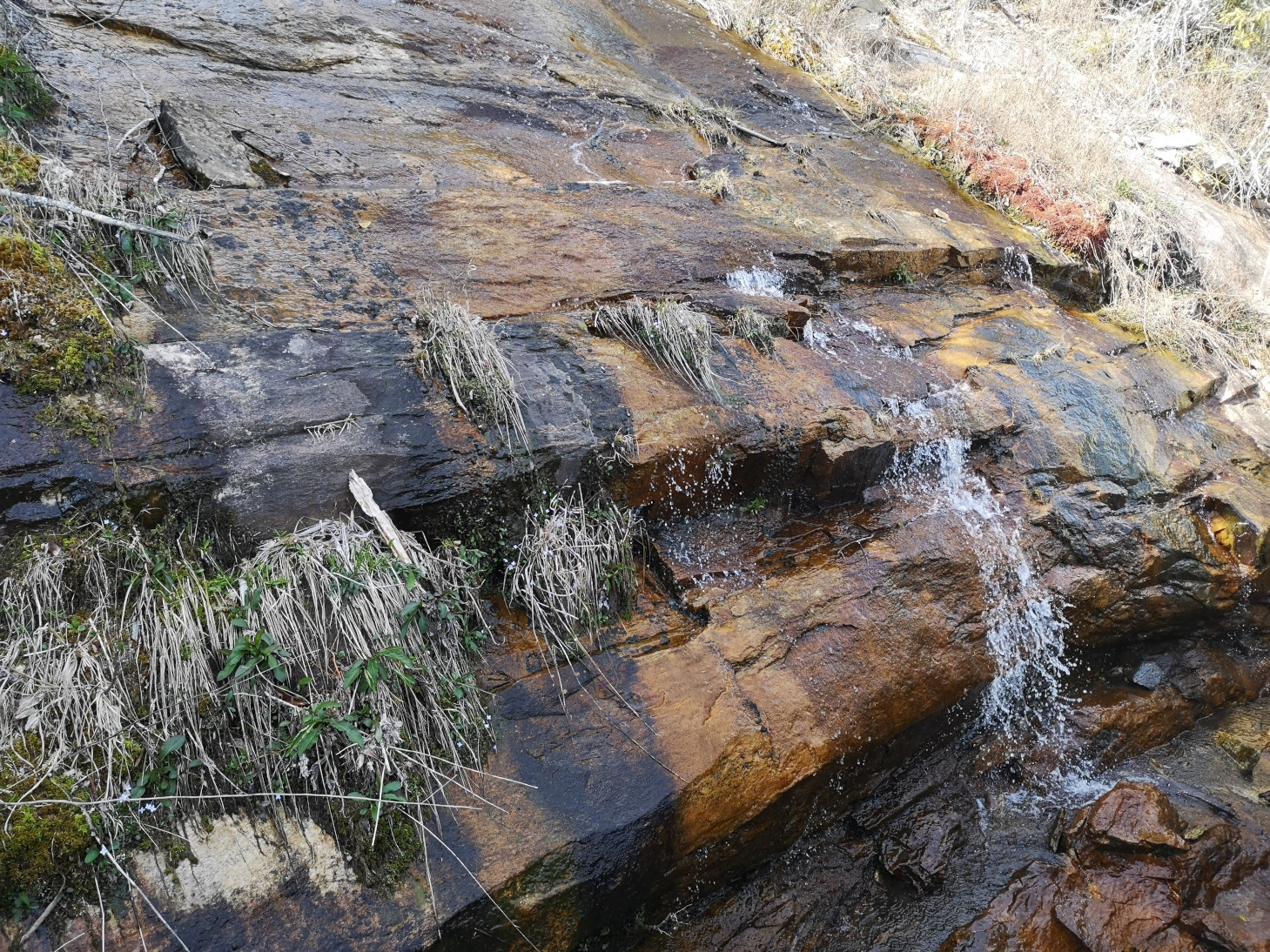
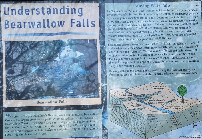
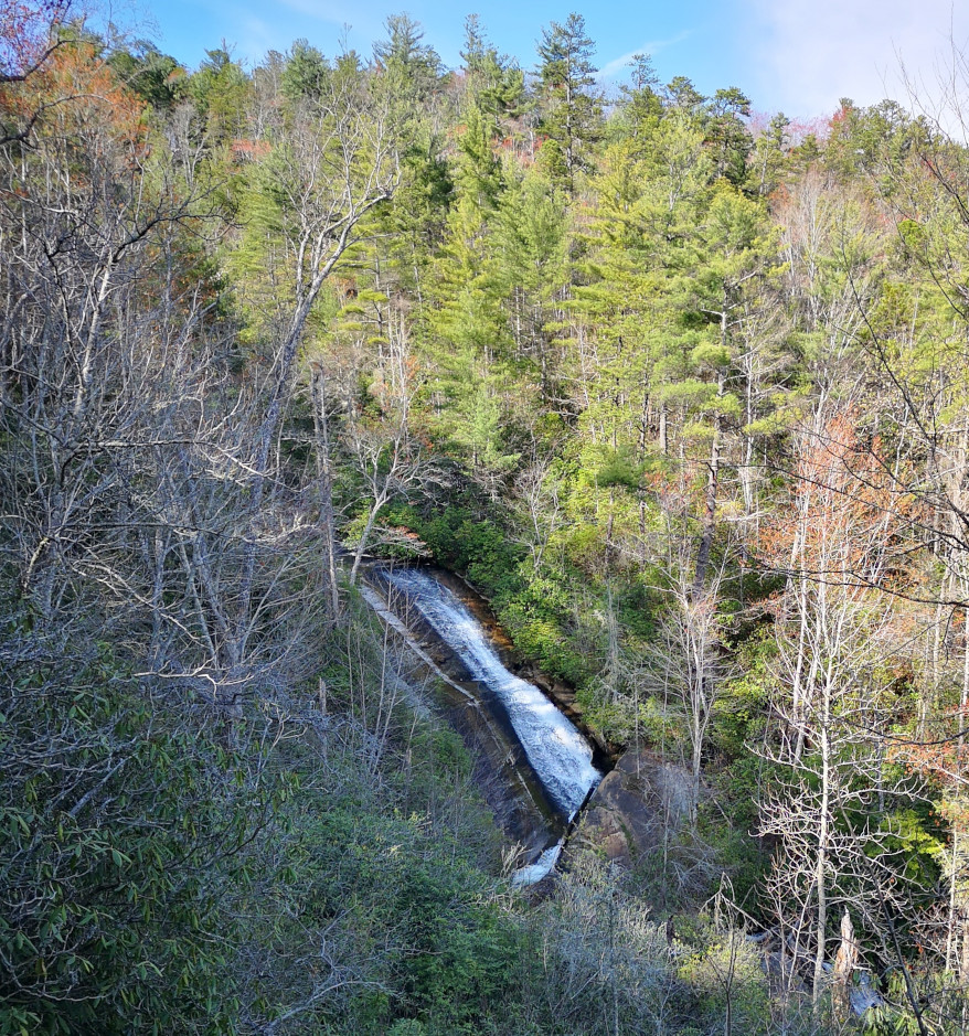
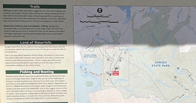
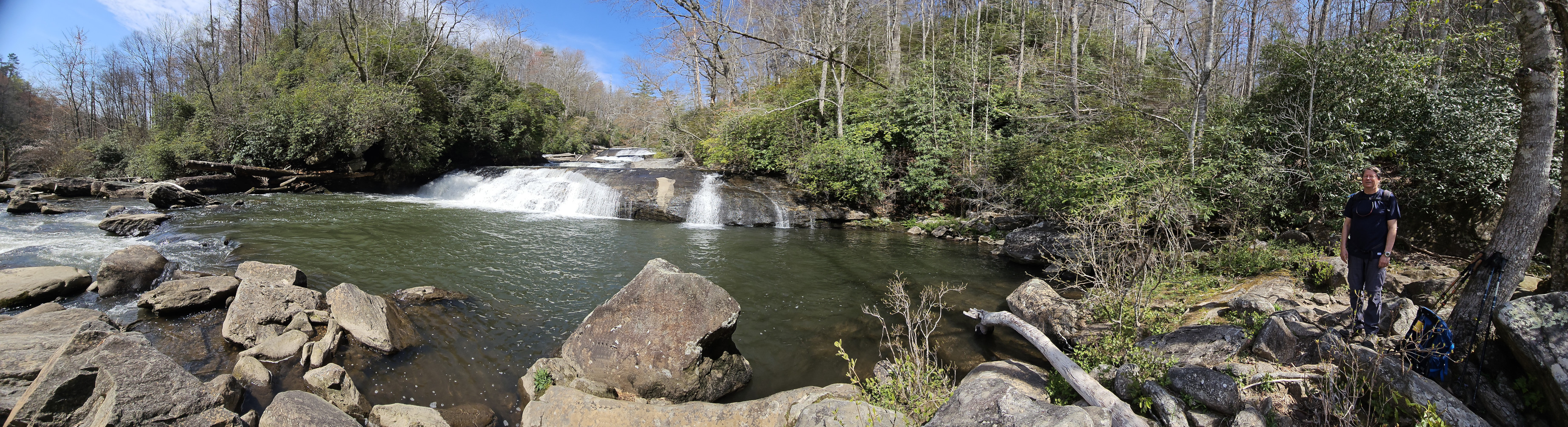
Gorges SP in North Carolina is huge at 7,709 acres and it is also the westernmost park in the state. The park is adjacent to the Pisgah National Forest. It is also one of the newest as the campground was just opened in November of 2022. The campsites were all massive and each site had full hookups. However, it was a bit awkward as none of the trails left from the campground. We asked the host about Mountain Biking, but he said most of the trails on the campground side of the park were not conducive to MTB riding. After we were setup, we decided to walk back along the one-way road that led to the campground and then do the short Bearwallow Falls trail (4 kms from the campground). Bearwallow Creek is the largest creek in the park. The viewing deck was a fair distance away from the falls.
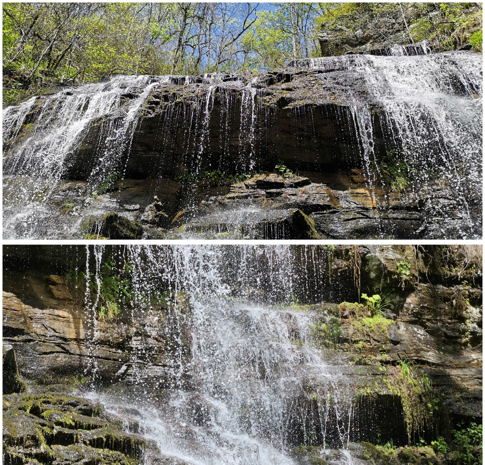
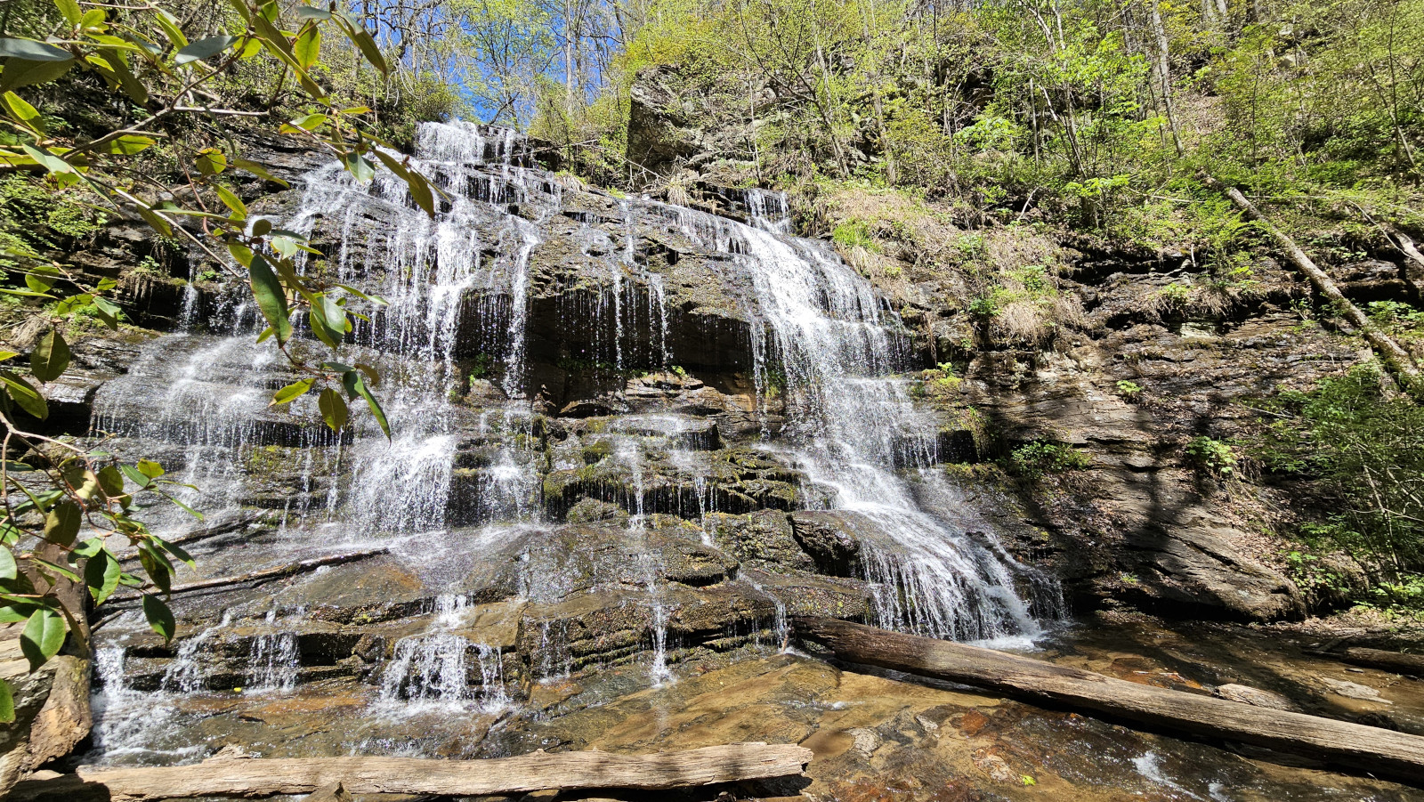
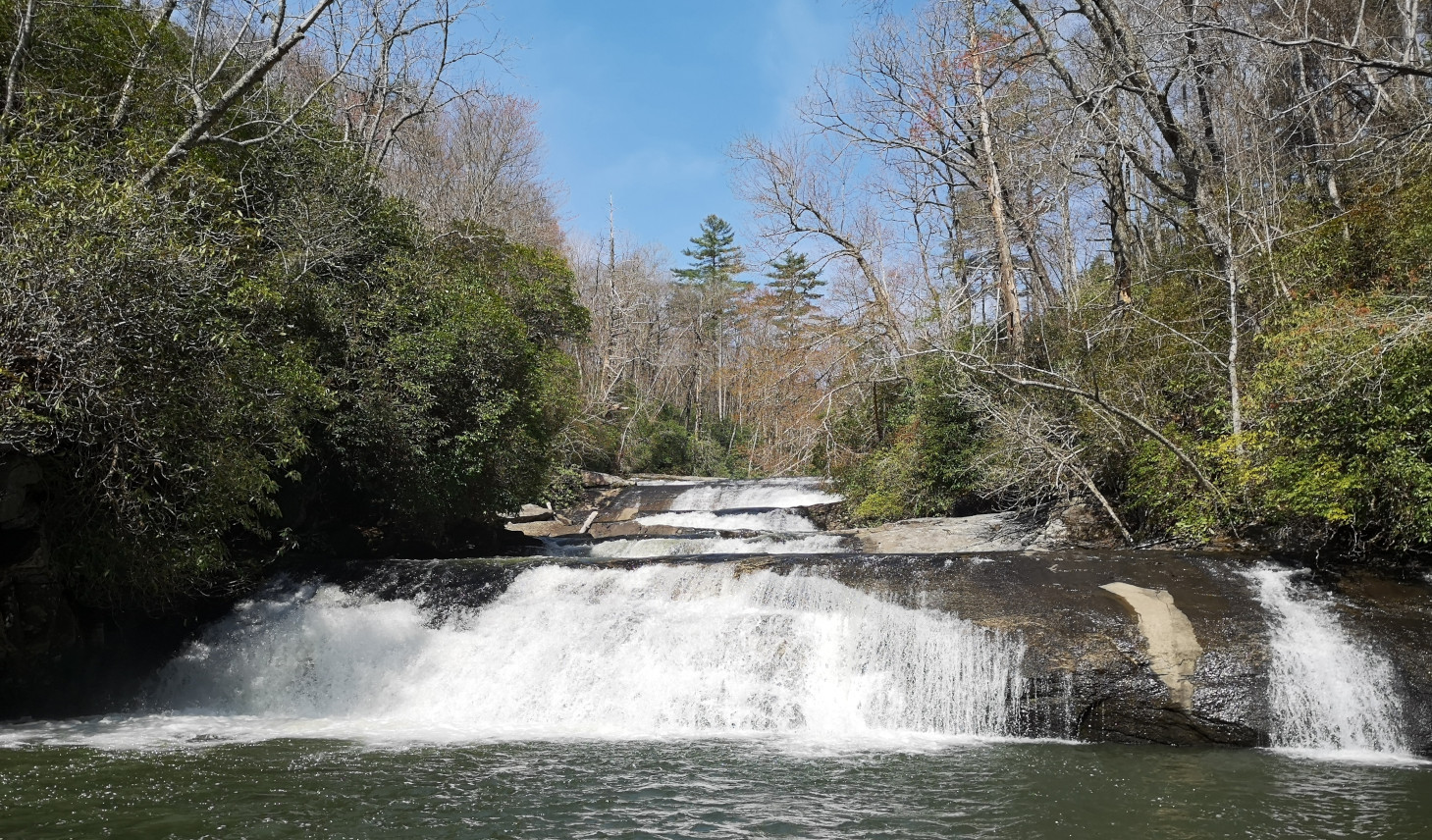
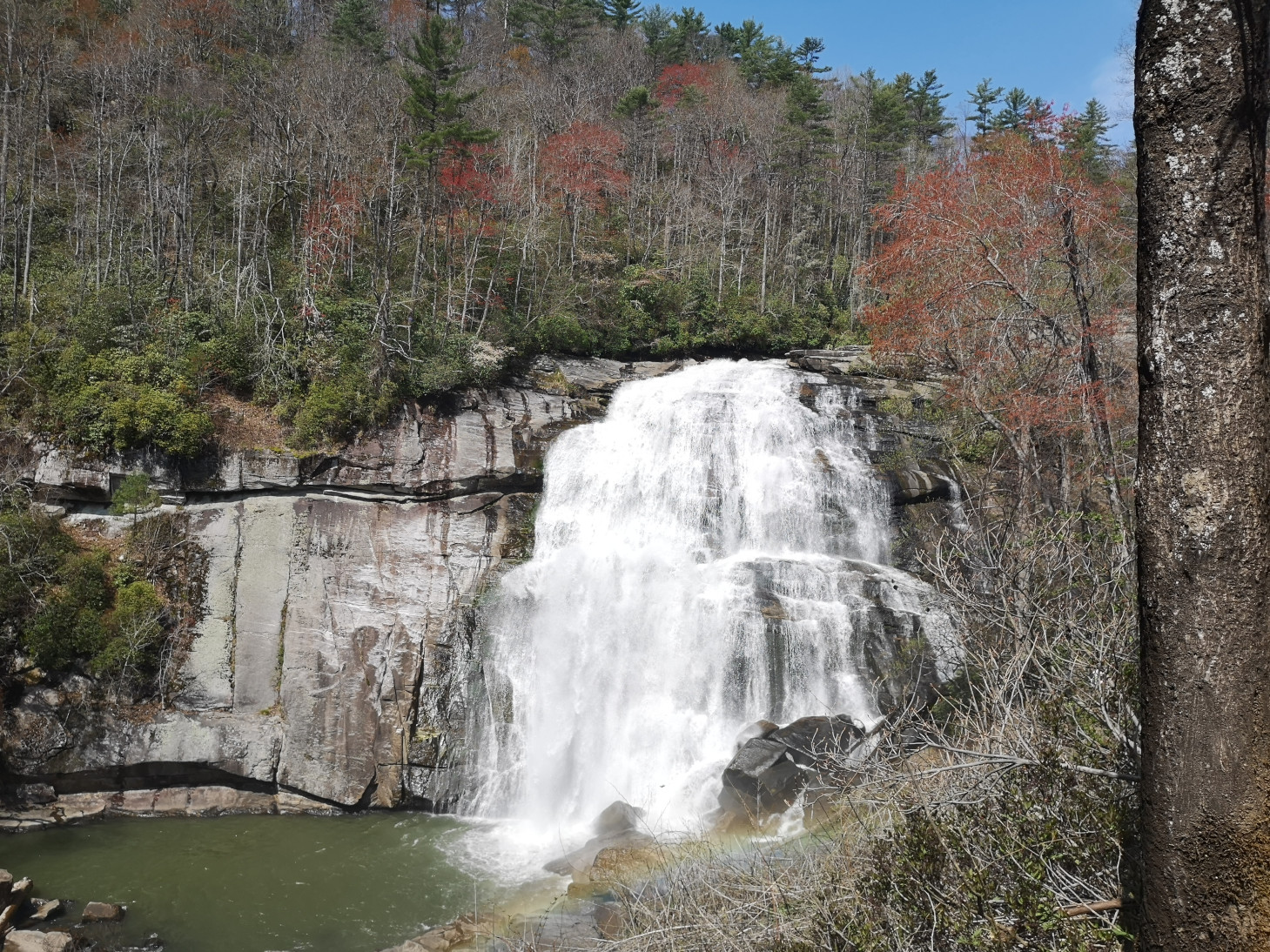
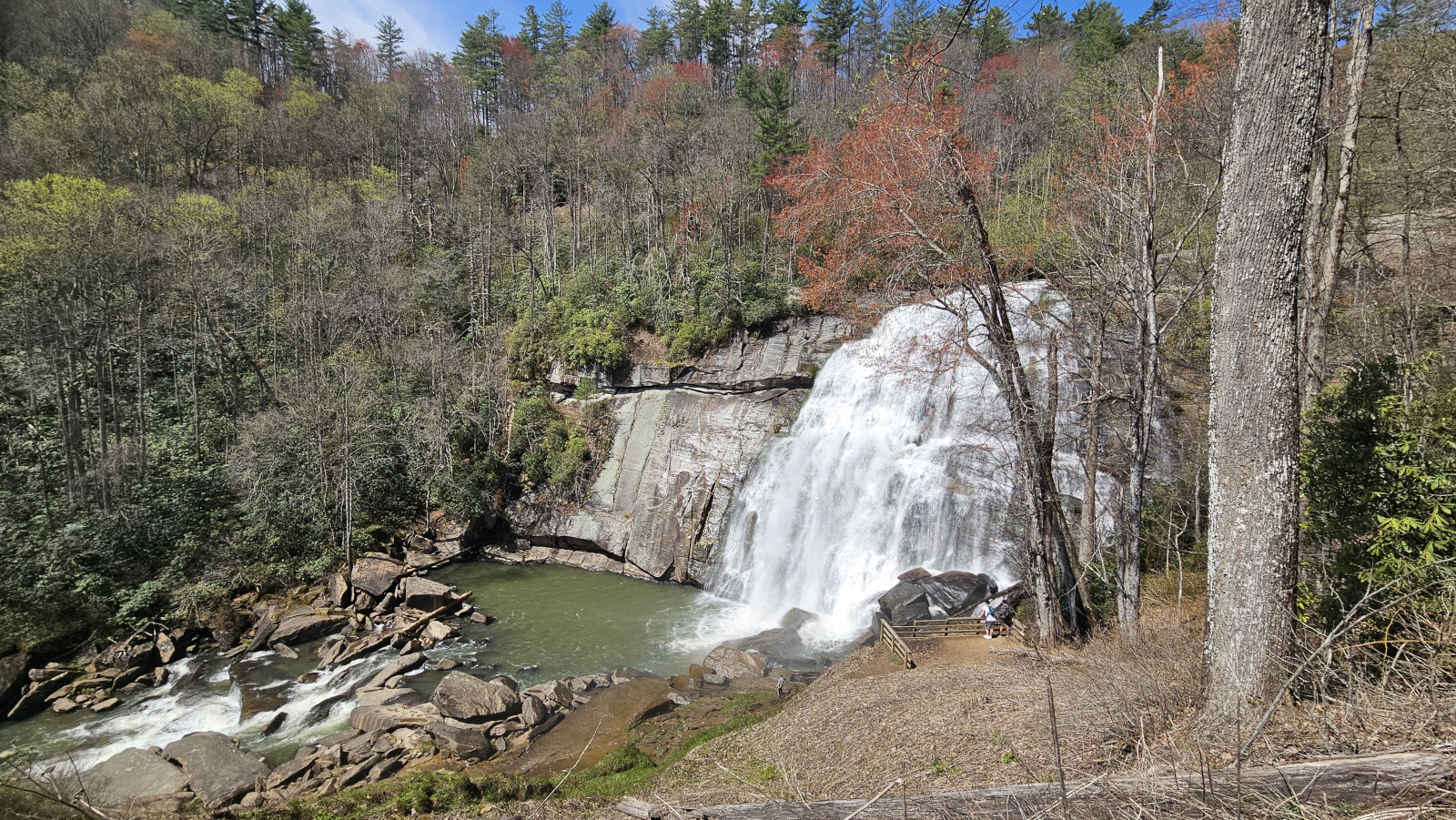
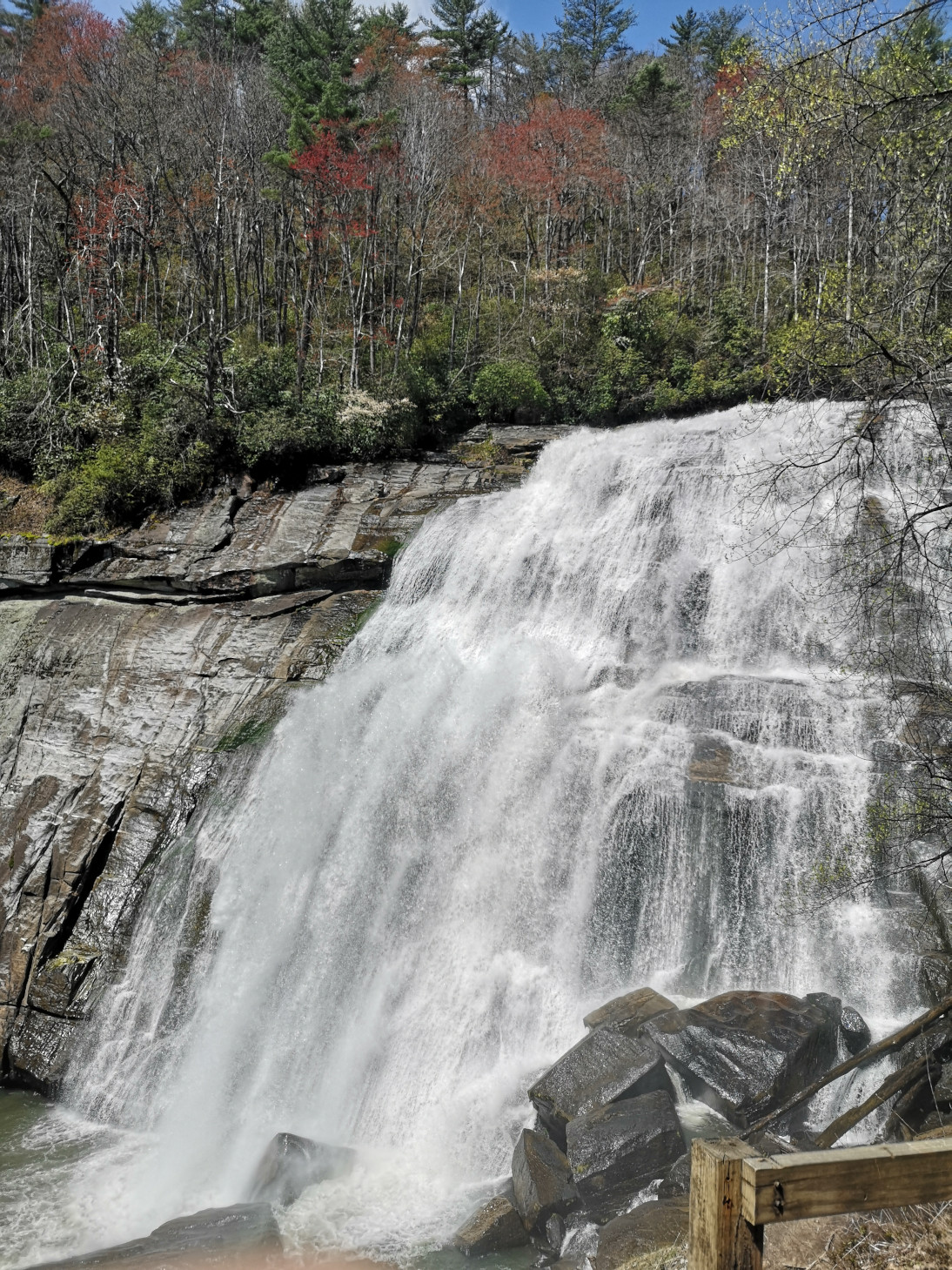
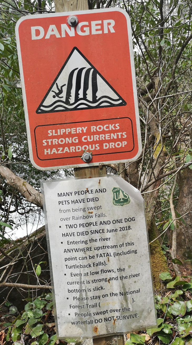
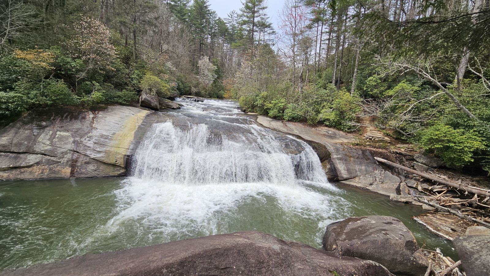
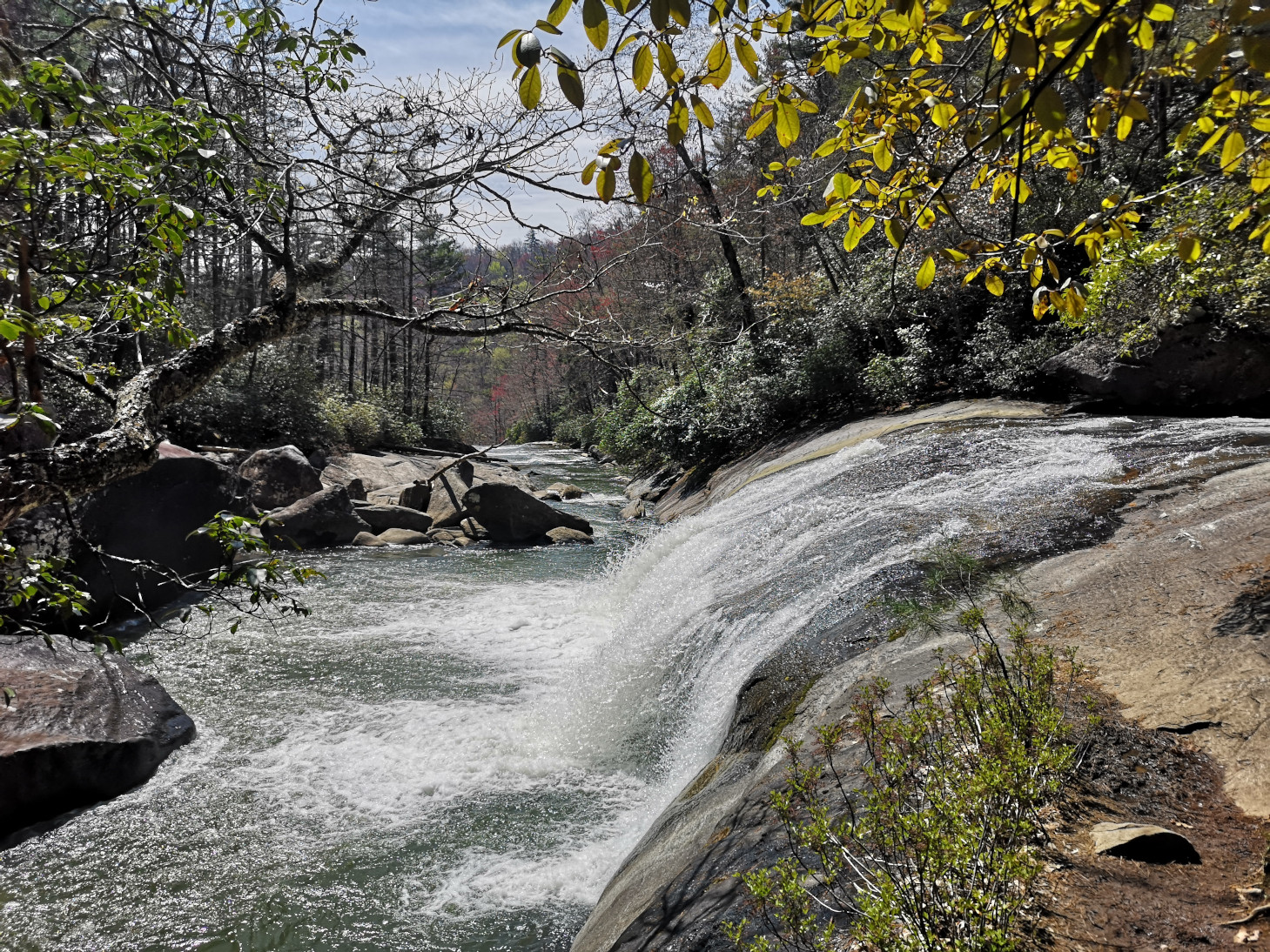
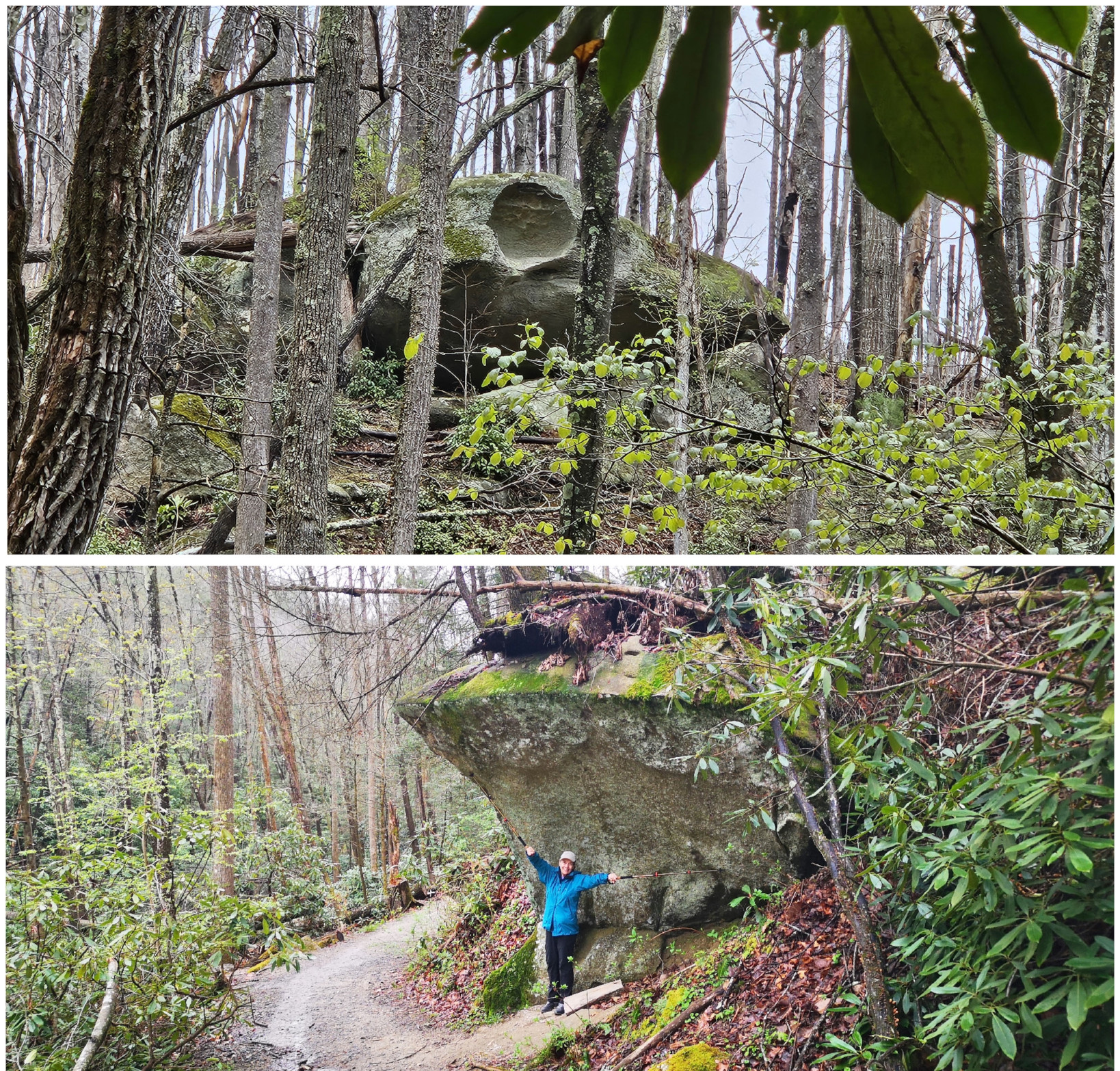
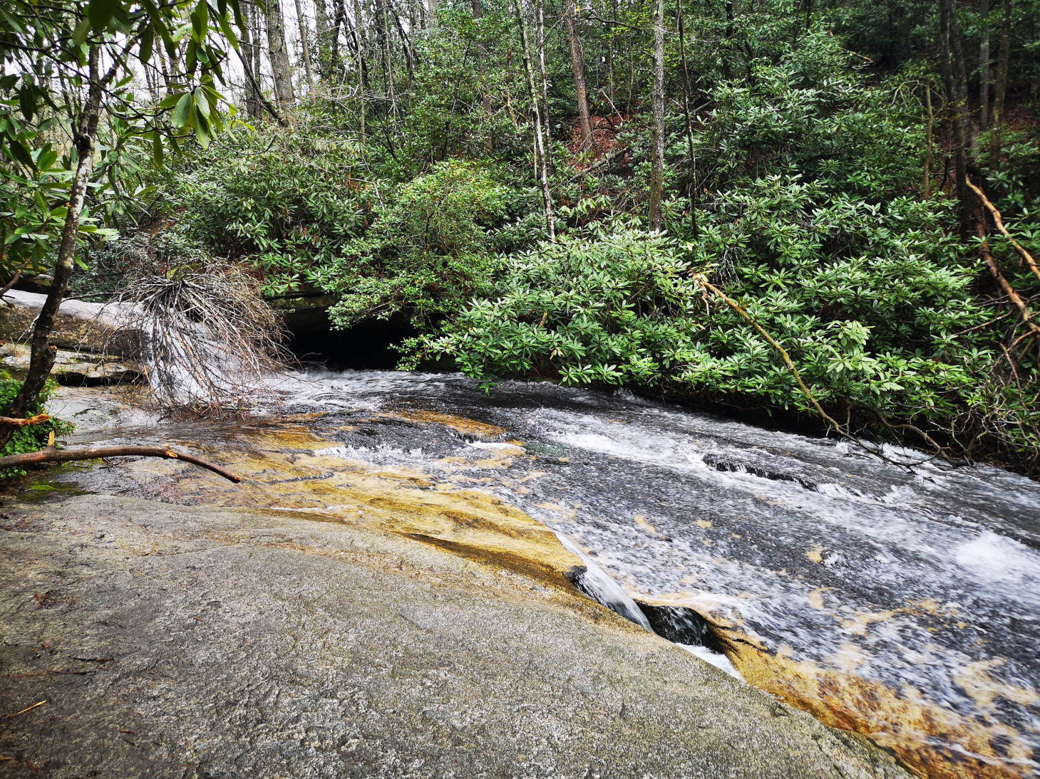
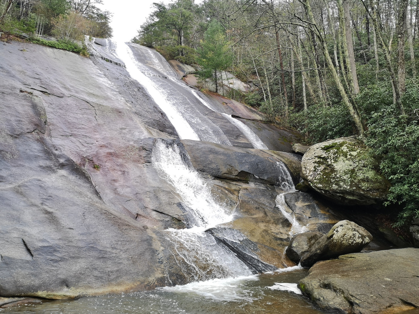
Our plan for the next day was to do the Rainbow Falls trail but the host also gave us some tips on how to get to Stairway Falls which wasn’t marked on the maps but was listed in Alltrails. Rainbow Falls itself is in the Pisgah National Forest and after you pass it you can get to Turtleback Falls. Our total hike was just over 10 kms. This was another one where you descended most of the way there and then had to return by coming back up the trail (317 m total elevation). To get to Stairway Falls you took a small side cut off the main trail and then did a bush track to get there but it was worth it. However, when we went to leave the landing below the falls, I pulled myself up and sent my head directly into a broken tree branch. My head started to bleed but luckily not too badly. Rainbow Falls was quite spectacular and aptly named with a faint rainbow at the base. Very few people seemed to carry on to Turtleback Falls as it was the least impressive of the 3. We found a spot just past it to have our lunch. These falls were all more impressive than Whitewater or Bearwallow since you could get so close to them.
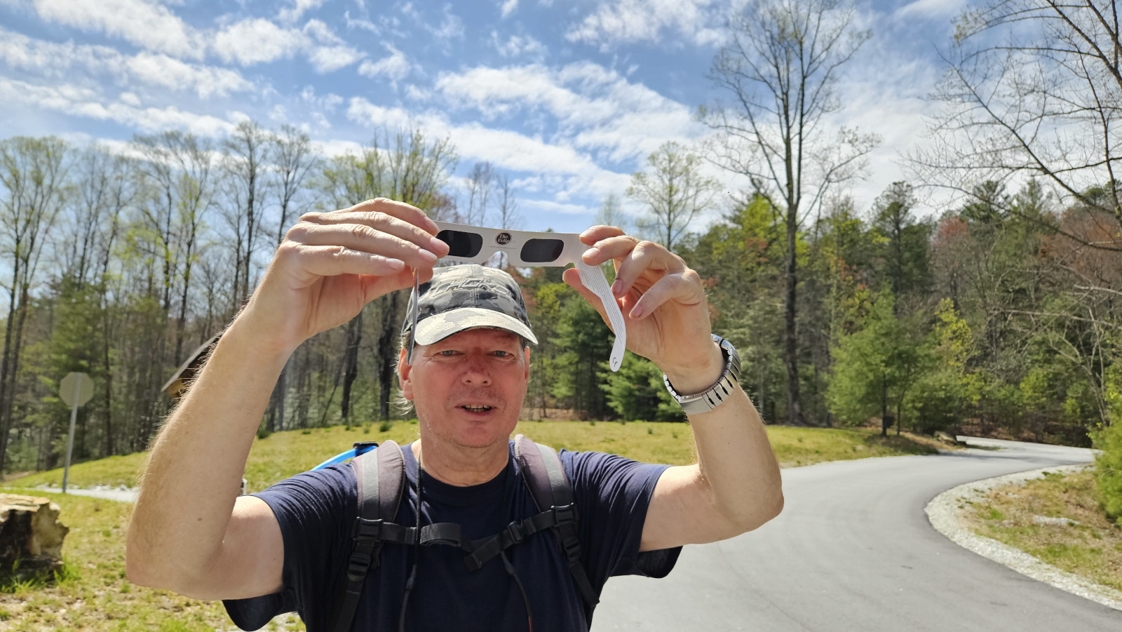
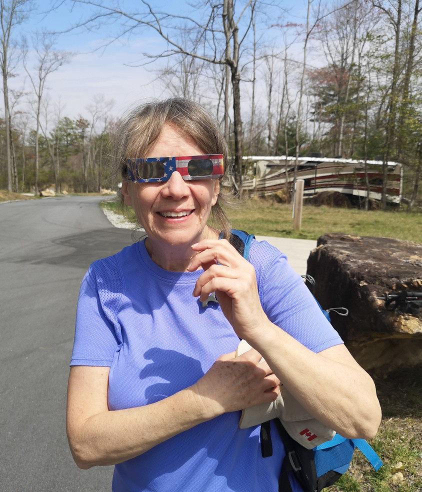
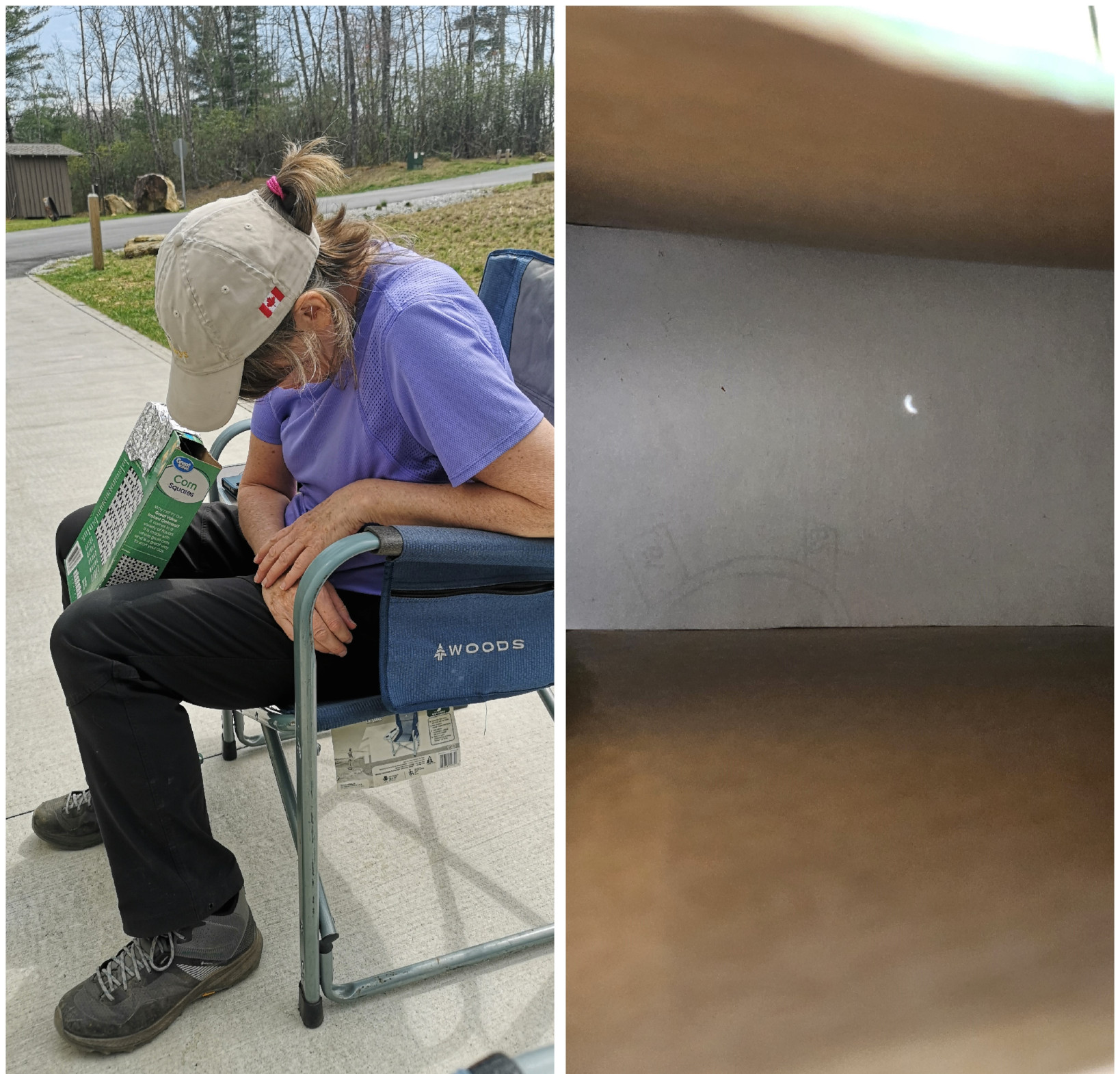
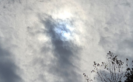
This day was the solar eclipse, although where we were was not in the path of totality, we were supposed to be 84% coverage. When we returned to the campground some other RV’ers were just checking in, so they let us look through their glasses since we didn’t have any. Back at our campsite Sharon used her cereal box viewer to watch some more of the eclipse.
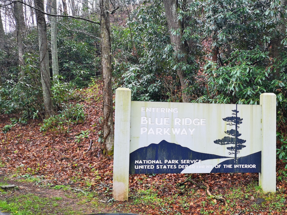
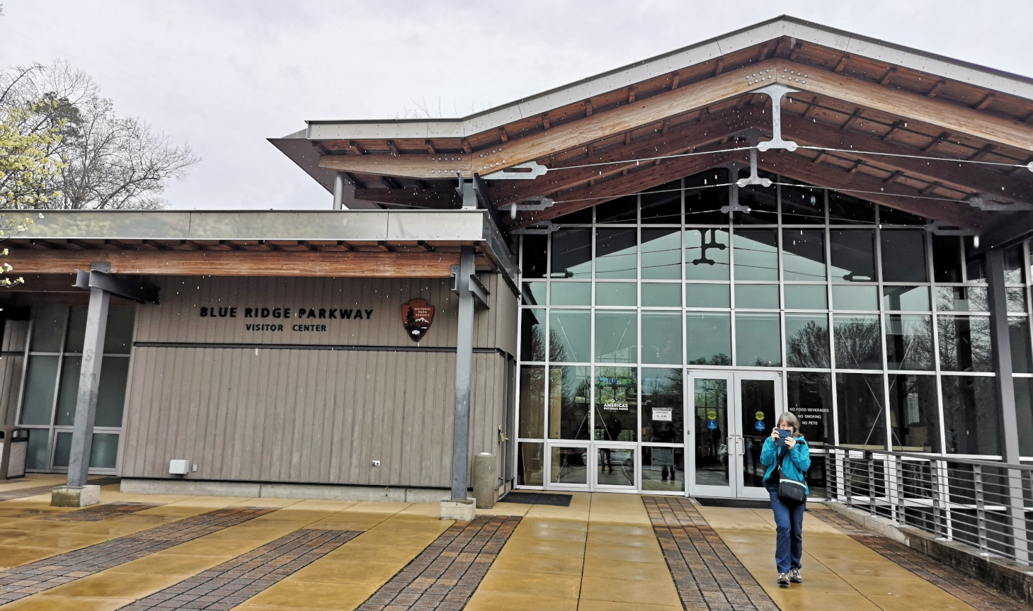
The reason we had come this direction was to try to drive along the Blue Ridge Parkway scenic drive which is a National Park (NP) and covers a total distance of 469 miles (755 kms), the longest linear park in the US. The Parkway has been the most visited unit of the National Park System almost every year since 1946. There is no fee to use the parkway and commercial vehicles are banned from the road. The speed is 45 mph so you have to plan accordingly as it takes you longer to cover large distances. It’s a bit tricky at this time of year as they close sections of the parkway to do road maintenance in the winter months. It was further complicated because it was pouring rain when we woke up to start our long drive day to get from Gorges SP to Stone Mountain SP in North Carolina. Also, at this time of year many of the National Park campgrounds along the parkway are closed and that is why we had picked Stone Mountain which was a state park off the parkway. Our first stop was the Asheville Blue Ridge Parkway visitor centre so we could gather additional information and find out about any closures. Here are some fun facts we learned:
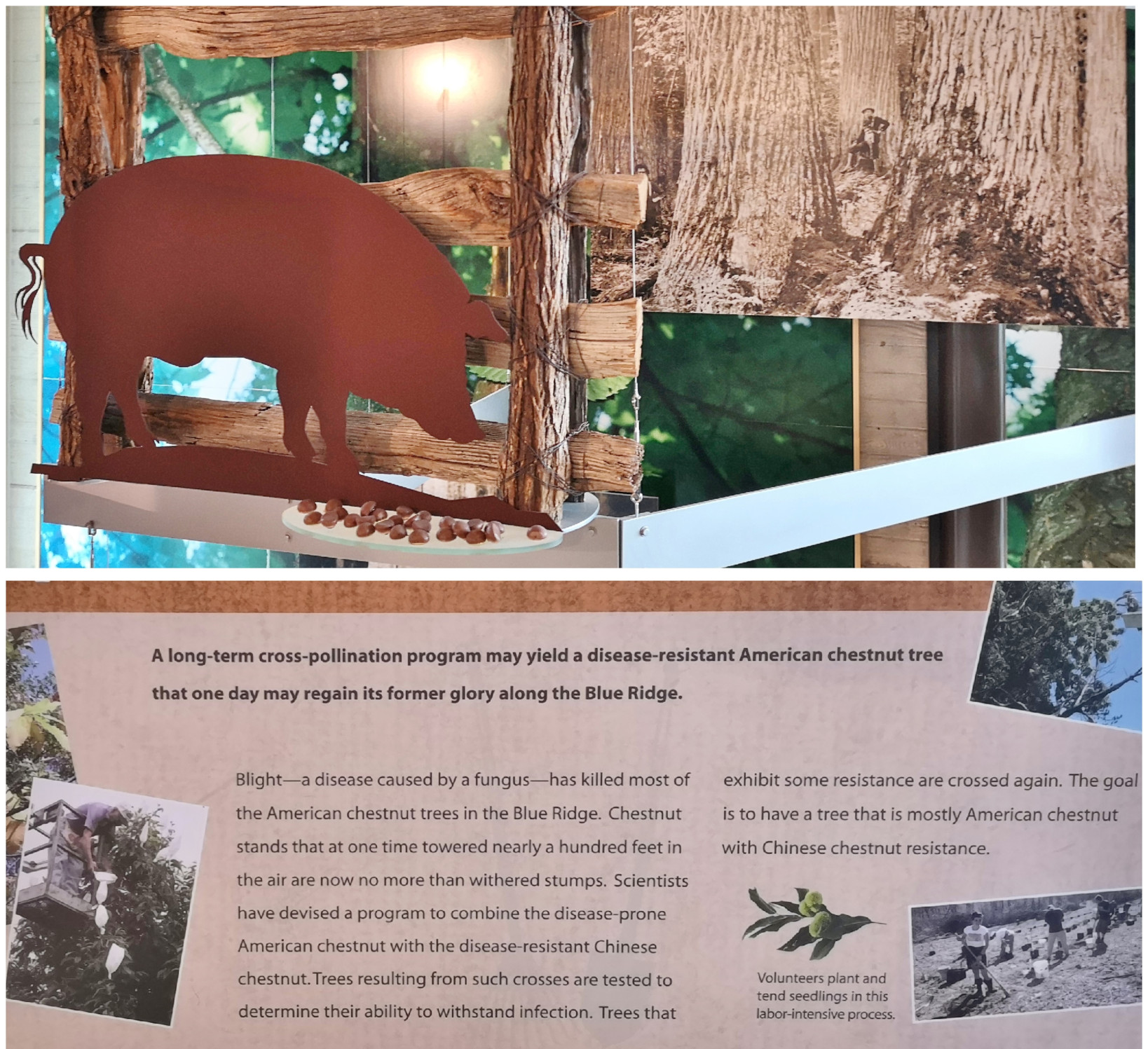
- For centuries the American Chestnut tree was the dominant tree in the Appalachian Forest. Farmers let their hogs run free in the forest so they could forage on the chestnuts, and the locals’ collected chestnuts as a cash crop. A fungus introduced by imported Japanese chestnut trees decimated the forest in the late 1800’s. The NP service has been trying to introduce a disease resistant version of the American Chestnut tree so they can return the area to the original forest conditions.
- The Blue Ridge music heritage stems from the fiddle and the banjo instruments. Civil War soldiers travelled through the area influencing the music, then recordings in the 1920’s helped to grow the audience for the stereotypical mountain people music.
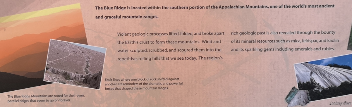
- The Blue Ridge is in the southern portion of the Appalachian Mountains which were formed by violent geologic activity that lifted, folded, and broke apart the Earth’s crust to form the mountains.
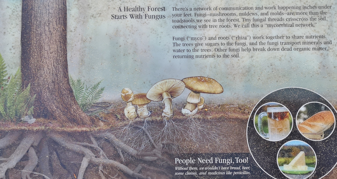
- The Blue Ridge Parkway spans a wider geographic area than any other NP in the US. There are over 100 types of trees, 1,400 kinds of plants, and more than 2,000 types of mushrooms and fungi. There are 311 bird species as the area is a critical part of the Atlantic migratory flyway.
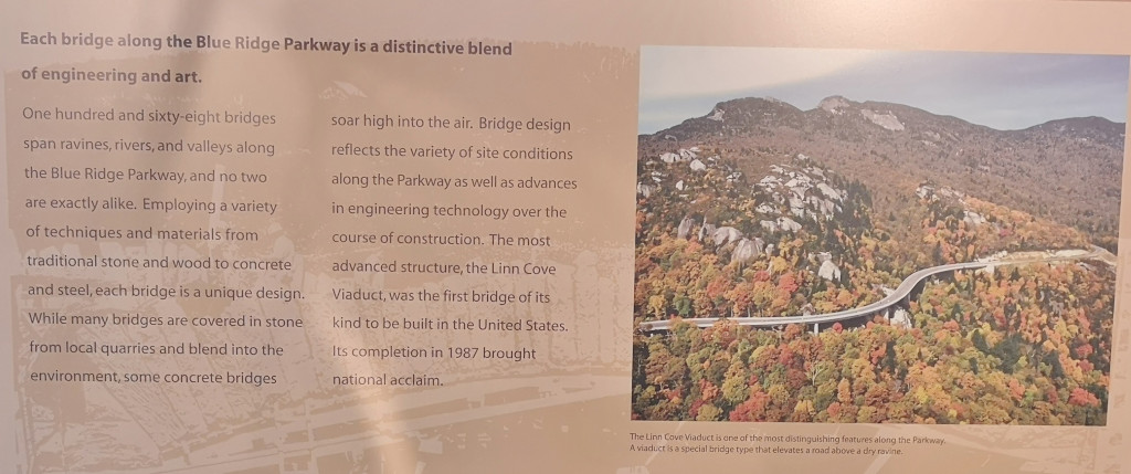
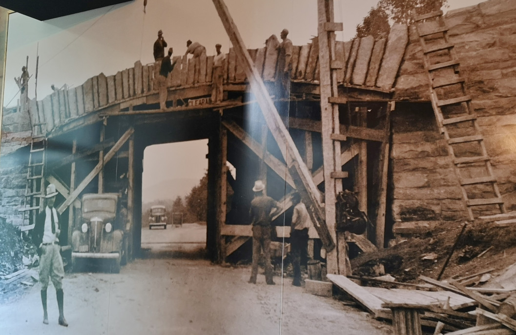
- There are 168 bridges spanning ravines, rivers, and valleys along the parkway and no two are exactly alike. The parkway was started in 1935 with CCC workers but the last viaduct wasn’t completed until 1987. The original architects designed scenic overlooks all along the parkway so you could pull off and enjoy the views.
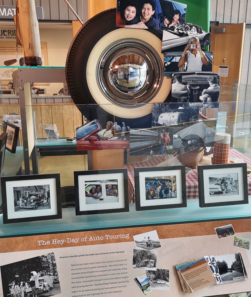
- After World War II automobiles were being used more for road trips and gasoline was cheap so the parkway was popular for recreational driving.
- If you would like to watch a video about the parkway you can click on this link: Driving the Blue Ridge Parkway
After we looked through the exhibits, we spoke with one of the volunteers to get guidance on the section we were planning to do to get to Stone Mountain. Then we watched a movie in the theatre (like the one above) before starting our journey.
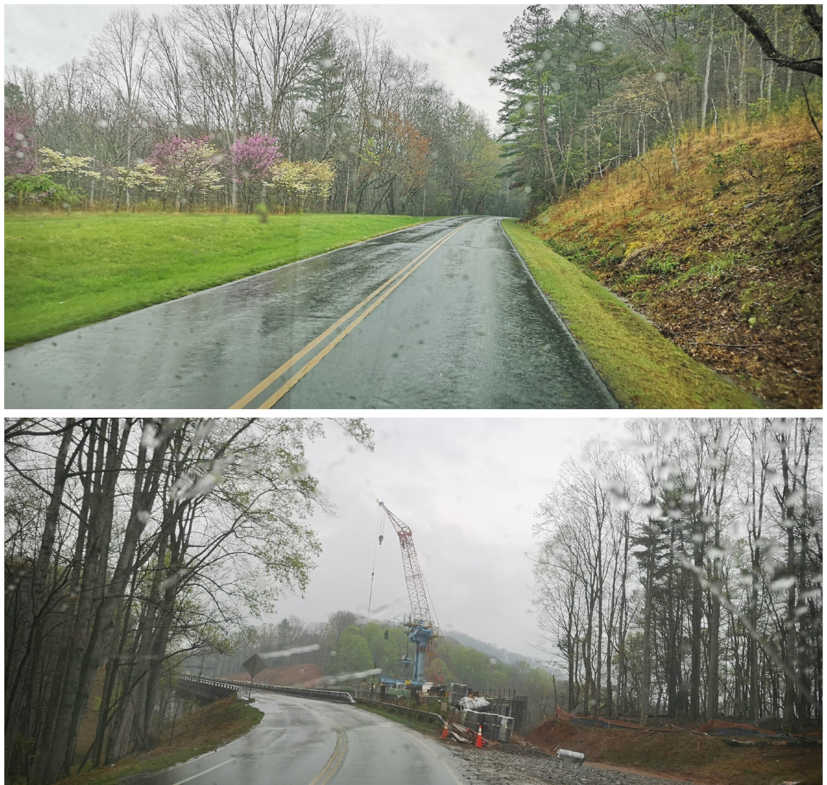
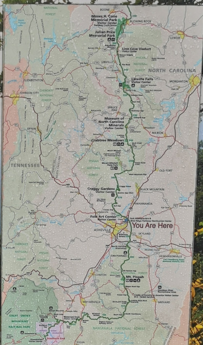
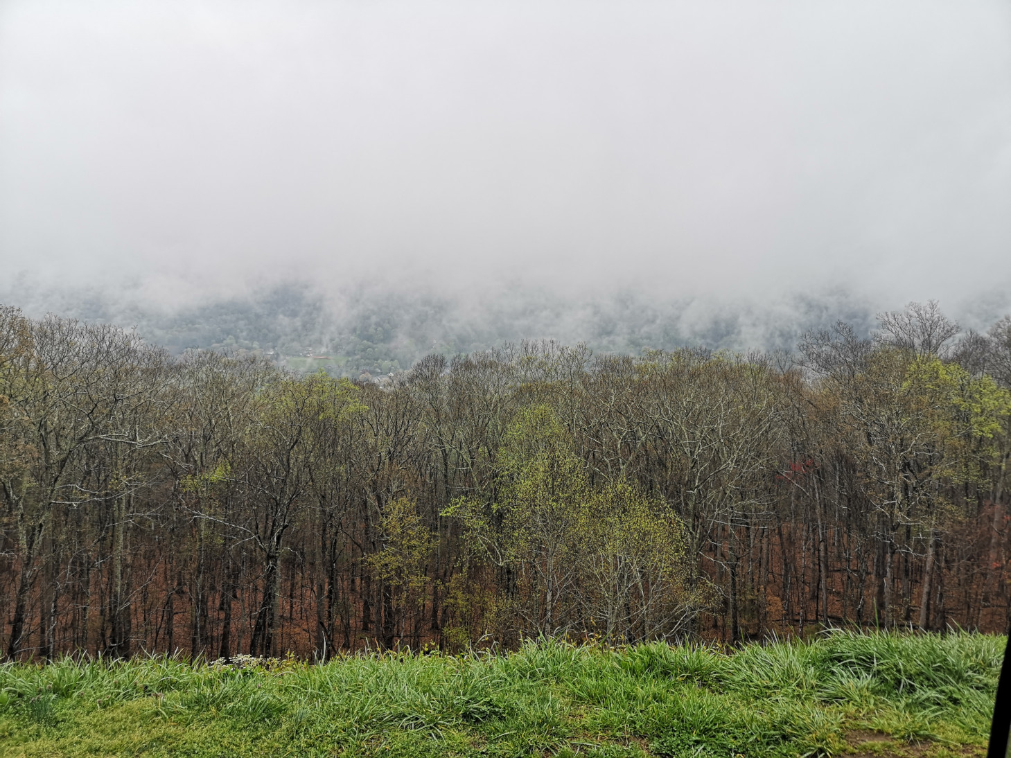
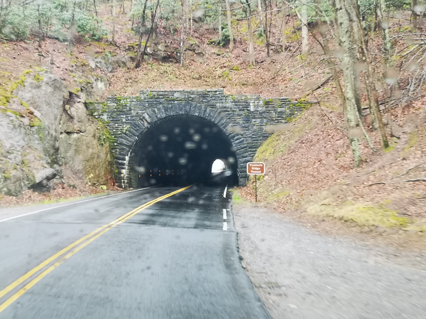
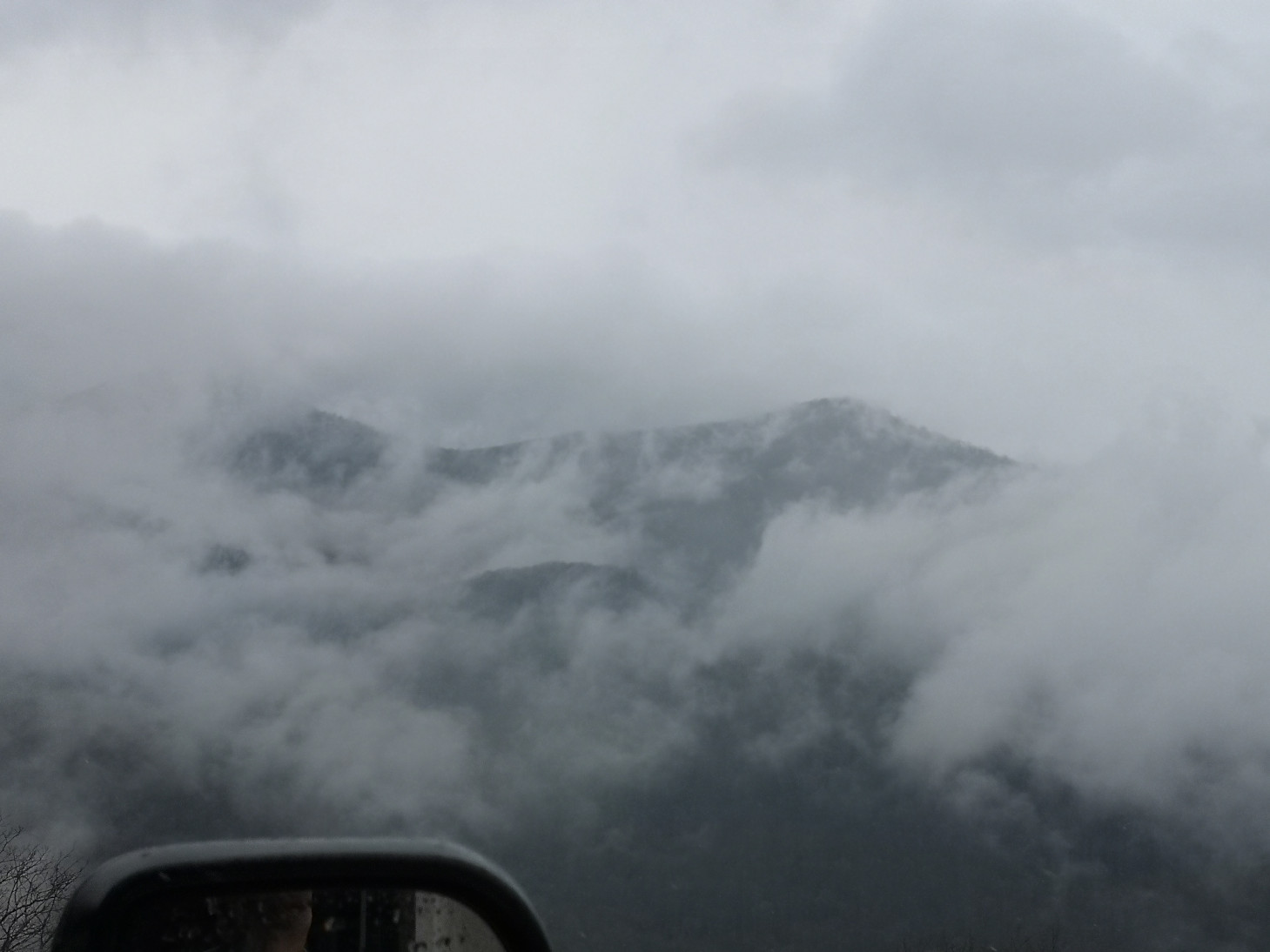
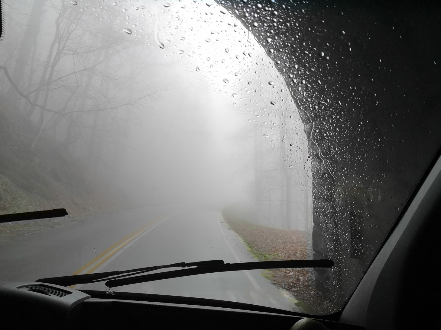
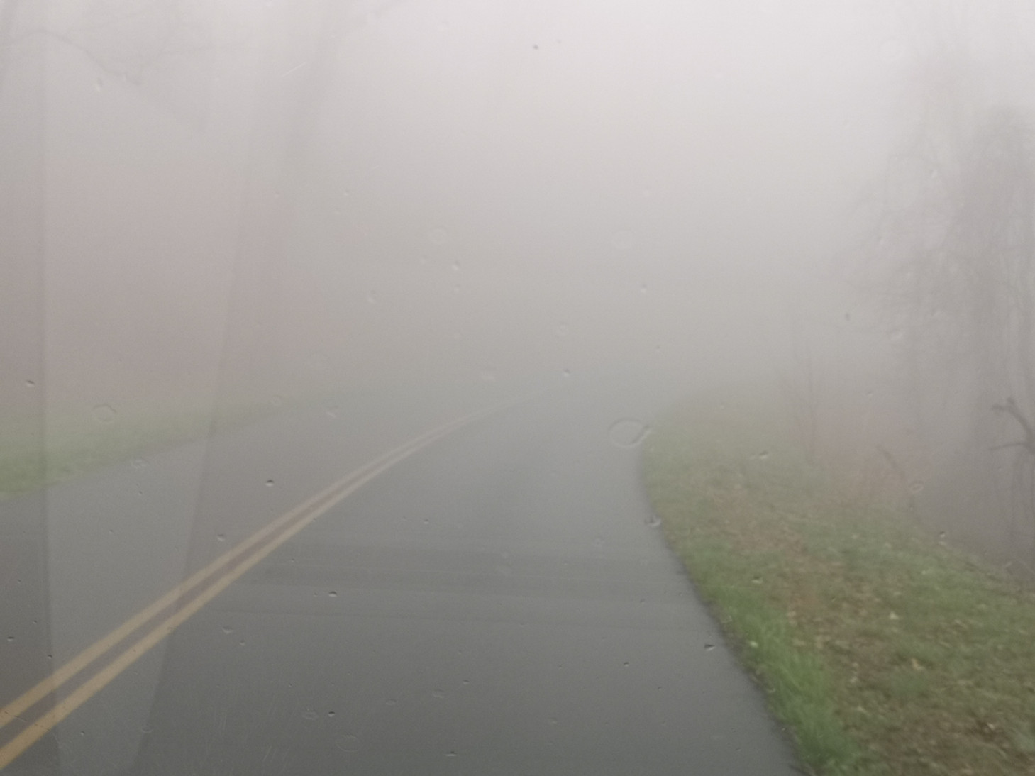
Armed with our map and information we headed out on what would be an adventure in driving!! As we went higher up the ridge the fog got thicker and the rain harder. To be honest we were totally shocked that the people in the visitor centre hadn’t warned us that it was a bad day to drive on the parkway. Before long all we could see was 1 to 2 car lengths in front of us, except when you went through a tunnel. We pulled off at a few of the overlooks but all you could see was fog and low-lying clouds. The issue you have on the parkway is that there are very few places where you can actually get off the road when you face bad conditions. We kept hoping that things would clear but they didn’t since we were more than 5,000’ in elevation. We finally did find an exit that would take us down from the elevation but of course it was a total switchback road to gradually bring you back down the mountain. It would have been fun in Sharon’s car but not so much fun in the RV. However, at least as we got lower it was just raining and not foggy anymore so you could see where you were going. What a scary 65 kms for our first drive along the parkway! We eventually went through the town of Marion and after an incredibly exhausting 320 km drive (5 hour and 37 minute) we finally reached Stone Mountain SP and just got checked in before the ranger left for the day.

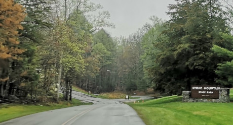
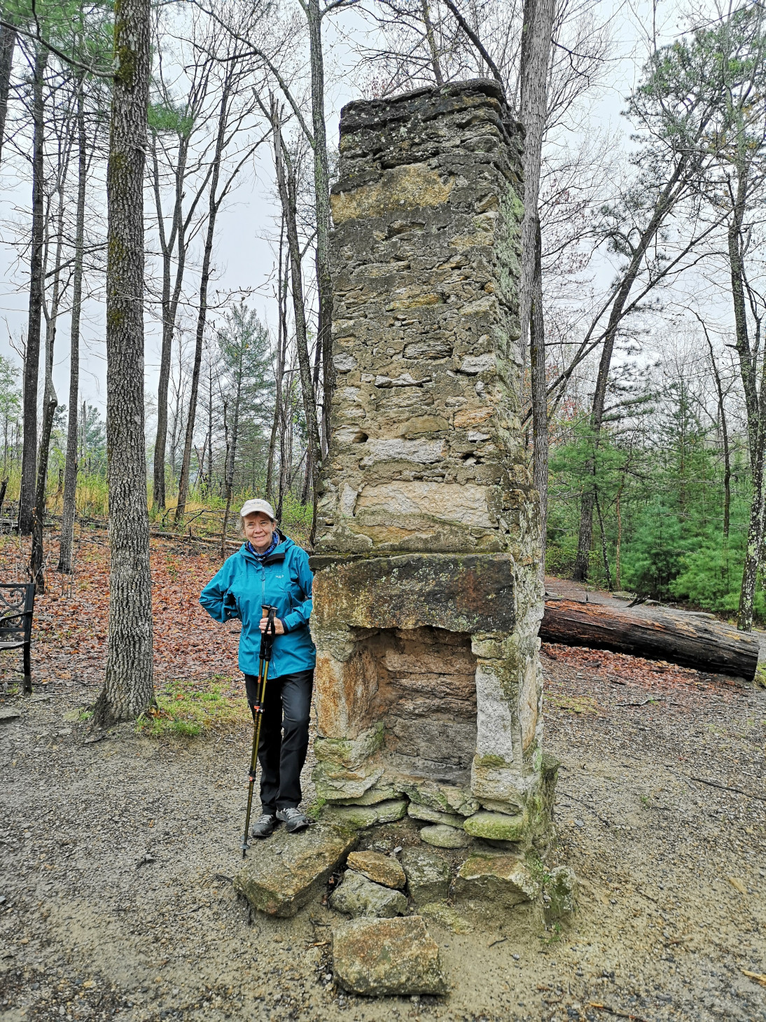
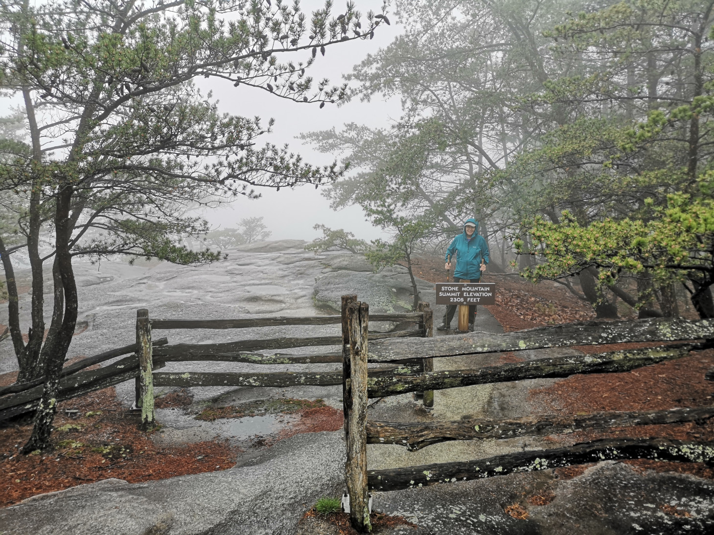
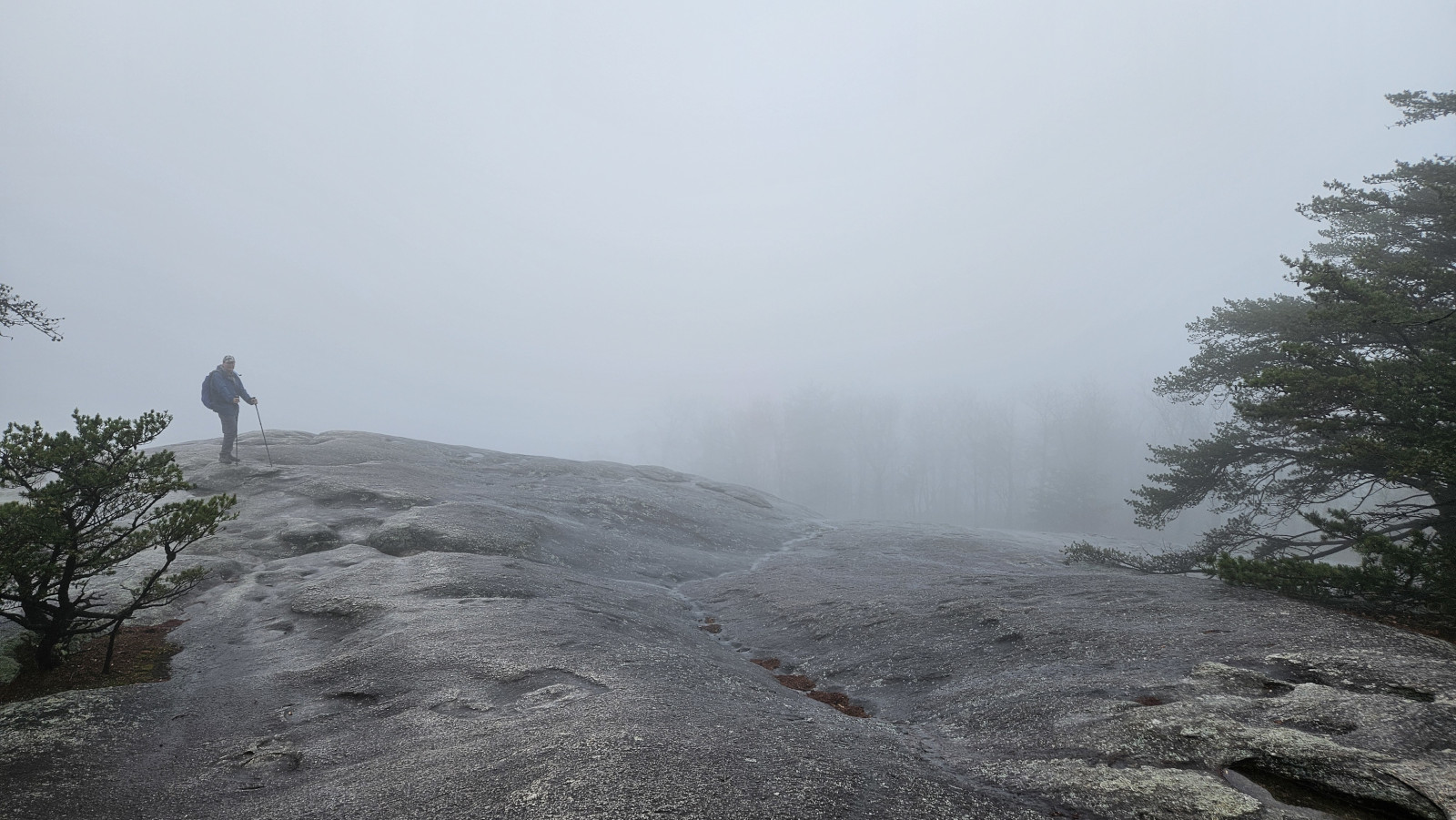
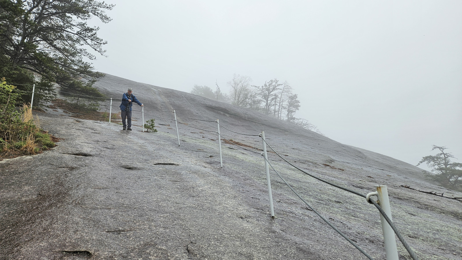
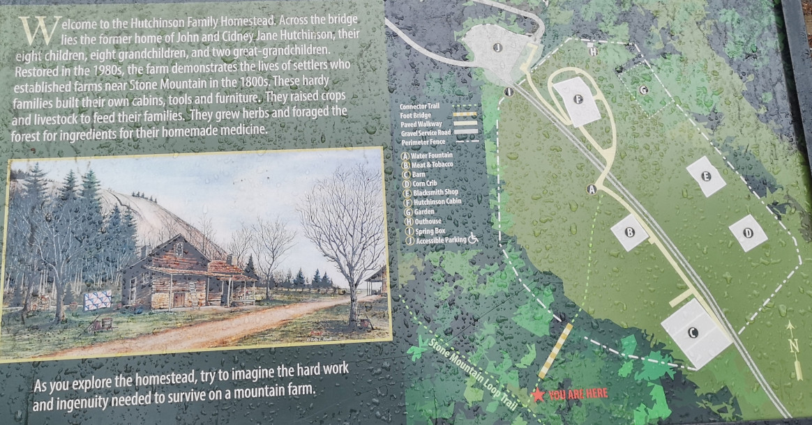
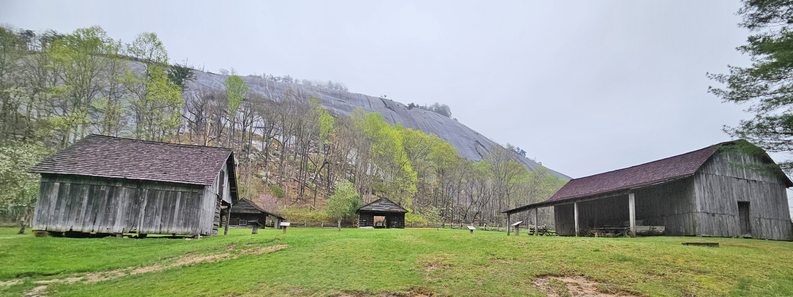
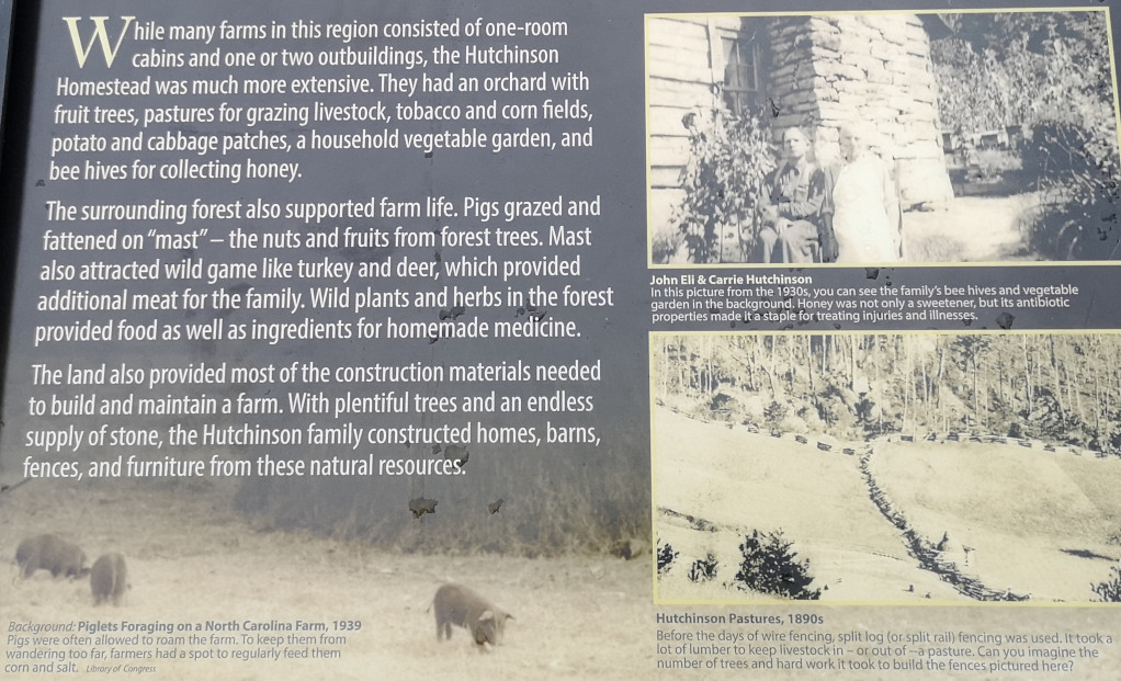
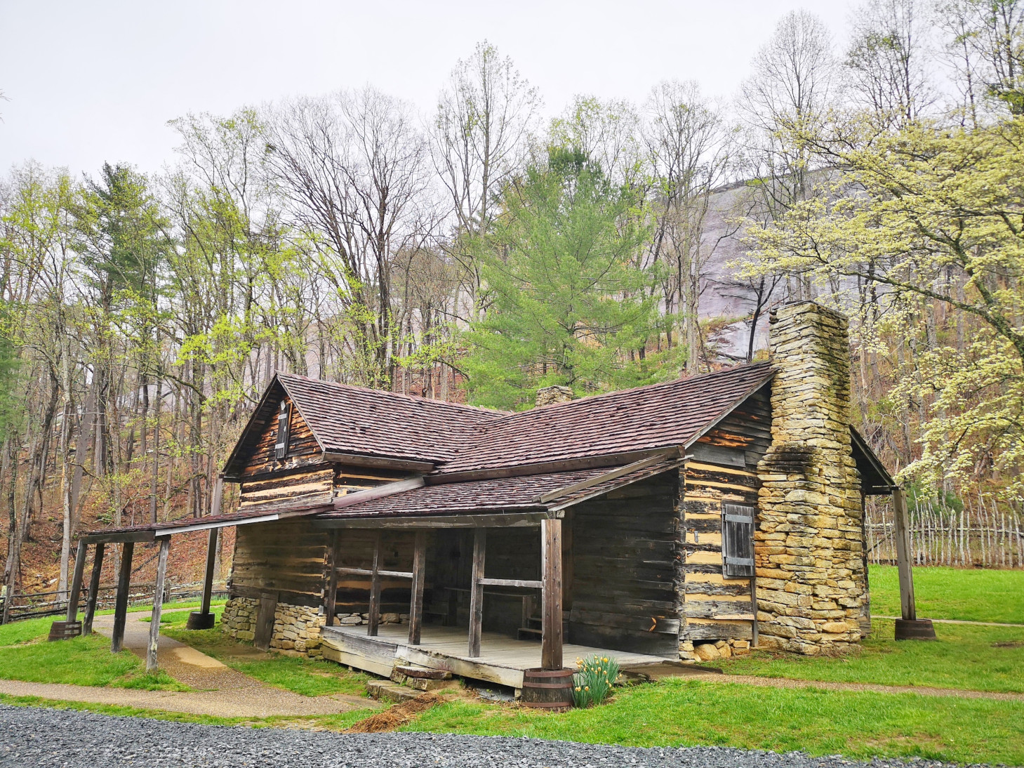
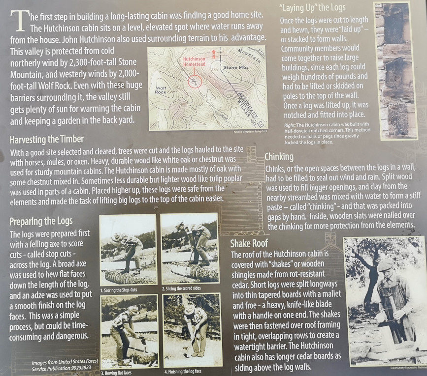
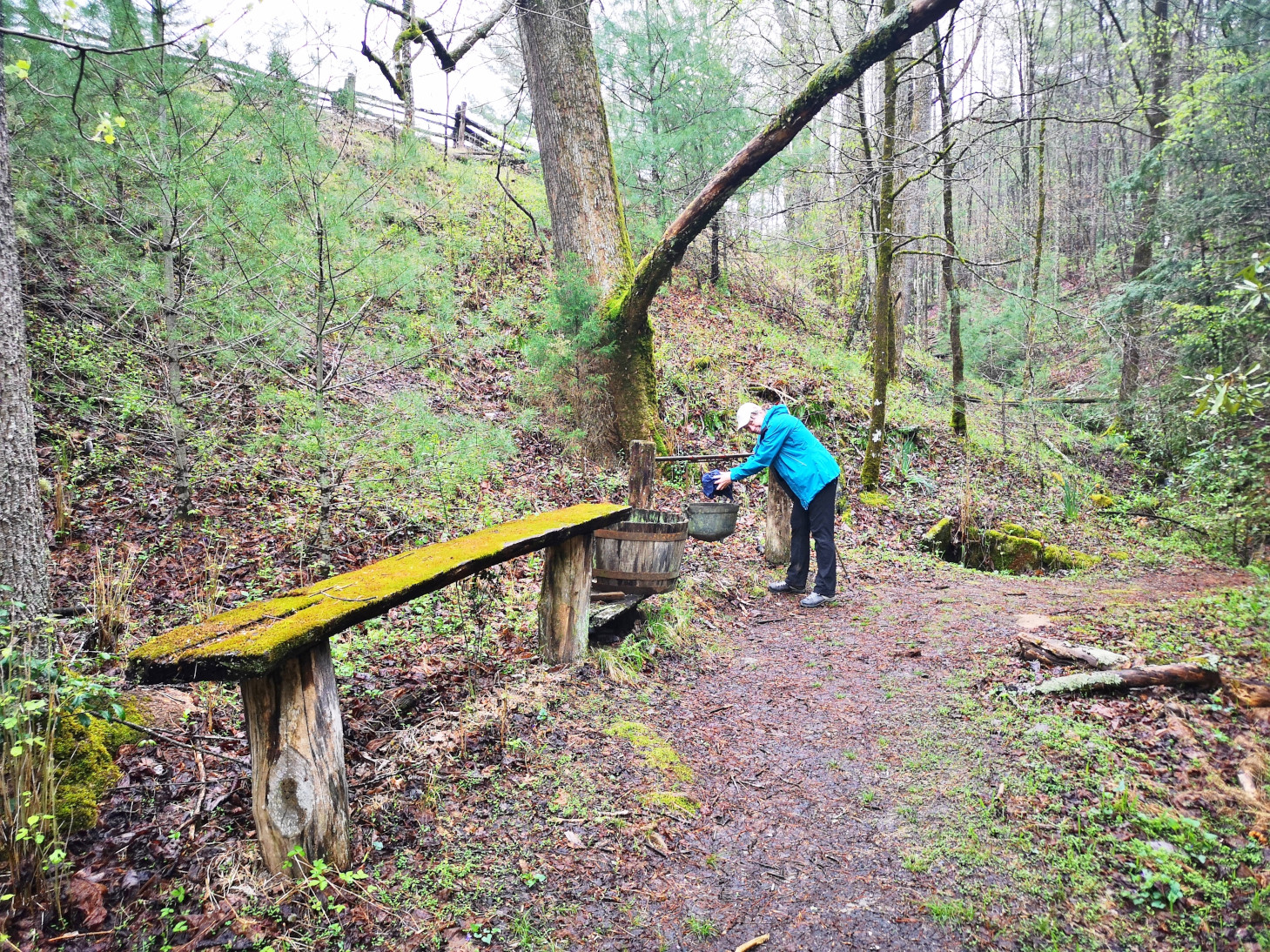
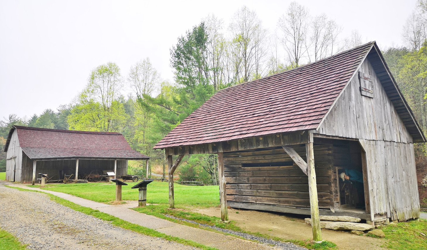
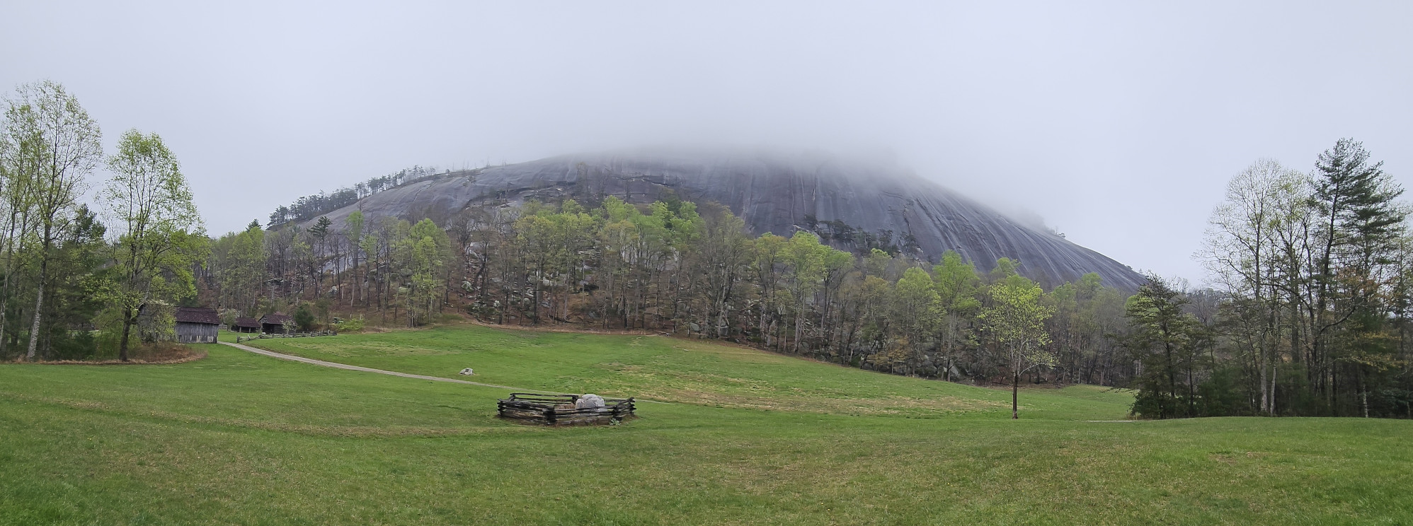
The centrepiece of the park is a large dome of exposed granite that rises 183 m above the surrounding terrain. The mountain was designated a National Natural Landmark in 1974. We had booked a 2-night stay at Stone Mountain which just gave us the one full day to explore the park, so even though it was rainy and foggy the next day we went on a 13 km hike on the Stone Mountain loop trail and to see the Hutchinson Homestead from the mid 19th century and several waterfalls. The hike was fairly strenuous with a 360 m elevation gain, but we were glad we had chosen to do it in counterclockwise direction from the campground as the one section from the main parking lot was straight uphill with stairs and steel cable railings versus the switchback trail, we had followed. The fog was quite thick at the summit of the mountain, but you still got a sense of how special this large granite dome was versus the surrounding area. After descending we went through a lush creek area until we arrived at the Hutchinson Homestead. The Hutchinson’s started building in 1855 and 4 generations of the family lived in the area until 1969 when it was purchased by the state park. Jim Hutchinson stayed on as the first ranger in the park until he moved away in 1979. Each building had a display board to explain what it was and how it was built and used. It was really fascinating to learn how they lived at the base of Stone Mountain and how the mountain provided them better weather conditions.
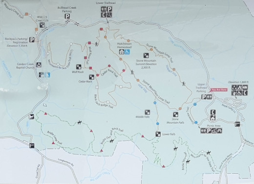
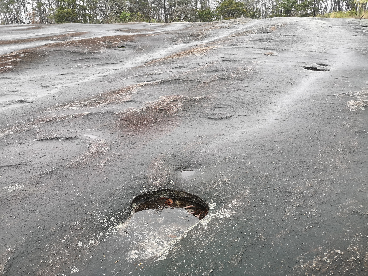
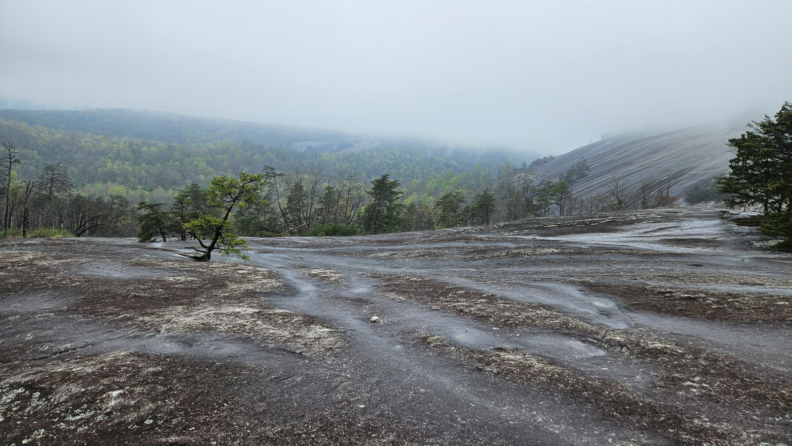
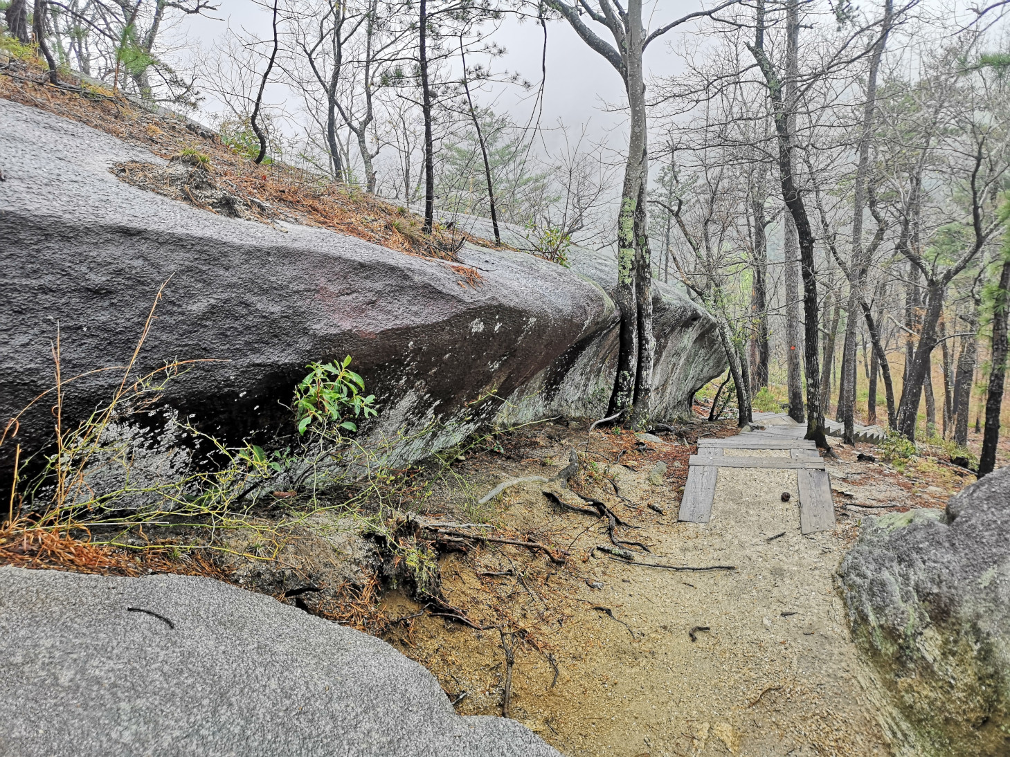
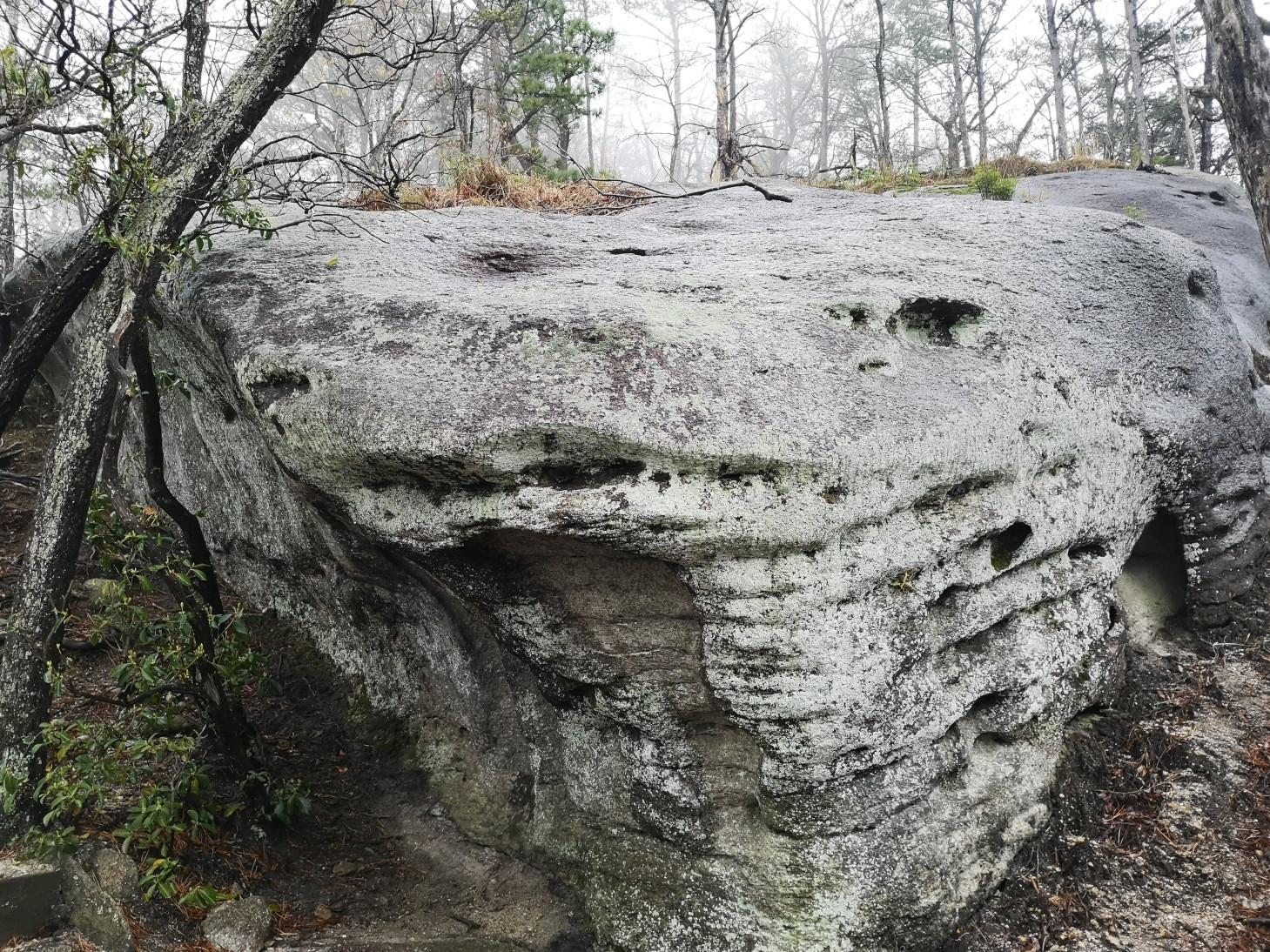
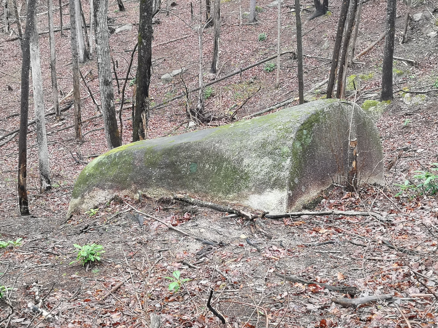
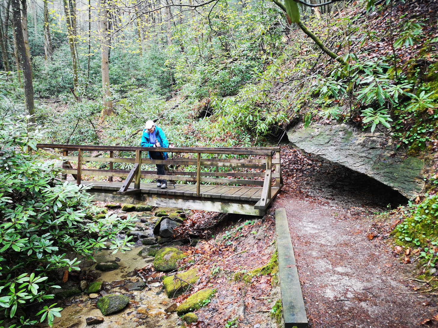
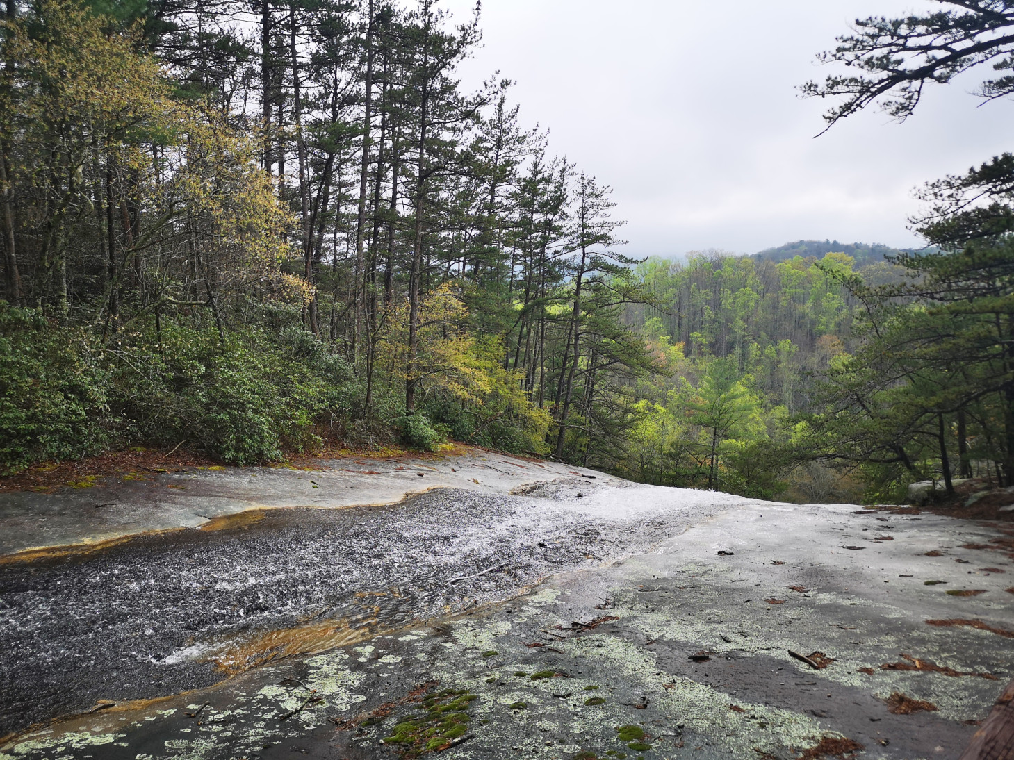
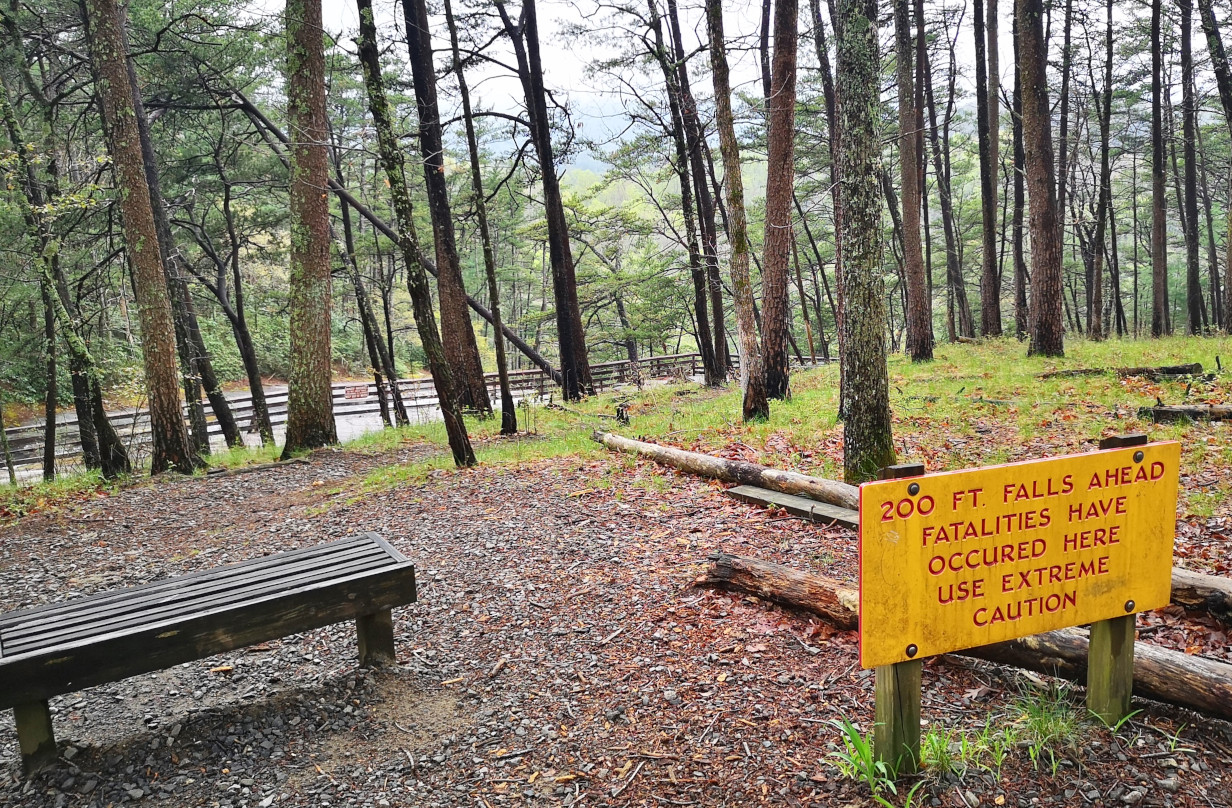
After the homestead the trail carried on through the lush valley by the creek and we decided to take a side trail to go see Middle Falls. It was a bit slippery due to the rain but luckily, we had our poles with us. Back on the loop trail we were supposed to see Stone Mountain falls but there were so many waterfalls we weren’t sure which one it was. However, after we saw the 200’ tall falls we knew that was the actual Stone Mountain falls. It really looked like it would be fun sliding down the slope but when we reached the top, we saw the warning sign about fatalities! Overall, this was a phenomenal hike with scenery, geology, and history. We could only imagine how much more spectacular it would be with sun and blue skies😉
We’ll close this blog off here and carry on in the next one with more of the Blue Ridge Parkway and Skyline Drive.

You kept writing blogs so I guess your bleeding head wasn’t too severe. You better wear helmets all the time.
LikeLiked by 1 person
No stitches’ required.
LikeLike
Your visibility experienced at Blue Ridge Parkway (or aka Blur Ridge driveway) is similar to my visit to Schweitzer Mountain Ski Resort in Idaho, all foggy. At least you came away unscathed. I left with couple of broken bones.
LikeLiked by 1 person
I think Stone Mountain was when Janice’s brother Mark went off hiking by himself for the day during a summer camping trip (I think he was 10 or 12) and gave their mom a big scare. I think her hair started turning white around that time. LOL.
LikeLiked by 1 person
We just missed you, as we were in Ashville April 16-18. I have done a large portion of the Blue Ridge Parkway, once on a motorcycle and once in a Mustang, more fun than in an RV I’m sure.
LikeLiked by 1 person
Too bad we missed you guys. We did imagine what it would be like to drive Sharon’s convertible along the Parkway;-)
LikeLike