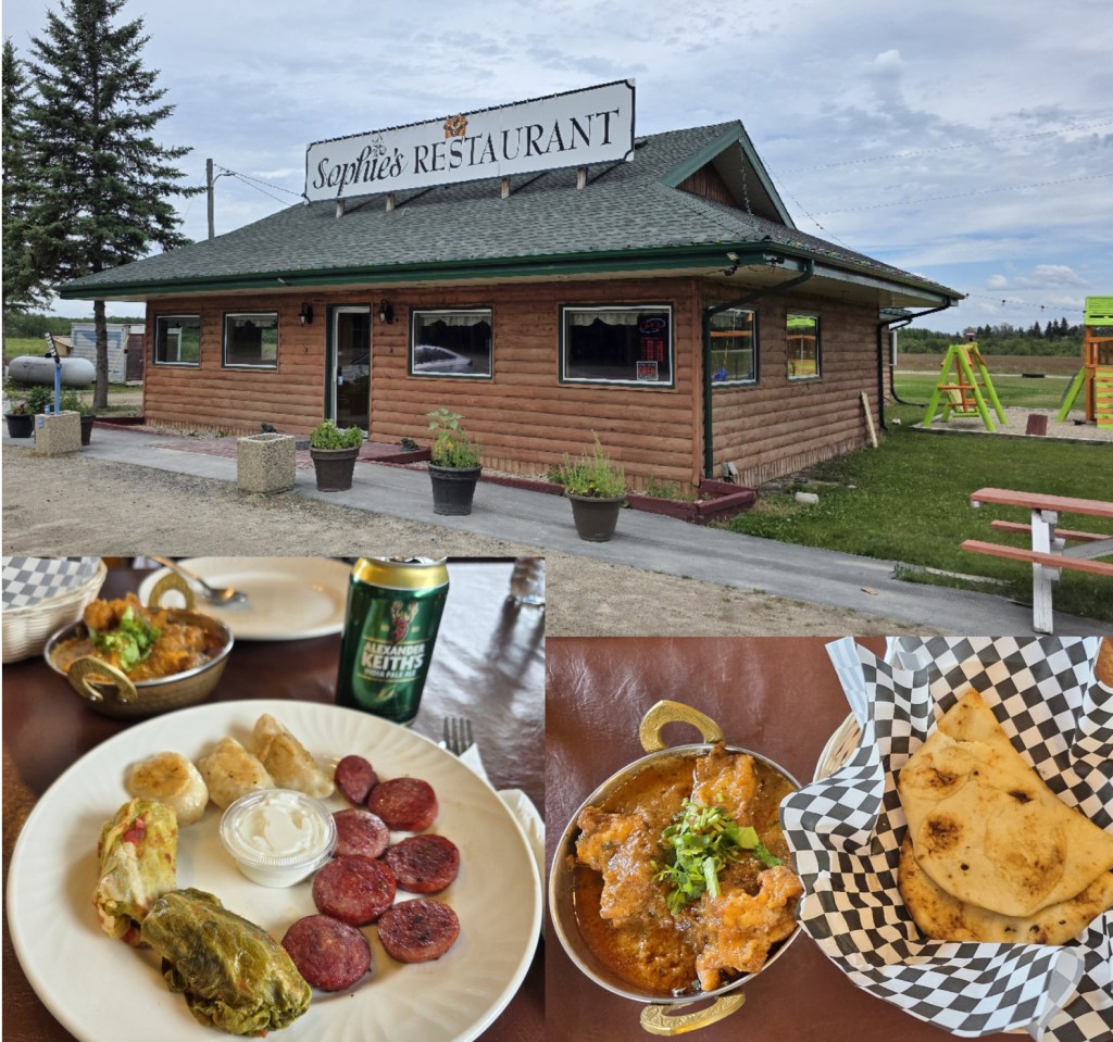
Our first stop as we left Winnipeg to head home was for lunch along the Trans Canada Highway at a restaurant that we had visited before called Sophie’s in Hadashville. It was known for its Ukrainian food, but it turns out there are new owners, and the new menu still has some of the Ukrainian items but also now has East Indian cuisine, an interesting combo. Consequently, we shared the Ukrainian platter with cabbage rolls, perogies, and kielbasa, and then also tried the spicy pickerel fish with naan, both were good but not exceptional.
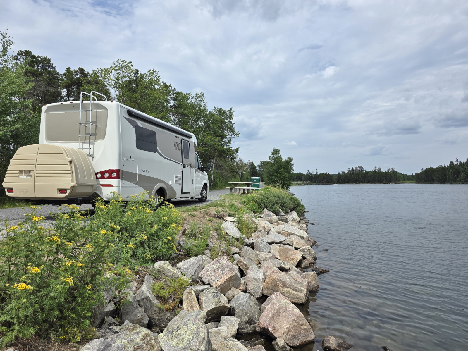
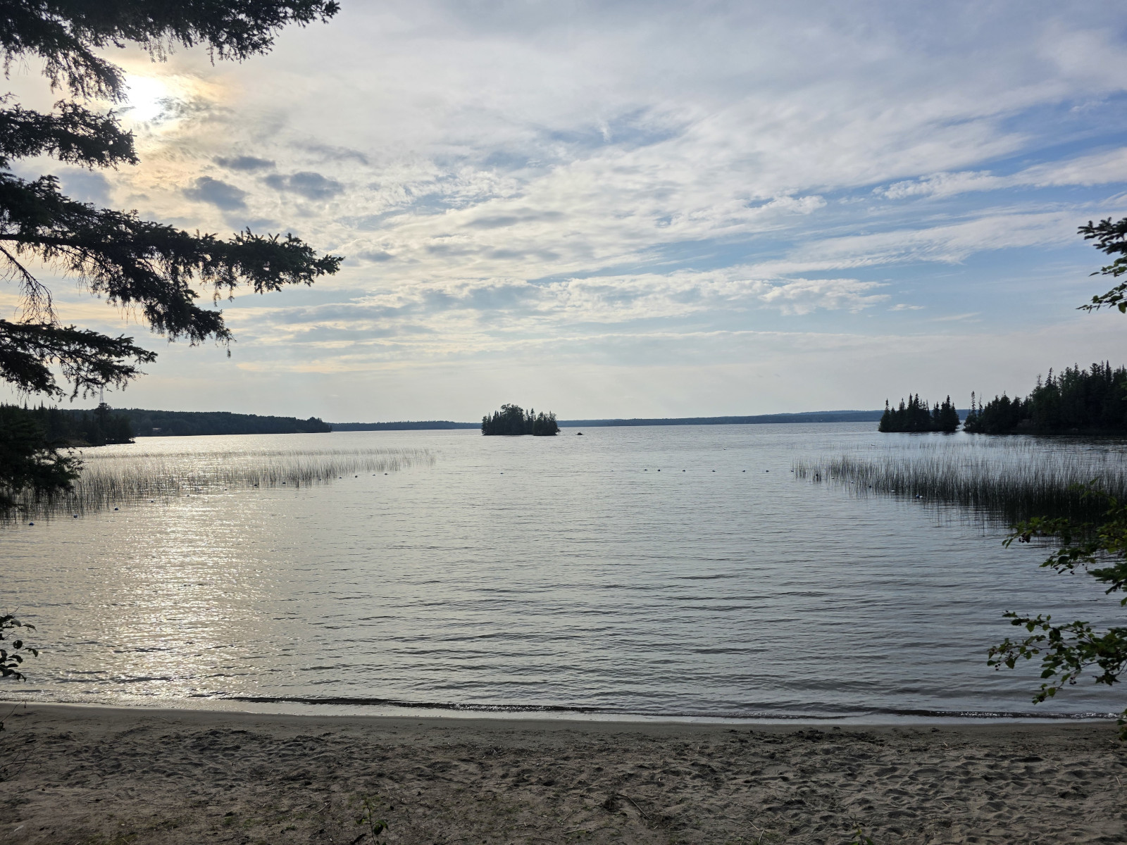
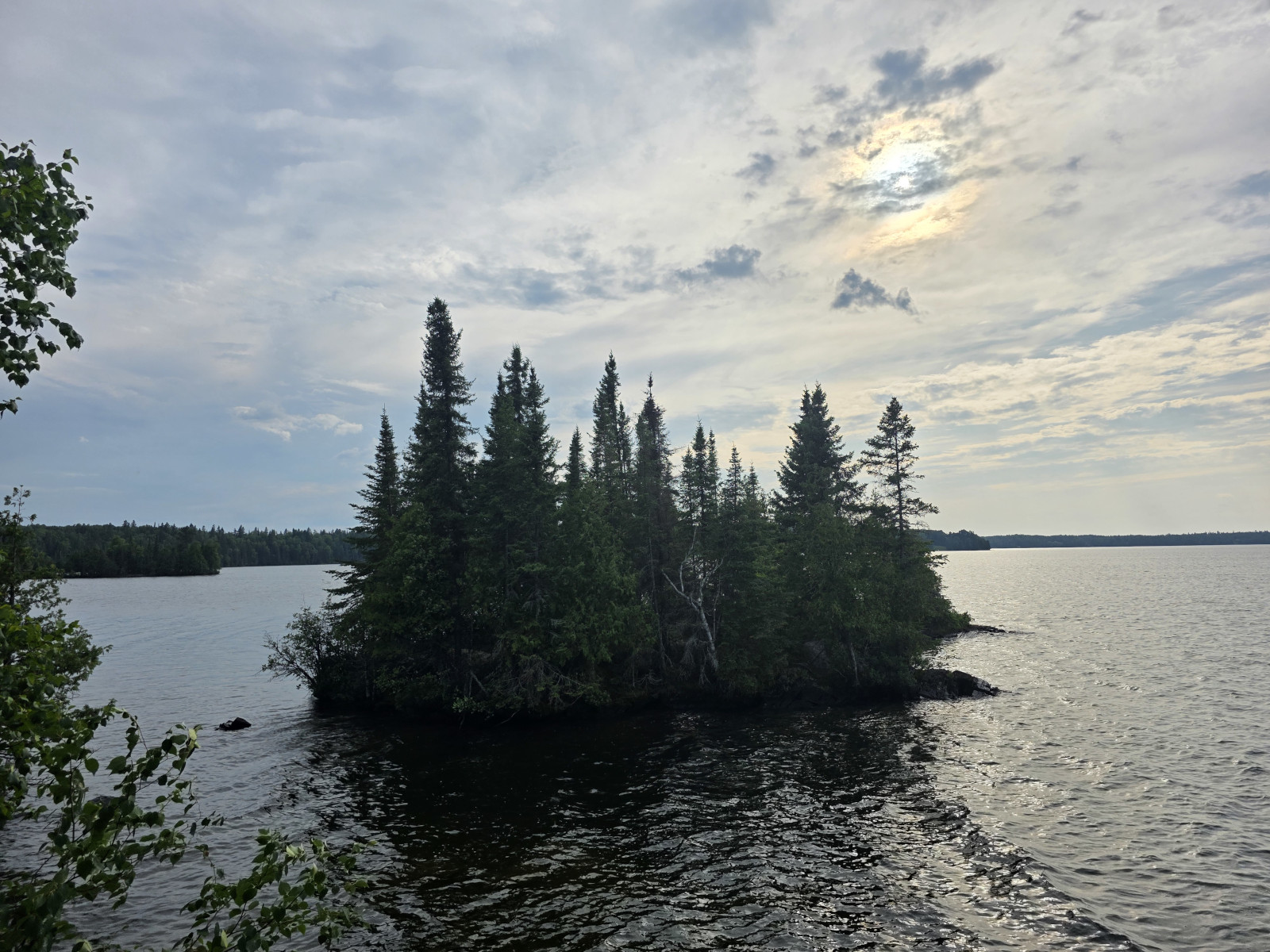
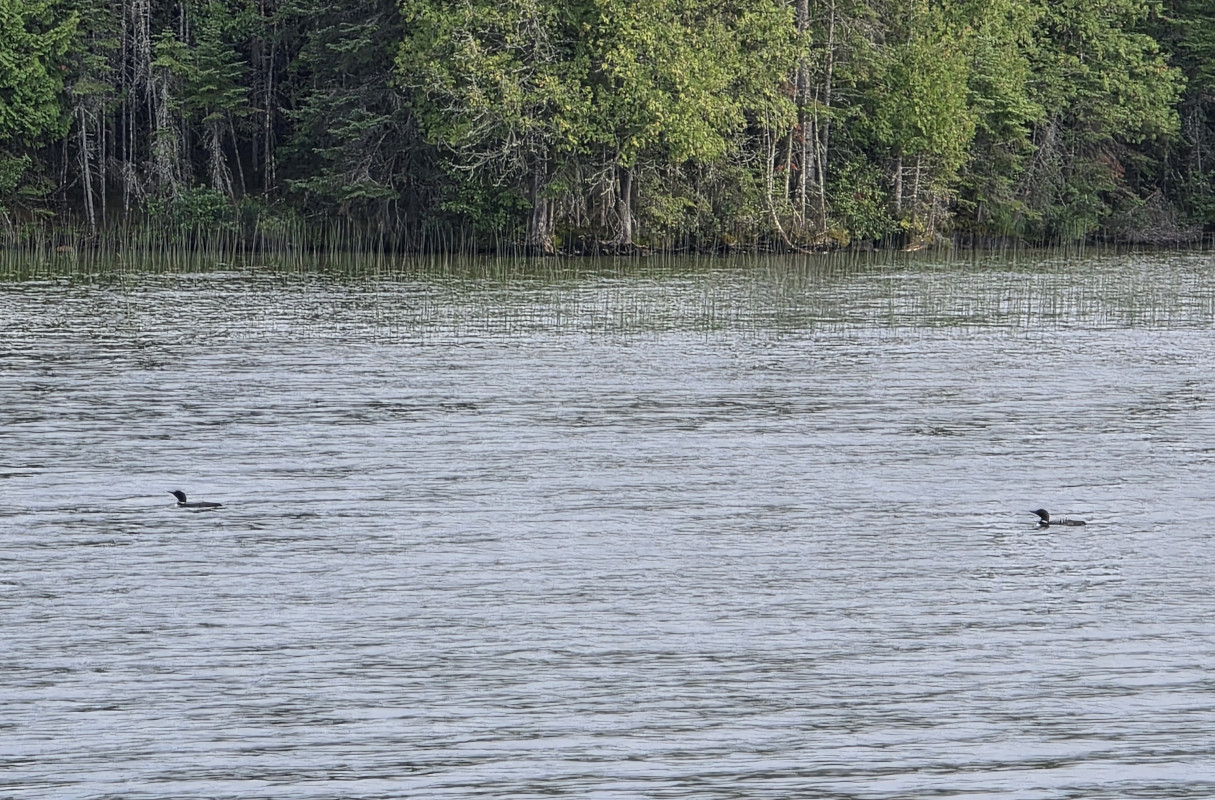
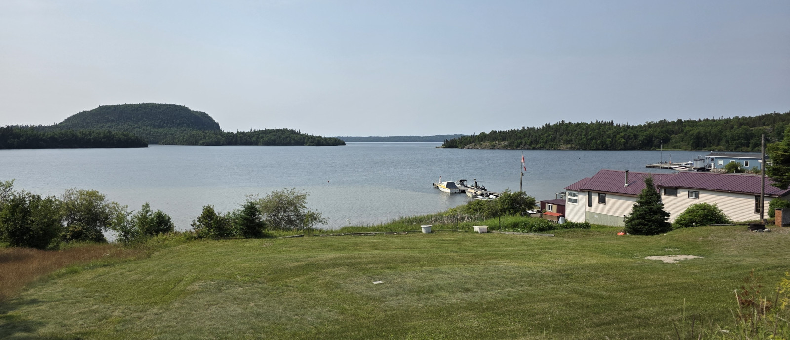
Since we’ve done this journey so many times, we had started a journal stating what sites or stops we should check out at various mile markers. We stopped in Ontario at one of the picnic stops that was along a lake but it turned out not to be as spectacular as we had thought. Our final destination for the first night was Aaron PP just east of Dryden Ontario, which we had been to before. Our electric site was quite large and very separated from any neighbours. After we setup we did a hike out to the peninsula point and then hiked on the Cedar Trail loop. The campground was quite full with a mix of seasonal and overnight campers. The views of the lake and islands, the calls of the loons, and the partially setting sun were quite nice.
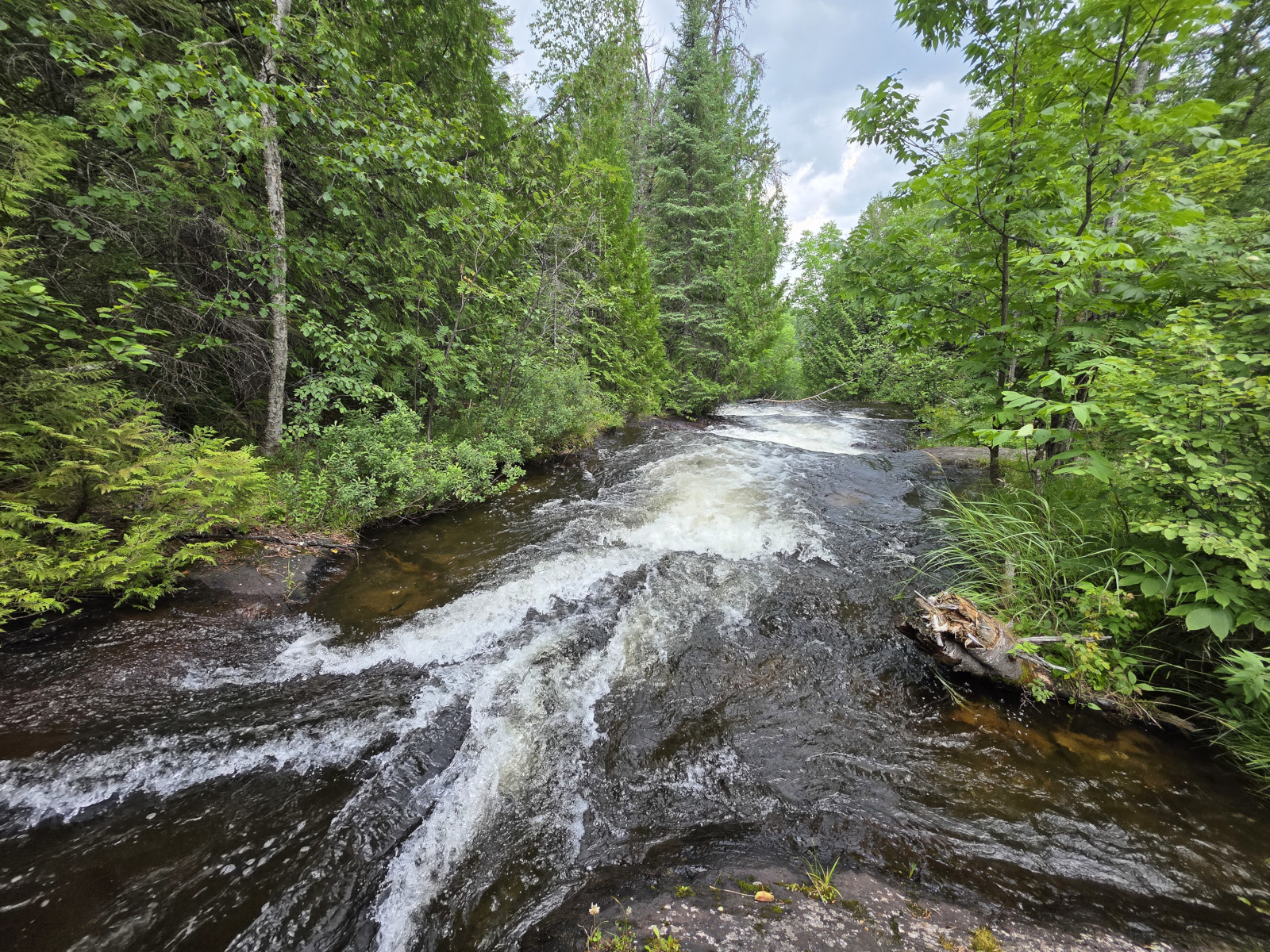
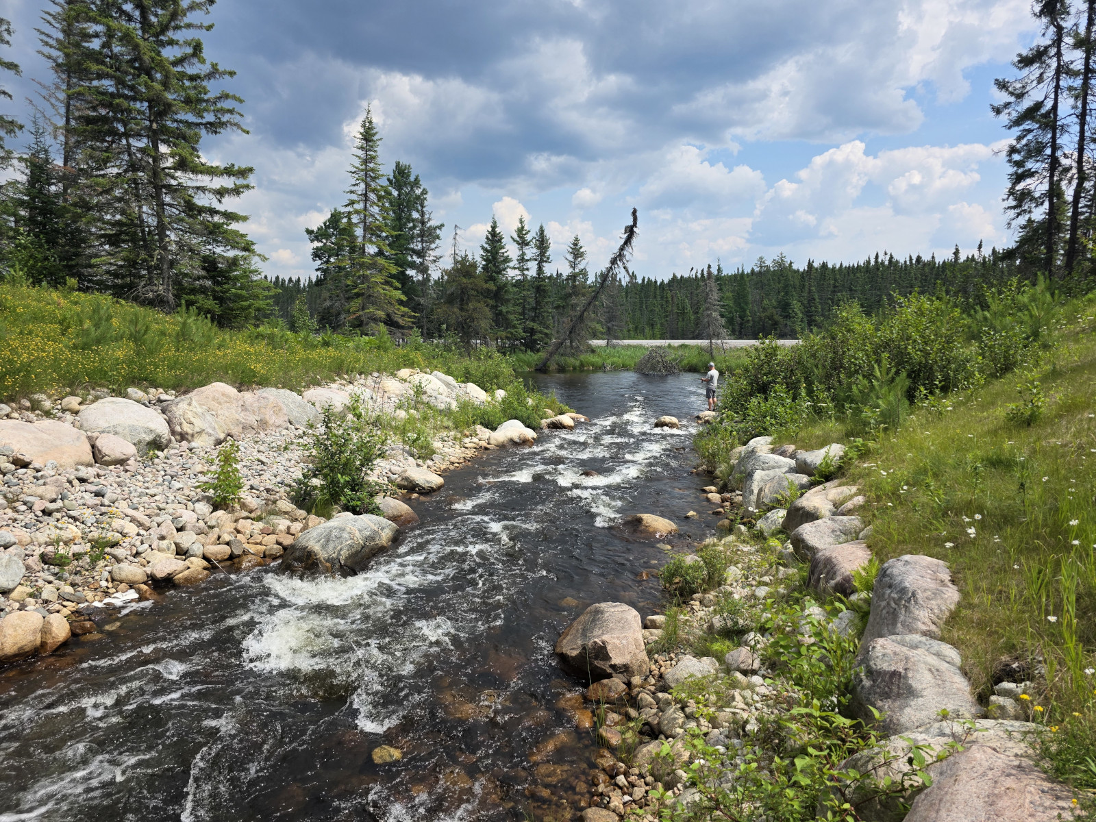
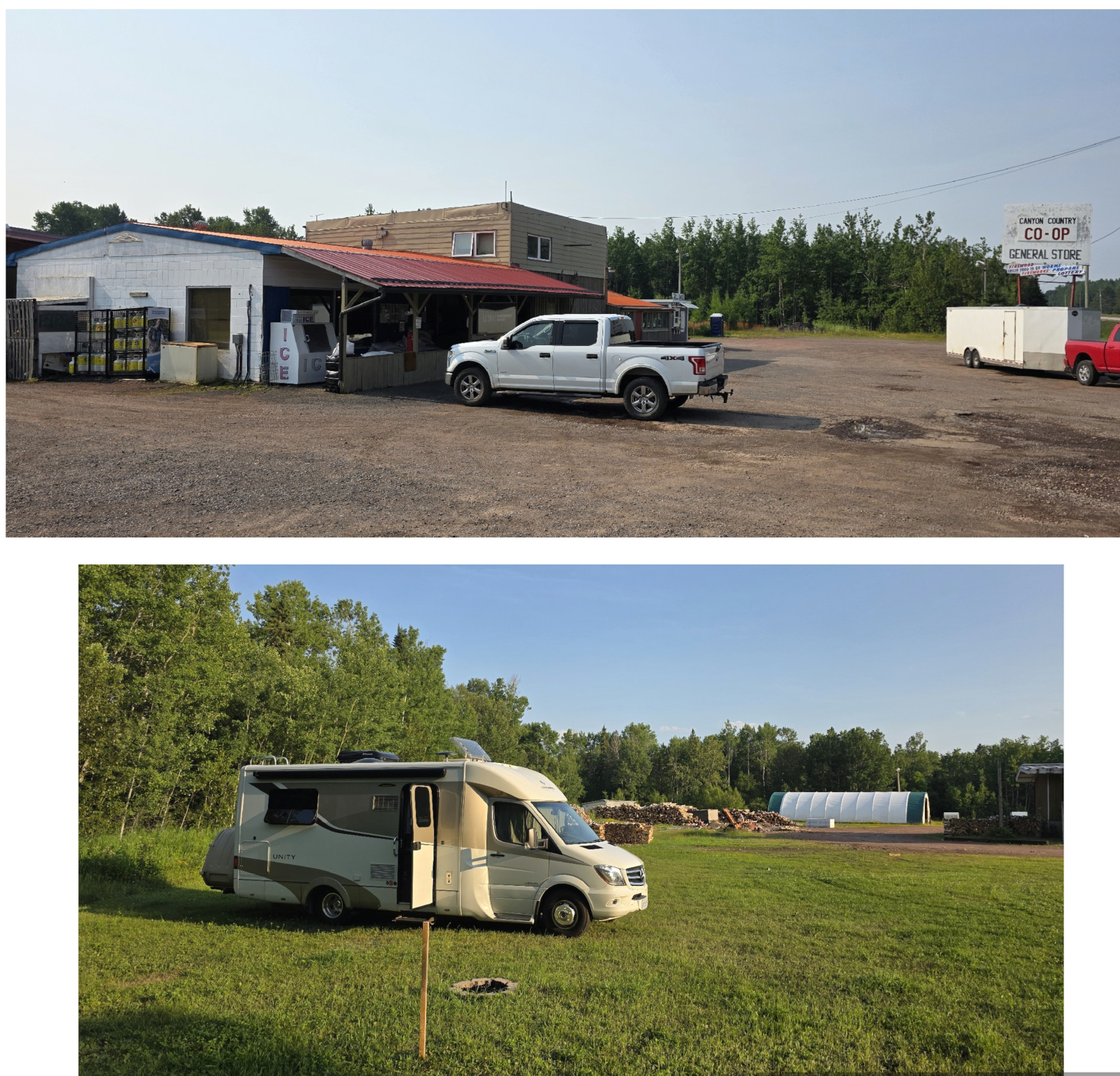
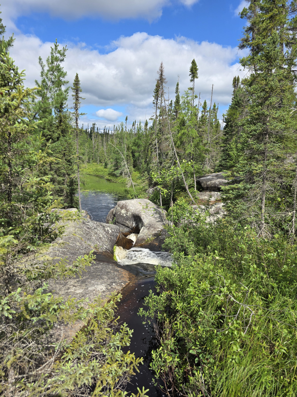
The next day we tried another new stop for us which was a picnic area called Raleigh Falls east of Ignace. A small but beautiful cascade with a fast-moving river and apparently a good spot for fishing. Then we had lunch at a pretty location along tannin coloured Lodge Lake, this one was definitely worth the stop. Our destination that evening was past Thunder Bay in Dorian where there was a Harvest Host location called Canyon Country Coop. The description said they had a Grill Shack that served burgers so that is what we had planned for dinner. However, when we got there it was closed for the day as the cook had an appointment, so we had to get creative with some leftovers. We parked at the far back of the lot behind a large Class A motorhome and the Trans Canada Highway noise was really not that bad for the night. Since the general store also had a liquor store, I was able to buy several local beers I hadn’t tried before from Sleeping Giant Brewery.

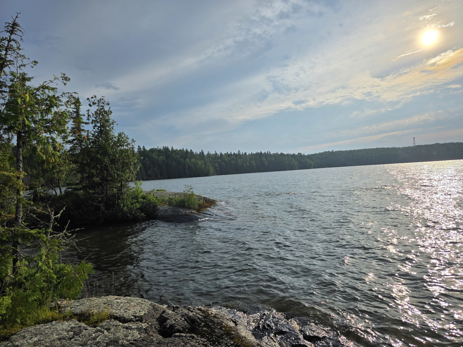
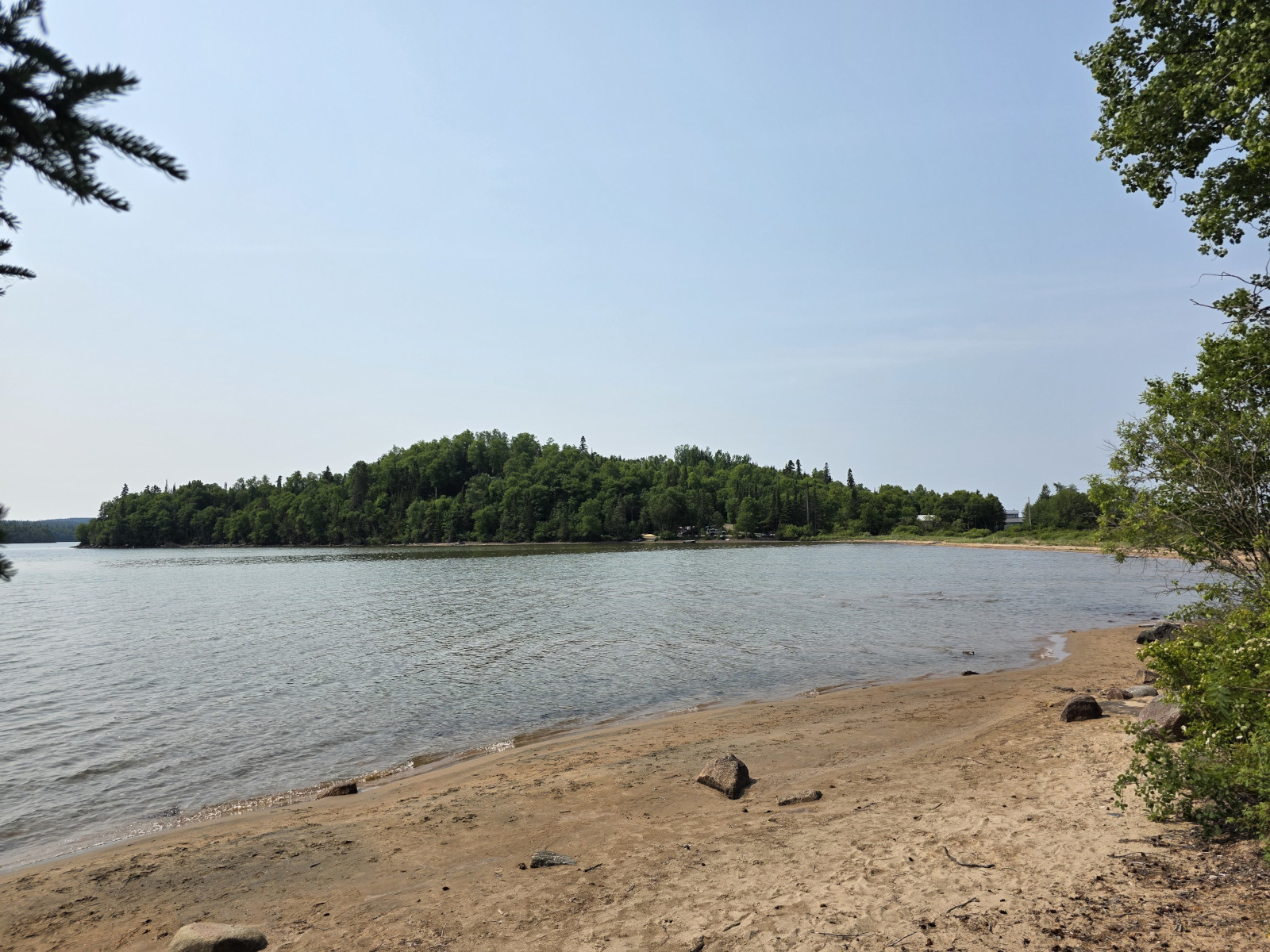
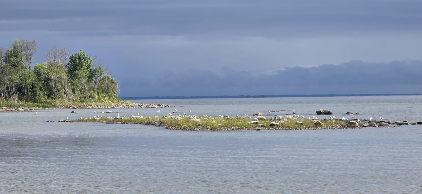
Our first stop the next day was the little village of Rossport as they had a park along the water with another one of the Group of Seven easels. Rossport is the site of one of the finest harbours on the north shore of Lake Superior due to the offshore islands that protect it from the large waves Lake Superior can generate. Here are some fun facts about Lake Superior:
- Lake Superior holds 10% of the Earth’s surface freshwater – enough to fill all the other Great Lakes plus 3 more Lake Erie’s.
- Lake Superior was created when glacial meltwater filled a billion-year-old volcanic basin 10,000 years ago.
- A drop of water takes almost 2 centuries to circulate in Superior before exiting the lake’s only natural outflow which is the St. Mary’s River in Sault Ste. Marie.
- Climate change has been warming Lake Superior by 1 degree every decade since 1980.
- Lake Superior contains 3 quadrillion gallons of freshwater – enough to cover the North and South American continents in 1 foot of water.
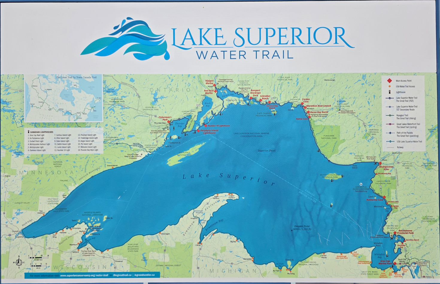
In the park we saw some sign boards about the Lake Superior Water trail which covers 1000 kms and just after reading the board we saw two people launch their ocean style kayaks to go for a day trip.
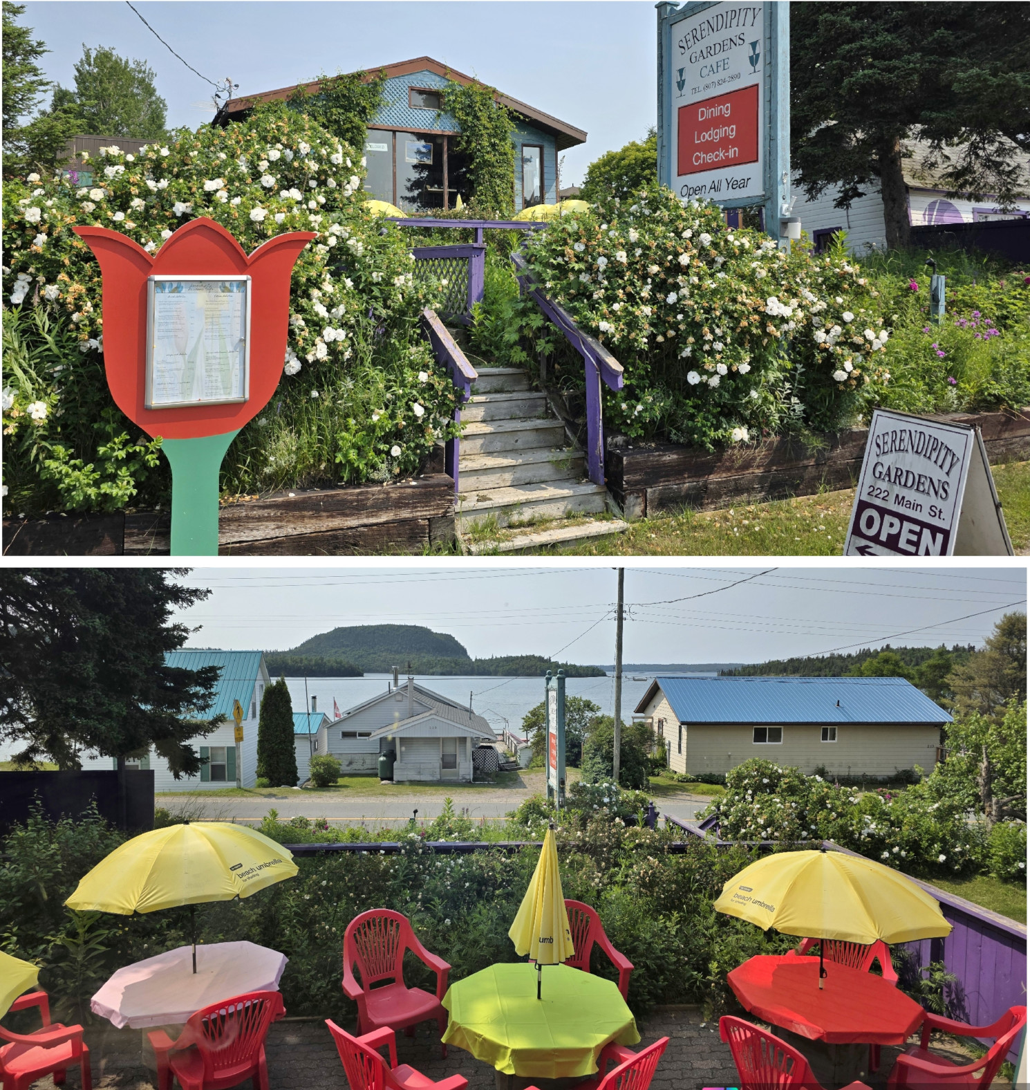
Sharon had read about a highly rated restaurant called the Serendipity Gardens Café that was scheduled to open at noon, so we decided to hang around and go there for lunch. It turned out the chef was late that day, but the server kept us interested with some local history and about life on Quarry Island where she lived. The food was phenomenal, I had the Baked Lake Superior Trout, and Sharon had the Smoked Salmon sandwich with a side salad. For dessert I had the Lucious Lemon Cake and Sharon had the Mile High Chocolate Cake. We will definitely return to this amazing little restaurant if our timing works well to visit Rossport on a future trip. Sharon even said it doesn’t matter what time of day it is, she’s returning for the Mile High cake!


We carried on from Rossport and when we drove through Nipigon we had a bit of a panic moment. There was an electronic board as you entered town that said Highway 17 south of Wawa had been closed to all traffic due to a road wash out. Since that’s the main road we would normally drive, we decided to pull over and do some research. One option was to turn Northeast after Nipigon and take Highway 11 but that would mean cancelling our booking for Thessalon, cancelling our ferry from South Baymouth to Tobermory, and driving a huge extra distance to get home. The second option we found was to turn in Wawa and take Highway 101/129 to bypass the area affected. It was only an extra 35 kms to do this and it would allow us to visit some more new places, so we decided to plan that option. In the meantime, they did get 1 lane open on Highway 17 later that day, but we wanted to avoid that traffic congestion. The drive south from Nipigon was very light in traffic both directions due to the closure. As we got closer to Wawa, I did see a mother and baby moose cross the highway, but it was too far in the distance for Sharon to get a picture. Our destination for that night was a Harvest Host called Algoma Highlands Wild Blueberry Farm and Winery in Wawa. We were very surprised when we arrived there as they had 6 other Harvest Host guests staying in the field by the building. This was the most campers we’ve ever seen at a Harvest Host location. We sampled the wine and purchased wine and some other food products.
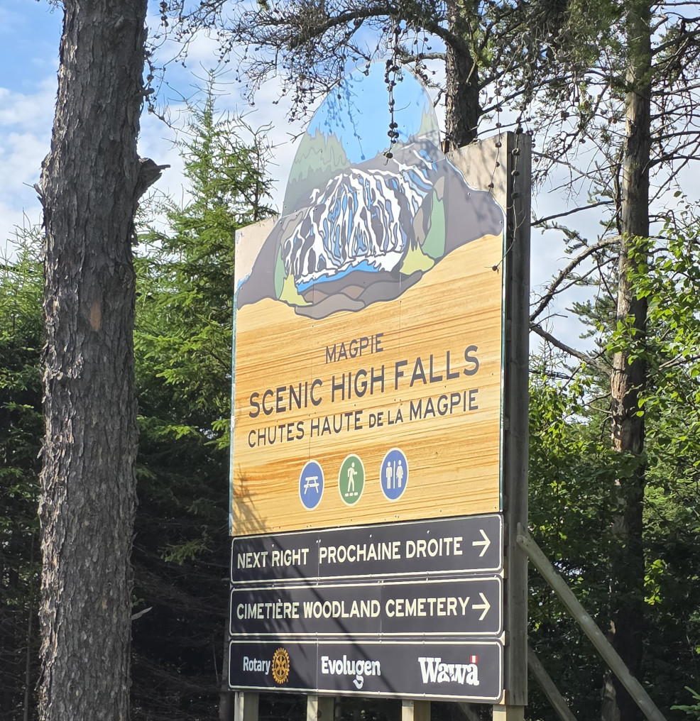
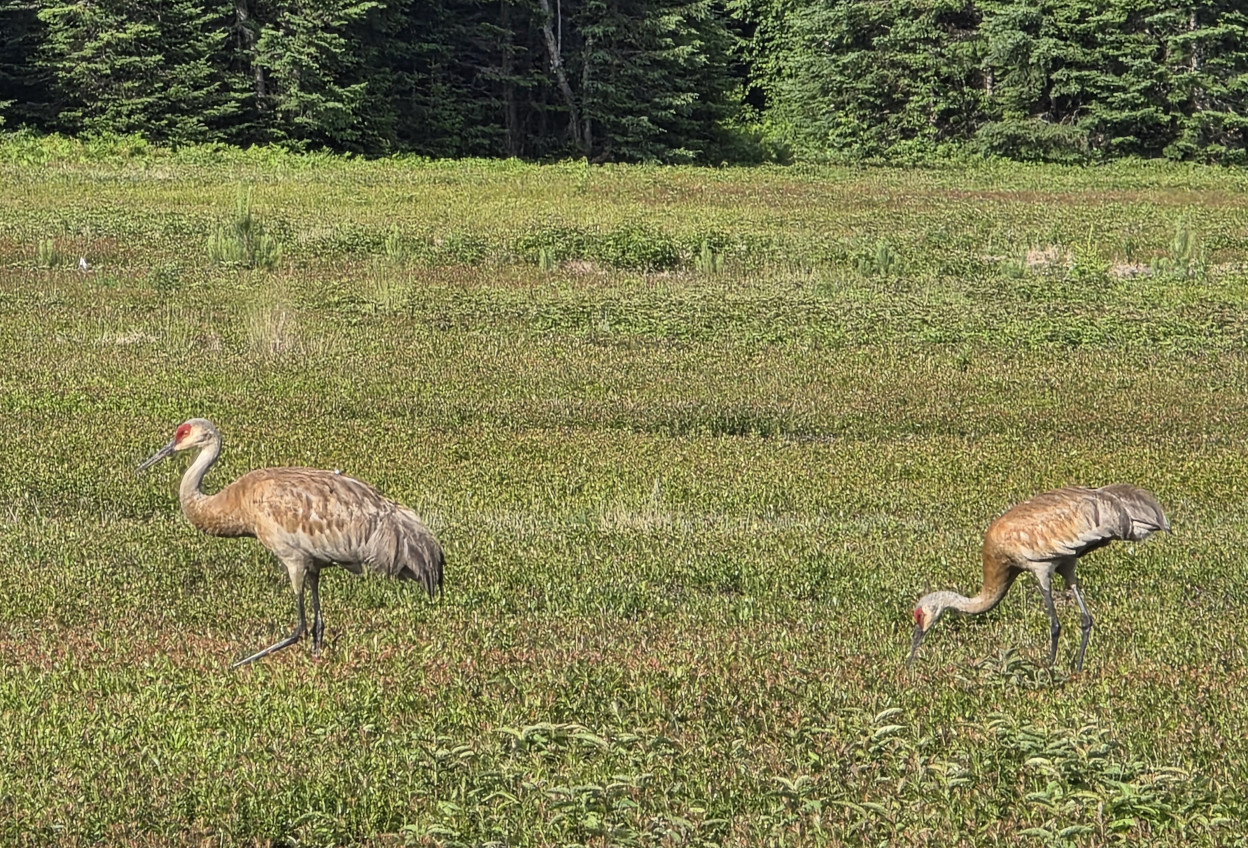
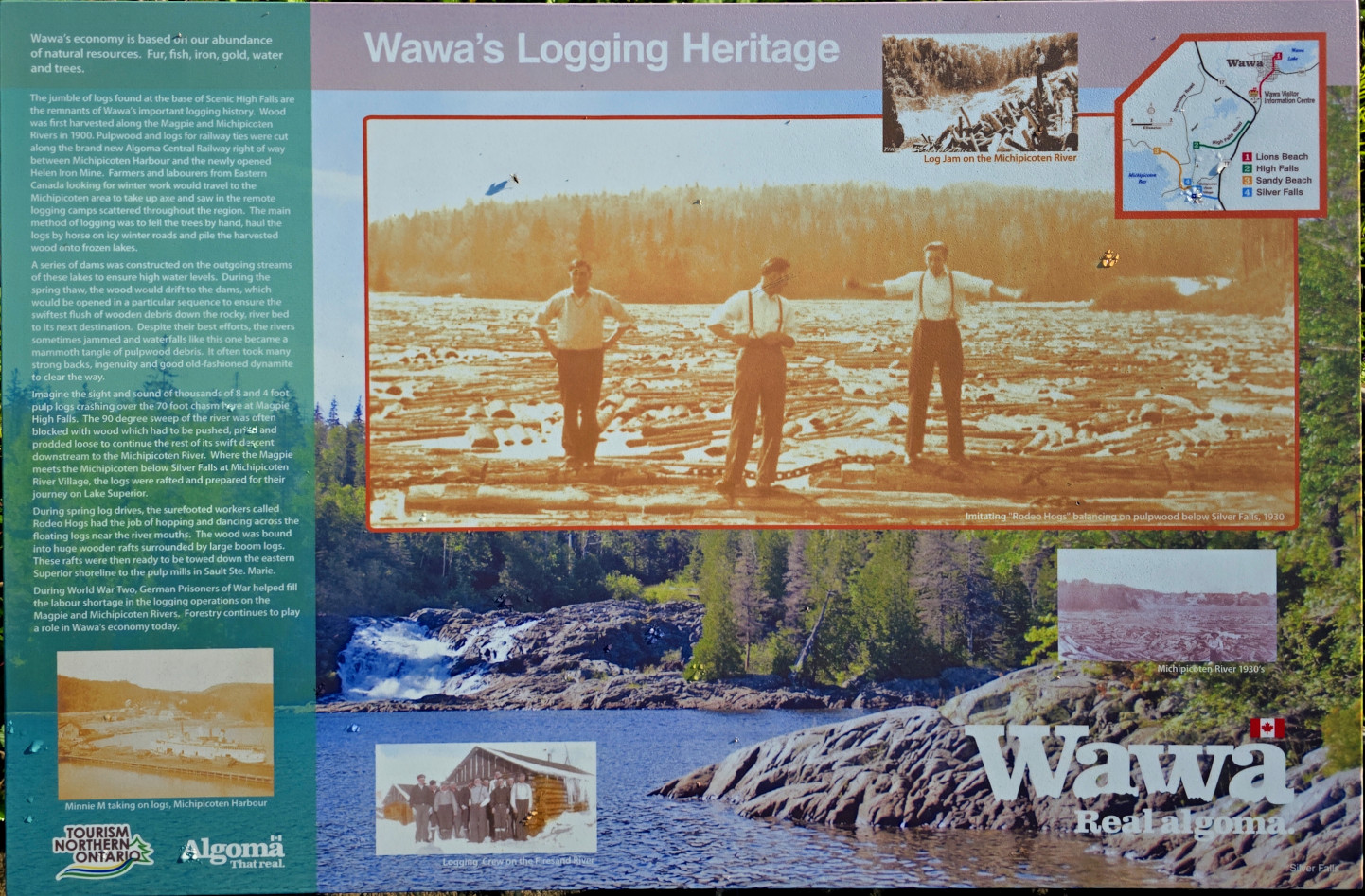
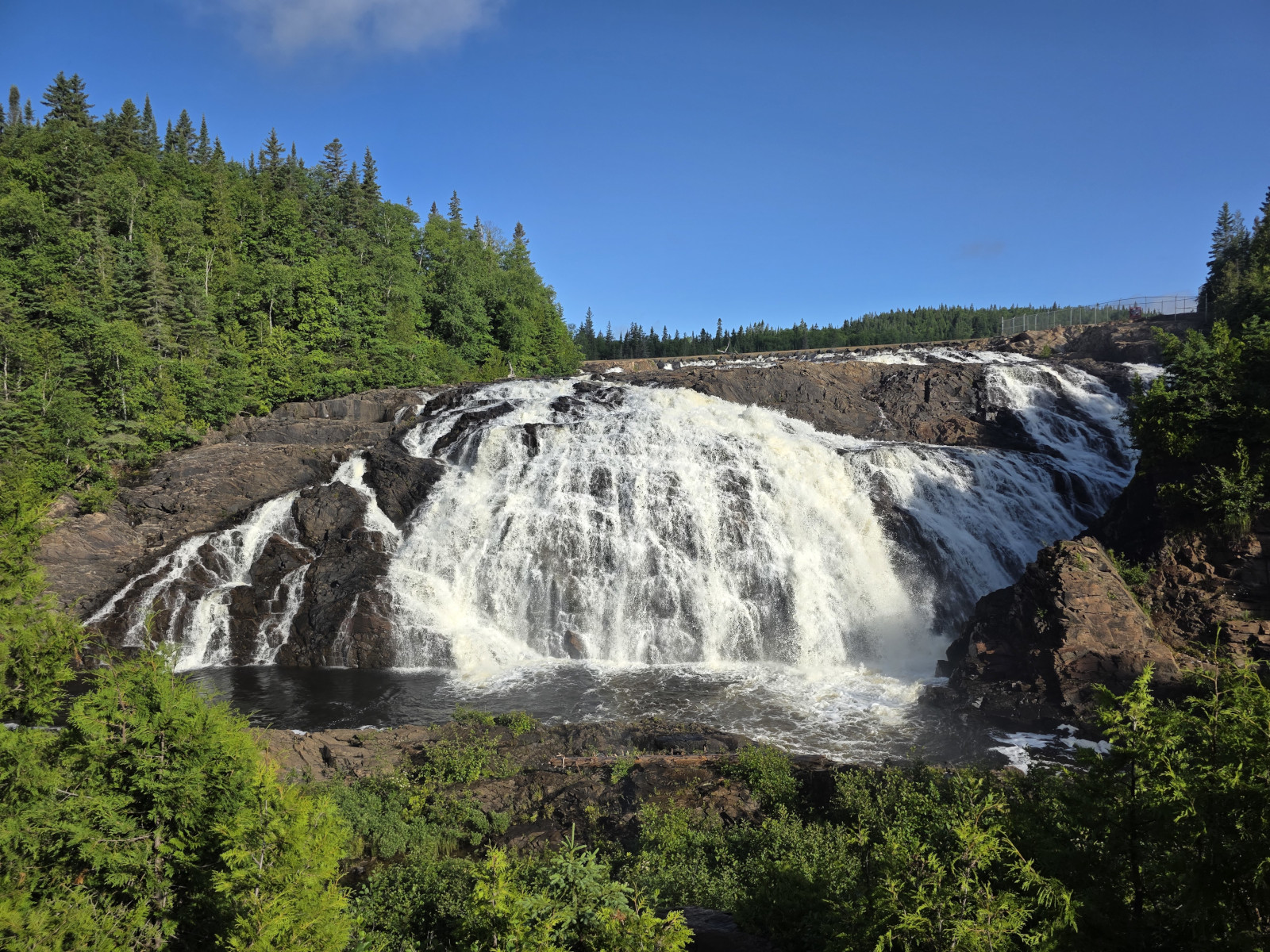
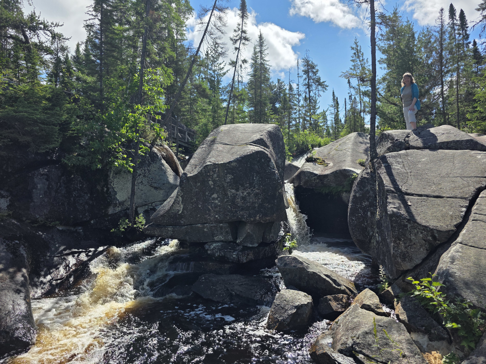
The next morning it was sunny (it had been raining the night before) so we decided to take the really rough gravel washboard road to High Falls. The road and fields to the falls were owned by Algoma Wild Blueberry Farms. We saw several Sandhill Cranes feeding in the fields. We were the first to arrive at High Falls that day and the sunlight was just starting to hit the falls, so it was quite picturesque. They had a display board about the logging in the area and about the dam construction to control the water flow for the logging. In addition, they had display boards about many prominent people from the Wawa area. One was about Glenn Gould the iconic Canadian piano virtuoso who loved the North and made frequent trips to Wawa, always staying in the same hotel room at the Wawa Motor Inn.
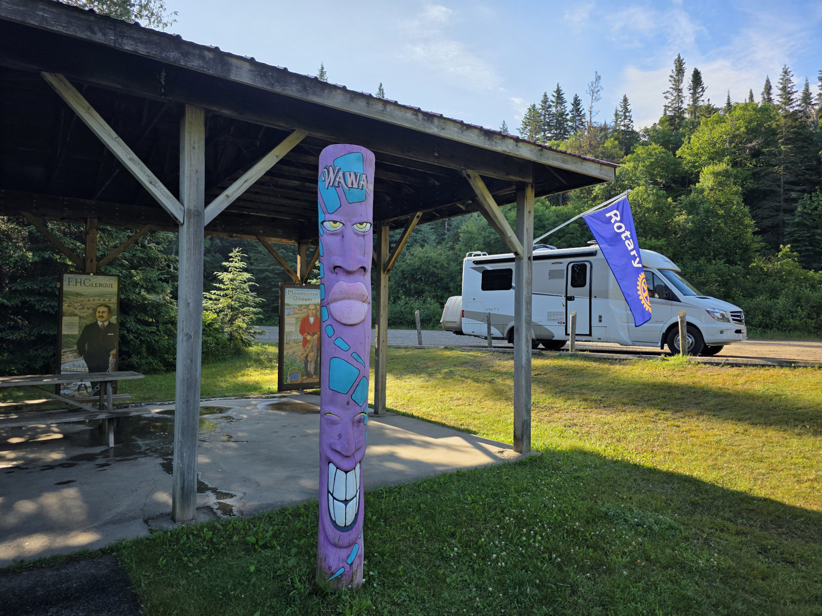


We drove back through Wawa and saw all the Goose statues and then started on Highway 101 east. The road had cliffs, forests and lakes so reminded me a lot of the start of Highway 11 from Nipigon that we had taken on another trip. We saw a temporary sign that said Emergency Situation Ahead and when we rounded the bend a worker stopped us and said we were ok to drive through as our lane was open. There were 2 very large tow trucks pulling a Class A motorhome out of the ditch. The shoulders all along this road were very soft so if you hit the shoulder, you would likely roll into the ditch. There were no ambulances or police cars, so we assume the driver was driving the road the night before, likely because this was a bypass for the Highway 17 closure, and got too close to the edge and crashed. The motorhome was totalled. After that scene Sharon said she didn’t want to do any of the driving along this route.
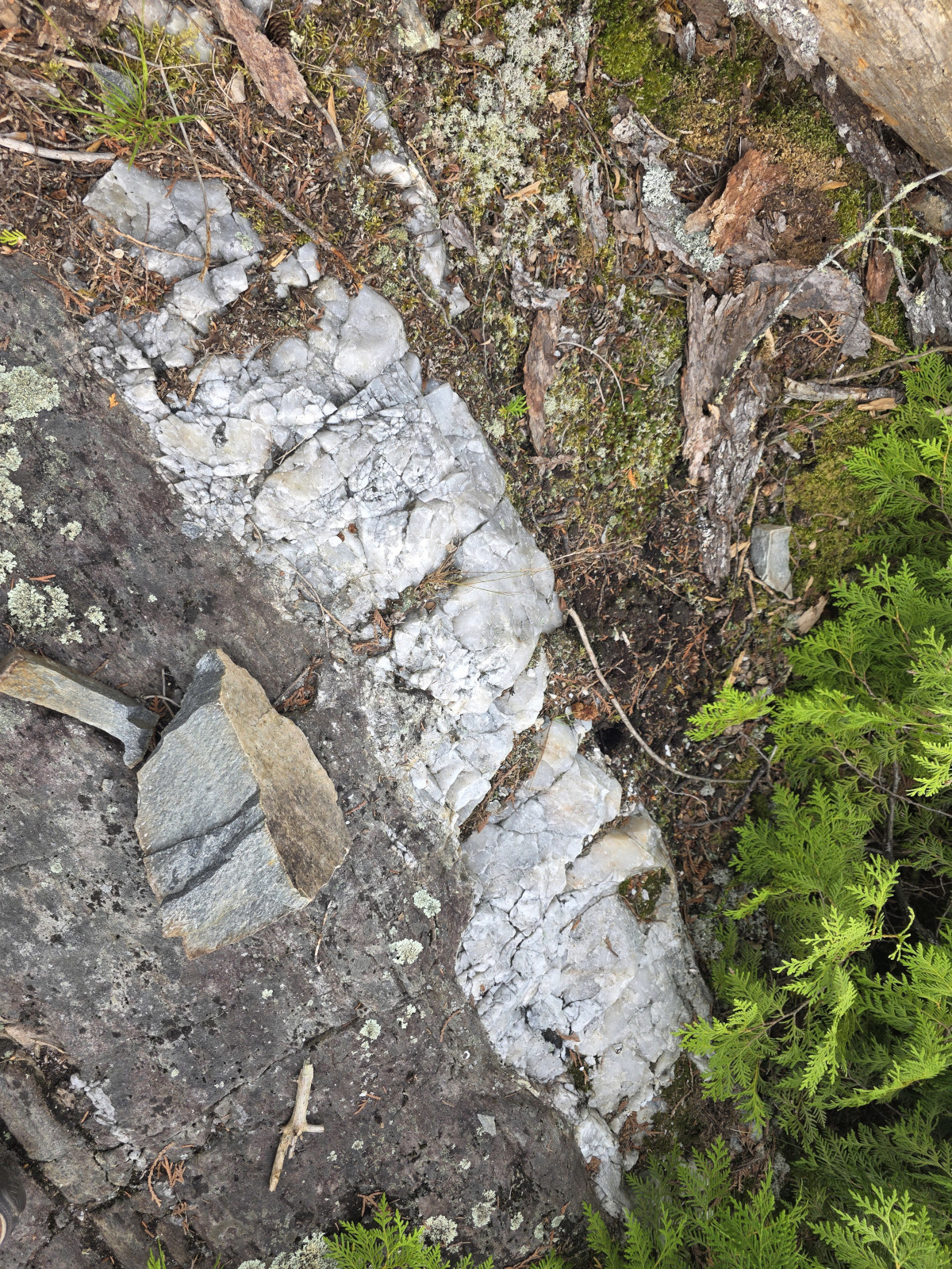
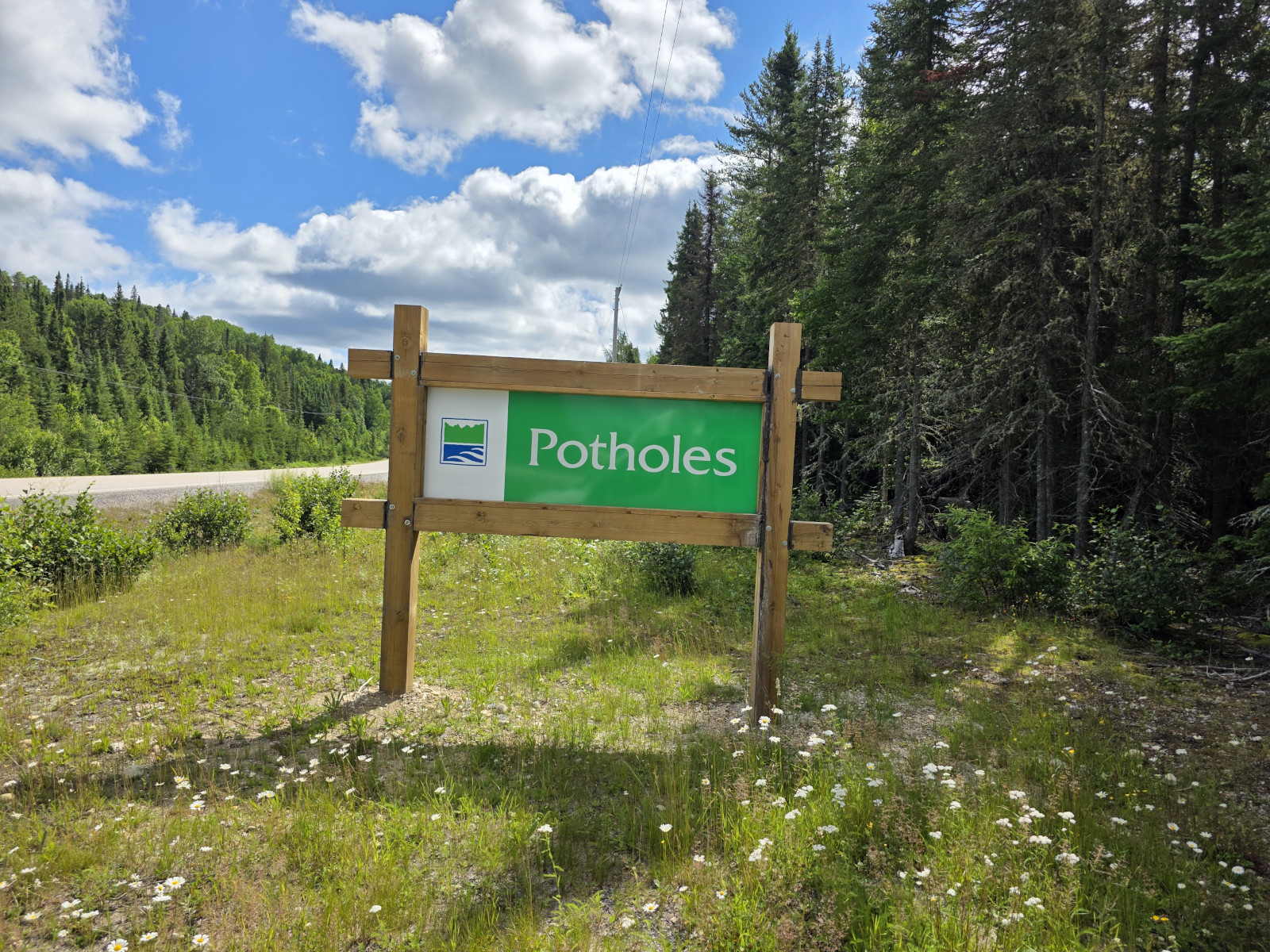
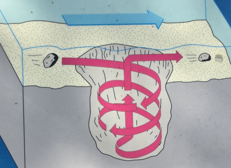
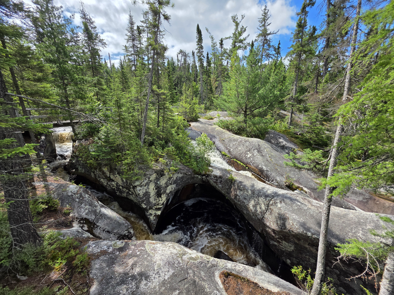
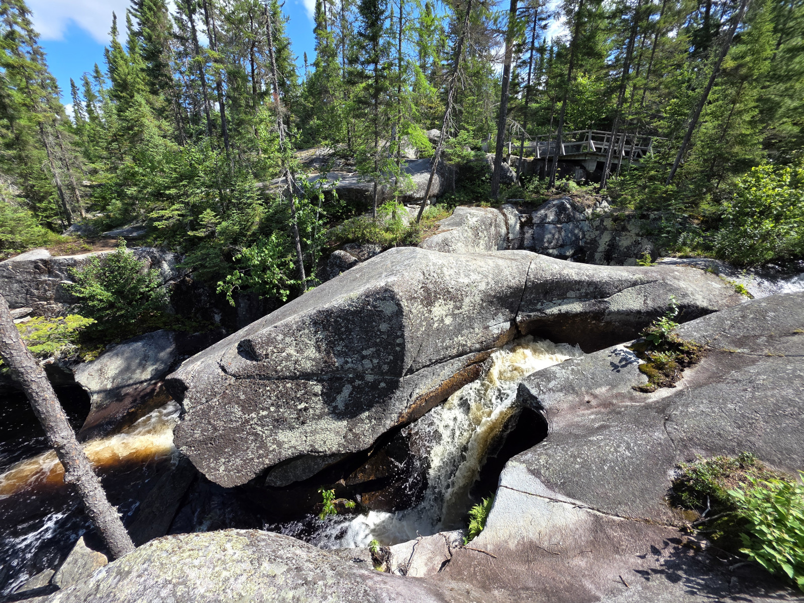
Our first stop was Potholes PP, an area set aside to preserve remarkable examples of erosion caused by glacial meltwaters on the granite bedrock. There is no camping in this park, but you can do a short hike to see the potholes carved in the Kinniwabi River. There was no one else in the park when we arrived but shortly after we saw a couple by the potholes and it turned out they lived in Chesley not too far away from where we live, small world. These potholes were much larger than the ones we see along the Bruce Trail in our area and were more interesting as the water is still flowing through them.

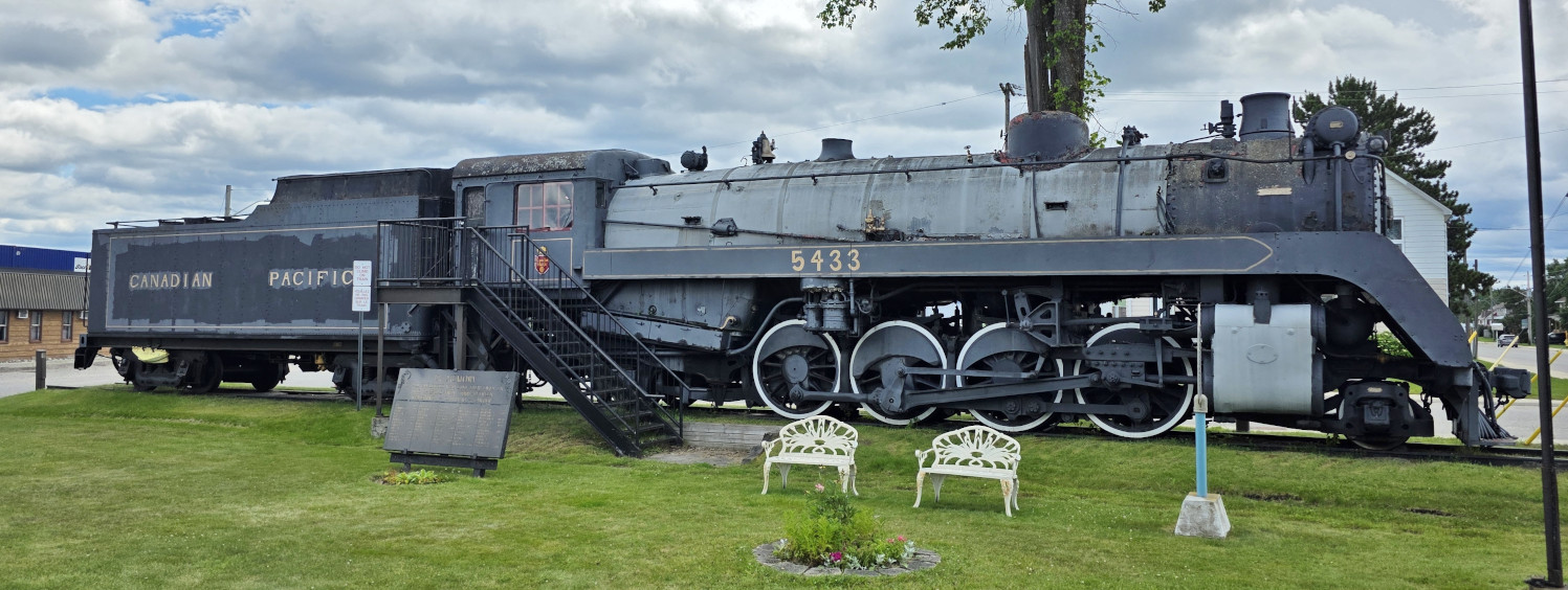
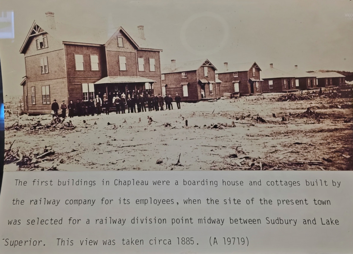
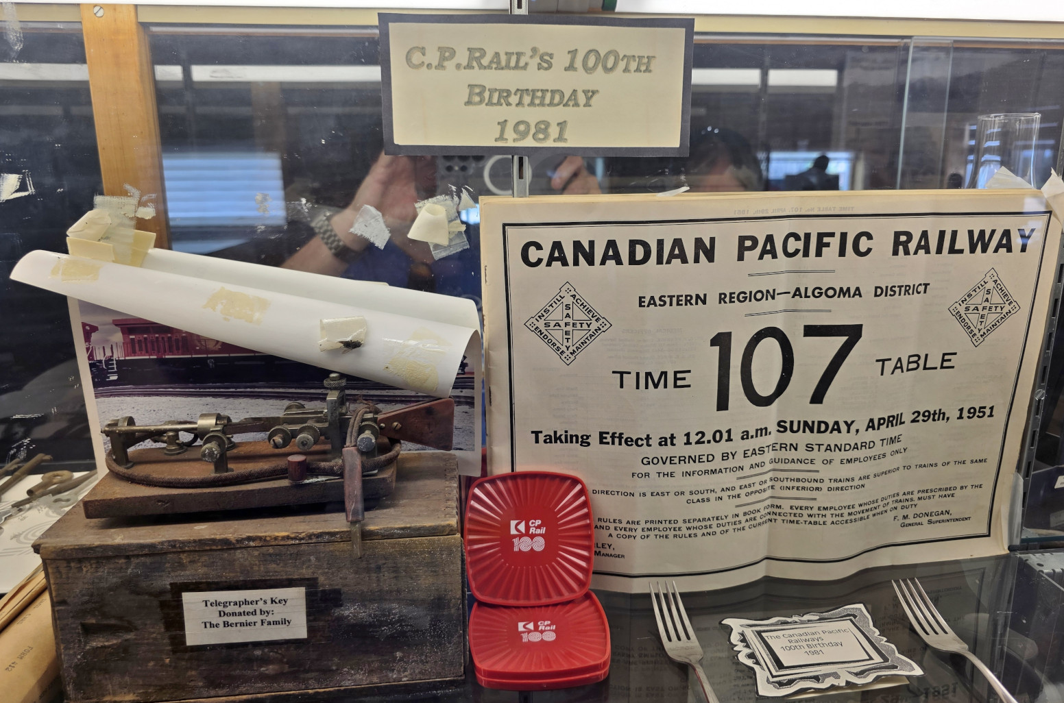
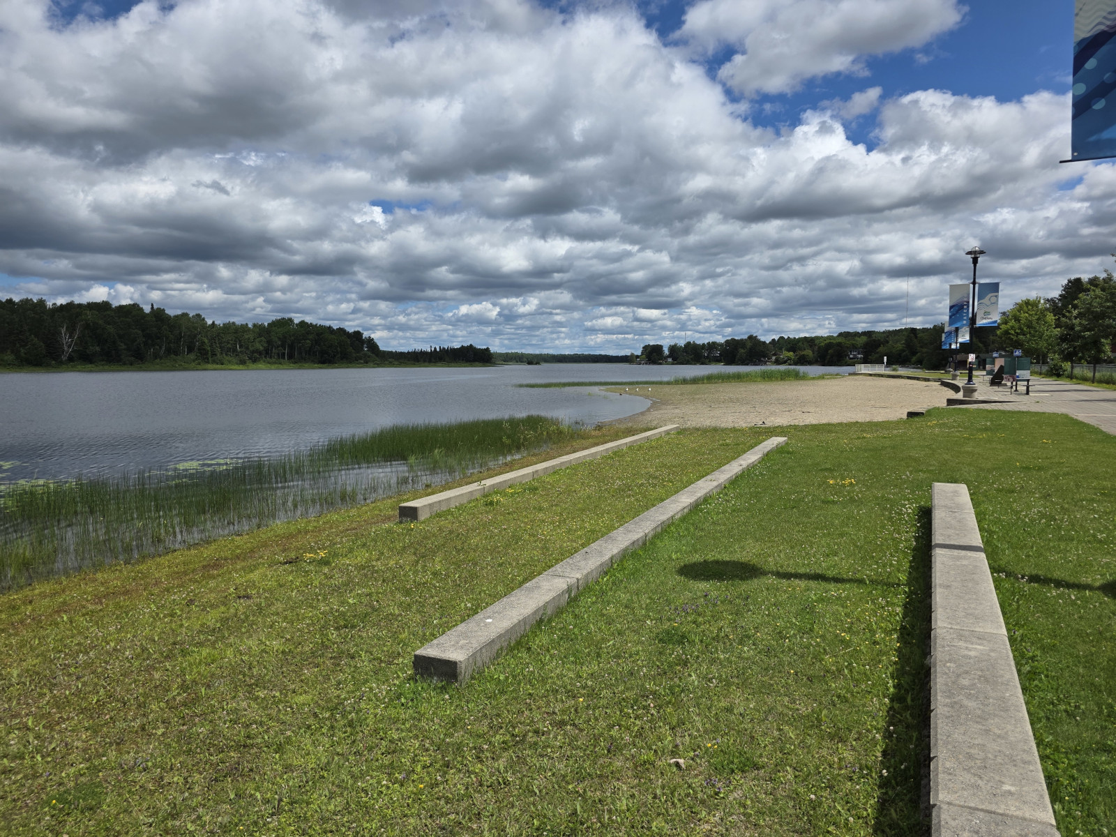
We decided to take a short detour to visit the town of Chapleau. It was a midway point on the train route from Sudbury to Lake Superior. We stopped at the visitor centre to see the locomotive placed there in August of 1964. The 2 staff in the visitor centre knew absolutely nothing about their town and couldn’t answer a single question we asked them! We toured the displays and then took the circular ramp road up and over the train tracks so we could get to the local waterfront displays and had lunch in the park. The forest industry was and still is a very large part of the town.


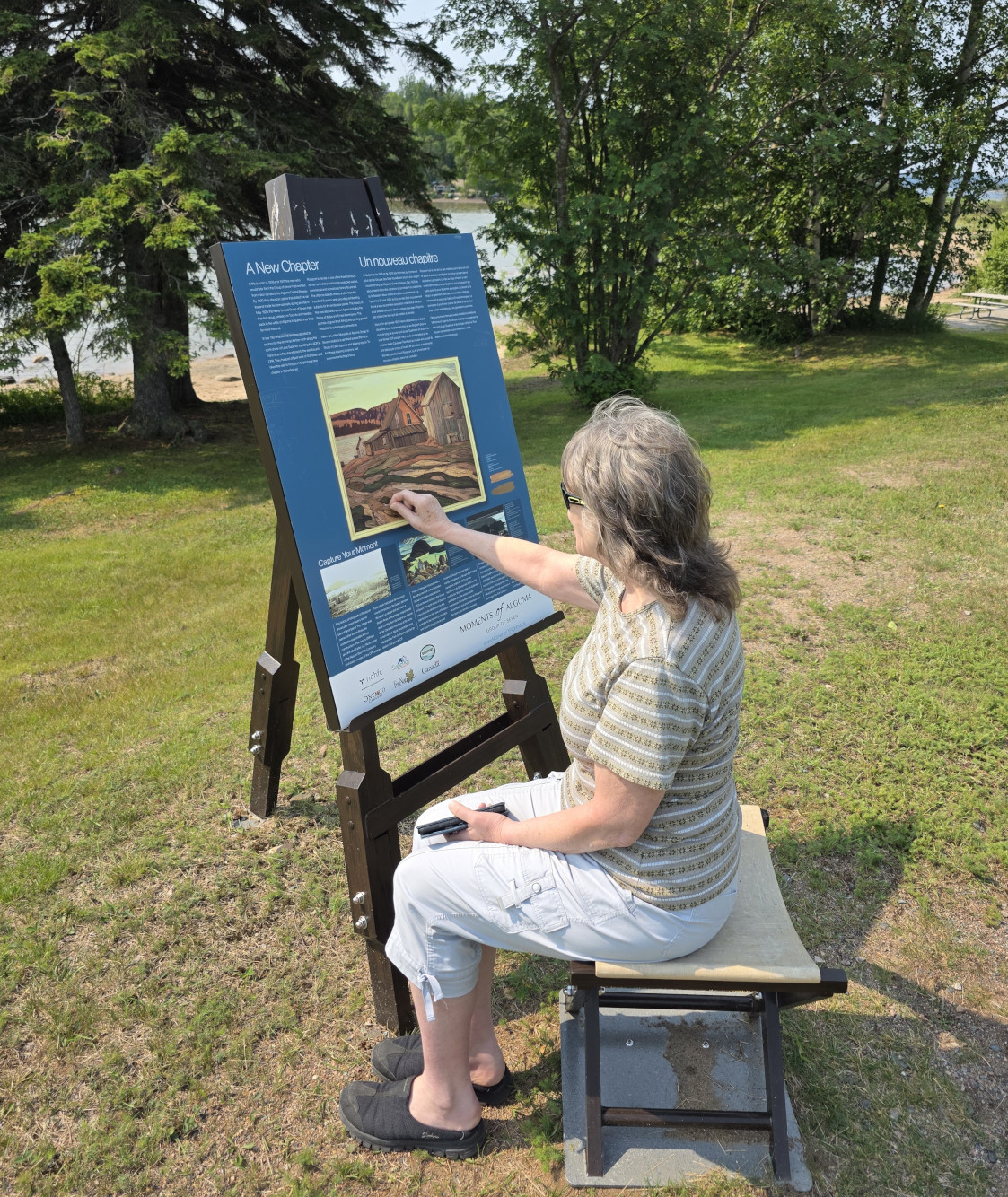
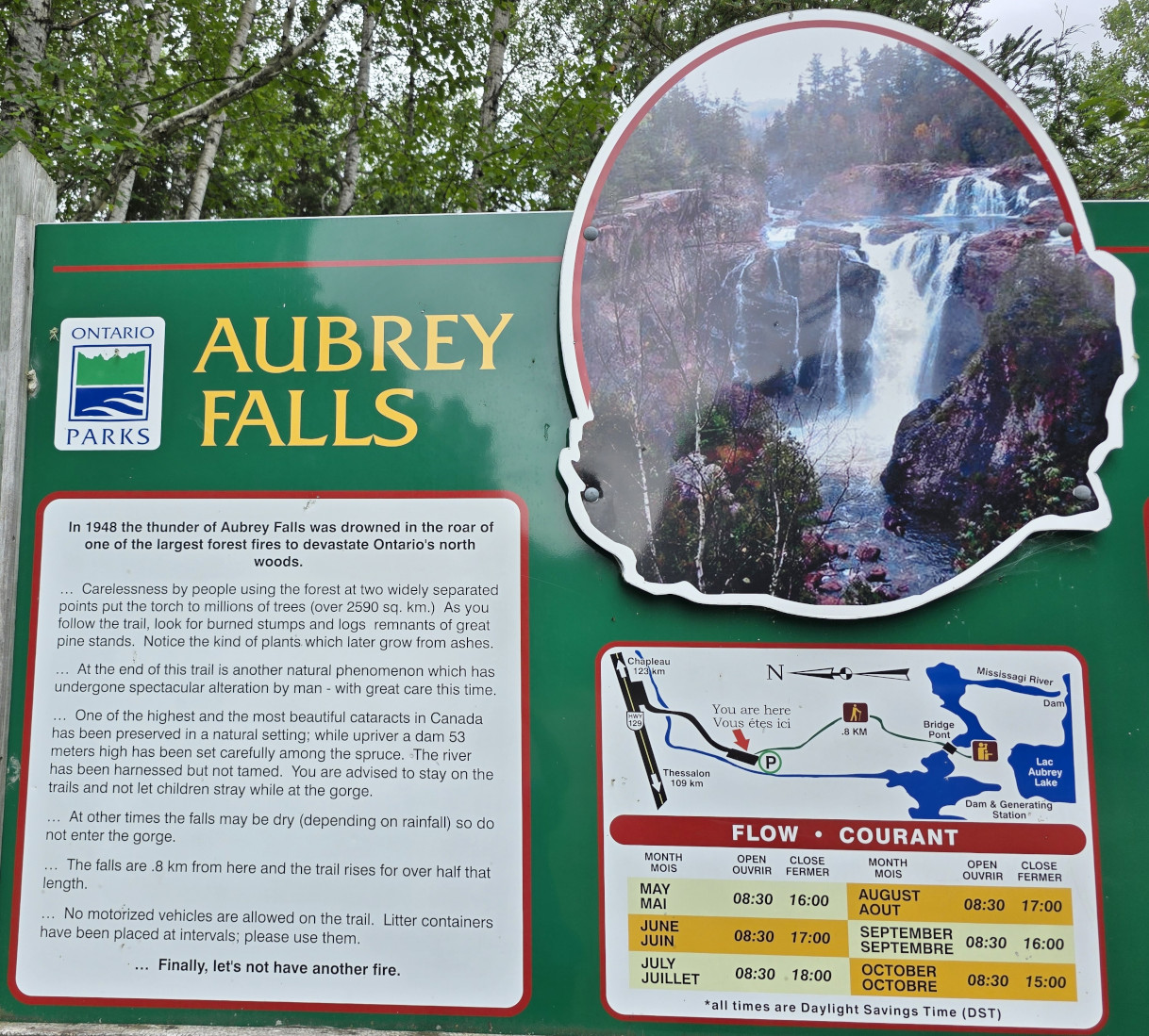
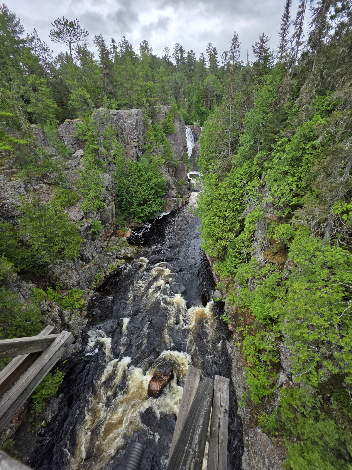
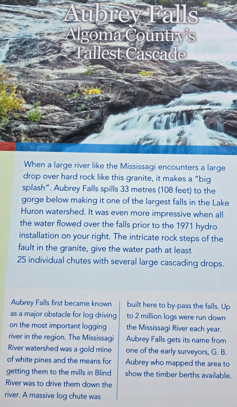
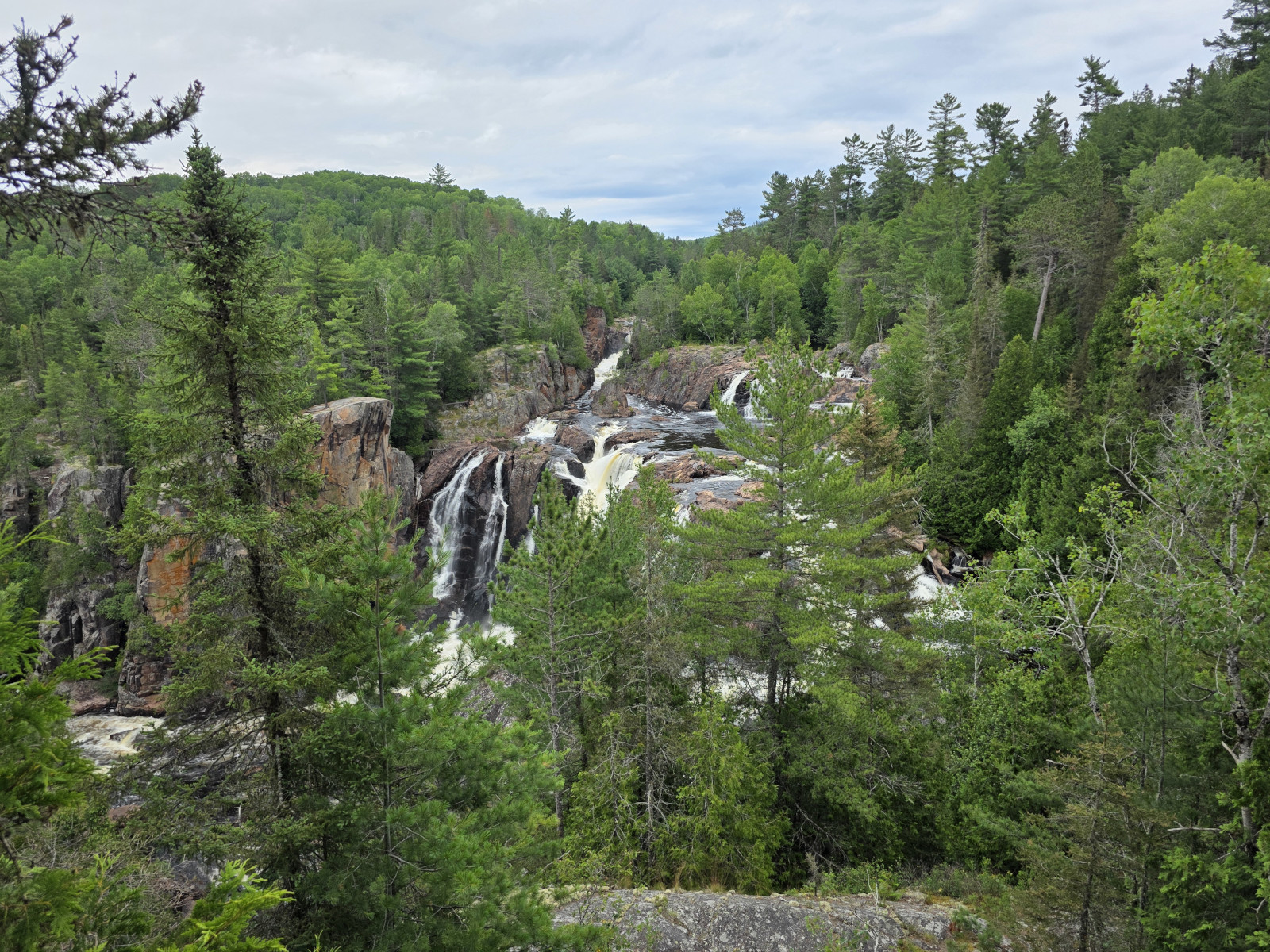
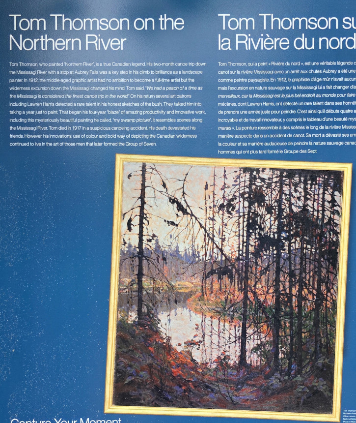
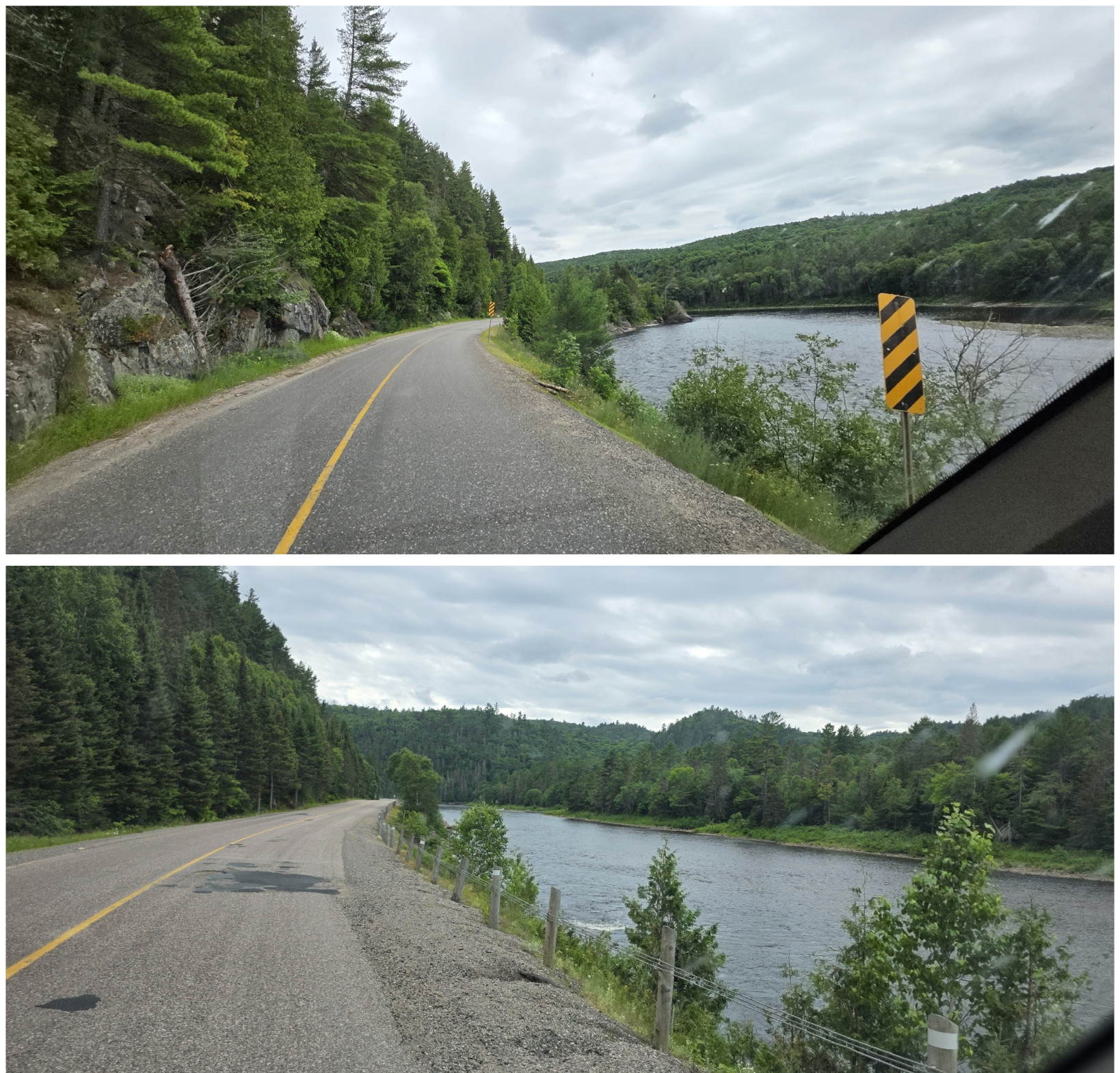
After lunch we headed south and joined into Highway 129 to complete the drive to Thessalon. This highway is called the tail of the dragon, and we would soon find out why. However, we had another stop we wanted to make which was at Aubrey Falls as they had another Group of Seven easel to see. We were glad we didn’t encounter any cars on the way in to the parking lot as the gravel road was barely wide enough for one vehicle. The hike was about 1 km but had some significant elevation gain and the forest was completely full of hungry mosquitoes. However, the view was worth it. There are hydro electric dams that now control the flow, so we were lucky to be there when the Mississagi River was flowing. Tom Thomson painted “Northern River” when he was canoeing along this river. We got our typical shot of Sharon painting at the easel😉

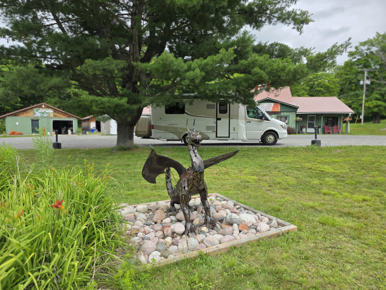
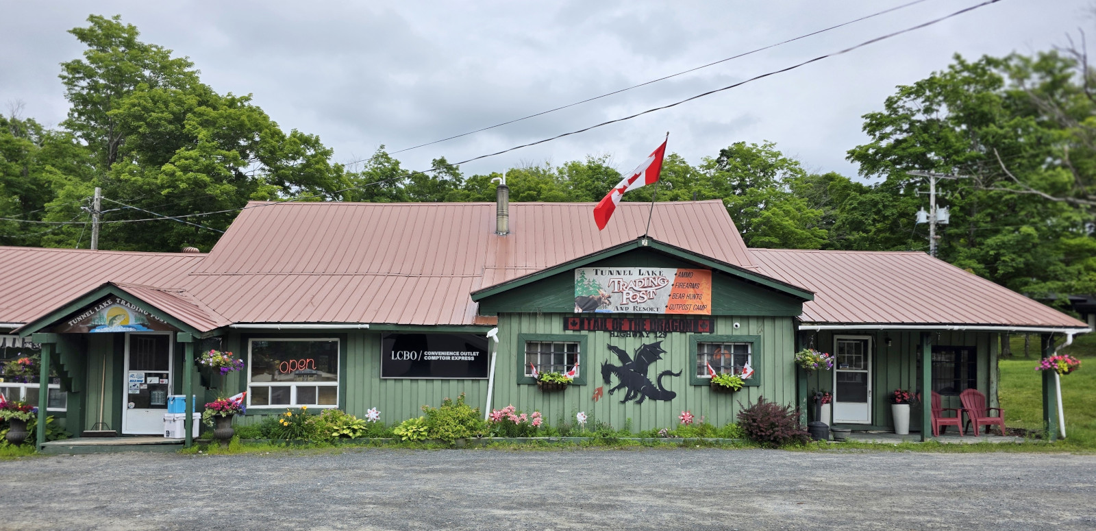
After Aubrey Falls the road lived up to its name of Tail of the Dragon. You were driving along a narrow road right beside the river with a shoulder that would take you into the river if you hit it. The road was twisty, had lots of climbs and drops, and you had to dodge the potholes! It was very challenging to drive in the RV and would have been a lot more fun in Sharon’s convertible. This same valley path is where the Algoma railway goes in the fall when people go to see the fall colours in the forest. We stopped for a quick rest at the Tunnel Lake Trading post as they had mini dragon statues, we had survived another wild ride😉
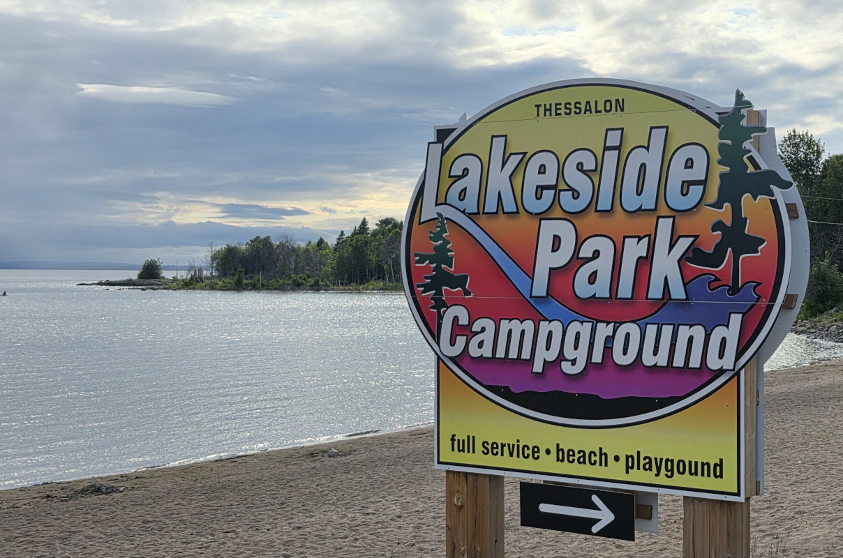
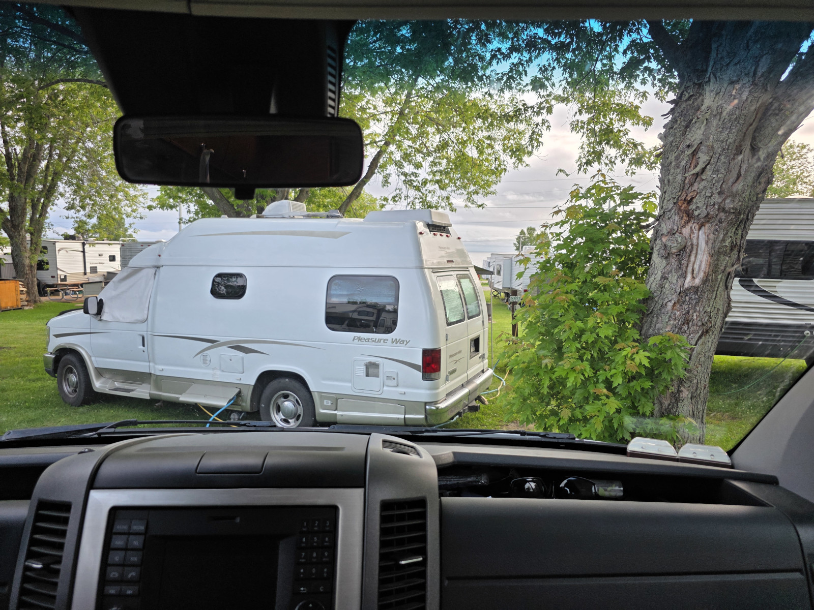
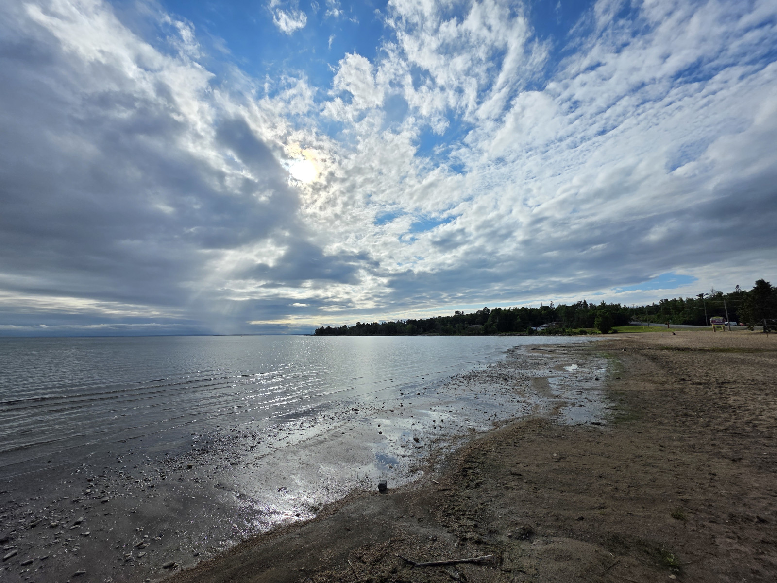
We arrived at Lakeside Park Community Campground and checked in and were totally confused when they told us about our transient campsite. We had a trailer 10’ from our side door, we had a campervan that parked directly in front of our vehicle blocking our view of the lake, and the Class C parked beside us had tied their dogs to our picnic table so we couldn’t use that space. Luckily this was only for 1 night and we could walk across the street and walk along the beach with the North Channel right there. We had really just picked this park as it had a dump station so we could clean out our tanks before returning home the next day.
I woke up very early the next day as our power went off at 6 am. I checked the pedestal but the whole campground was off. Someone finally arrived at the campground around 7:45 and got the power started again. I’m guessing we won’t return to this campground again.
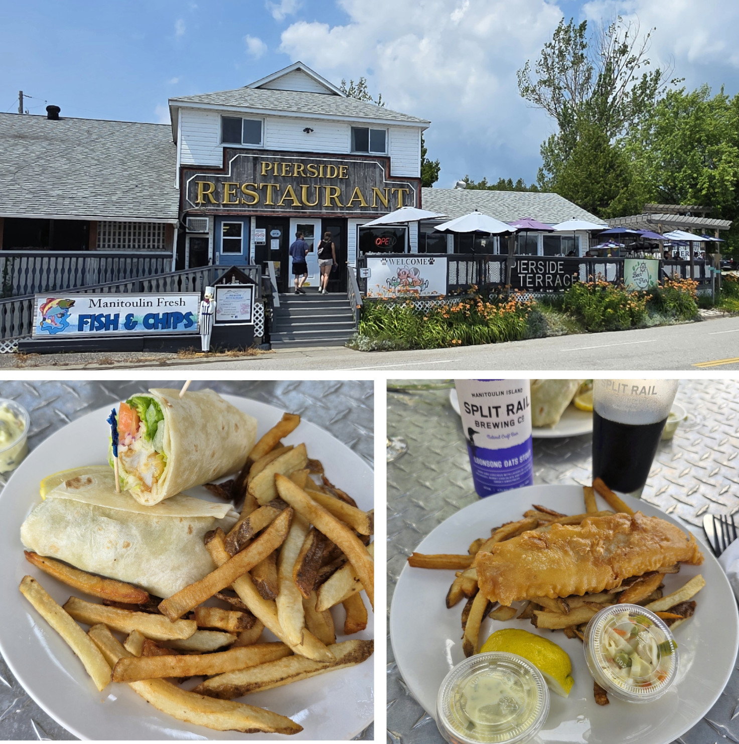
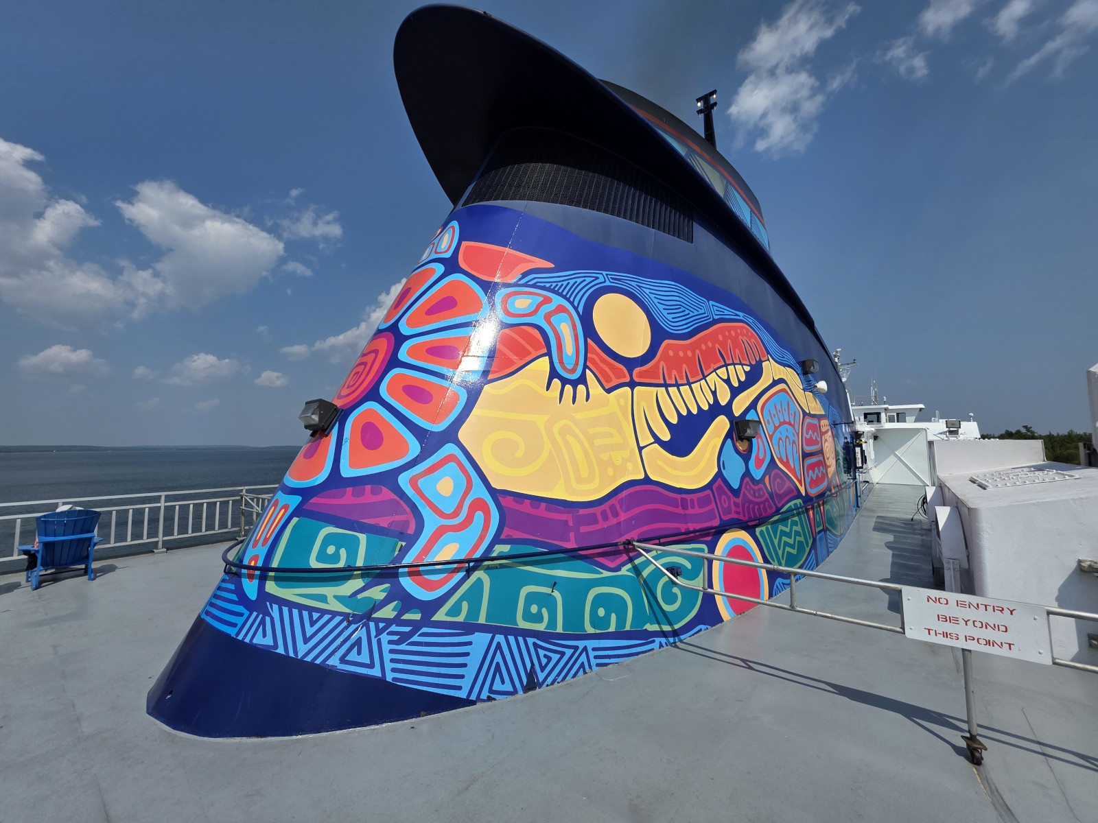
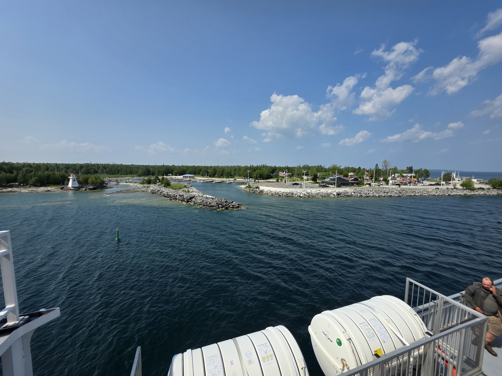
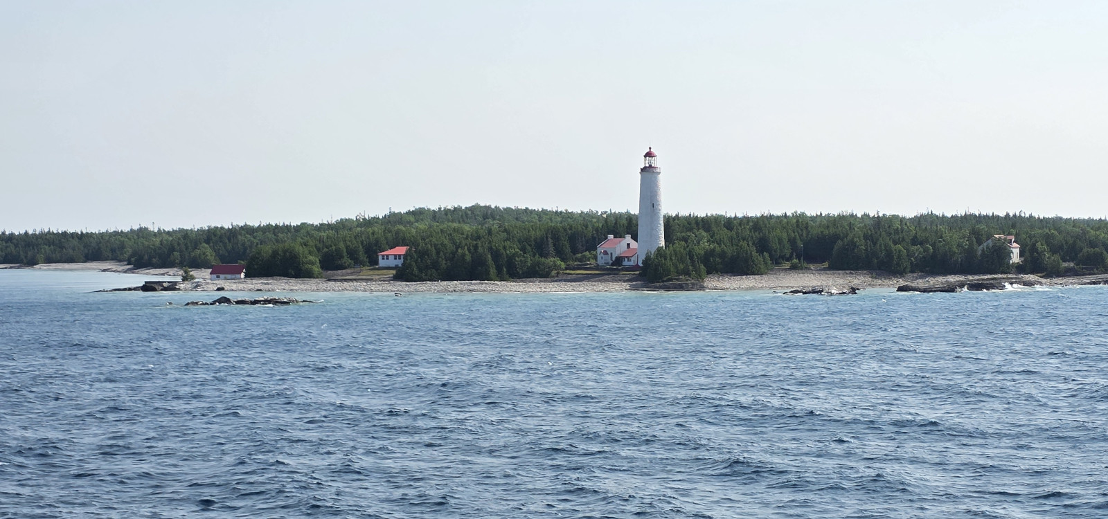
We got our tanks cleaned out and then started the long journey. We had a 3 hour drive to South Baymouth to catch the ferry, we grabbed lunch in South Baymouth, the 2-hour ferry across to Tobermory, and then the 1-hour drive home. Lunch at the Pierside restaurant (I had Fish & Chips and Sharon had the Fish Wrap) was quite good with excellent service and even better, they had a stout beer from Spilt Rail Brewery that I hadn’t tried before. The ferry crossing was quite busy with a bit of chop due to the winds but the blue sky and views of Cove Island just prior to Tobermory made it all worthwhile. The ferry saves the very long drive to Sudbury and around Georgian Bay.


This will conclude the last blog for the 1-month RV Trip 13 from home to Western Canada return. Here is the link for the full journey (RV Trip 13 Full Map), which was 5,578 kms. It also covered our 9th and 10th trips in the RV along the north shore of Lake Superior and even with that many trips we still found it possible to visit new places or have new experiences every single day. We also enjoyed lots of family time in Winnipeg, Moose Jaw, and at the family reunion in Regina. What a perfect way to “Live for the journey Not the destination”. Safe Travels

Hi Joel & Sharon, it’s AB, I just finished reading the latest blog which was gre
LikeLiked by 1 person
Thanks for your comment AB and so glad you enjoyed it.
LikeLike
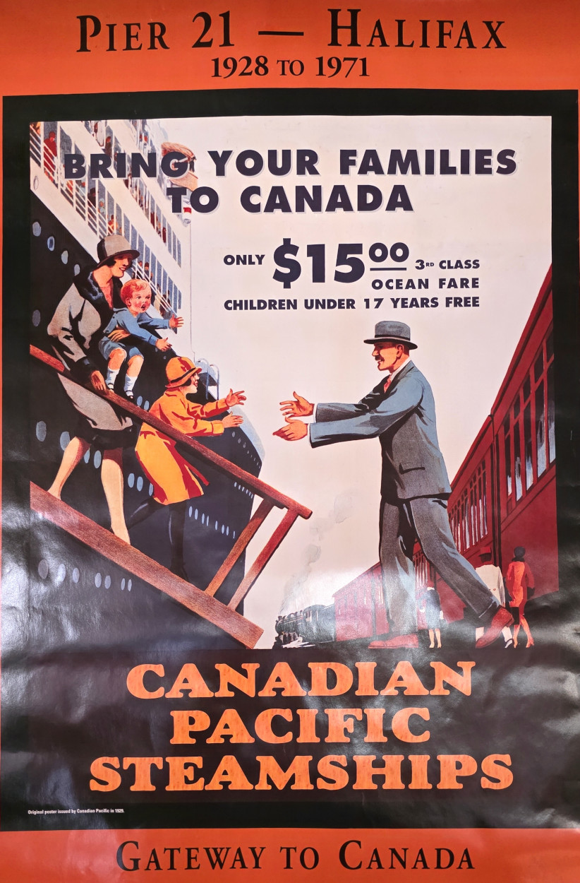
Thanks for the interesting blog. Beautiful waterfalls along your route and cool restaurant visits. Enjoyed the fun facts about Lake Superior. The Canada Pacific Steamships poster advertising the “only $15 3-class Ocean Fare” to Pier 21 – Halifax is neat and follows the theme of your trip to Saskatchewan.
LikeLiked by 1 person
Thanks for your comments Janice. I also thought that poster was a perfect fit👍
LikeLiked by 1 person
Beautiful pictures, vibrant colours. Love it that you are exploring this wonderful country of ours, Lynda
LikeLiked by 1 person
Thanks for your comments Lynda, it was another great trip😎
LikeLike